Last Updated: 20th Mar 2024

Experienced

Save Trail Save

I've done it Done

Banks Peninsula Ultra Beer Run

Christchurch, Canterbury

Submitted by Tony Sharpe

Last Updated: 20th Mar 2024

Experienced

Save Trail Save

I've done it Done

Notice More info

Grunt Factor: 75 ?

Gnarl Factor: 41 ?

50.0km

2400m

1950m

918m


Login as a VIP to see driving directions, distance and time.

Trail Map

Type of Run

Front country - easily accessible

Point to Point (one way)

Undulating, some big hills

Native bush

Plantation/exotic forest

Open farmlands

Open tussock/grasslands

Open ridges/tops

Volcanic

Run Makeup

10%
30%
40%
20%

Sealed Road

Easy Single Track

Moderate Single Track

Technical Single Track

Average Uphill Gradient: +9.5%

Average Downhill Gradient: -9.8%

Trailhead

Login as a VIP to see the trailhead information.

Estimated Times to Run

10:00

Slow

7:00

Moderate

5:00

Fast

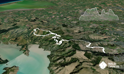
This is a great long run in its own right, showcasing all that is best with Banks Peninsula. You'll need to organise a transport connection - ideally a friend or family member who can join you for a cold one and a feed at the Hilltop Tavern at the end, where you can kick back and enjoy the views and reflect on your adventurous spirit.

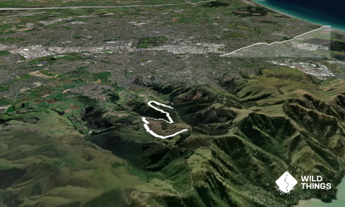
Start at the foot of Worsley Spur in Cashmere near the Christchurch Adventure Park. Ascend Worselys road for 3km until it reverts to 4WD track and climb steadily to the "Bodybag" at the top of Marleys Hill. Descend a short section of road to the Summit Road.

Here choose either the Summit Road or the awesome Crater Rim Track (south side of the road) and head towards Gebbies Pass. Distance is about the same but the trail is much more fun. The author has done this section both ways, but if you have a time constraint the road is quicker. The downhill section to Gebbies will need to be on the road.

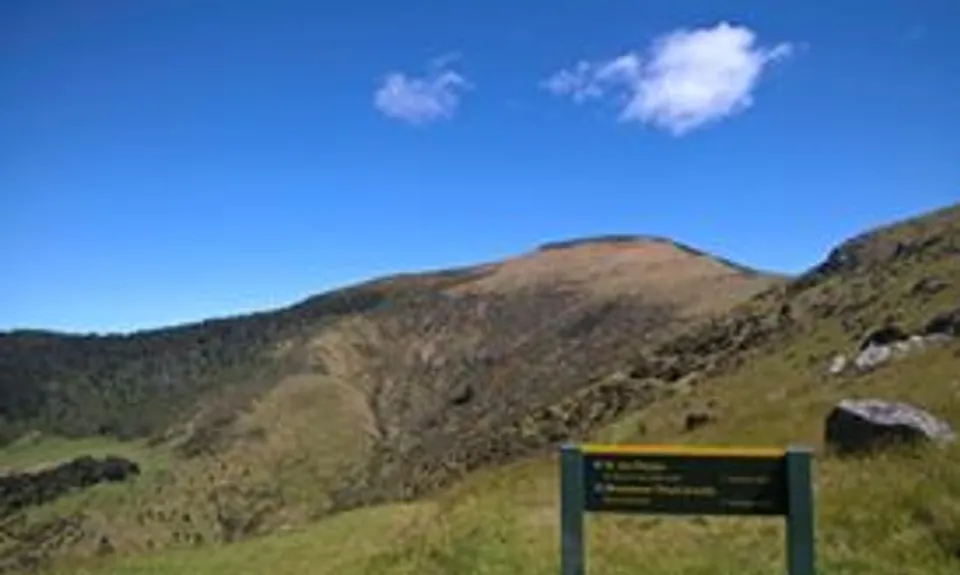
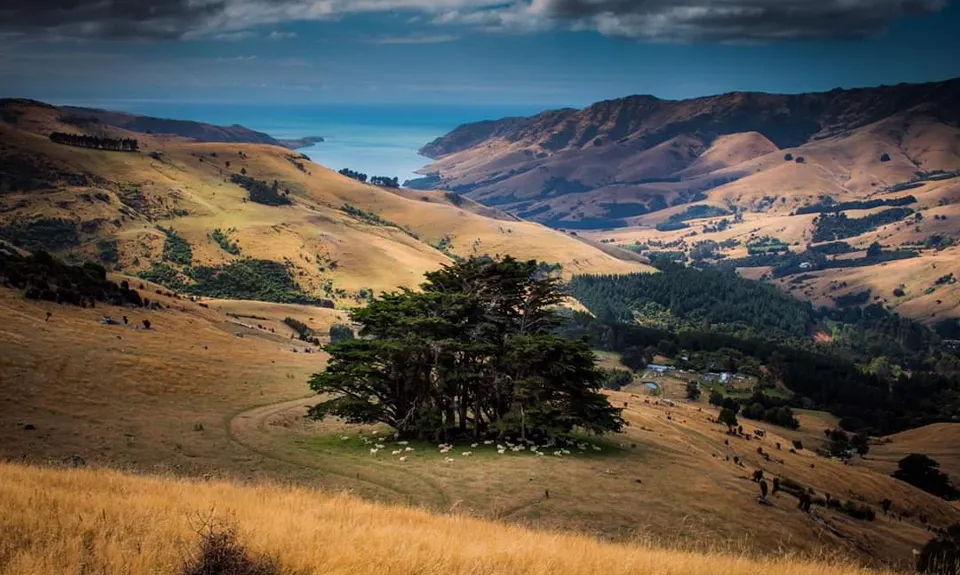
At Gebbies Pass locate the track to Packhorse Hut and enjoy the mix of farm trails and single trail in and out of forest and past the Remarkable Dykes up to Packhorse Hut. Here you can water up and check out this lovely bolthole.

One of the largest climbs of the day then follows, up the flank of Mt Bradley and up to Mt Herbert. Views are great but it can be greasy up here after significant rain. Just before you crest Mt Herbert you will spot a shelter, which is another source of water. Unless you divert to the Rod Donald Hut later on this will be your last water supply until the pub.

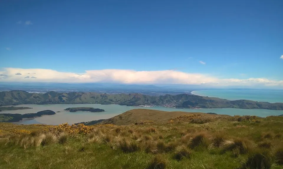
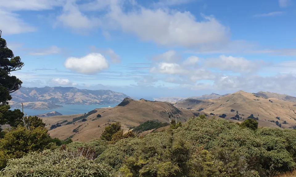
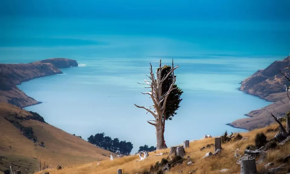
Views from Herbert on a good day are sweeping and magnificent. But be aware, its very exposed, and any bad weather will punish you up here. Be well prepared with warm waterproof clothing food, and good routefinding skills if it clags out on you.

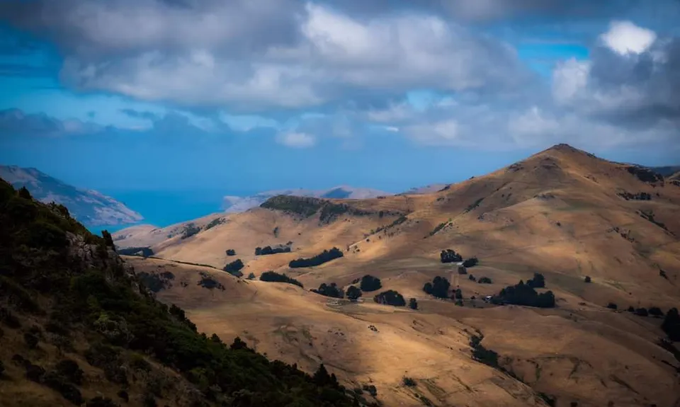
Onwards from Mt Herbert head along the ridgelines and trails to the Port Levy saddle. Some great downhills, undulations and views as you progress, and also the chance for a support crew hookup at the Port Levy Saddle if you desire.

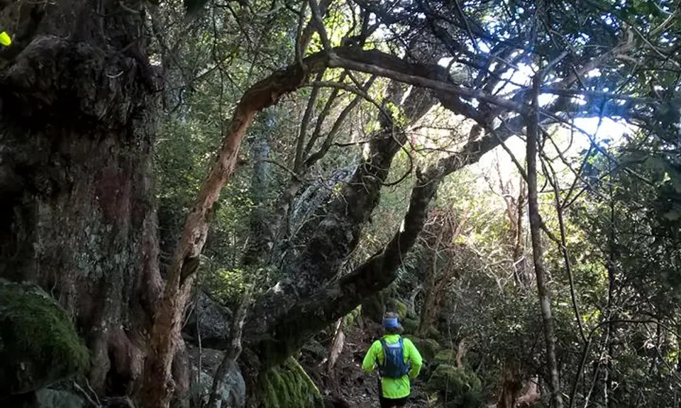
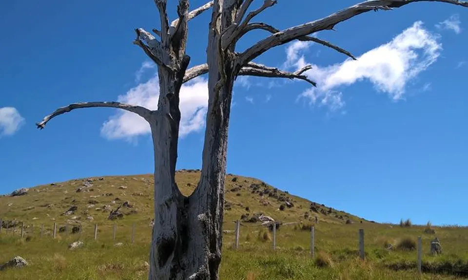
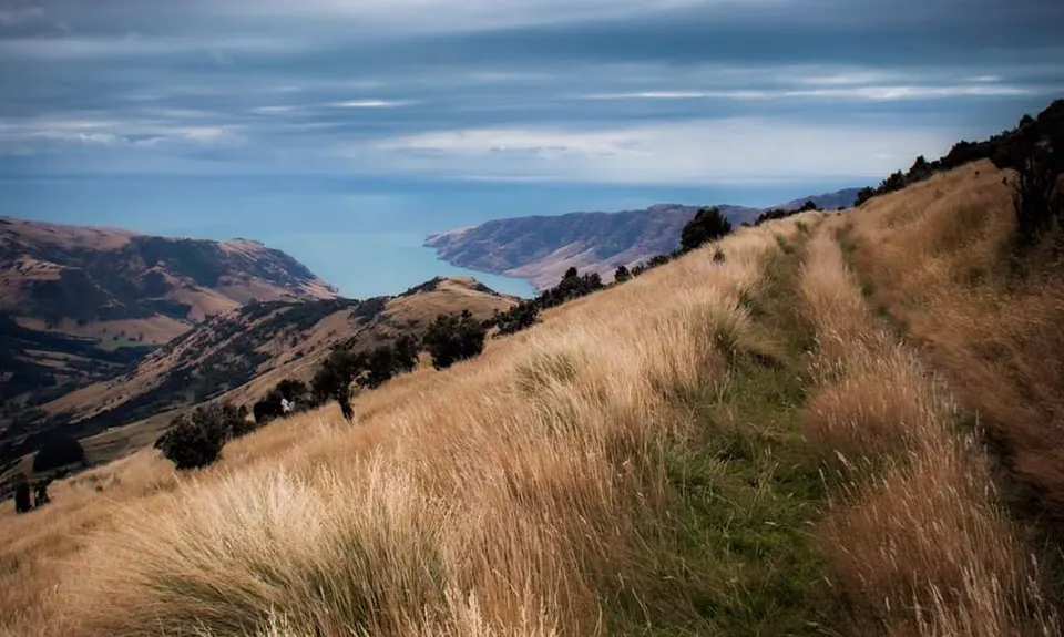
From Port Levy Saddle remain on the ridgelines following the Summit Track all the way across Mt Fitzgerald, Sinclair and Montogmery. Remnant stumps from felled forests interspersed with regenerating natives and open farmland provide a rewarding last quarter of this trail, with a final moderately technical downhill through the Montgomery Reserve and its amazing old trees to finish on the Akaroa Summit Road, and a then short road section to shake down to the pub. Enjoy a beer and a feed and hopefully meet your support to drive you home - unless you want to camp out somewhere around Akaroa or the outer Bays, or else retrace your steps for a 100KM epic (only for the truly committed!)

Run from Christchurch to the Hilltop Pub, almost entirely on trails if you wish, just a couple of small road connections. You will travel the ridgelines and summits of Banks Peninsula for a wonderful day out - but beware of weather changes. If the weather really craps out there are plenty of exit strategies down to lower elevations. Much of the route has phone reception, but it does drop out in sections from Mt Herbert through the Port Levy Saddle

Park alongside Worselys Reserve at the bottom of the hill

6 km

17 minutes

Unknown

No

Moderate.

Its pretty well marked at key points, but pay attention that you go the right directions between Mt Herbert and the Port Levy Saddle. For example, the Monument Track is the wrong way!

Patchy.

Lightweight fleece top, Short-sleeved thermal top, Long-sleeved thermal top, Seam-sealed waterproof jacket, Windproof jacket, Gloves, Beanie/thermal headwear, Whistle, First aid kit, Extra food for emergencies, Survival blanket, Cellphone, Compass, Map, Headtorch and spare batteries

Packhorse Hut and Mt Herbert Shelter

Beyond Gebbies Pass is closed for lambing in the spring- check DOC website for timings.

Hilltop Tavern
Akaroa Highway
Great beer and food and a wonderful view to unwind

Trail Legend

JR

Jennifer Rankin

has completed Banks Peninsula Ultra Beer Run twice in the last year.

Learn about Trail Legends.

You and Banks Peninsula Ultra Beer Run

As a VIP member you can record private notes for this trail, see all of your times and more.

Register Now

Already have an account? Login now

Trail Reviews

Heads up: no water at Mt Herbert Shelter or beer at the Hilltop (closed). Other than that we had a fun day out. Best not to do on a very hot day as not much shelter from the sun (or wind for that matter). Lots of variety and good runnable sections. Great views down into the bays and further afield on a clear day. We took as many of the off road options as possible. Head down to one of the bays for a swim afterwards!

Elly Arnst

January 21

Ran it in reverse today. Great day out! Heaps of variety and endless views. Would be 5 stars except for the logged plantation and the Bastard. It was hot and dry so we brought heaps of water but even still we ran out in the last 5 kms. Thirsty work going up the Bastard… Great call to finish the run with a beer 🍺

Matt Halverson

October 30, 2022

Lovely run, never ending views, sweet technical downhill at the end, lots of elevation but not too steep. Only drawback for me is the tarseal section down to Gebbies & the current condition of Worsleys track which has been turned into a forestry road due to the logging operations after the fire. Will run up through the CAP next time on the uphill only trail that is open to everyone.

Matt Doherty

December 18, 2017

Login to submit a review

Trail Running Community

Find people who are interested in or have completed this trail run.

You must register or login to view this feature.

Register Now

Overlapping Trails

These overlap with this trail to some degree. You may wish to combine them but please note that to qualify for FKTs on these runs you should record a separate activity for each.

Lyttelton to Diamond Harbour

Lyttelton to Diamond Harbour

Length: 43.5km

Level: Intermediate

Summit Walkway

Summit Walkway

Length: 34.0km

Level: Intermediate

Gebbies to Packhorse Romp

Gebbies to Packhorse Romp

Length: 11.4km

Level: Beginner

A Diamond in the Rough

A Diamond in the Rough

Length: 19.0km

Level: Beginner - Intermediate

Diamond, Herbert & Fitzgerald

Diamond, Herbert & Fitzgerald

Length: 38.0km

Level: Intermediate

Other trails nearby
The Governator

The Governator

Length: 9.9km

Level: Intermediate - Experienced

Avon - Source to Surf

Avon - Source to Surf

Length: 30.0km

Level: Beginner - Intermediate

Dog Sniffing Rhythms - Harbour Crusin'

Dog Sniffing Rhythms - Harbour Crusin'

Length: 5.4km

Level: Beginner

Westmorland Wetland Time Trial

Westmorland Wetland Time Trial

Length: 1.7km

Level: Beginner

Find more trails and peaks nearby