Upper East Side hill reps, Canterbury, New Zealand - Trail Running Directory - Wild Things

Last Updated: 23rd May 2026

Beginner

Save Trail Save

I've done it Done

Upper East Side hill reps

Five laps exploring the Upper Eastside Bush area of Victoria Park, each on a different route with varying intensity.

Submitted by Alice Talbot

Last Updated: 23rd May 2026

Beginner

Save Trail Save

I've done it Done

Open

Grunt Factor: 9 ?

Gnarl Factor: 13 ?

6.1km

395m

390m


Become a VIP to see driving directions, distance and time.

Trail Map

This Topo layer only covers NSW/ACT.
Switch to another map layer when viewing outside this area.

Type of Run

Urban fringe

Out and Back

Undulating, some big hills

Dog Friendly

Native bush

Plantation/exotic forest

Run Makeup

100%

Farm Road / 4WD Track

Average Uphill Gradient: +12.90%

Average Downhill Gradient: -12.70%

Garmin Course

VIP Feature: Send this route to your Garmin account so you can follow the course on your Garmin device.

Send to Garmin

Learn about sending to Garmin.

Trailhead

Become a VIP Member to see the trailhead information.

Estimated Times to Run

1:15

Slow

00:50

Moderate

00:35

Fast

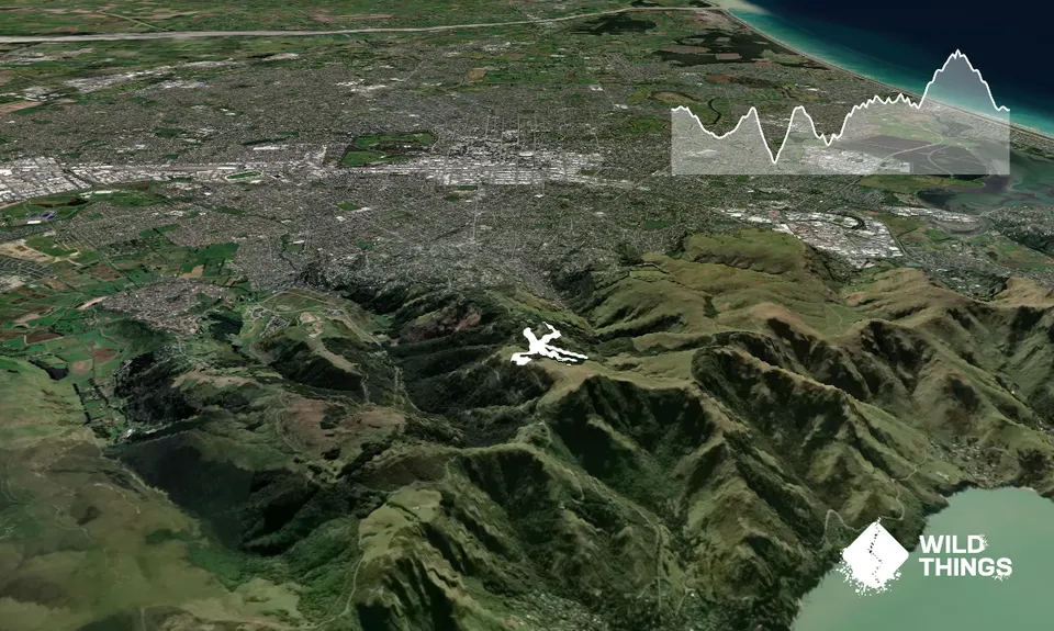
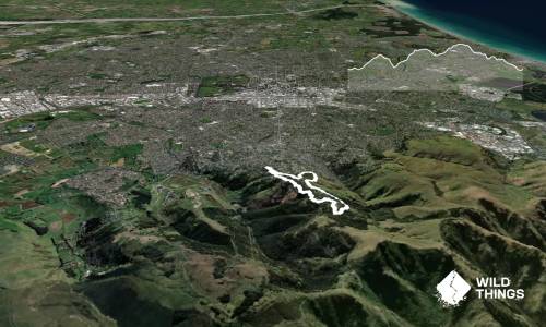
This route links together five hill reps, with each lap starting and finishing at a water fountain, so you can run light. The route is entirely on shared use 4WD roads, however, this is an MTB area and there are multiple downhill bike tracks criss-crossing the 4WD roads so take care.

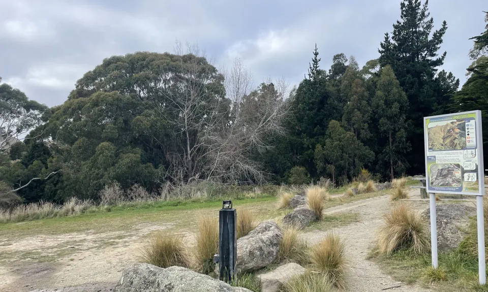
Park near the 19th Memorial or anywhere else in Victoria Park and make your way to the trailhead at the Upper Eastside Bush entrance gate. There is a short warmup along the gravel road before you arrive at the water fountain in the MTB hub.

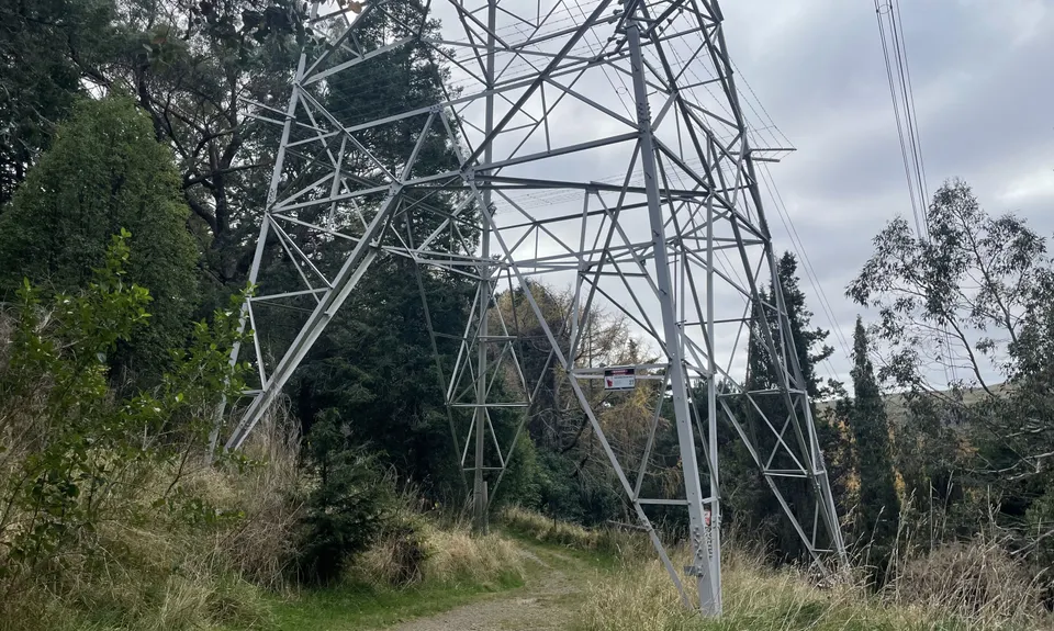
Your first lap starts directly east of the water fountain - the trail is slightly hidden but it's right between the power pylon and a big fir tree. This track is undulating, providing a nice warm up before the hills to come. Carry on down until you reach the intersection with the Eastside Bush Track steps on your left. Turn around here and head back up the way you came.

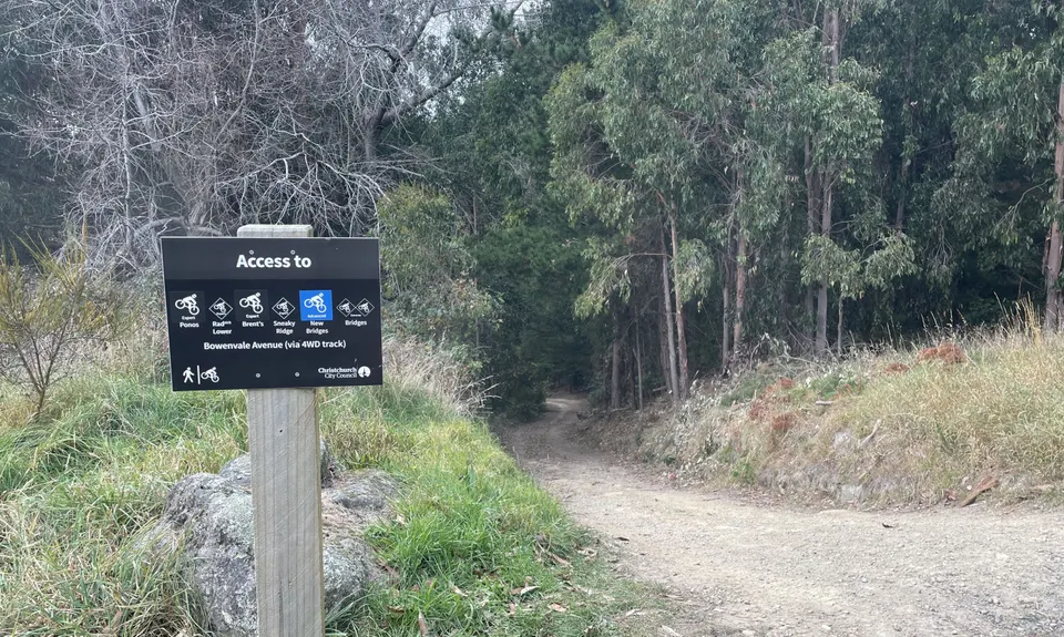
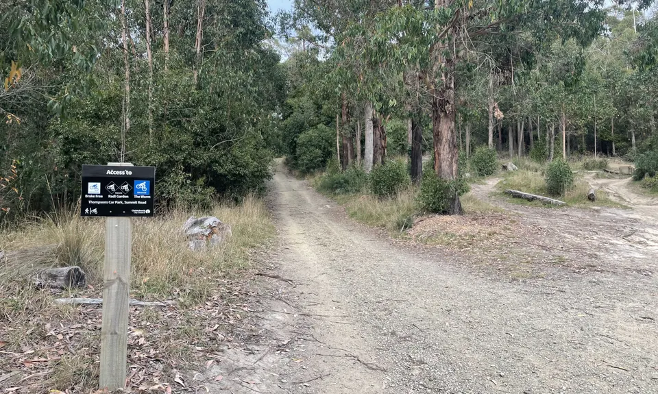
The second lap is a beast. Start at the sign labelled "Bowenvale Avenue (via 4WD track)" and multiple MTB trails. Head down the steep, straight gravel road. Keep going in a straight line, ignoring the other 4WD roads intersecting the road you're on, until you reach a fallen pine tree where the road turns into an MTB singletrack heading round a berm. Turn around and head back up to the water fountain.

Third lap - a few zig zags in this one. Start at the same place as lap 2 but veer off to the right down the gentler gradient 4WD road. At the first junction take a hard left, followed by a hard right at the second junction. You'll cross a small drainage gully just before a little uphill section where the track joins another 4WD road. This is the turn-around point - go back up the way you came.

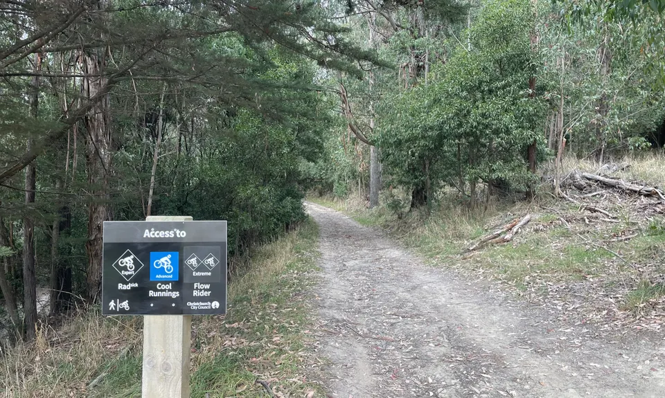
Fourth lap - this one is a gentler gradient - enjoy a bit of active recovery before the final climb. From the same start point, take the flatter road signposted "Access to Rad/Cool Runnings/Flow Rider". Follow the road, taking the left fork at the junction, until it turns into an MTB track at the drainage gully. Turn around here.

Fifth and final lap - here we're mixing it up and doing the climb first. Head up the 4WD road between the Latters Spur Track and the MTB jumps. Take the right fork at the top of the first hill and keep going up to the grassy field with amazing views of the Southern Alps on a clear day. Turn left and carry on up to Summit Road following the climb trail/4WD road. Give yourself a pat on the back - you've now done over 350m of elevation gain. Cruise back down the way you came and back to the finish.

If you know of any public toilets near the trail start or on the route, please login and then let us know so we can update this section.

Parking throughout Victoria Park

8 km

22 minutes

Yes

No

Easy.

Generally good.

Cellphone

Water fountain at the start & finish of each lap.

Do you have a suggestion on where to go afterwards for the best coffee / cake / breakfast / brunch / beer?

Trail Legend

Alice Talbot

Alice Talbot

has completed Upper East Side hill reps once in the last year.

Login as a VIP to become a Trail Legend. Learn about Trail Legends.

You and Upper East Side hill reps

As a VIP member you can record private notes for this trail, see all of your times and more.

Become a Member

Already have an account? Login now

Trail Reviews

Be the first to submit a review for Upper East Side hill reps!

Login to submit a review

Trail Running Community

Find people who are interested in or have completed this trail run.

You must register or login to view this feature.

Register Now

Overlapping Trails

These overlap with this trail to some degree. You may wish to combine them but please note that to qualify for FKTs on these runs you should record a separate activity for each.

Victoria's Secrets

Victoria's Secrets

Length: 5.5km

Level: Beginner

Takahe to Taylors

Takahe to Taylors

Length: 21.0km

Level: Beginner - Intermediate

Port Hills 8-Attack

Port Hills 8-Attack

Length: 17.7km

Level: Beginner - Intermediate

The North Faces

The North Faces

Length: 24.8km

Level: Beginner - Intermediate

2 Sugars, 2 Vernons & a Half Shot

2 Sugars, 2 Vernons & a Half Shot

Length: 21.9km

Level: Beginner - Intermediate

Vicki Vale

Vicki Vale

Length: 9.3km

Level: Intermediate

The Crater Rim

The Crater Rim

Length: 27.9km

Level: Intermediate

Pour Some Sugarloaf On Me

Pour Some Sugarloaf On Me

Length: 8.3km

Level: Beginner - Intermediate

Port Hills Spur Challenge!

Port Hills Spur Challenge!

Length: 18.5km

Level: Intermediate

Takahe Half

Takahe Half

Length: 21.1km

Level: Beginner - Intermediate

The Guv'nor & His Birds

The Guv'nor & His Birds

Length: 16.0km

Level: Intermediate - Experienced

Lava - H.ELL Loop

Lava - H.ELL Loop

Length: 10.3km

Level: Intermediate

Gondola Gallop

Gondola Gallop

Length: 11.3km

Level: Beginner - Intermediate

The Bowenvale Elevator

The Bowenvale Elevator

Length: 11.2km

Level: Beginner

VKV challenge

VKV challenge

Length: 10.0km

Level: Intermediate

Port Hills Nearly Half Marathon

Port Hills Nearly Half Marathon

Length: 18.0km

Level: Intermediate - Experienced

Sign Of The Takahe - Rapaki

Sign Of The Takahe - Rapaki

Length: 13.0km

Level: Beginner - Intermediate

Rapaki Sugarloaf Return

Rapaki Sugarloaf Return

Length: 15.0km

Level: Beginner - Intermediate

The Gorsetrack Strikes Back

The Gorsetrack Strikes Back

Length: 14.0km

Level: Beginner

Other trails nearby
Sumner Half Heads

Sumner Half Heads

Length: 21.6km

Level: Beginner - Intermediate

360 Trail - Dunes Wetlands Section

360 Trail - Dunes Wetlands Section

Length: 15.9km

Level: Beginner

Horsing Around

Horsing Around

Length: 5.6km

Level: Beginner

Hunting Out A Gorge-ous Loop

Hunting Out A Gorge-ous Loop

Length: 5.0km

Level: Beginner - Intermediate

Find more trails and peaks nearby

Wild Things
Wild Things
Explore more

Plan smarter, stay motivated, track your progress, and unlock the full Wild Things experience — while saving along the way.