Last Updated: 3rd Feb 2024

Beginner - Intermediate

Save Trail Save

I've done it Done

Landfill Lark

Christchurch, Canterbury

Submitted by Brion Matthews

Last Updated: 3rd Feb 2024

Beginner - Intermediate

Save Trail Save

I've done it Done

Open

Grunt Factor: 10

Gnarl Factor: 22

10.0km

125m

125m

20m


Login as a VIP to see driving directions, distance and time.

Trail Map

Type of Run

Urban fringe

Loop

Totally/mostly flat

Dog Friendly

Plantation/exotic forest

Beach

Coastal

Run Makeup

60%
40%

Easy Single Track

Moderate Single Track

Average Uphill Gradient: +2.5%

Average Downhill Gradient: -2.5%

Trailhead

Login as a VIP to see the trailhead information.

Estimated Times to Run

1:30

Slow

1:10

Moderate

0:50

Fast

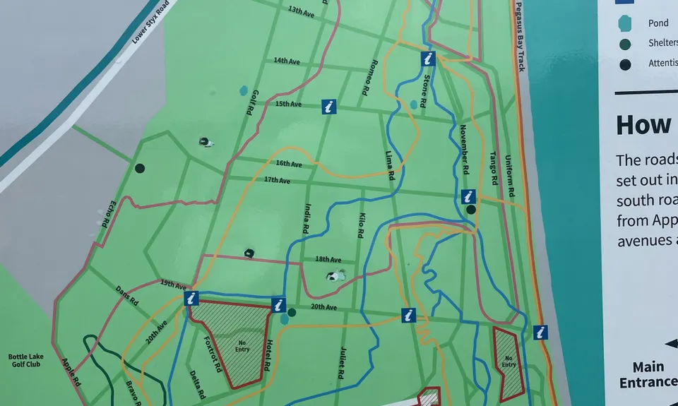
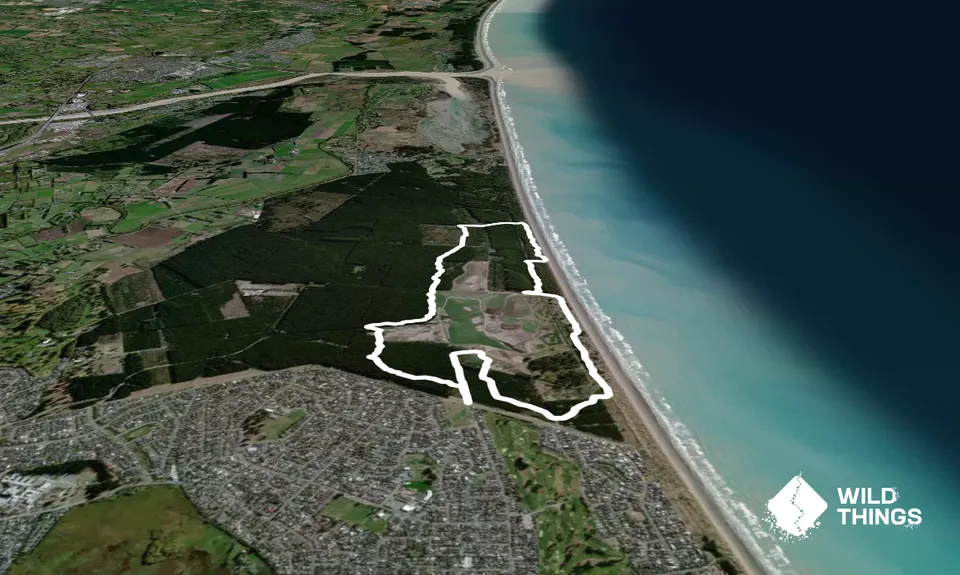
This is what happens when you order a cheap knockoff of ‘Bottlelake Blue Loop’ over the internet. We are largely following minor trails that can sometimes be hard to spot so we would recommend following the gpx file. Things can get confusing in the forest very quickly, and while you won't get dangerously lost, you can often accumulate additional distance by taking wrong turns and backtracking.

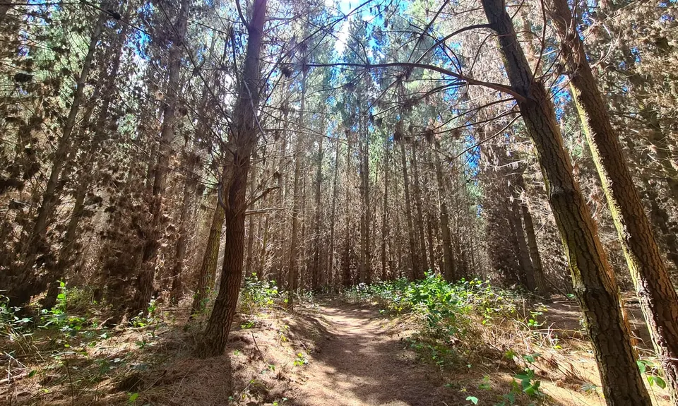
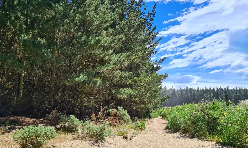
Head off up the gravel road (Lima Road) before taking a left into the forest. This piece wiggles and winds through the trees. We are taking the main line, but it can be easy to divert to a side-track unintentionally. You will soon come to a junction with a main left leading turn. Instead of taking this go straight, towards a clearing. The landfill fence will be on your RHS. Follow the track sticking to the fence until you pop out at Landfill Road (the main tar-sealed road), which we will cross straight over.

Now it is time to follow the dots, which pick up to the right before connecting to the main groomed running track. This piece can be slow – It’s soft and spongy and takes a bit of attention to follow the spray marks on the trees. These dots carry on after the junction of roads and MTB tracks. At a junction we take a right and momentarily join the actual ‘blue loop’ before breaking left (at approximately 3km).

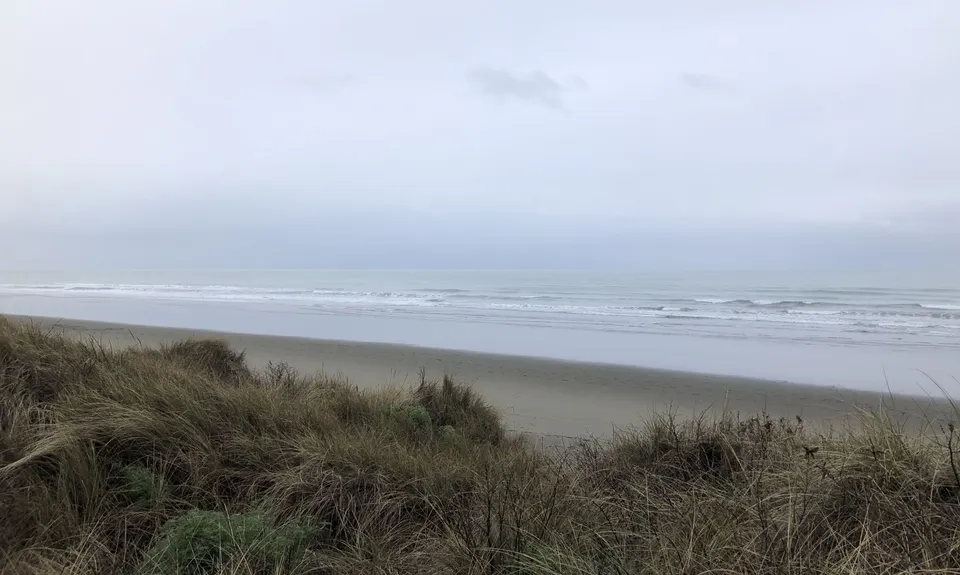
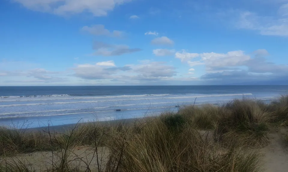
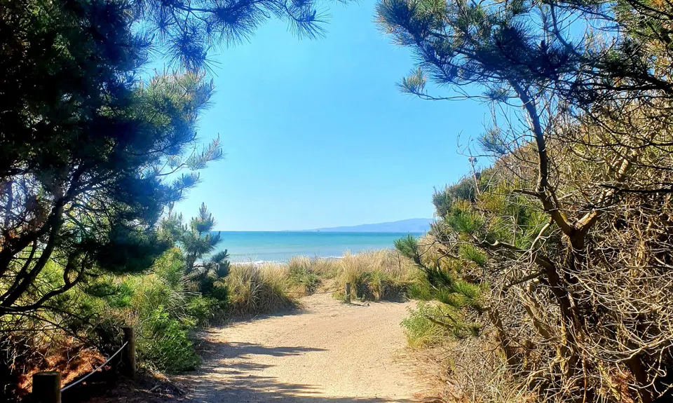
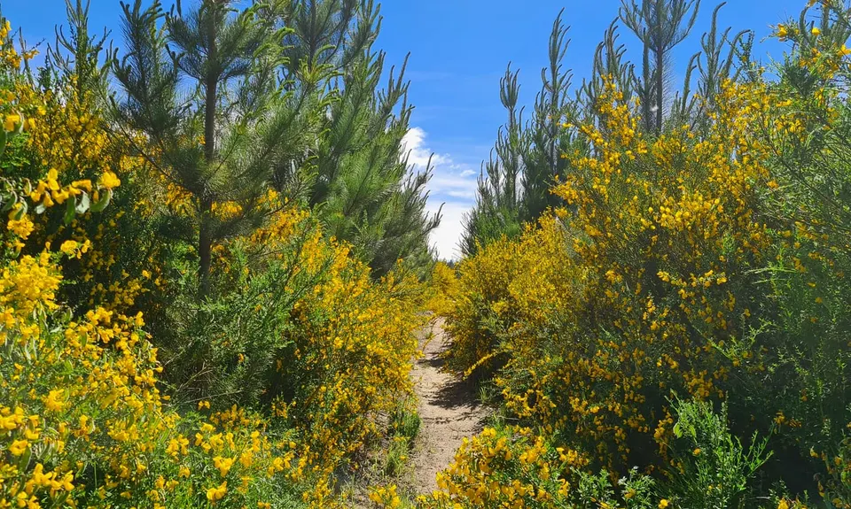
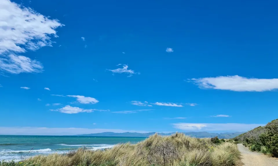
Follow this track, cross the gravel road, and carry on until reaching 15th Ave. At this point we head beachward and follow the ‘Pegasus Bay Track’ for a bit, which is an opportunity to make up on lost time. Soon you will come to a section that climbs and pops out for a view of the beach. Part way along take a left off the tops (ha) and head down the sandy trail. This next part can be tricky to find – after Uniform Road (rutted 4wd track), but before Tango Rd (sandy track) there is a hard to spot goat track to the left. Persevere on this – it’s gets better as you go and is subjectively the best bit of single track in the forest.

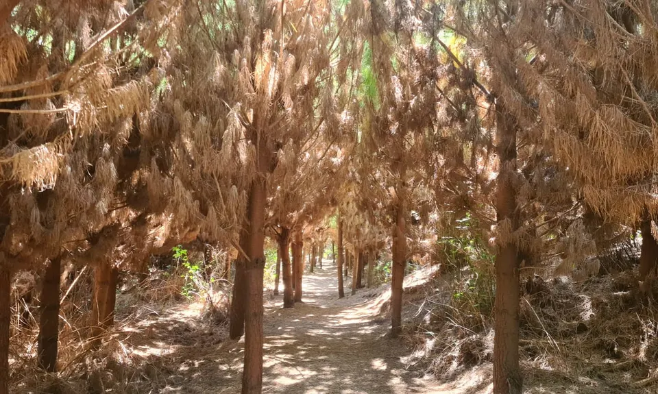
At the end of this section, head beachward again and pick up the ‘Pegasus Bay Track’ until ducking back inland (yet again) at approximately 6.8km. Follow alongside the ponds before getting into the pine trees again. Loads of goat tracks to get lost on here, but we will end up in roughly the same spot no matter what. The goal is to pop out at the old landfill, head up the steep grassy side and back down past the rotunda. Take Lima Road for a sprint finish back to the start.

Past and present landfill sites. Beach views.

Plenty of parking in the gravel carpark and surrounding streets.

12 km

21 minutes

Yes

No

Moderate.

Roads are organised as a grid with East/West alphabetically (Apple to Whiskey (closest to beach)), and numerically North/ South (10 to 28). This route starts at the junction of 28th and Lima.

Patchy.

Short-sleeved thermal top, Windproof jacket, Whistle, First aid kit, Extra food for emergencies, Cellphone, Map.

Fountain/tap at Broadhaven Reserve.

The area by the ponds at Whiskey Road can get covered in water/ boggy in winter.

Trail Legend

Corey Woodward

Corey Woodward

has completed Landfill Lark twice in the last year.

Learn about Trail Legends.

You and Landfill Lark

As a VIP member you can record private notes for this trail, see all of your times and more.

Register Now

Already have an account? Login now

Trail Reviews

A cool loop around the forest with lots of tracks I hadn't run on before. Had to double check the map a lot and managed to add an extra km by regularly missing turn-offs. Good fun to run with friends.

Stefanie Parks

July 17, 2022

A real trail run with a wide range of variable trails - gravel, forest, sand, and 4WD. Kept getting lost despite the GPX file, and the unexpected detours kept coming even towards the end! I added over 2km extra! It was interesting to run through the less used trails in Bottle Lake. Although I did not like the muddy swamp like part near the end. A good one for exploring.

Heidi Su

November 12, 2021

Perfect for when you are really unfit, you have the excuse of needing to stop every few hundred meters to have a breather and check where you are going! Some really nice trails that I have never done before and would never have found without a .gpx file, even with it I ended up off the 'track'.

Leah King

October 31, 2021

Great fun with off trail routes. Sure to find a new trail here even if you are a Bottle Lake veteran. Will be good to use as a time trial to test your fitness once you're familiar with the route.

Jeremy Wheeler

October 10, 2021

Login to submit a review

Trail Running Community

Find people who are interested in or have completed this trail run.

You must register or login to view this feature.

Register Now

Other trails nearby
Sign Of The Takahe - Rapaki

Sign Of The Takahe - Rapaki

Length: 13.0km

Level: Beginner - Intermediate

The ATH (Around The Harbour)

The ATH (Around The Harbour)

Length: 61.4km

Level: Intermediate

Travis Wetland Loop

Travis Wetland Loop

Length: 11.7km

Level: Beginner

Lyttelton to Diamond Harbour

Lyttelton to Diamond Harbour

Length: 43.5km

Level: Intermediate

Find more trails and peaks nearby