Last Updated: 11th Jan 2024

Intermediate

Save Trail Save

I've done it Done

The Crater Rim

Christchurch, Canterbury

Submitted by Tony Sharpe

Last Updated: 11th Jan 2024

Intermediate

Save Trail Save

I've done it Done

Open

Grunt Factor: 41

Gnarl Factor: 46

27.9km

1100m

1450m

573m


Login as a VIP to see driving directions, distance and time.

Trail Map

Type of Run

Urban fringe

Point to Point (one way)

Undulating, some big hills

Native bush

Open tussock/grasslands

Open ridges/tops

Volcanic

Run Makeup

30%
50%
20%

Easy Single Track

Moderate Single Track

Technical Single Track

Average Uphill Gradient: +11.2%

Average Downhill Gradient: -10.8%

Trailhead

Login as a VIP to see the trailhead information.

Estimated Times to Run

6:00

Slow

4:30

Moderate

3:00

Fast

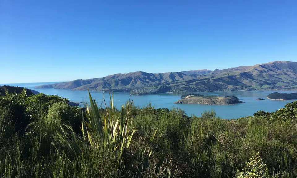
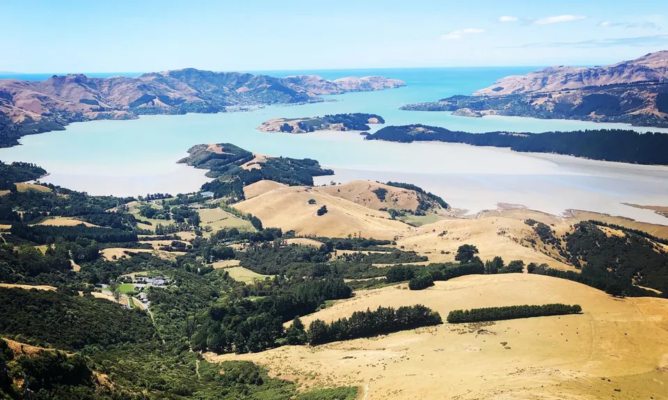
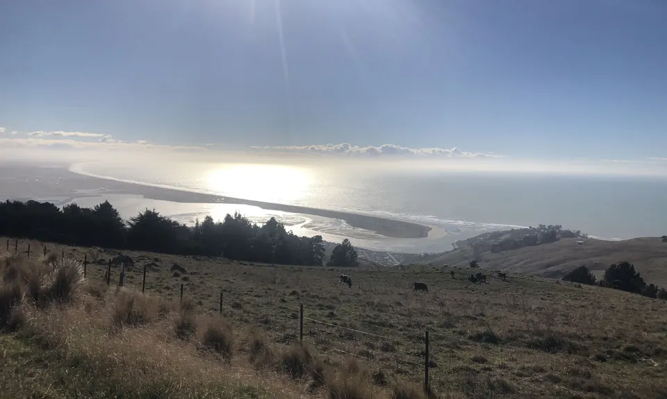
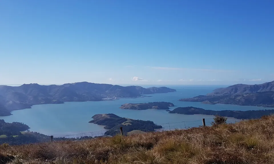
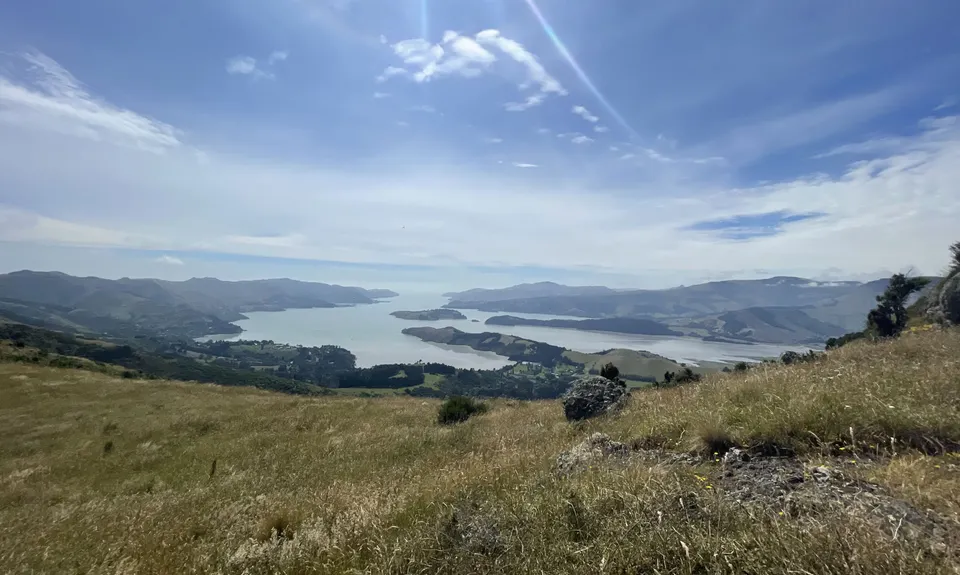
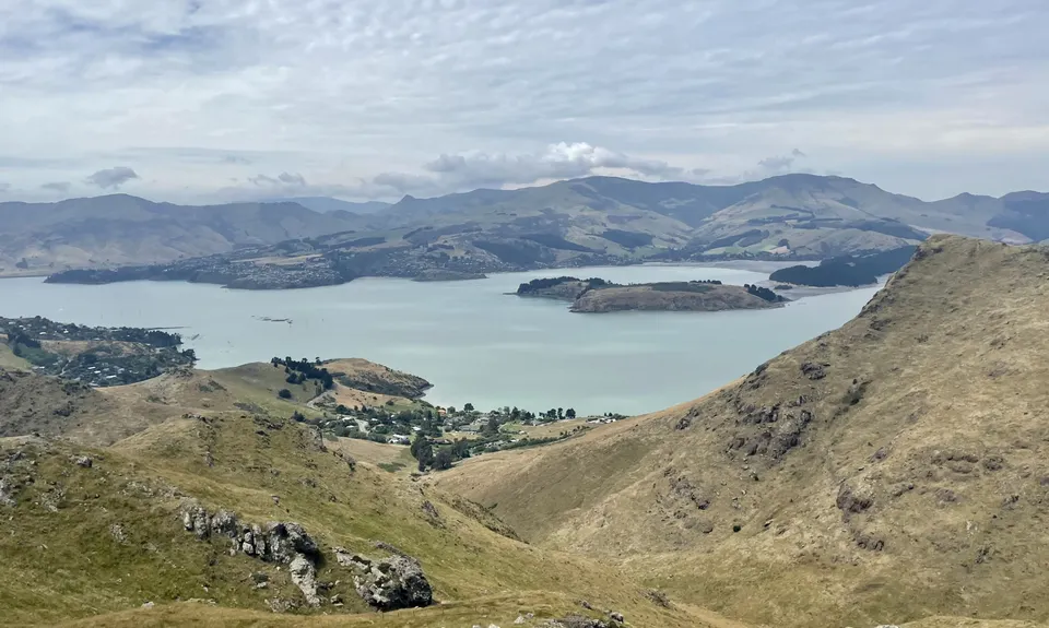
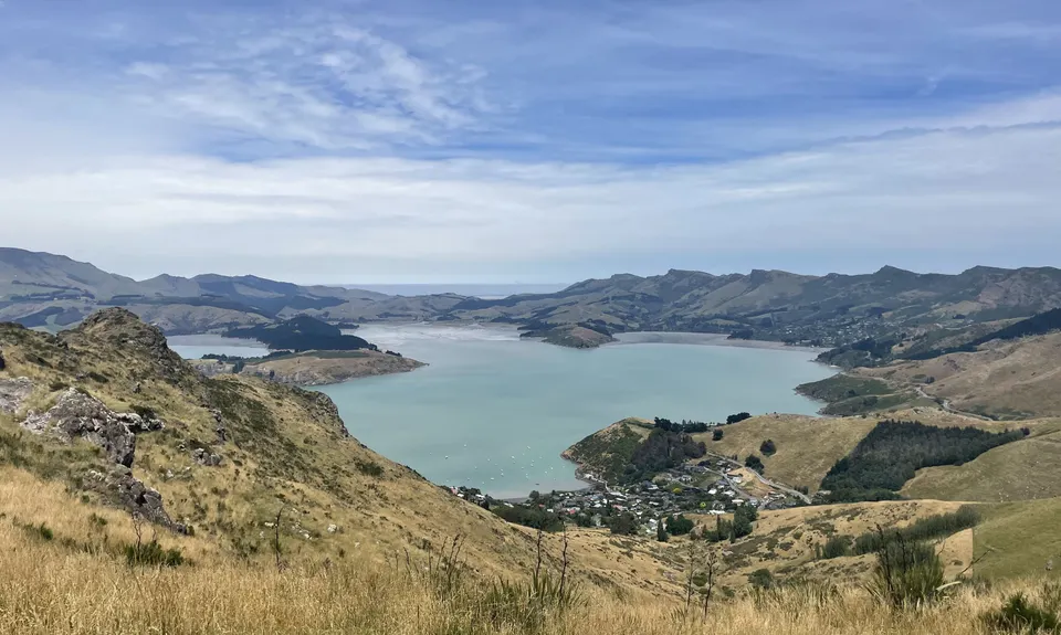
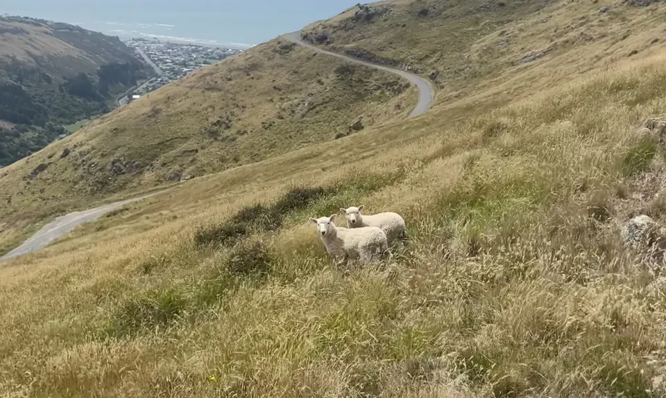
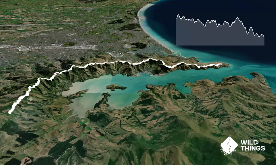
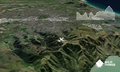
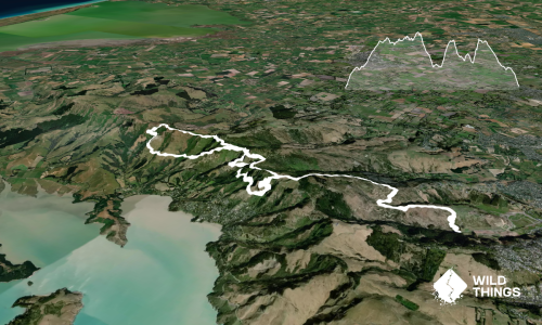
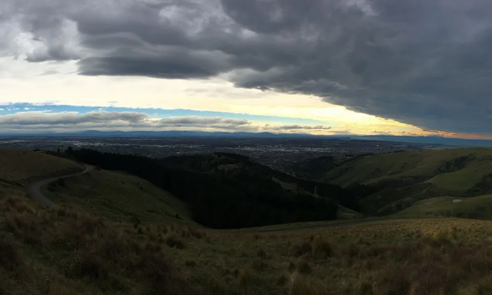
What could be better than nearly 30km of end to end top of the hills trail goodness? Best run west to east as you start higher , and once you've decided on your drop off/ vehicle shuttle plan it's just you and the top of the hills for as far as the eye can see and the feet can eat. Harbour and ocean views on one side, the city and plains on the other and the constant expansive view out to the Southern Alps on any good day

The western end of the Crater Rim trail starts under Coopers Knob - itself a very worthy diversion especially for the trig baggers among you. The track nips in and out of patches of remnant native bush and open grasslands as you gain the first few km to the Sign of the Bellbird. Its an up and down undulating journey and there are some real gems as you wind your way along. There's a toilet at the Bellbird if needed down by the shelter. Maybe an hour or so in most will be getting close to the Sign of the Kiwi, where you can fuel up with some water or something from the shop.

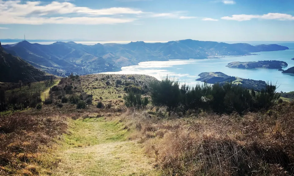
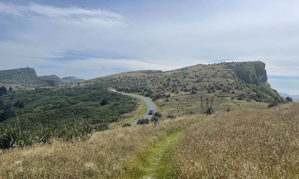
Past the Kiwi and Dyers Pass ascend the slopes of Sugarloaf. If you feel like another frig you can head straight up and regain the Crater Rim Trail off its NE flank easily. Continue east over three more 'lumps" which are each enough vert to get the puffing levels back up, then you'll reach Mt Vernon and its rock strewn summit landscape - great spot for a photo or two.

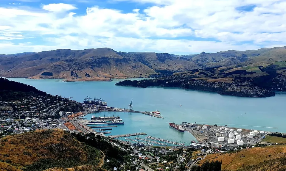
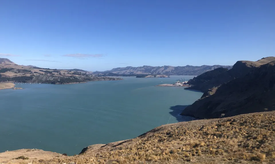
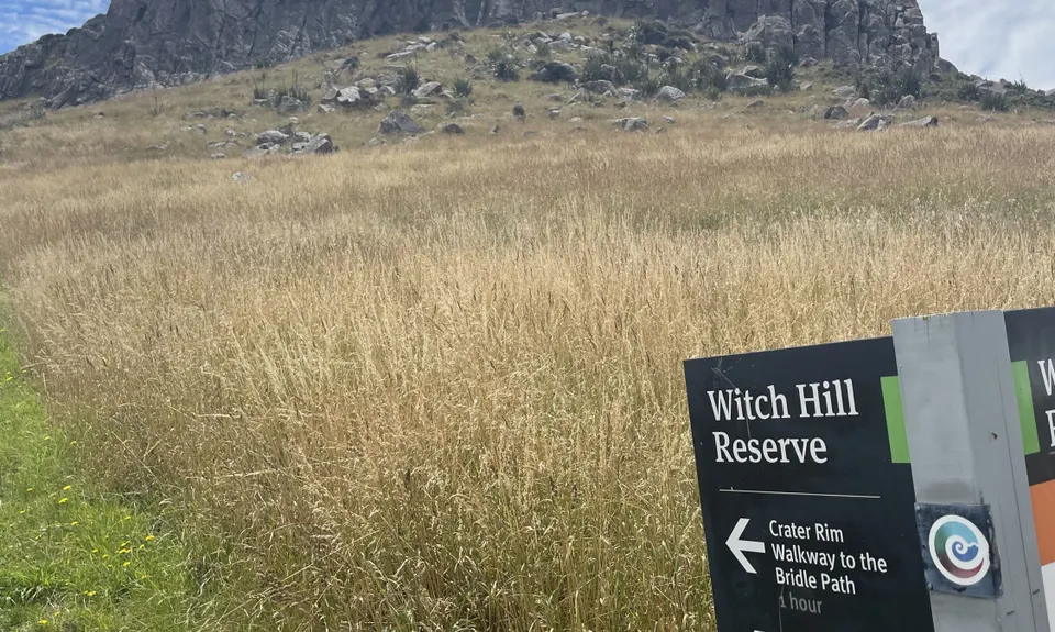
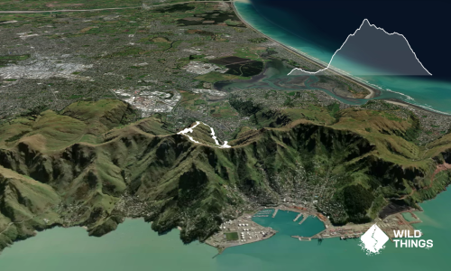
Since the earthquakes some of the trail from Mt Vernon to Bridle Path has been rerouted to follow more closely the still closed Summit Rd Section, which is still open for bikes and feet between the top of Rapaki and Castle Rock. Which Hill and its awesome memorial seat are also worth a diversion just past Rapaki Rock. Make sure you pick the trail up over The Tors as there's some of the nicest trail of the whole day to follow here, especially the sweeping descent to the Bridle Path Summit.

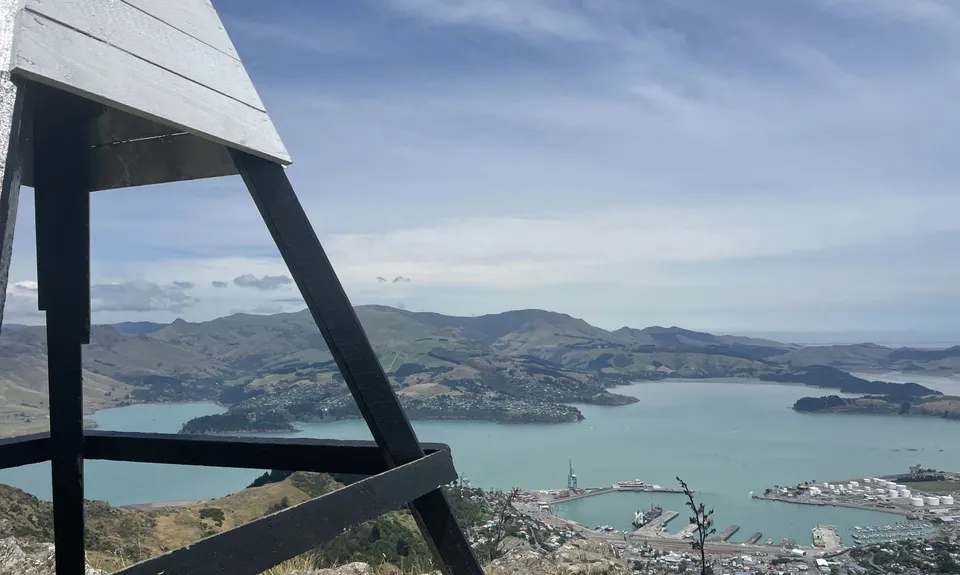
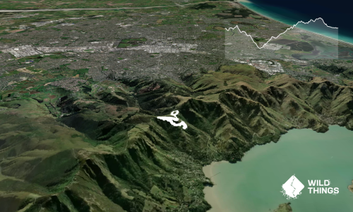
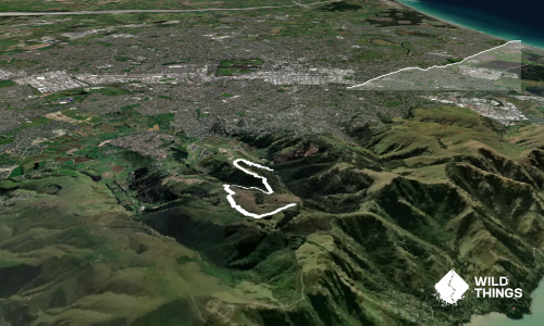
Next stop is a quick ascent of Mt Cavendish, and past the Gondola Top Station- itself a handy stop for a snack, coffee or the loo. Another quick short decent gets to the saddle between Mt Cavendish and Mt Pleasant- up Mt Pleasant can be a bit sketchy to follow but if you lose the trail which does some longer loops to aid MTB's then just follow your nose to the mast and another trig at the summit.

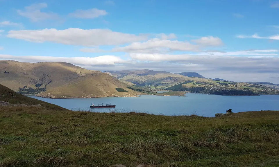
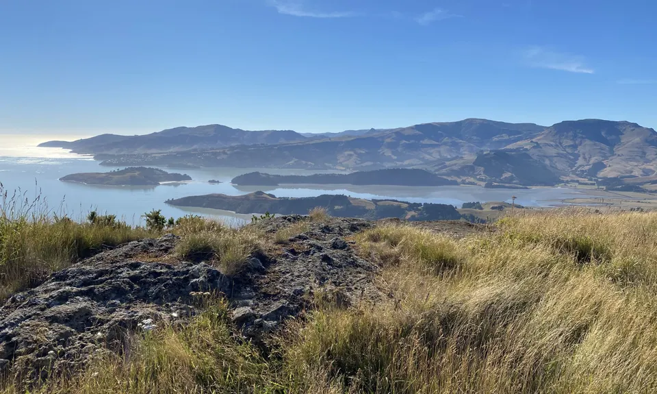
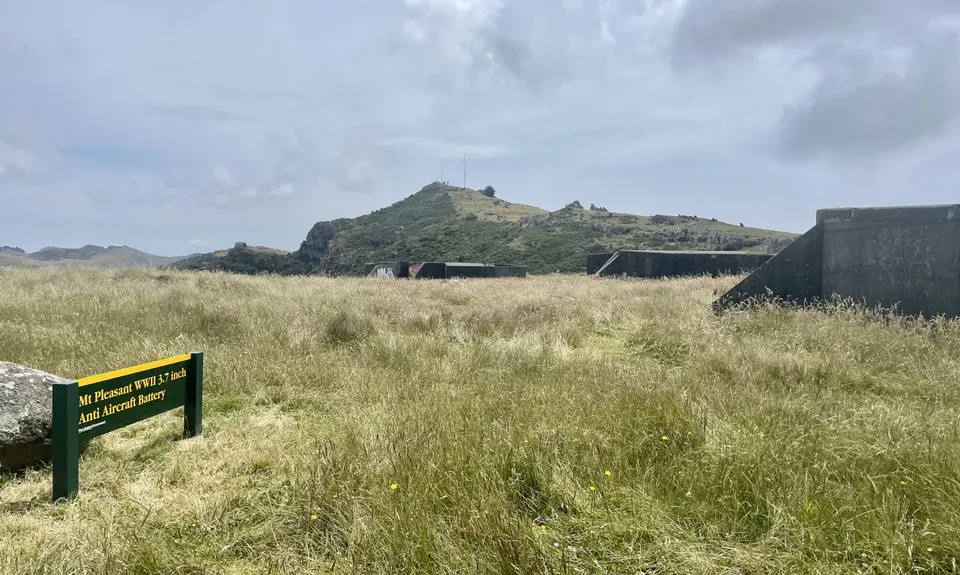
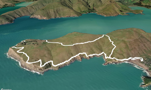
Mt Pleasant to Evans Pass is aptly named, mainly downhill on steady gradient as you wing your away around the tops. The last section follows several moderately large hills out to Godley Head, the trail varies from moderately formed and well marked until towards the last couple of kms where recent upgrades have meant a really nice cruisy finish down past the bunkers to the gun emplacements and the playground that is Godley Head.

If you feel like a little extra for dessert add the Taylors Mistake and/or Scarborough sections to get you to Sumner, although the Godley Head carpark is the true end of the Crater Rim track


Explore the length of the formerly volcanic Port Hills on the aptly named Crater Rim Track. You'll be on the crest of the hills virtually the whole way with commanding 360 degree views and superb trails to follow on this point to point icon of Christchurch's trail network.

Given this is end to end a drop off or car shuffle is needed. Unless you want to go there and back!!

19 km

41 minutes

Unknown

No

Moderate.

Just keep following the trails across the tops

Generally good.

Thermal leggings, Lightweight fleece top, Long-sleeved thermal top, Seam-sealed waterproof jacket, Windproof jacket, Gloves, Beanie/thermal headwear, Whistle, First aid kit, Extra food for emergencies, Survival blanket, Cellphone, Map.

Sign of the Kiwi and the Gondola

Some sections muddy/ greasy after rain. It can be exposed and cool up here any time of year, but especially in winter so take appropriate warm and dry stuff to use.

The odd sheep and a few boy racers on occasional crossings of the Summit Road

Sumnmer has a few really nice cafe's and eateries.

Trail Legend

Kane Aitken

Kane Aitken

has completed The Crater Rim once in the last year.

Learn about Trail Legends.

You and The Crater Rim

As a VIP member you can record private notes for this trail, see all of your times and more.

Register Now

Already have an account? Login now

Trail Reviews

Wowza!! Awesome. Wanted to run it again while I was still doing it! 🤩🤩
Stopped at the Gondola to refill water.
Also ran around the coastal track down to Taylor’s Mistake to finish off the run adventure and meet my ride - it was perfect with a food truck selling hot salty chips, coke, and fruit ice-cream. 🙌👌

Kerri Dewe

January 8, 2022

Great opportunity to put all the pieces together and run a multitude of fun trails all in one go!

Katie Ridley

August 6, 2021

Crown jewel of the Port Hills and Christchurch’s trail running scene. So lucky to have this in our back yard!

Matt Halverson

May 15, 2021

What a run! Great track, great views and pausing at Gondola for sugary treats was a huge bonus on a hot day.

Stefanie Parks

February 8, 2021

Login to submit a review

Trail Running Community

Find people who are interested in or have completed this trail run.

You must register or login to view this feature.

Register Now

Overlapping Trails

These overlap with this trail to some degree. You may wish to combine them but please note that to qualify for FKTs on these runs you should record a separate activity for each.

Godley Head loop

Godley Head loop

Length: 18.1km

Level: Intermediate

Whigs' Flying Fifty (WFF)

Whigs' Flying Fifty (WFF)

Length: 50.3km

Level: Intermediate

The ATH (Around The Harbour)

The ATH (Around The Harbour)

Length: 61.4km

Level: Intermediate

The Guv'nor & His Birds

The Guv'nor & His Birds

Length: 16.0km

Level: Intermediate - Experienced

Takahe Half

Takahe Half

Length: 21.1km

Level: Beginner - Intermediate

Trinity - Harbour Bruisin'

Trinity - Harbour Bruisin'

Length: 20.1km

Level: Intermediate

Christchurch 360 Trail - Sugarloaf Hills Section

Christchurch 360 Trail - Sugarloaf Hills Section

Length: 18.2km

Level: Intermediate

Bird to Bird

Bird to Bird

Length: 9.8km

Level: Beginner - Intermediate

The Governator

The Governator

Length: 9.9km

Level: Intermediate - Experienced

Governator 2 - Judgement Day

Governator 2 - Judgement Day

Length: 7.7km

Level: Intermediate

Other trails nearby
Springing Around Longhurst

Springing Around Longhurst

Length: 3.1km

Level: Beginner

Lava - H.ELL Loop

Lava - H.ELL Loop

Length: 10.3km

Level: Intermediate

Tauhinu-Korokio TKO

Tauhinu-Korokio TKO

Length: 4.9km

Level: Beginner

Orton Odyssey

Orton Odyssey

Length: 13.6km

Level: Beginner - Intermediate

Find more trails and peaks nearby