Last Updated: 21st Sep 2023

Intermediate - Experienced

Save Trail Save

I've done it Done

The Governator

Christchurch, Canterbury

Submitted by Tony Sharpe

Last Updated: 21st Sep 2023

Intermediate - Experienced

Save Trail Save

I've done it Done

Open

Grunt Factor: 25

Gnarl Factor: 81

9.9km

845m

845m

483m


Login as a VIP to see driving directions, distance and time.

Trail Map

Type of Run

Urban fringe

Combo

Mountainous

Native bush

Open tussock/grasslands

Open ridges/tops

Volcanic

Run Makeup

5%
20%
75%

Sealed Road

Moderate Single Track

Technical Single Track

Average Uphill Gradient: +18.8%

Average Downhill Gradient: -20.7%

Trailhead

Login as a VIP to see the trailhead information.

Estimated Times to Run

2:15

Slow

1:45

Moderate

1:15

Fast

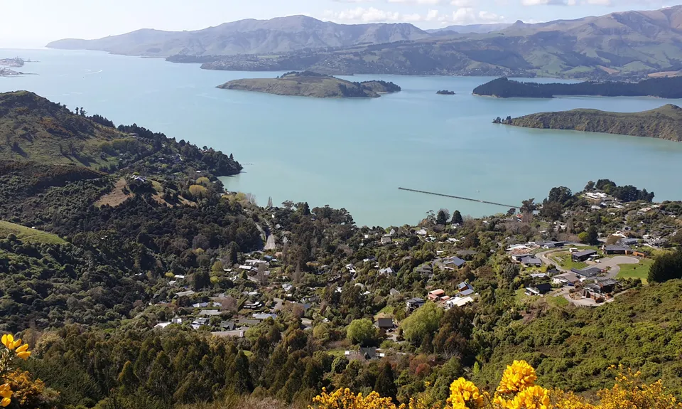
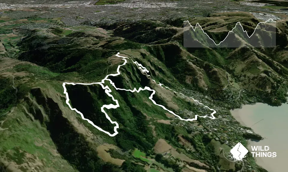
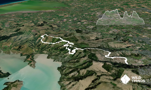
The hills behind Governors Bay hold one of the best kept secrets in Christchurch - a myriad network of interconnecting steep, gnarly tails that provides rewards in spades for anyone seeking a hard workout. This one is NOT for those seeking to hit cruise mode and glide across fast easy trails. This one is for those technical trail junkies who just can't get enough vert.

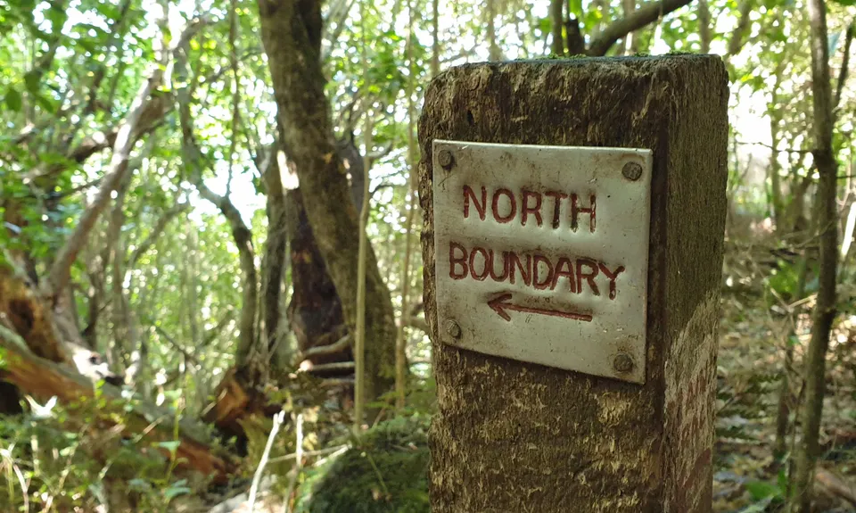
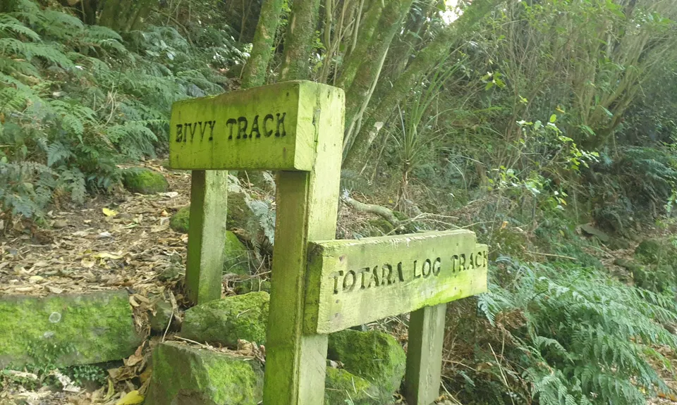
From the carpark trot up the hill to the stile and hop over to descend Faulkners Track. Keep going downhill until it pops you into a bushy area. Drop a bit more altitude and you'll reach a signposted fork - take the left fork marked North Boundary. This track will provide a juicy little loop back up to near the top of Faulkners and get your uphill legs ready for later. It can be a bit sketchy and overgrown through here at times, but its still pretty straight forward to follow.

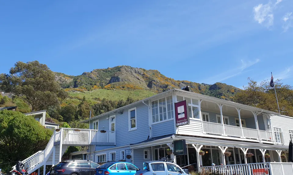
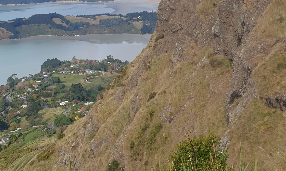
Eventually you'll loop back round to familiar territory near the top of Faulkners. Head back down again for a second time but at the fork in the bush this time head right and take a sidling descent down into the houses at the top of Governors Bay. Follow the short bits of road and connecting tracks down through Lighthouse Lane to the main road. Head right on the main road to the Governors Bay Hotel. Pick up the road behind the pub and head up to a connecting trail and gravel road section which takes you out onto which Bay Heights Road, which you cross to find the entrance to the Titoki Track on the bend.

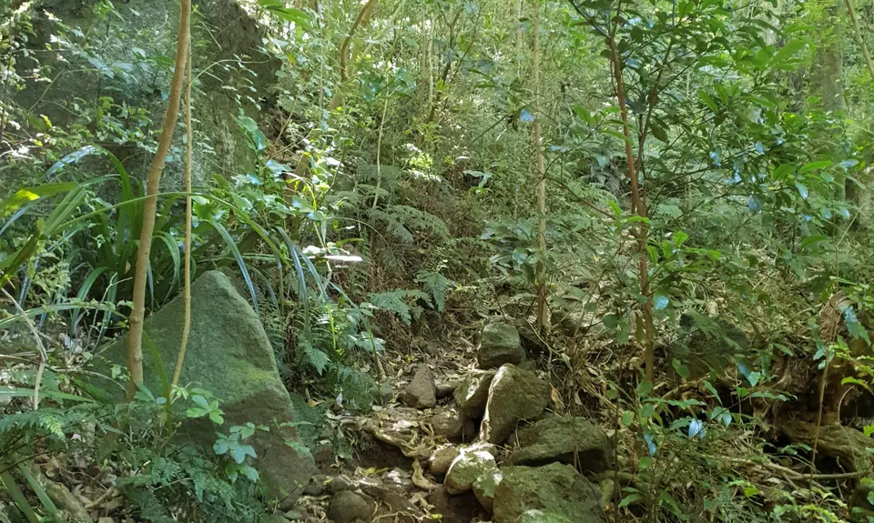
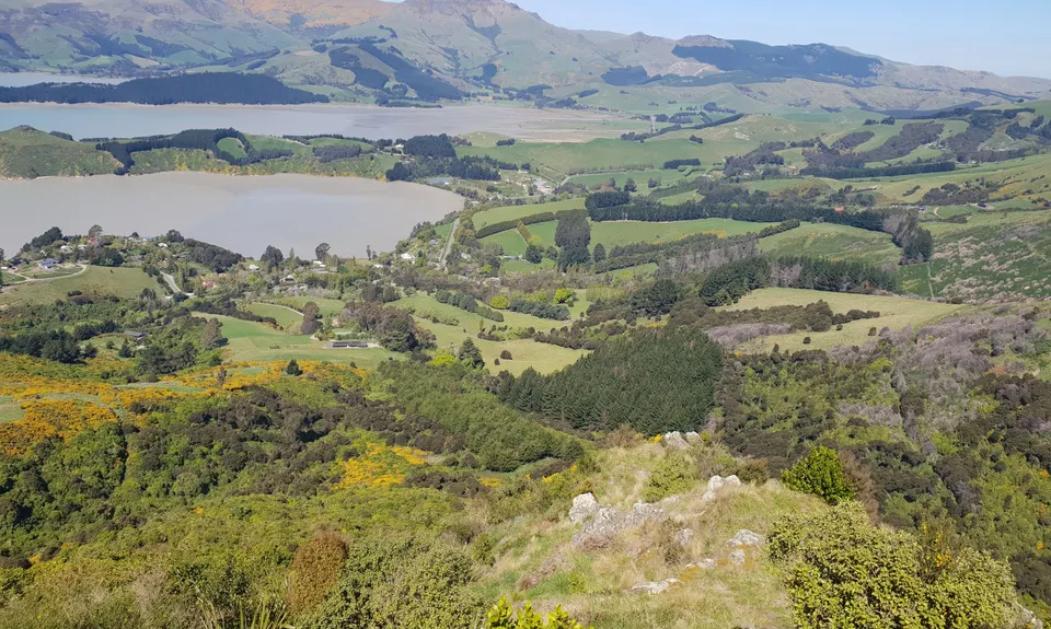
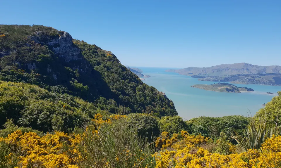
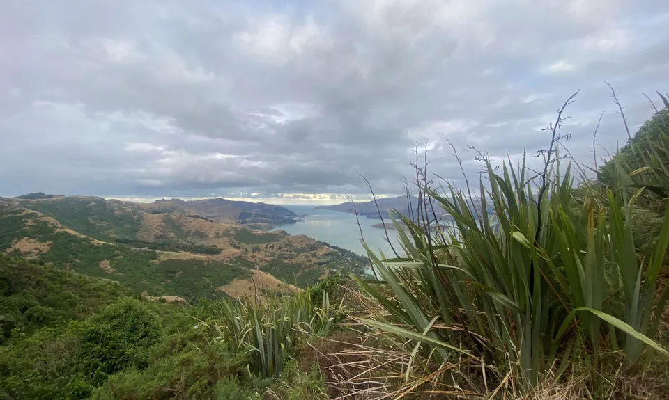
The Titoki Track is awesome, climbing pretty steadily and occasionally steeply up through native forest. At about 320M above sea level the Titoki ceases, hang left onto the South Boundary Track for a short bush undulating sidle and then ride the Watlings Track all the way back up to the Crater Rim. Next you need to head west a few hundred metres along the Crater Rim and take the signposted Bush Road Track all the way down to O'Farrells. Carry on down further- you ain't done with the downhill yet... the short Kanuka Track will loop you down and back up further round O'Farrells. Note the orange markers in the Kanuka section, if you get lost go back to the last marker.

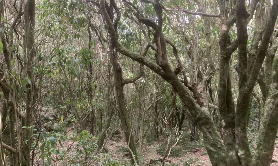
Straight across here pick up the wonderful Bivvy Track which will take you all the way back up yet again to the Crater Rim. Take note that Bivvy Track is less defined but marked with spraypaint on the trees but if you lose the trail just keep heading up, the bush is nice and open and wonderfully technical. At the top return to the car east along the Crater Rim and 360 Trail for a well earned break.

The most BRUTAL 10Km of vert to be found on the Port Hills. If anyone ever tells you Christchurch is flat... send them to this! Native bush, Steep trails, Sumptuous views.

Room for a few cars, usually not too busy.

12 km

25 minutes

Unknown

No

Moderate.

Take a map or GPS option as there's a myriad of trails and options for alternate routes here.

Perfect throughout.

Short-sleeved thermal top, Windproof jacket, Gloves, Beanie/thermal headwear, Whistle, First aid kit, Cellphone, Map.

No taps, streams often dry. So BYO water supply, you'll be wanting a fair amount!

In the wet these trails reach another level of tecnhical. Wear your best grippy soles in here.

Theres a risk you'll get addicted to vert in here and want to add more loops on to the west for e.g. Cass Ridge Track.

Governors Bay Hotel
Main Road Governors Bay
http://www.governorsbayhotel.co.nz/
Great food and beer

She Universe Cafe
Main Road, Governors Bay
https://sheuniverse.com/
Chocolate, coffee and great food

Protocol Bar
Bottom of Cashmere Hill
http://www.protocoloncolombo.co.nz/
Beer and feed on the town side of the hills

Trail Legend

Jonathan Scott

Jonathan Scott

has completed The Governator once in the last year.

Learn about Trail Legends.

You and The Governator

As a VIP member you can record private notes for this trail, see all of your times and more.

Register Now

Already have an account? Login now

Trail Reviews

How good! Got a bit lost in the Northern Boundary loop but beautiful mossy boulder sections. I love the flora transition from Watling to Kanuka. Views inward and outward are equally amazing. One of the best gnarly short tracks in Canterbury.

Greg O’Brien

July 18, 2023

Yowza!

Matt Halverson

October 19, 2021

Brutal and awesome :)

Simon Dunlop

April 7, 2021

Wickedly delightful. Plenty of Beautiful bush & terrain that will make your quads squeal!

Karen Muller

September 5, 2020

Login to submit a review

Trail Running Community

Find people who are interested in or have completed this trail run.

You must register or login to view this feature.

Register Now

Overlapping Trails

These overlap with this trail to some degree. You may wish to combine them but please note that to qualify for FKTs on these runs you should record a separate activity for each.

The Guv'nor & His Birds

The Guv'nor & His Birds

Length: 16.0km

Level: Intermediate - Experienced

The Crater Rim

The Crater Rim

Length: 27.9km

Level: Intermediate

Takahe Half

Takahe Half

Length: 21.1km

Level: Beginner - Intermediate

Christchurch 360 Trail - Sugarloaf Hills Section

Christchurch 360 Trail - Sugarloaf Hills Section

Length: 18.2km

Level: Intermediate

Bird to Bird

Bird to Bird

Length: 9.8km

Level: Beginner - Intermediate

Port Hills Protocol

Port Hills Protocol

Length: 32.0km

Level: Intermediate

O'Farrells For Shore

O'Farrells For Shore

Length: 11.5km

Level: Intermediate

Governator 2 - Judgement Day

Governator 2 - Judgement Day

Length: 7.7km

Level: Intermediate

Other trails nearby
Beer Bum Bluffs

Beer Bum Bluffs

Length: 9.5km

Level: Intermediate

Lyttelton Dress Circle

Lyttelton Dress Circle

Length: 9.0km

Level: Intermediate

Montgomery Loop

Montgomery Loop

Length: 7.9km

Level: Beginner - Intermediate

VKV challenge

VKV challenge

Length: 10.0km

Level: Intermediate

Find more trails and peaks nearby