Last Updated: 21st Sep 2023

Beginner - Intermediate

Save Trail Save

I've done it Done

Takahe Half

Christchurch, Canterbury

Submitted by James Stewart

Last Updated: 21st Sep 2023

Beginner - Intermediate

Save Trail Save

I've done it Done

Open

Grunt Factor: 31

Gnarl Factor: 44

21.1km

830m

830m

502m


Login as a VIP to see driving directions, distance and time.

Trail Map

Type of Run

Urban fringe

Out and Back

Undulating, some big hills

Dog Friendly

Native bush

Open farmlands

Open tussock/grasslands

Open ridges/tops

Volcanic

Run Makeup

30%
50%
20%

Easy Single Track

Moderate Single Track

Technical Single Track

Average Uphill Gradient: +9.0%

Average Downhill Gradient: -8.9%

Trailhead

Login as a VIP to see the trailhead information.

Estimated Times to Run

3:30

Slow

2:30

Moderate

1:45

Fast

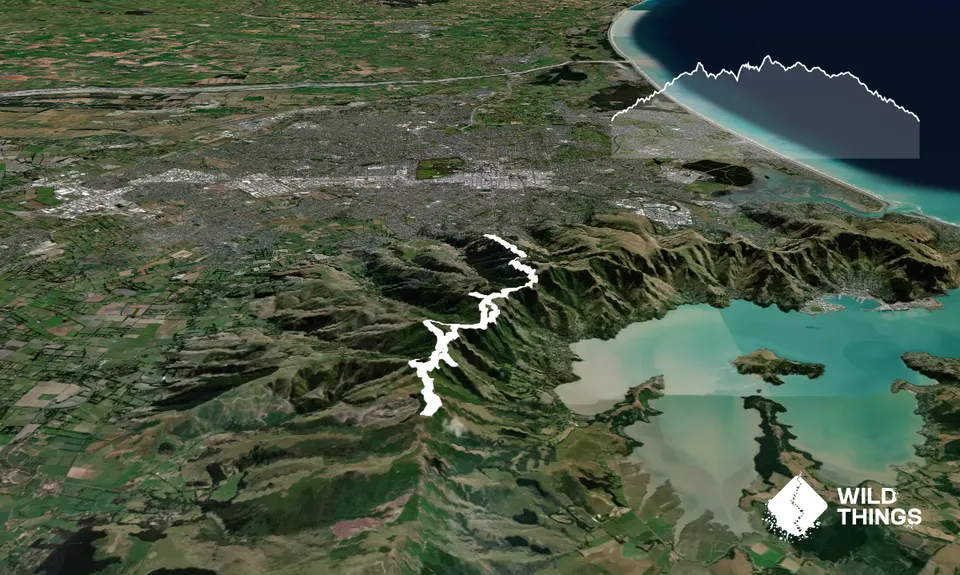
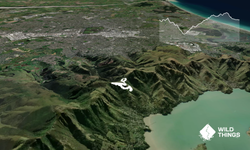
Start at the Sign of the Takahe and head up into Victoria Park. 100m in you'll see signage on your right for the Harry Ell track. Jump on this and head on up. You'll blaze through stunning native bush and a good swath of Christchurch locals stretching their legs. Halfway up you'll note the impact of the 2017 fires on both sides of the track and across the valley at the Christchurch Adventure Park (CAP).

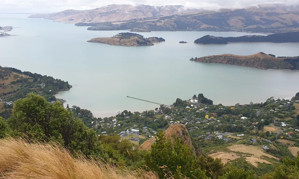
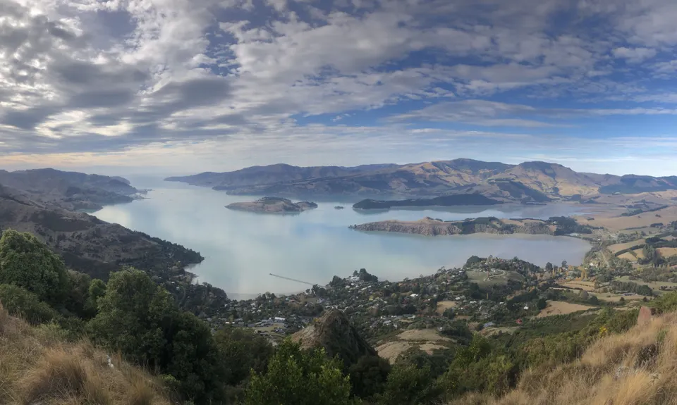
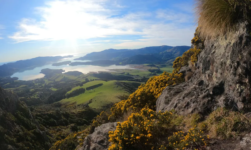
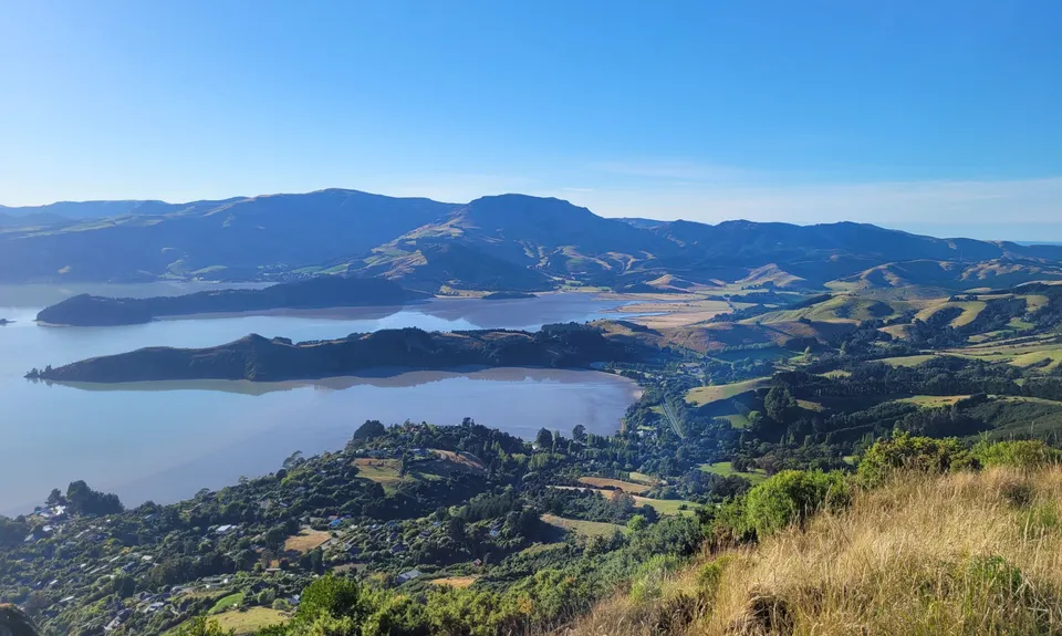
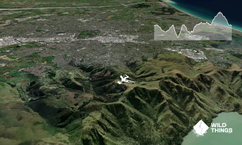
When you hit the summit, head down past the Sign of the Kiwi and keep tracking west on the Crater Rim Trail. This will take you around Coronation Hill, past the top of CAP. After about 6km you'll face a split in the trail, CRT to the right, Trig V straight and boundary track down to Lyttelton Harbour. Take the middle track for a neat peak to bag and a stunning view of the harbour and over to Mt Herbert.

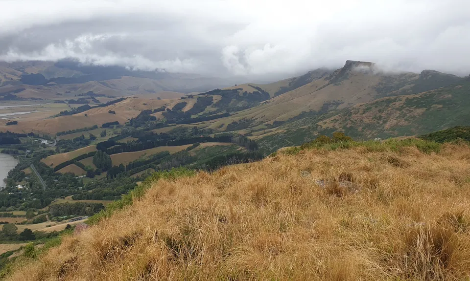
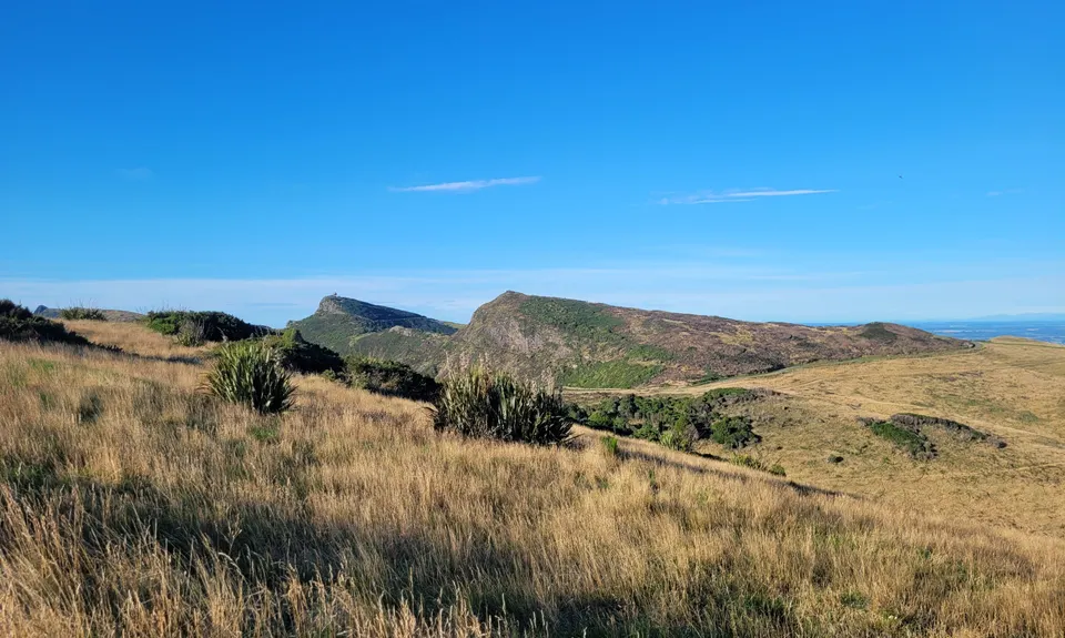
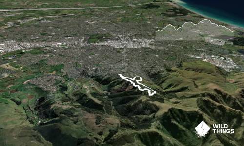
You'll rejoin the CRT and at about the 7.5km mark head left at the trail fork onto Ella's Track around the back of Mt Ada. Continue on Ella's track until you hit the Cass Ridge Track at 8.8km. Follow this up the hill where you'll shortly meet up with the CRT. Hang a left and keep on. At 9.6km you'll have the chance to deviate up to Cooper's Knob, a stunning rocky outcrop with amazing views. Local legend has it if you give it a rub it will be bigger for the next visitor...

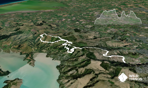
Stick on the CRT until the 11km mark. There's a side track to the right that takes you to Summit Road. Here you have three choices, (i) head back the way you came (out and back) (ii) head over the road and tackle a gorsey 4WD track back the way you came or (iii) take the tarmac option back to the Sign of the Kiwi and back down Harry Ell to the start.

Climbing up the original Lyttelton/Christchurch road, named after one of Christchurch's early trail-blazers and environmentalists, Harry Ell.
Scooting across the rim of a dormant volcano
Stunning views of Lyttelton Harbour, the Christchurch Adventure Park, Christchurch City, Pegasus Bay and the Southern Alps
A real life regenerating natural environment following the Port Hills fires of early 2017.
Amazing pockets of dense native bush along the Crater Rim Trail.

Heaps of parking, on-street (around the Sign of the Takahe) or in Vic Park

6 km

15 minutes

Yes

No

Moderate.

Generally good.

Thermal leggings, Long-sleeved thermal top, Seam-sealed waterproof jacket, Windproof jacket, Gloves, Beanie/thermal headwear, Whistle, First aid kit, Extra food for emergencies, Cellphone, Map.

Frequent spots up Harry Ell track and at the Sign of the Kiwi

Pretty muddy after rain.
Very exposed to southerly gales across the tops.

Trail Legend

Heidi Su

Heidi Su

has completed Takahe Half once in the last year.

Learn about Trail Legends.

You and Takahe Half

As a VIP member you can record private notes for this trail, see all of your times and more.

Register Now

Already have an account? Login now

Trail Reviews

A great run with great views, and some pretty rough sections that are more of a scramble than a run but still plenty of fun.
Point to note, Ellas track was technically closed yesterday. It was passable but if you're one for following the rules, you won't be able to do this one.

Alun Davies

July 18, 2021

Gorgeous panoramic views, endless mostly runnable trail, what's not to like? I followed the GPX and ran back along Summit Rd. I have actually never run along the road - always take the CRW - and I was shocked at how few cars there were! It was a really pleasant way to zip back home.

Matt Halverson

May 8, 2021

Love this one, regular 20km+ for me

Conor Keena

February 6, 2018

Nice run. First time at this end of the hills for me since the fires, such a difference. Coopers knob didn't grow when rubbed as suggested in the guide, probably due to the cold, -6 degrees. Lots of frozen mud, ice and a bit of snow. Nice alternative on the return leg, slip in a quick trip down the fantastic Flying Nun and flow through to Old Dyers Rd track to meet Harry Ell halfway back from the Kiwi

Matt Doherty

July 30, 2017

Login to submit a review

Trail Running Community

Find people who are interested in or have completed this trail run.

You must register or login to view this feature.

Register Now

Overlapping Trails

These overlap with this trail to some degree. You may wish to combine them but please note that to qualify for FKTs on these runs you should record a separate activity for each.

The Guv'nor & His Birds

The Guv'nor & His Birds

Length: 16.0km

Level: Intermediate - Experienced

The Crater Rim

The Crater Rim

Length: 27.9km

Level: Intermediate

Vicki Vale

Vicki Vale

Length: 9.3km

Level: Intermediate

Bird to Bird

Bird to Bird

Length: 9.8km

Level: Beginner - Intermediate

The Governator

The Governator

Length: 9.9km

Level: Intermediate - Experienced

Governator 2 - Judgement Day

Governator 2 - Judgement Day

Length: 7.7km

Level: Intermediate

Other trails nearby
Hey Sisters!

Hey Sisters!

Length: 2.0km

Level: Beginner

Gates Of The East

Gates Of The East

Length: 14.0km

Level: Beginner - Intermediate

Lyttelton Semi-Circle

Lyttelton Semi-Circle

Length: 5.7km

Level: Beginner - Intermediate

Avon City Loops

Avon City Loops

Length: 11.1km

Level: Beginner

Find more trails and peaks nearby