Wild Things - New Zealand's trail running community
New Zealand's trail running community

Login


don't have an account?

Port Hills Protocol, Canterbury

Trail Directory proudly supported by Further Faster

Update Your Header Picture

Port Hills ProtocolIntermediate

Submitted by Mike Steel

Info Info
Map Loading

Trail Information

32.00km

1050m

1050m


Canterbury

Christchurch

Urban fringe

Loop

Undulating, some big hills

Native bush
Beach
Coastal
Riverside
Open farmlands
Open tussock/grasslands
Open ridges/tops

Intermediate

6:00 (Slow)
4:00 (Moderate)
3:00 (Fast)

-8.9%

+8.4%

Download PDF Guide

Fastest Known Times (FKTs)

Please set your gender to see your position on the FKT leaderboards.

Men

Show more

Women

Show more

Filter FKTs

The more , the harder the FKT will be to beat. Learn about Fastest Known Times.

Missing your time?

Register or login as a VIP and get yourself on the FKT leaderboard!

Register Now

Description

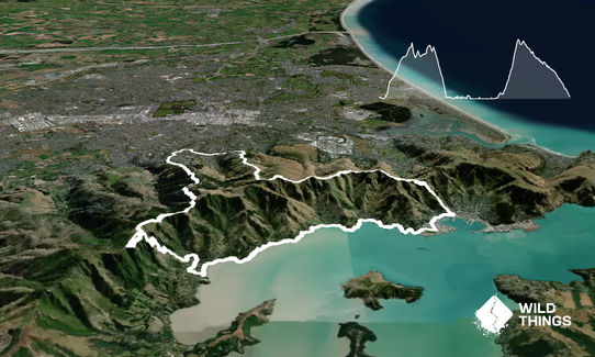
From Protocol head along Centaurus Road then up Major Aitken Drive. At the first hairpin dive off onto the Coronation Reserve trail, cross the bridge and follow up the newish track up through bush. The stairs and slopes get you very quickly up to Vista Place and onto upper Hunstbury Ave.

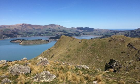
Follow this up to the end (carpark), pop over the stile on your right and follow faint trails up, passing just a little to the left of the rocky outcrop/cabbage tree on the ridge – the trail descends slightly to a fence that leads to the long grassy flat ‘runway’ and on to upper part of the gravel road. Cross the summit road and climb up Mt Vernon for great views.

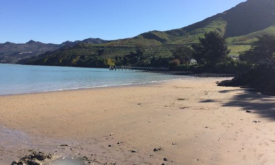
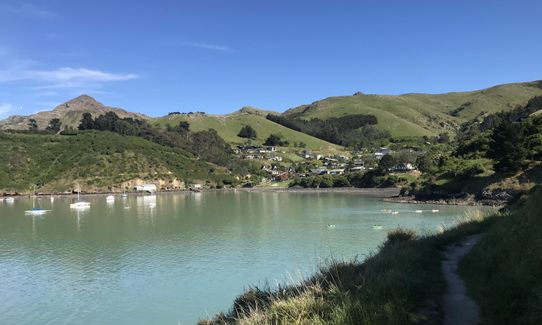
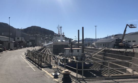
Descend east on the Crater Rim track and follow this all the way to the Bridle Track. Drop down to Lyttelton and head west past the tunnel and turn left on the Godley Quay road which leads to a rugby field. Continue on this road to the Naval Point boat club building, just to the right leads to a rocky/sandy beach. Cross this and climb up a short distance onto a wide grassy track which takes you to Corsair Bay (great swimming), then narrows to single track onto Cass Bay (toilets at both these beaches).

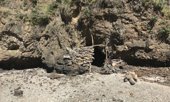
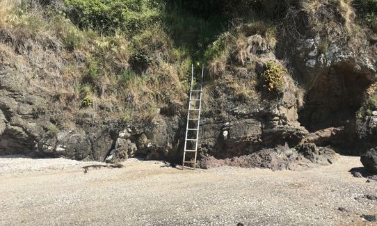
The trail continues beyond Cass Bay on round the coast (towards ‘Pony Point’) – follow this until you are as far out to sea as possible, at which point the track climbs steeply on an obvious/new wooden staircase. Don’t go up there - instead drop down to the sea – there’s no track, and it looks bluffed below, but carefully head down (good clumps of grass to hang onto!) tending right towards a ramp that allows you to find land below. Now you’re down with the shellfish, begin the delicate ballet dance/run along the rocky coast that leads to Rapaki beach (with its two little thermal pools).

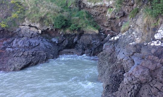
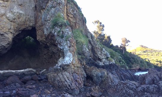
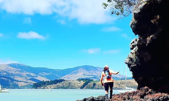
Continue ‘running’ along the coast which becomes increasingly remote – in places it's a bit slow, but there are faster sections on sandy beach or flatish rocks . At one point the sea comes into a tight cove – it’s possible to keep your feet dry here by climbing along ledges on the right (see pic) and stepping over onto the big rock. The coastal rocky running improves a bit after this, and includes a delightful secluded sandy beach.

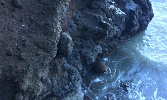
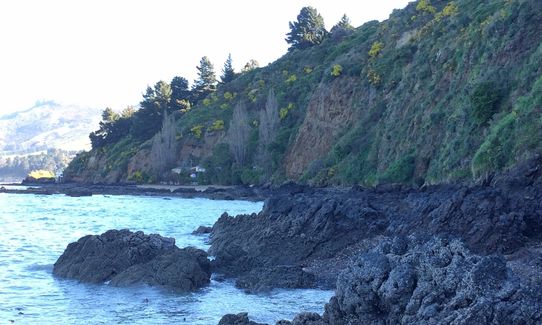
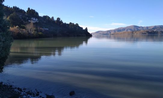
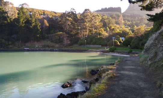
Beyond this there is one more obstacle where climbing seems tricky, but if the tide is low enough you might just keep your feet mostly dry by going low and jumping between rocks (if not, it’s not deep!). Continue around the coast – ignore any tracks that head up, eventually passing a couple of batches -- the running improves, and when you round a corner by a derelict wharf you’ll see a grassy trail on your right that leads into Sandy Bay (toilet here) – continue past this on the level road (not the climbing road) and take the single track trail that leads off left to the Governors Bay jetty - it stays very near the water, and pops out on the road just above the jetty.

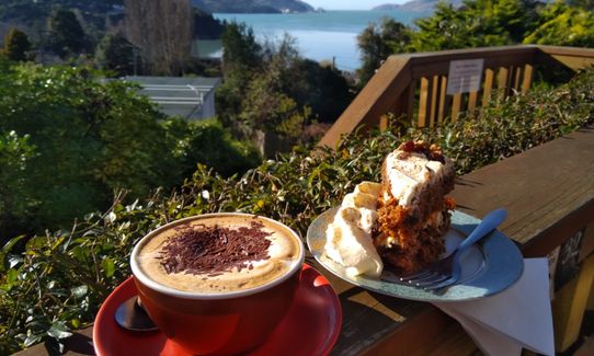
Run up the road to the Harbour House Cafe (formerly She Universe Cafe) - the high cliffs ahead of you are where you're heading so maybe call in for a coffee and some scones! From the café you need to find Faulkner’s track.To do this, run on Main Rd towards Dyers Pass, turn left at Zephyr Terrace, left again at The Terrace and just after Hyland Brae on your right is a narrow staircase (with concrete block sides). This is the start of Faulkner's track.

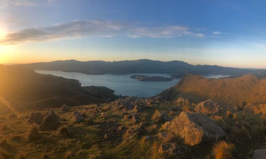
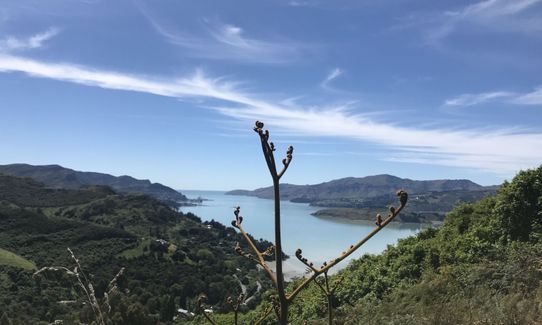
Follow Faulkner’s track up which first climbs up steeply past houses, before entering Ohinetahi reserve, and climbing more gently south for a while. The track then begins a sharp ascent, zig-zagging its way up an improbably steep slope between bluffs and briefly entering a prominent bushy gully. However, the cleverly placed track is pretty much runnable all the way (slowly) right up to the crater rim walkway. Here turn left and go up to Trig V for superb views down the harbour- then continue on that track south till it meets the Crater Rim again, and then follow the Crater Rim back – it’s pretty much all downhill to the Sign of the Kiwi (another great café here, also toilets and water) then down the Harry Ell track, past The Cup café, and down the final stretch of Dyers Pass road back to Protocol.


Trail Community

Find people who are interested in this run.

You must register or login to view this content.

Features of interest

This 32k circuit run starts and finishes at Protocol café/pub in south Colombo Street, and involves no backtracking. It can only be done around LOW TIDE, and even then you may still get wet. It passes four other fine cafes, but also takes in two summits, and a rarely visited/remote part of the Lyttelton harbour coastline, and several sandy beaches (including one with two tiny thermal pools). There’s a pumping climb up arguably the most ‘interesting’ ascent on the Port Hills (Faulkner’s Track). This run has all types of tracks (including no track at all) and all styles of running -- including no running at all! Plenty of things to see along the way (bush, beaches, rocky cliffs, seagulls, oystercatchers, ducks, shellfish).


Make Up of Run

Untracked / Route only: 10%

Technical Single Track: 15%

Moderate Single Track: 20%

Easy Single Track: 25%

Farm Road / 4WD Track: 10%

Gravel Road: 5%

Sealed Road: 15%


Route Data

Reviews:

You must register or login to view this content.


Overlapping Runs

The following trails overlap with this run to some degree. You may wish to combine them but please note that to qualify for FKTs on these runs you should record a separate Strava activity for each

VKV challenge

VKV challenge

Length: 10.00km

The Governator

The Governator

Length: 9.85km

The North Faces

The North Faces

Length: 24.80km


Photos:

You must register or login to view this content.

Your Trail Wishlist

All the runs that are on your To Do list (no limit).

Add to wishlist view wishlist

Your Trail Dreamlist

The runs you most want to do (limited to 10).

Add to dreamlist view dreamlist

Wild Explorers

I did it!

See other runs nearby:

Godley Head loop
Lyttelton to Diamond Harbour
Halswell and Kennedys
Summit Walkway
The Bowenvale Elevator
The Gorsetrack Strikes Back
Rapaki Sugarloaf Return
Sign Of The Takahe - Rapaki
Port Hills Nearly Half Marathon
Horse Longitudes
Horse Latitudes
Sumner Half Heads
Whigs' Flying Fifty (WFF)
VKV challenge
Banks Peninsula Ultra Beer Run
Bottle Lake Blue Loop
Gebbies to Packhorse Romp
Hagley Figure of 8
Bowenvale / Huntsbury Loop
Avon City Loops
Avon - Source to Surf
Okuti to Hilltop Amble
Gondola Gallop
Orton Bradley Loop
The ATH (Around The Harbour)
Lava - H.ELL Loop
Travis Wetland Loop
Punk Rock Assault On Windsor Castle
The Guv'nor & His Birds
The Crater Rim
Lava Lite
Takahe Half
North New Brighton Spit
Mt Pleasant Trig
God's Con - Rehab Road
Gang of Four
Dog Sniffing Rhythms - Harbour Crusin'
Trinity - Harbour Bruisin'
Gates Of The East
Hunting Out A Gorge-ous Loop
Lyttelton Dress Circle
A Diamond in the Rough
Port Hills Spur Challenge!
Up Hill Down Valley
The Coffee Run
Pour Some Sugarloaf On Me
Never Trust A Crocodile
Lyttelton Semi-Circle
Hagley Perimeter
Holliss Stairway to Heaven
Diamond, Herbert & Fitzgerald
Barnett Bunker Buster
The Pipeline of Pain
Mt Vernon Farm Track
Vicki Vale
Heathcote River Run - Opawa to Hoon Hay
Christchurch 360 Trail - Sugarloaf Hills Section
Little Learner Loop (Halswell Quarry)
Bird to Bird
Bodybag
O'Farrells For Shore
The Governator
Heathcote Meander
Spitting Distance
Montgomery Loop
Canterbury Agricultural Park Loop
2 Sugars, 2 Vernons & a Half Shot
Quail Island Looping
The Chairlift Choice
Tussock Hill Ridge
Mt Pleasant Elevator
McLeans Meander
Girdle the Groynes
Governator 2 - Judgement Day
Christchurch 360 Trail - Godley Cliffs Section
Westmorland Wetland Time Trial
Loopy in Siberia
The North Faces
Westmorland Hill Reps
360 Trail - Dunes Wetlands Section
Rocking Gibraltar
Dune Bugging
Hey Sisters!
Living Springs Loop
Springing Around Longhurst
Lady Isaac Loop
The Missing Link
Beer Bum Bluffs
Brooklands for the Birds.
Surf's Up!!!
Styx Pick Me Up
Orton Odyssey
Shoeing the Horse
Tauhinu-Korokio TKO
Double Top
Beginner's Adventure Park Loop
Boulder Dash
Clan of the Cave Runner
Taiora Track
Landfill Lark
Morgans Baa Baa Loop
Mary Had a Little Lamb
Horsing Around
Port Hills 8-Attack
Pinecone Pirate - Waitākiri/Bottle Lake Forest Park
Frogger
Takahe to Taylors

Show all

Got a favourite trail? Tell us about it.

Share the love and add your favourite trail(s) to our growing trail directory.

Submit A Trail

Become a member today

Start enjoying the many benefits to becoming a member of our thriving community.

Become a member

Great brands at great prices with our VIP member's discount

Stay up to date

Sign up to our newsletter for latest offers and trail guides

Share this trail with a friend:

VIP Membership

Please register as a VIP or login to your VIP account to view this content.

Cancel Login Register

Membership Required

You can see up to three trail guides without being logged in but after that we require you to be logged in to your Free or VIP account. If you don’t yet have an account you can register here.

Login Register