Last Updated: 29th Nov 2023

Intermediate

Save Trail Save

I've done it Done

Punk Rock Assault On Windsor Castle

Christchurch, Canterbury

Submitted by Matt Doherty

Last Updated: 29th Nov 2023

Intermediate

Save Trail Save

I've done it Done

Open

Grunt Factor: 20

Gnarl Factor: 56

12.0km

525m

525m

298m


Login as a VIP to see driving directions, distance and time.

Trail Map

Type of Run

Urban fringe

Loop

Undulating, small hills only

Dog Friendly

Open farmlands

Open tussock/grasslands

Run Makeup

5%
20%
45%
30%

Sealed Road

Easy Single Track

Moderate Single Track

Untracked / Route only

Average Uphill Gradient: +12.1%

Average Downhill Gradient: -10.2%

Trailhead

Login as a VIP to see the trailhead information.

Estimated Times to Run

2:15

Slow

1:30

Moderate

1:00

Fast

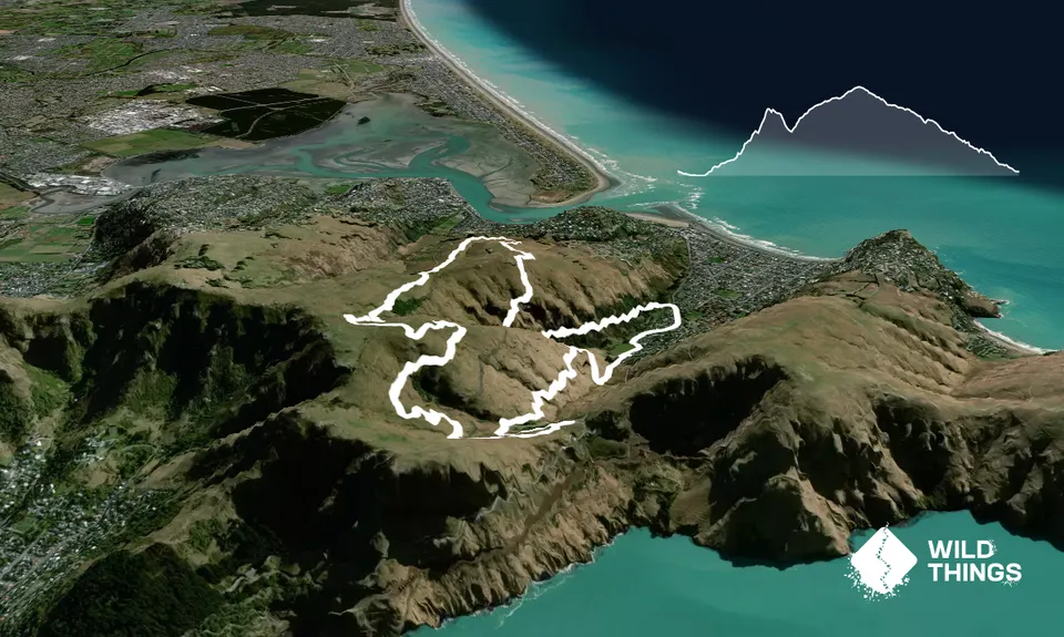
The start of the track takes you through a rockfall hazard area which doesn't have any signage at the bottom of the track. Possibly because the track was closed post quakes due to rockfall danger and a new track was put in further around the valley to avoid this area. There are no longer track closed signs or barriers at this entrance, but if this does concern you, you can avoid this 1.5km section and follow the "B" route beginning described at the end.

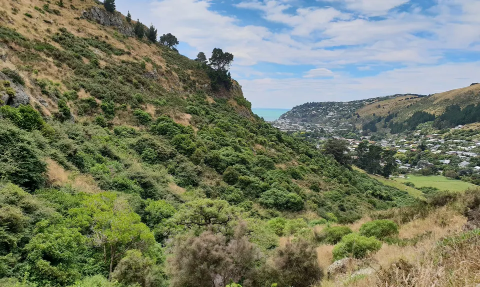
From the start point at the road follow the creek for a few metres then head up the bank in front of you onto the old disused Captain Thomas track. This has degenerated since it was was moved to a different part of the valley after the Canterbury quakes but it is kept open by locals using it.
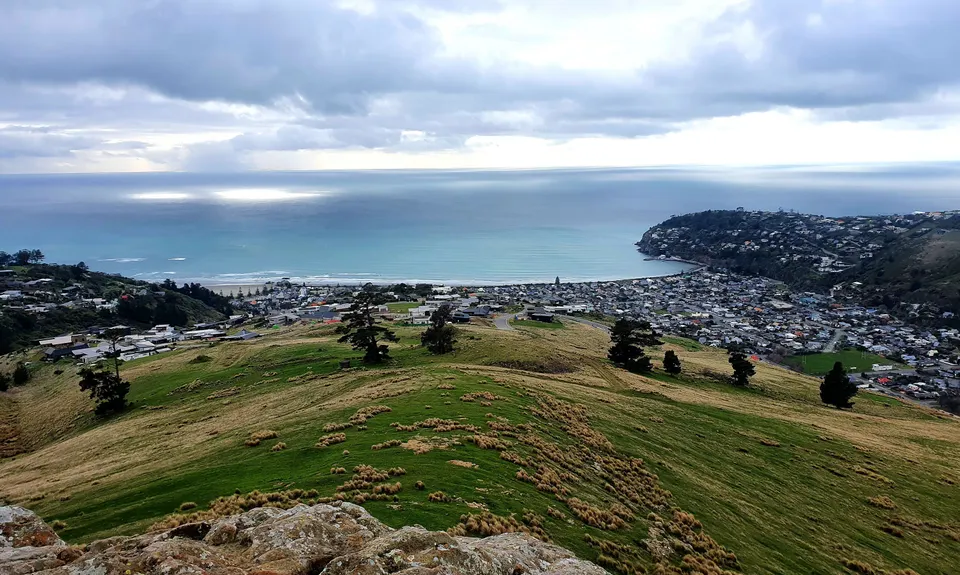
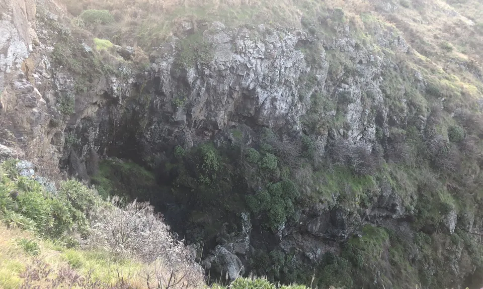
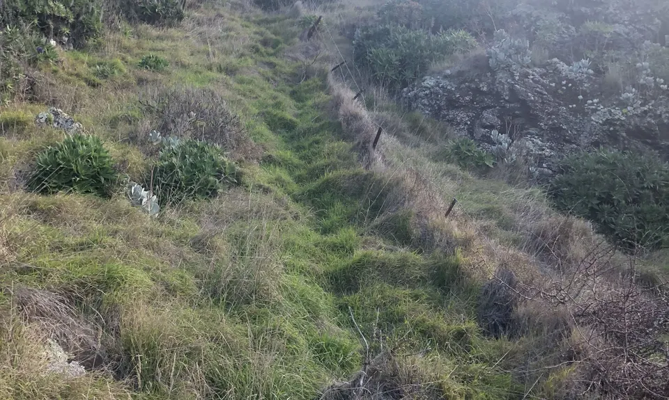
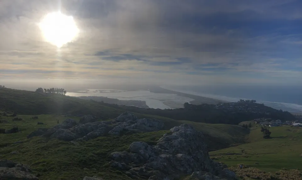
The track climbs steeply at first with boulders and slips making it quite technical. After the first short climb the track traverses the hill beneath Punk Rock gaining altitude until you pass a waterfall/bridge. A few meters past this you will climb a small rocky section a couple of meters long (if you come to a gate you have gone too far) Turn right here off the track and follow the fenceline up along the edge of the bluff and above the (often dry) waterfall.

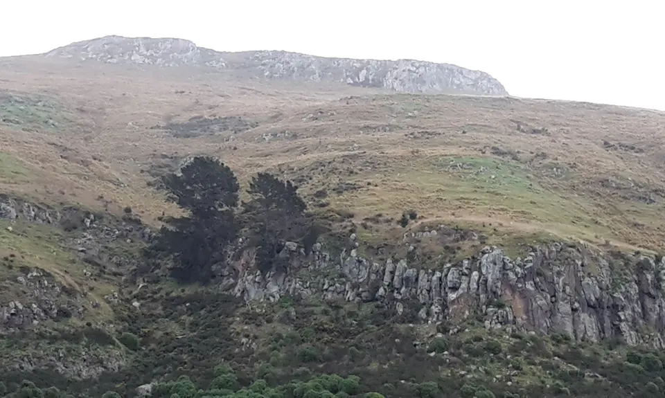
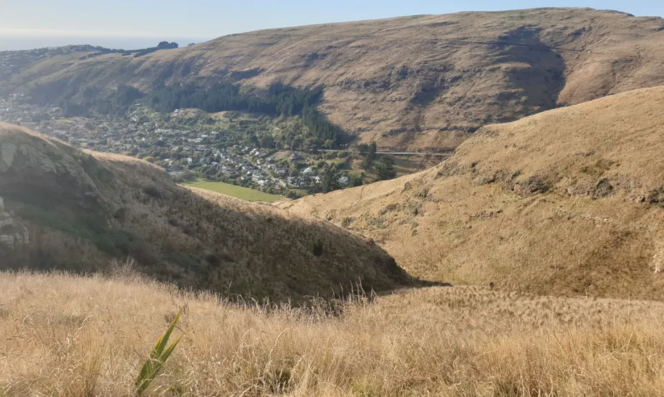
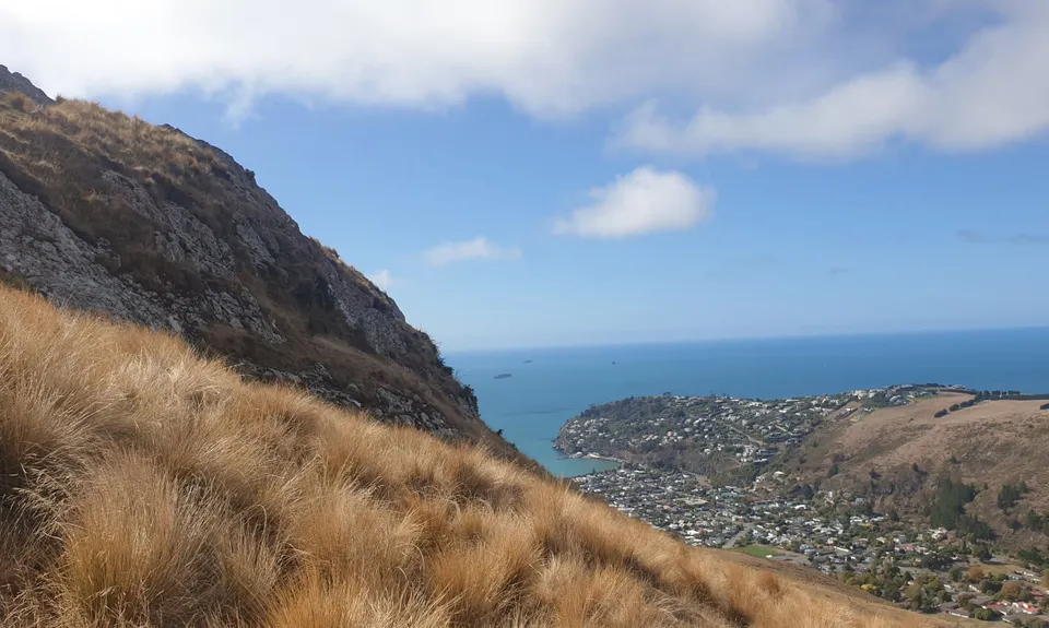
Continue climbing roughly following the creek (you will be on the true right of the creek) until you are high enough to cross the creek and head up to Windsor Castle above most of the bigger bluffs. Windsor Castle will be seen at the top of the hill to your right. Sidle across the hill through tussock using sheep paths & fences if you find some until you are below the Windsor bluff, then head straight up aiming for left of centre for the easiest acess to the top.

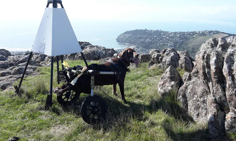
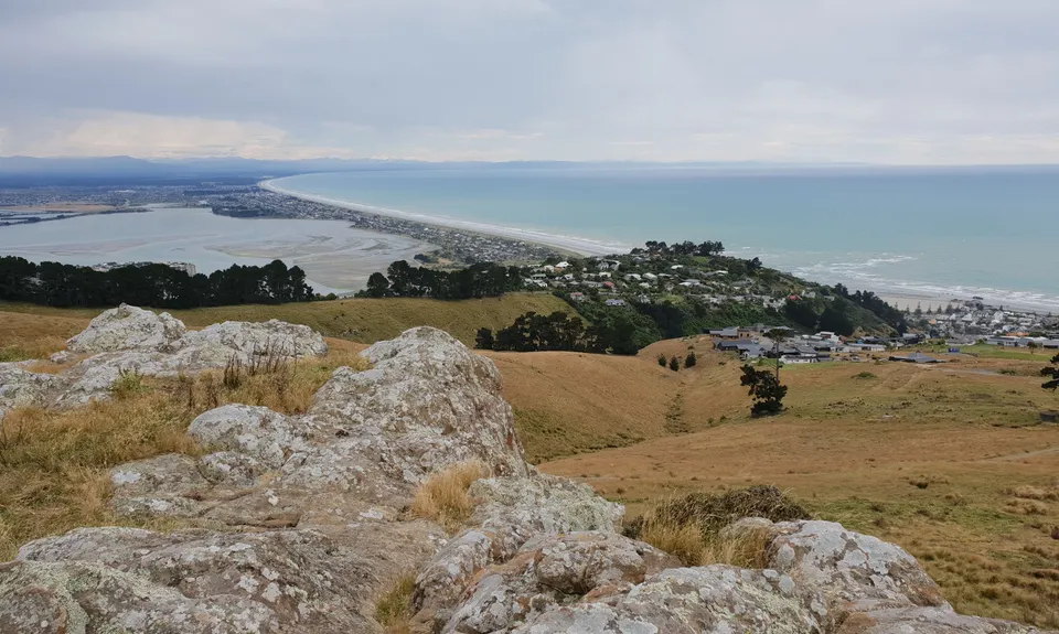
On top head over to the trig and check out the 360 views (amusingly, on a clear day you can see Balmoral to the NW) From the trig, stand with your back to the bluff face. Head left for a few meters to a fence, turn right at the fence and follow this to a stock road a 100 or so meters away. Across the road there are 2 gates in front of you. Go through the left gate and look across the valley in front of you to a line of pine trees up on the next ridge, this is where you are aiming for, ignore any other tracks you come across. At the pine trees turn left onto a track and follow the track with marker poles closest to the fence all the way to a stile. Over the stile, sight the big solitary pine in front of you and head for it. From the pine stay on the same trail until you hit the sumit road.

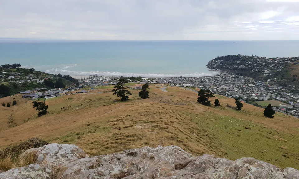
Over the stile, turn right along the trees for 100m, Cross the road, over another stile and pick up the MTB track in front of you (not the farm track) this climbs for a km or so then joins into Greenwoods MTB trail, turn left at this junction and it's a sweet 3.5km downhill to Evans Pass cross roads, last 100m are on tarseal still heading dowhill on the road, immediately before the crossroads pick up the top entrance to Captain Thomas and it's another nice 3km downhill.

From the bottom of the track, head down the steps tp the leaft of teh roundabout, follow round the horse paddock then through the kids playground onto Sumnervale, head along sumnervale to the end the left onto Wakefiel Ave back to the starting point.

"B" Alternative start to route. From the starting point head along Wakefield ave away from Sumner, 1st right Sumnervale Drive, across the playground and round the horse field, up the steps and turn right at the roundabout, head up the new Captain Thomas track (over stile & bridge) for just over 1km. Through the trees and swithcbacks then turn right when you hit the flat track. In a few meters there is a locked gate and danger track closed sign. You are only going on the first 20meters of this track and not to the danger area. Jump the gate and after a few meters you will hit a small rocky descent. Turn left off the track here and join in with the original description.

Punk Rock & Windsor Castle are 2 bluffs on Richmond hill in Sumner. Punk Rock was a popular rock climbing face, Windsor Castle sits on top of the hill.
Queens Birthday weekend seemed like an apt time to go to Windsor Castle, Punk Rock was thrown in along the way as it is 40 years since Queenies silver jubilie and I'd heard The Sex Pisols God Save The Queen (also 40 years old this month) on the radio the just the other day.

Head through Sumner along Wakefield Ave. past the 2 rock protection walls on the right hand side until you see Paisley St on your left. Just past Paisley street is Van Asch school. You can park here.
Purple bus route termination point is by Van Asch school at the end of Wakefield Ave

14 km

23 minutes

Yes

No

Moderate.

Generally good.

Long-sleeved thermal top, Seam-sealed waterproof jacket, Gloves, Beanie/thermal headwear, Whistle, First aid kit, Extra food for emergencies, Cellphone, Map.

Water at the horse paddock at the end of the route

Can be very muddy after rain

Rockfall hazard particularly around Punk Rock.
Under runners on the unmarked route portion
MTBs on the downhills

You and Punk Rock Assault On Windsor Castle

As a VIP member you can record private notes for this trail, see all of your times and more.

Register Now

Already have an account? Login now

Trail Reviews

Totally hated it from 2k to 4.5k mark according to gps track. If you really have nothing to do, give it a go. Gaiters and patience recommended.

Massimo Nember

January 22, 2023

Did it in reverse but more like type 3 fun! Suggest wearing long trousers.

Mike McManaway

September 30, 2022

Definitely an adventure! I did this in reverse and enjoyed the views and lovely single track for the first 10km or so. After that I seemed to do a lot of bush bashing, tripping over tussock and getting scratched by bushes. It was a relief to get to the track at the bottom. A fun adventure and will be back to try it the other way round.

Stefanie Parks

August 21, 2022

Fantastic route of two halves. The old Captain Thomas track is one of my favourites. It seems to have had a lot of work done on it by the locals of late. Very tidy, and the precarious 'bridge' has been re-built. Route description still checks out - it's just hard to not get sucked to the RHS of Windsor Castle. The mountain bike track at the start of Greenwoods Reserve is still there - it's called 'Titus'. Take a hard left after climbing the stile after crossing Summit Road to find it.

Brion Matthews

February 4, 2022

Login to submit a review

Trail Running Community

Find people who are interested in or have completed this trail run.

You must register or login to view this feature.

Register Now

Overlapping Trails

These overlap with this trail to some degree. You may wish to combine them but please note that to qualify for FKTs on these runs you should record a separate activity for each.

Sumner Half Heads

Sumner Half Heads

Length: 21.6km

Level: Beginner - Intermediate

Trinity - Harbour Bruisin'

Trinity - Harbour Bruisin'

Length: 20.1km

Level: Intermediate

Gates Of The East

Gates Of The East

Length: 14.0km

Level: Beginner - Intermediate

Other trails nearby
Mt Pleasant Elevator

Mt Pleasant Elevator

Length: 11.8km

Level: Beginner - Intermediate

Tauhinu-Korokio TKO

Tauhinu-Korokio TKO

Length: 4.9km

Level: Beginner

Westmorland Hill Reps

Westmorland Hill Reps

Length: 4.0km

Level: Beginner - Intermediate

Port Hills 8-Attack

Port Hills 8-Attack

Length: 17.7km

Level: Beginner - Intermediate

Find more trails and peaks nearby