Last Updated: 16th Jan 2024

Beginner

Save Trail Save

I've done it Done

Horsing Around

Christchurch, Canterbury

Submitted by Callum Templeton

Last Updated: 16th Jan 2024

Beginner

Save Trail Save

I've done it Done

Open

Grunt Factor: 10 ?

Gnarl Factor: 35 ?

5.6km

325m

325m

216m


Login as a VIP to see driving directions, distance and time.

Trail Map

Type of Run

Urban fringe

Out and Back

Undulating, small hills only

Native bush

Open farmlands

Open tussock/grasslands

Run Makeup

1%
39%
20%
20%
20%

Gravel Road

Farm Road / 4WD Track

Easy Single Track

Moderate Single Track

Technical Single Track

Average Uphill Gradient: +11.4%

Average Downhill Gradient: -11.4%

Trailhead

Login as a VIP to see the trailhead information.

Estimated Times to Run

1:00

Slow

0:45

Moderate

0:30

Fast

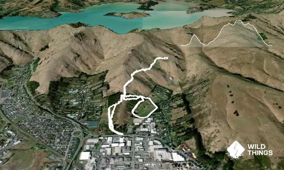
A 5.6km jaunt to explore the tracks and trails that run through native planting at Duncan park.

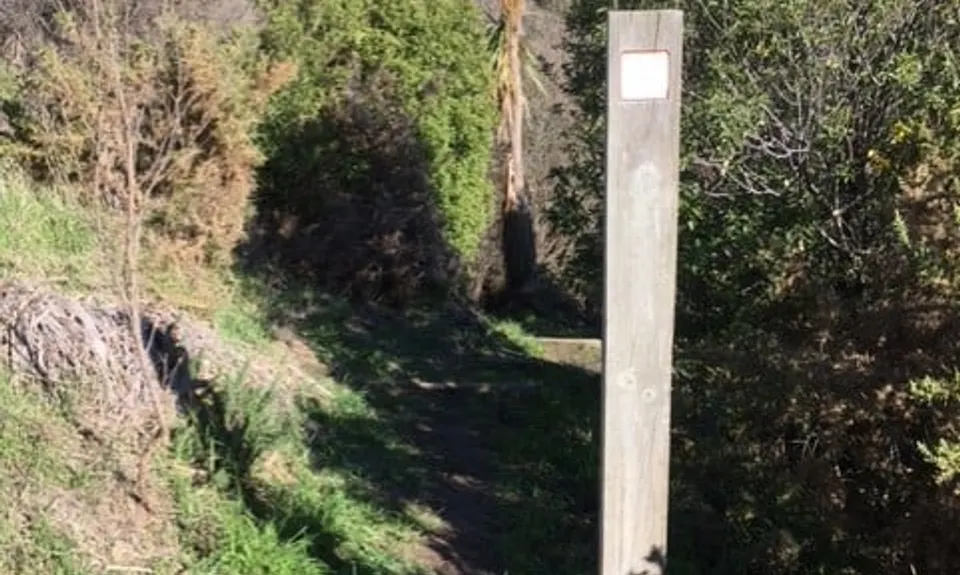
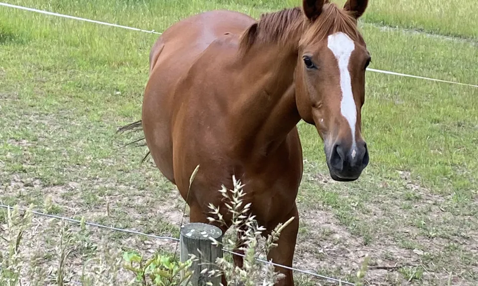
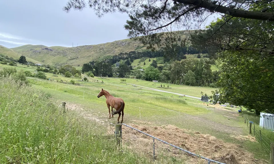
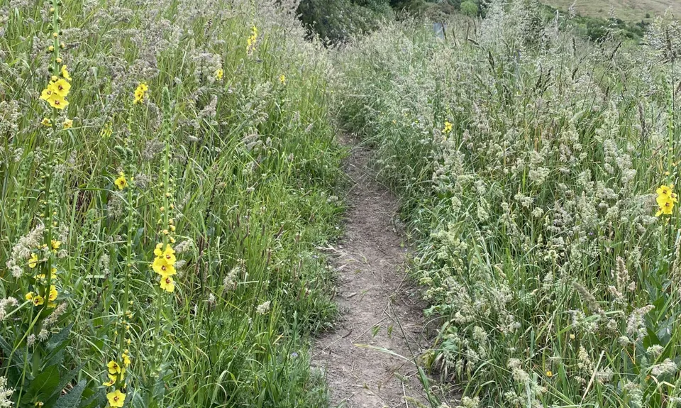
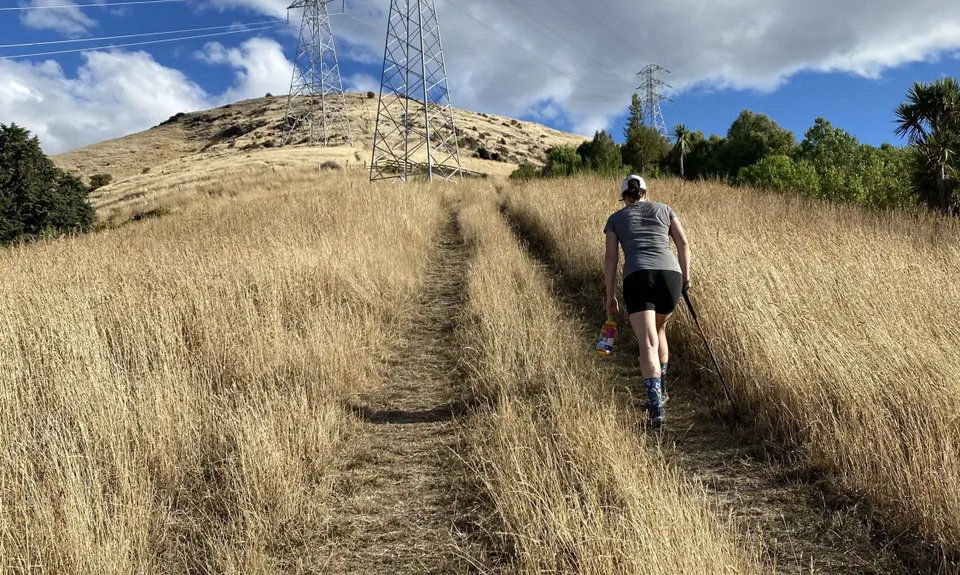
The trail starts at the Duncan park sign on Port hills road, run the short distance on a shingle road which becomes a car park, when you reach the end go straight ahead and through the farm gate which is usually open the track is clay based and gets super hard in summer but after rain can be slippery. As you progress up this track you will have horse paddocks on your left and a mix of native bush and gorse on your right, the track is clearly marked with tall wooden poles with W on them.

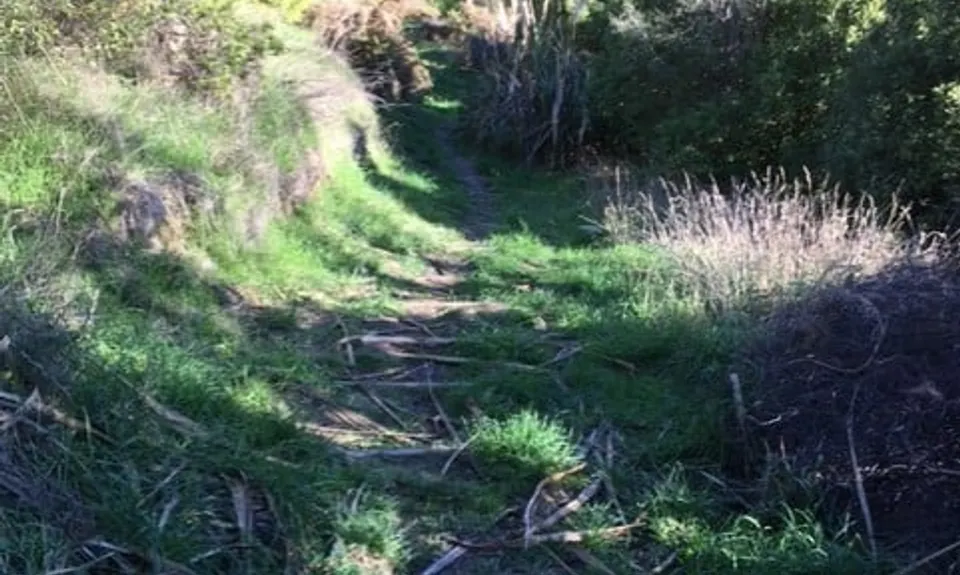
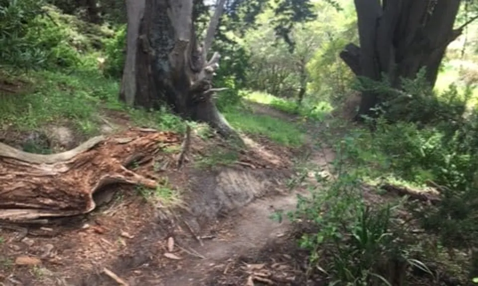
After a bit you will come to a pine plantation - one track will head towards the trees and another will head right and uphill. The uphill track that you want to follow. After a few minutes you will see a track on your right hand side cutting through the native bush, this is the track you will finish on when you come back down. Keep following the track until you reach the stile. Climb over the stile and follow the trail across the ridge to the next stile, follow the trail down. It's clearly marked with dooden poles and a fair amount of the steps on the way down have been created using old car tires.

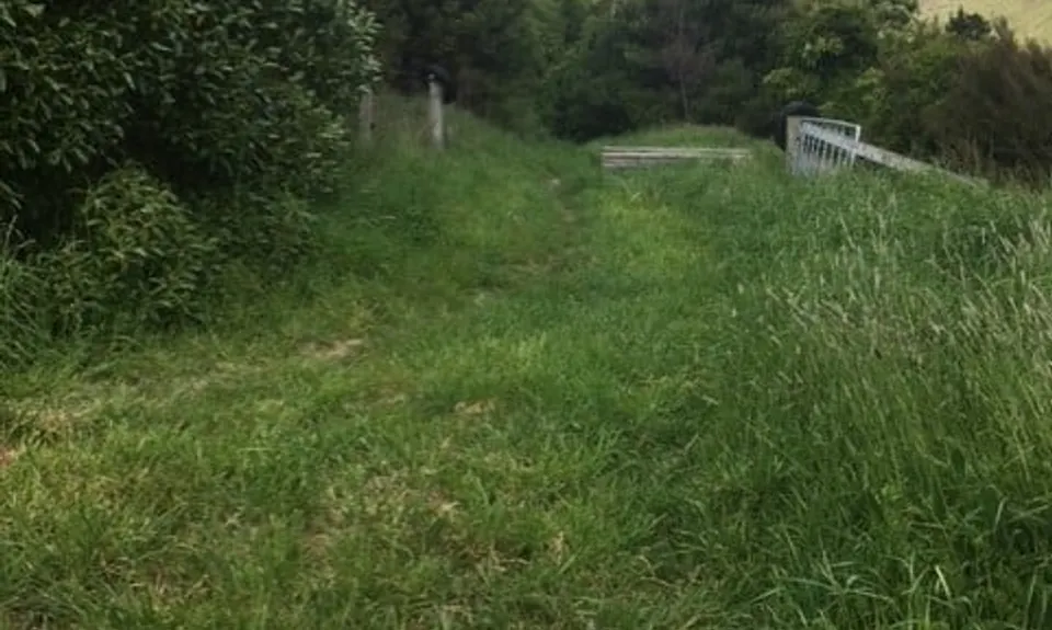
Follow the track all the way down into Avoca Valley. The track ends up between two fence lines before you turn right at the end and end up in a large field. Follow the W poles which are in a large field, run around this field with the poles to your left and the open space to your right. On the other side of the poles there will be a creek and native plantings. Once you reach the tall wooden timber fence/hitching post follow that to the shingle road, cross the single road and head up through the oak trees. The club house will be on your left hand side. Follow the track up, after about 300mtrs it will give you the option of going left, ignore this and keep heading straight you are now on part of the cross country course. It is rarely used by horses but the jumps are still there.

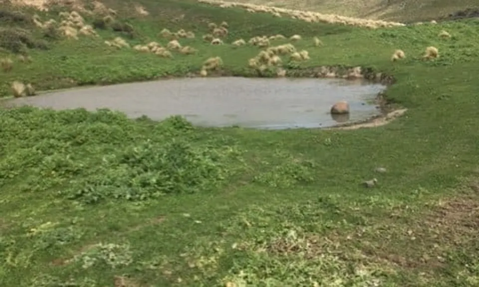
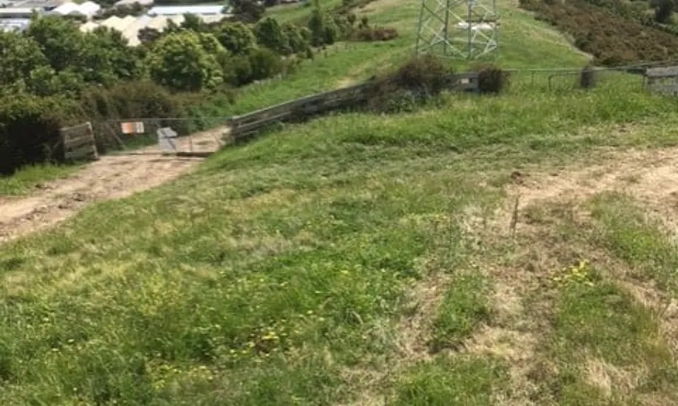
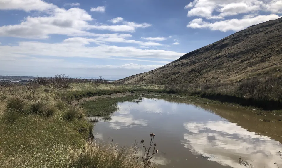
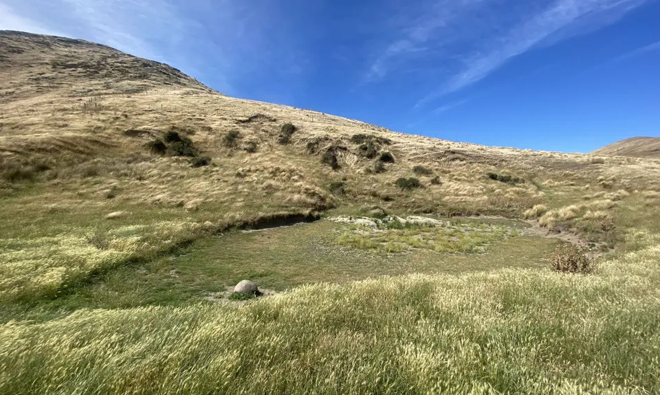
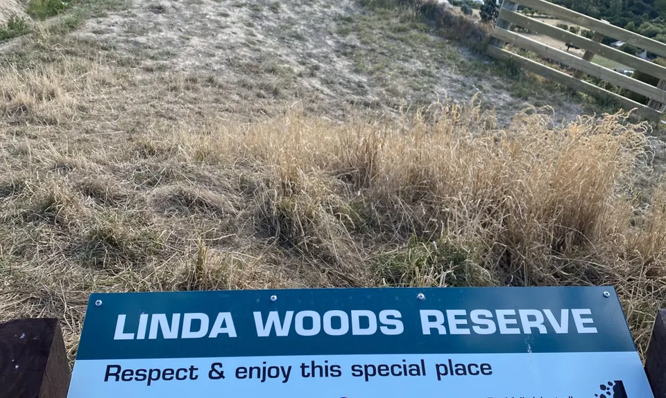
Eventually the track will reach a point where you can see a wooden pole and where you came down - ignore this and follow the track you are on through the bush and up through the gate that's always open onto the ridge. Turn right and head up the ridge past the power Pylon and through the farm gate. To your left and about 100 metres up the hill you are going to see two tall farm gates head up to them and if they are closed then go through the right hand side one as it's easier to open. After a bit of uphill the track becomes undulating with more ups than downs on the way out eventually you will reach a pond on a flat part of the Linda Woods reserve. If you have brought your togs and a picnic and the wind isn't blowing then you are in for a treat.

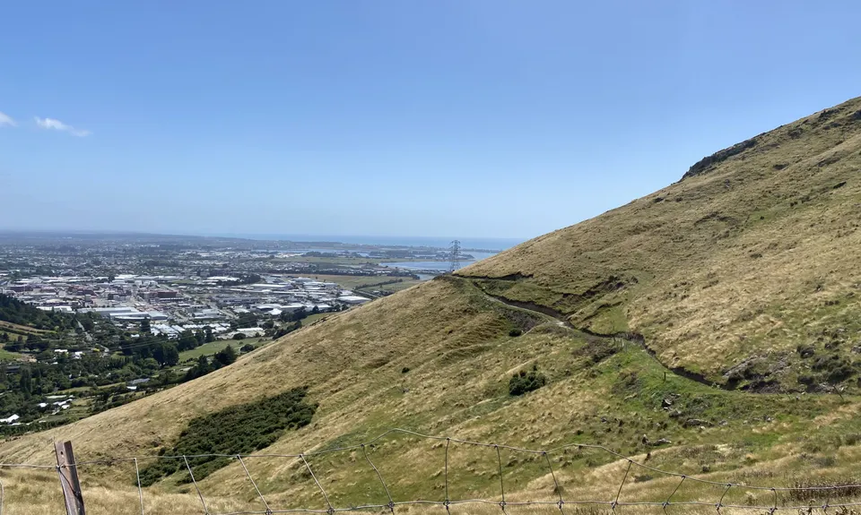
From the point you can see the Kaikoura Ranges, Montgomery Spur and Rapaki track, you will also get a great view of Avoca valley which is being transformed with Native planting. 25,000 trees are being planted this year. Once you have enjoyed the space then run around the pond and head back down the track, passing through the gates and back past the power pylon on the ridge to the first stile that you crossed over head back down the trail till you come to a track on your left cut through the native bush, this track was created by the team who are responsible for the native planting on both sides of the ridge, this work was started in 2014 and is already transforming the space from a gorse ridden wasteland into beautiful nature reserve. Follow this track all the way until you reach the small gate, head through this gate back to your start point by the sign.

The late Mary Duncan bequeathed Duncan Park to the Christchurch City Council in 1949, for a public reserve. Duncan Park consists of 23.4 hectares extending east from the Avoca stream over a steepish spur and down into Horotane Valley. Access is from Port Hills Road. The Duncan Family originally farmed the site. In the 1860s the site was also used as a shooting range and military camp for various colonial volunteer training events. Since 1962, the park has been leased by the Ferrymead Pony club, One of the highlights is the cross-country course, which is unique in Christchurch, due to its steep terrain. Although entrusted to Christchurch City by the late Mary Duncan with the aim of providing for and supporting educational and botanical values, no use was initially found for the land. For a period of 15 years it was neglected, becoming infested with noxious weeds - there was an estimated 13 acres of gorse. Erosion had also caused considerable damage. Early club members had the massive task of re-establishing the land.

Recommend parking outside on Port Hills road, there have been issues in the past with people breaking into cars in the carpark.

8 km

14 minutes

Unknown

No

Easy.

When you are coming down the track on the Avoca valley side, midway down you will see the track that you head back up on below you, just keep heading down.
When heading through the farm gate on your way to the track that heads to the pond, you will see a farm track that heads down into Avoca Valley ignore this track, if you end up on a farm track that heads down with lots of gates then you are heading the wrong way.

Perfect throughout.

Short-sleeved thermal top, Windproof jacket, Beanie/thermal headwear, First aid kit, Survival blanket, Cellphone

No Water fountains or toilets on site

In summer generally bone dry, it winter after prolonged rain the tracks can get muddy and slippery as most of them are clay based.

As you drop down into Avoca valley the track has been constructed in places with clay filled tyre's as steps. And some places on the cross country trail you will find presents left behind from a horse. The track up to the pond is being widened and drainage pipes put in the digger tracks have put some ruts in this section.

The Tannery
3 Garlands road
https://cassels.nz/brewery-bar/
Wood fired pizza, great chips, beer maybe.

Valley Inn Tavern
Cnr Marsden and Flavell streets
http://valleyinntavern.co.nz/
Great food, hitching post outside, the fanta's are always cold

CRAFT ROOM CAFE
82a Port Hills Road
Always packed, great smoothies and food

Trail Legend

Corey Woodward

Corey Woodward

has completed Horsing Around once in the last year.

Learn about Trail Legends.

You and Horsing Around

As a VIP member you can record private notes for this trail, see all of your times and more.

Register Now

Already have an account? Login now

Trail Reviews

I think I was lucky in my timing today. A lot of the tracks had been cleared which made for a very enjoyable run. There were a couple of overgrown, spiky sections but they were only a few metres long. Great to explore some new tracks, the longer stretch up to the pond and back was a great runnable track with brilliant views.

Stefanie Parks

January 8, 2023

I had been curious to explore these trails for a while, so I enjoyed having an excuse to do it! I reckon this trail is best enjoyed in springtime :) As a summer run it had heaps of thistles and foxtails and agreed that the pond was not especially appealing. It’ll be great to follow the Avoca Valley planting… this run will only get better with time.

Matt Halverson

January 28, 2022

Always love finding new trails with this site. Would give this 4 stars if the runable trails weren't overgrown by armpit high grass, which also meant I missed a couple of turns, but thankfully had loaded gpx. Had to forgo the run around the 'lake' due to thistles. Recent rains had also made it look fairly unappealing for a swim despite the hot norwest day I ran in. Great views.

Rebecca Sunderland

December 21, 2021

Login to submit a review

Trail Running Community

Find people who are interested in or have completed this trail run.

You must register or login to view this feature.

Register Now

Overlapping Trails

These overlap with this trail to some degree. You may wish to combine them but please note that to qualify for FKTs on these runs you should record a separate activity for each.

Tussock Hill Ridge

Tussock Hill Ridge

Length: 5.0km

Level: Intermediate

Other trails nearby
Sign Of The Takahe - Rapaki

Sign Of The Takahe - Rapaki

Length: 13.0km

Level: Beginner - Intermediate

Vicki Vale

Vicki Vale

Length: 9.3km

Level: Intermediate

Port Hills 8-Attack

Port Hills 8-Attack

Length: 17.7km

Level: Beginner - Intermediate

Whigs' Flying Fifty (WFF)

Whigs' Flying Fifty (WFF)

Length: 50.3km

Level: Intermediate

Find more trails and peaks nearby