Last Updated: 21st Sep 2023

Beginner - Intermediate

Save Trail Save

I've done it Done

Orton Odyssey

Christchurch, Canterbury

Submitted by Ciaran Hayes

Last Updated: 21st Sep 2023

Beginner - Intermediate

Save Trail Save

I've done it Done

Grunt Factor: 22

Gnarl Factor: 43

13.6km

695m

695m

600m


Login as a VIP to see driving directions, distance and time.

Trail Map

Type of Run

Urban fringe

Loop

Undulating, some big hills

Native bush

Open farmlands

Open tussock/grasslands

Run Makeup

40%
30%
30%

Farm Road / 4WD Track

Moderate Single Track

Technical Single Track

Average Uphill Gradient: +10.5%

Average Downhill Gradient: -10.9%

Trailhead

Login as a VIP to see the trailhead information.

Estimated Times to Run

2:30

Slow

1:50

Moderate

1:30

Fast

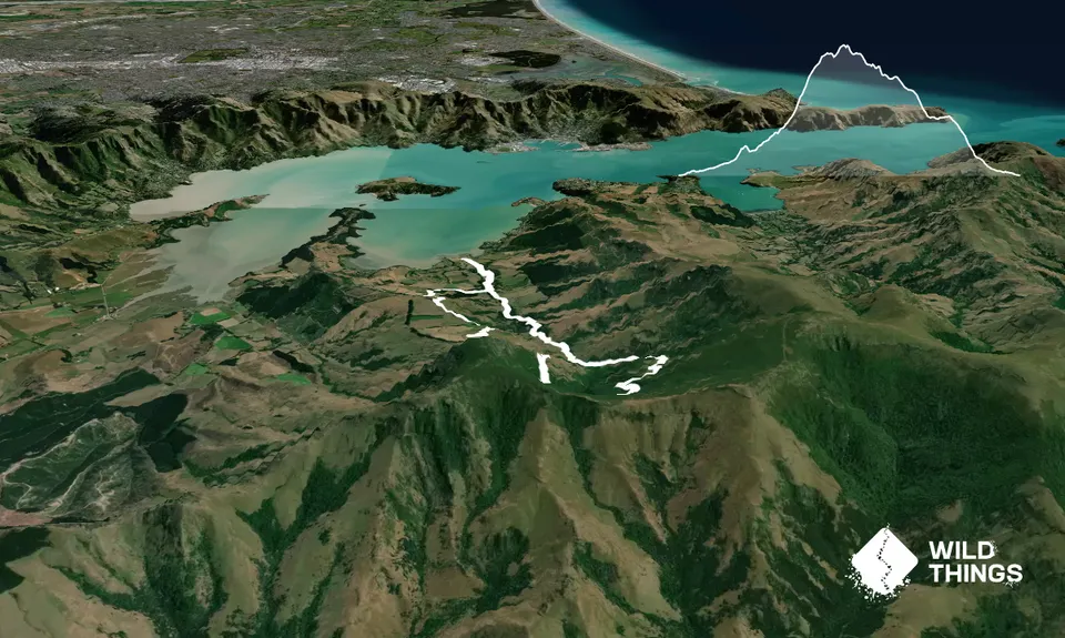
This provides a longer alternative to the Orton Bradley Loop run.

Follow sealed road entrance into Orton Bradley Park. Take a left along the Rhododendron path. Follow single track through to the playground. Pass playground and cross over bridge. Run along the road 100m and enter the park; from here keep following the blue marked stakes, through the trees and into an area populated by gum trees.

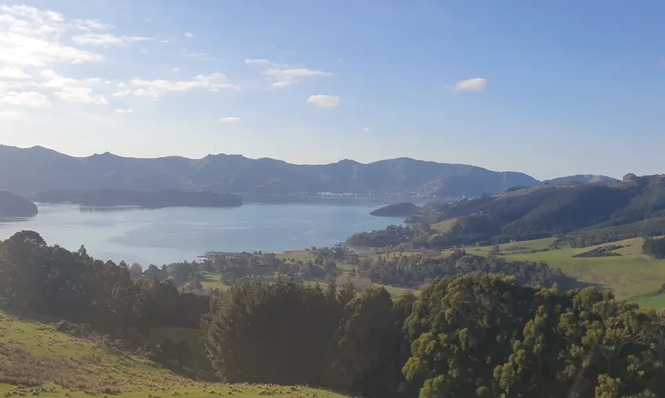
Keep going along the well-marked track, following the stream on your left hand side. Emerge onto a 4wd track and steadily climb upwards. Crossing a number of stiles en route, and again making sure not to lose track of the blue markers, you eventually come to a stile pointing in the direction of the waterfall - ignore this and keep following the fence, through muddy 4WD track until you get to another stile and a sign for Mt Herbert track.

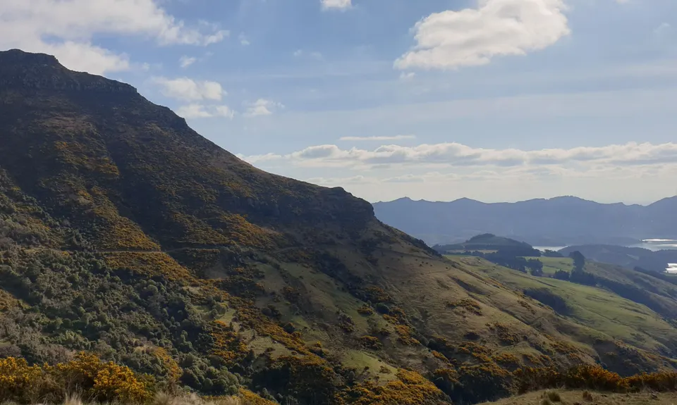
From here the going gets a bit slow, through winding gorse track and some steep technical trail upwards, as well as having to negotiate a wee stream crossing and an ankle-deep muddy traverse - you have now lost track of the blue markers and need to follow the orange markers instead. Keep climbing until you get to another 4WD track which curves around the valley between Mt Herbert and Mt Bradley.

Follow this track - it can get quite cut up, so be careful not to roll an ankle - and watch for cows! Keep going until you catch sight of the blue markers yet again, hopping a few more stiles over a nice flat/downhill section back to the entrance to the park.

Simply retrace your steps through Rhododendron park and back to the start!

Waterfall as a detour

Limited space for parking on main road. Parking spaces at a fee in the park

25 km

38 minutes

Unknown

No

Moderate.

Try and follow blue markers as much as possible until passing the sign for the waterfall - then keep following the fence until you see the sign for Mt Herbert where the orange markers take over

Generally good.

Short-sleeved thermal top, Windproof jacket, Whistle, First aid kit, Extra food for emergencies, Cellphone, Map.

Taps at start

Very muddy after rain - some streams may be full

Cows along the farm track
Exposed heading up the valley so windbreaker might come in handy

You and Orton Odyssey

As a VIP member you can record private notes for this trail, see all of your times and more.

Register Now

Already have an account? Login now

Trail Reviews

This is a trail run through lots of varied terrain, including covered single track, gravel, and plenty of open farm paddocks. There is a very cool downhill section through gum trees near the end. The climb was pretty steep and comes all in one big hit - same with downhill on the other side. If you like undulating, flow-y trails this is probably not the one!

I recommend using the GPX file on your watch- even then I found myself off-track often. There are many turnoffs that are less than obvious and sections that cross paddocks and fences (not to mention straight through gorse bushes!).

Overall it's a great workout, and the view of the harbour from the top of the hill is breathtaking.

Rob Meili

February 25, 2022

Never seen so much gorse in one spot. My favourite part of the run was actually the rhododendron trail! What a gorgeous place to be in spring.

Matt Halverson

October 31, 2021

Look out for the nettles in the bush. Good honest climb, route down could use a few more poles but pretty intuitive in clear wx. Take the GPX. Thanks!

Tony Sharpe

August 16, 2020

Login to submit a review

Trail Running Community

Find people who are interested in or have completed this trail run.

You must register or login to view this feature.

Register Now

Overlapping Trails

These overlap with this trail to some degree. You may wish to combine them but please note that to qualify for FKTs on these runs you should record a separate activity for each.

Orton Bradley Loop

Orton Bradley Loop

Length: 10.0km

Level: Beginner

Double Top

Double Top

Length: 21.5km

Level: Intermediate

Other trails nearby
VKV challenge

VKV challenge

Length: 10.0km

Level: Intermediate

Living Springs Loop

Living Springs Loop

Length: 7.5km

Level: Beginner - Intermediate

Trinity - Harbour Bruisin'

Trinity - Harbour Bruisin'

Length: 20.1km

Level: Intermediate

Port Hills 8-Attack

Port Hills 8-Attack

Length: 17.7km

Level: Beginner - Intermediate

Find more trails and peaks nearby