Last Updated: 19th Feb 2024
Horse Latitudes
Last Updated: 19th Feb 2024
Open
Grunt Factor: 7 ?
Gnarl Factor: 29 ?
5.1km
180m
180m
197m
.jpg)

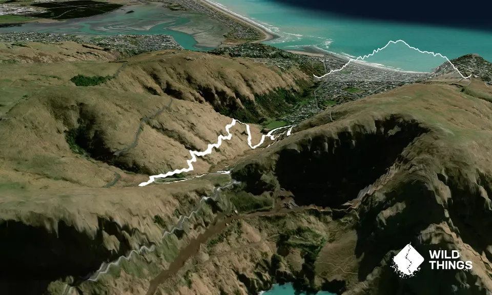
Trail Map
This Topo layer only covers NSW/ACT.
Switch to another map layer when viewing outside this area.
Switch to another map layer when viewing outside this area.


