Last Updated: 5th Mar 2024

Beginner - Intermediate

Save Trail Save

I've done it Done

Gang of Four

Christchurch, Canterbury

Submitted by Matt Doherty

Last Updated: 5th Mar 2024

Beginner - Intermediate

Save Trail Save

I've done it Done

Open

Grunt Factor: 22

Gnarl Factor: 44

15.7km

570m

570m

483m


Login as a VIP to see driving directions, distance and time.

Trail Map

Type of Run

Urban fringe

Loop

Undulating, small hills only

Dog Friendly

Native bush

Open farmlands

Open tussock/grasslands

Run Makeup

5%
5%
30%
35%
25%

Sealed Road

Farm Road / 4WD Track

Easy Single Track

Moderate Single Track

Technical Single Track

Average Uphill Gradient: +10.9%

Average Downhill Gradient: -10.3%

Trailhead

Login as a VIP to see the trailhead information.

Estimated Times to Run

:.45

Slow

1:45

Moderate

1:15

Fast

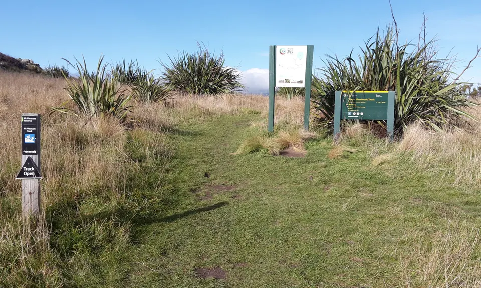
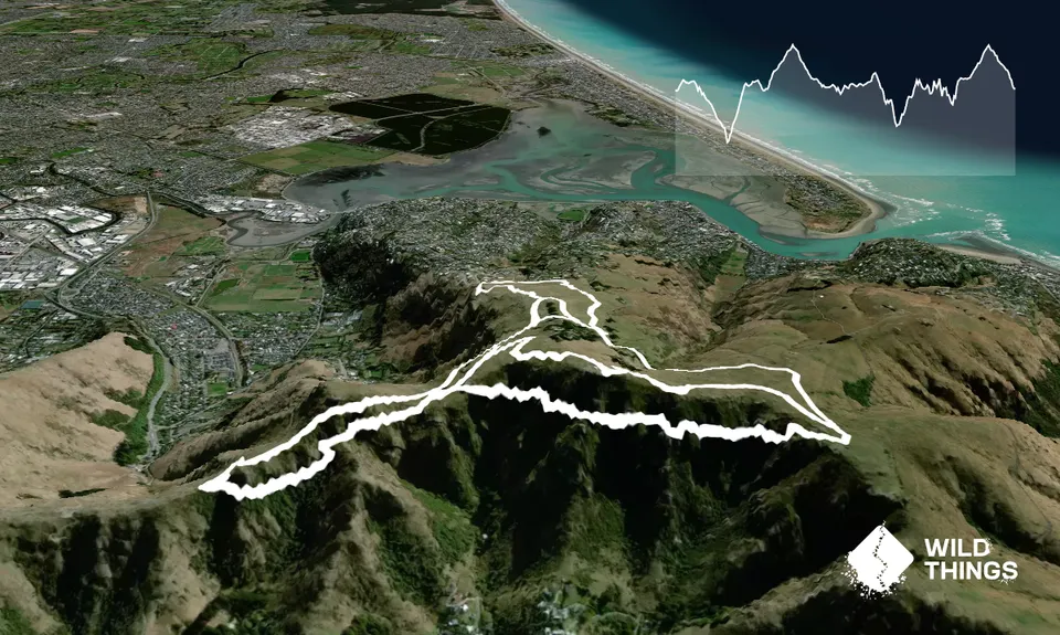
4 short loops all starting from the same point, each getting a little more technical. Each loop is also nicer than the one before it.

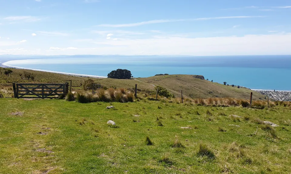
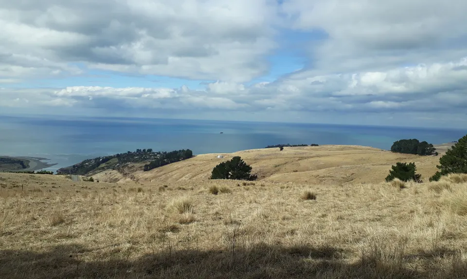
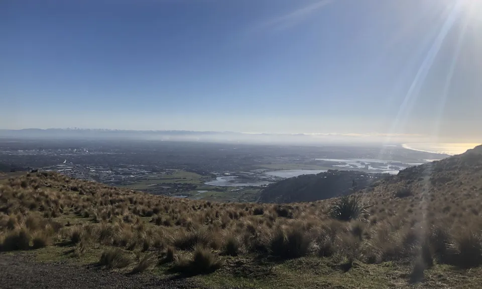
Loop 1 - Open farmland singletrack with a bit of a grunt. Head back along the summit road for 300meters, before the cattle stop turn left into John Brittan reserve and do an anti clockwise loop around the reserve (run parallel with the summit & then Mt Pleasant road for the first 2 sections then roughly follow the pylons along the bottom section) There is a nice wee rocky section before the steep climb back up to the sumit road. When back up at the top, retrace your steps back to the start point. This loop is what gave the overall enjoyment score a 4 instead of 5

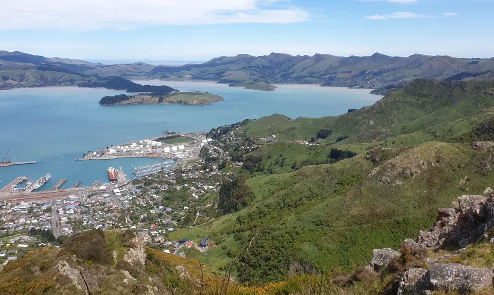
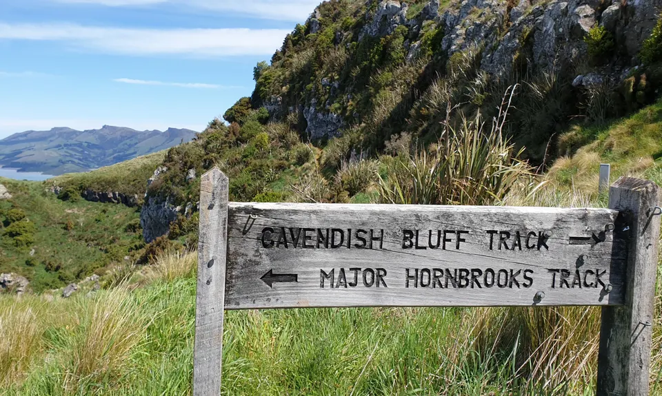
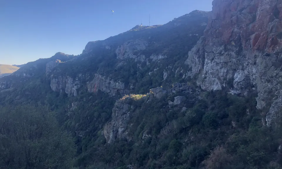
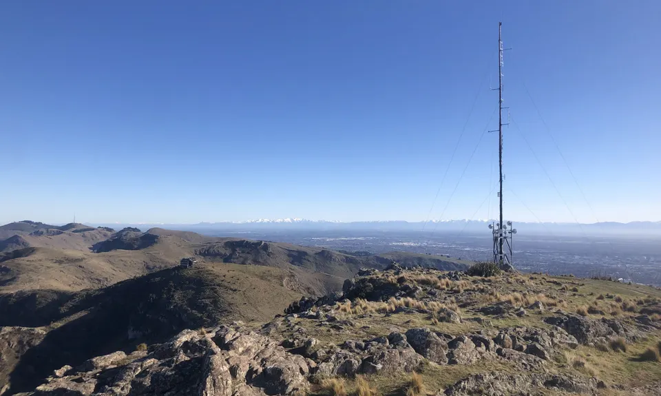
Loop 2 - Singletrack climb to trig with a bit of semi-technical on the return. Over the stile at the start and turn left to take the Mt Pleasant MTB Track / Crater Rim Walkway. Follow this as it winds up the hill to a gravel road. Turn right at the road and on for 100m to the trig point just above the track. Have a look over the cliff from the trig (The 4th loop traverses below the 2nd bluff below you). From the trig pick up the track & carry on in the same direction, over the fence and follow the sweet slightly rocky descent to a farm track. Left at the farm track for a couple of hundred meters then pick up the mtb track on the LEFT. Follow this back to the road. At the road head up hill past Mt Pleasant road then into John Brittan reserve on the right hand side. stay on the left hand side track which runs alongside the reserve until you are back on the summit road in a km or so. Cross the road & jump the fence, follow the bike track up to the junction then RIGHT and back to the start. 

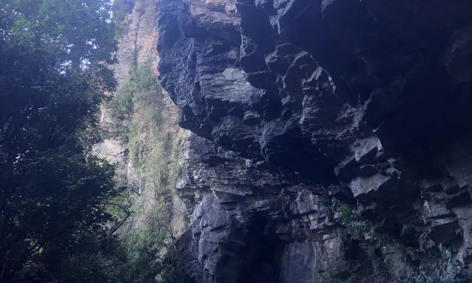
Loop 3 - Short but technical loop round the gondola. From the stile go straight to take the Major Hornbrook track. Go for 100-200 m (you will have descended 10 or 20 vertical metres from the saddle), then keep an eye to the right to pick up the Cavendish Bluffs track. As of winter 2021 this is completely unsigned; however there is a 4x4 wood post with a blank metal plate on it. Follow this track until it joins the Gondola track where you should turn right. Head up past the gondola and descend back down to the start point.

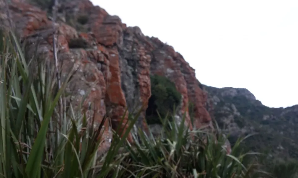
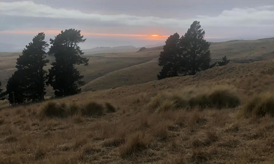
Loop 4 - More technical singletrack. From the stile veer left on the Crater Rim Track round to the harbour side of the hill and behind the big red cliffs. This is a slippery gnarly trail for a beginner but there are a few tree handles when you need them & patches of gorse when you don't. At the end of this part of the loop you will come into some WW2 gun emplacements, turn left in the middle of these & follow the track to the farm gate. Turn left at the gate & head up to the trig & back to the start in the opposite direction of loop 2

WW2Gun Emplacements
If you are lucky and early enough you may catch a rare sighting of the Lesser Spotted Pendle or Trick feeding behind the trig point on loop 2

Parking as described in the Start Point Description.
No public transport.

14 km

28 minutes

Yes

No

Easy.

The first loop round John Brittan reserve has lots of different tracks in it. You won't get lost but it is easiest to do a circumnavigation if going anti clockwise round the reserve, the climb back up is more through the center of the reserve than along the side.

Generally good.

Long-sleeved thermal top, Seam-sealed waterproof jacket, Gloves, Beanie/thermal headwear, Whistle, First aid kit, Extra food for emergencies, Cellphone, Map.

There is a water tap on the Summit Rd just downhill from the junction of Mt Pleasant Rd, which you will pass near the end of loop 2

Cold & windy on the top. Very slippery after heavy rain round the dark side of the hill (Loops 3 & 4)

Trail Legend

Mark De Goldi

Mark De Goldi

has completed Gang of Four once in the last year.

Learn about Trail Legends.

You and Gang of Four

As a VIP member you can record private notes for this trail, see all of your times and more.

Register Now

Already have an account? Login now

Trail Reviews

Don’t be put off by the overlapping loops - think of this as four separate runs sharing the same start point. Ok ok loops 3 and 4 are way more technical than the others, and included two new trails for me. Cavendish Bluffs Track is AWESOME! Although it seems the nice wooden sign in the pictures below has gone by the wayside. The loop 4 track below the Mt Pleasant bluffs is officially closed due to rockfall risks but obviously frequently used: there are handwritten notes on the “closed” signs disagreeing with the track closure, there are trap lines clearly maintained, there are heavily used climbing crags, not to mention I passed a family of four walking towards me. In contrast to the Beer Bum Bluffs track (also closed due to rockfall), I saw no sign of rockfall. Careful with ice though if you run this in winter. Get amongst it - this is a hidden gem of the trail directory!

Matt Halverson

July 10, 2021

Nice concept with the increasing technicality. Bit of route finding for me around John Brittan as there are so many little goat tracks intersecting, but that just lack of familiarity. Nicely put together and was a fresh take on some tracks I know well. Even the repetitions make sense in the scheme of things.

Brion Matthews

March 20, 2021

Great way to check out most of the tracks around Mt Pleasant. You often get stunning views from up here so be sure to take the camera. Even though I am a local, I ran a short track that I never ran before!

Jeremy Wheeler

March 28, 2020

I'll give it 5 stars because loops 3 and 4 made up for loop 1. The loops get rougher as you progress. Views over either Lyttelton or Christchurch at all times.

Brad Spiers

October 20, 2019

Login to submit a review

Trail Running Community

Find people who are interested in or have completed this trail run.

You must register or login to view this feature.

Register Now

Overlapping Trails

These overlap with this trail to some degree. You may wish to combine them but please note that to qualify for FKTs on these runs you should record a separate activity for each.

Mt Pleasant Trig

Mt Pleasant Trig

Length: 5.9km

Level: Beginner

Trinity - Harbour Bruisin'

Trinity - Harbour Bruisin'

Length: 20.1km

Level: Intermediate

Gates Of The East

Gates Of The East

Length: 14.0km

Level: Beginner - Intermediate

Lyttelton Dress Circle

Lyttelton Dress Circle

Length: 9.0km

Level: Intermediate

Mt Pleasant Elevator

Mt Pleasant Elevator

Length: 11.8km

Level: Beginner - Intermediate

Christchurch 360 Trail - Godley Cliffs Section

Christchurch 360 Trail - Godley Cliffs Section

Length: 16.1km

Level: Beginner - Intermediate

Beer Bum Bluffs

Beer Bum Bluffs

Length: 9.5km

Level: Intermediate

Tauhinu-Korokio TKO

Tauhinu-Korokio TKO

Length: 4.9km

Level: Beginner

Other trails nearby
Living Springs Loop

Living Springs Loop

Length: 7.5km

Level: Beginner - Intermediate

Horse Longitudes

Horse Longitudes

Length: 10.6km

Level: Beginner - Intermediate

Horse Latitudes

Horse Latitudes

Length: 5.1km

Level: Beginner

Canterbury Agricultural Park Loop

Canterbury Agricultural Park Loop

Length: 5.3km

Level: Beginner

Find more trails and peaks nearby