Last Updated: 18th Jan 2024

Intermediate - Experienced

Save Trail Save

I've done it Done

The Guv'nor & His Birds

Christchurch, Canterbury

Submitted by Tony Sharpe

Last Updated: 18th Jan 2024

Intermediate - Experienced

Save Trail Save

I've done it Done

Open

Grunt Factor: 32

Gnarl Factor: 64

16.0km

1025m

830m

490m


Login as a VIP to see driving directions, distance and time.

Trail Map

Type of Run

Urban fringe

Point to Point (one way)

Very hilly

Native bush

Open tussock/grasslands

Open ridges/tops

Volcanic

Run Makeup

2%
10%
38%
50%

Sealed Road

Easy Single Track

Moderate Single Track

Technical Single Track

Average Uphill Gradient: +13.6%

Average Downhill Gradient: -12.3%

Trailhead

Login as a VIP to see the trailhead information.

Estimated Times to Run

3:30

Slow

2:45

Moderate

2:00

Fast

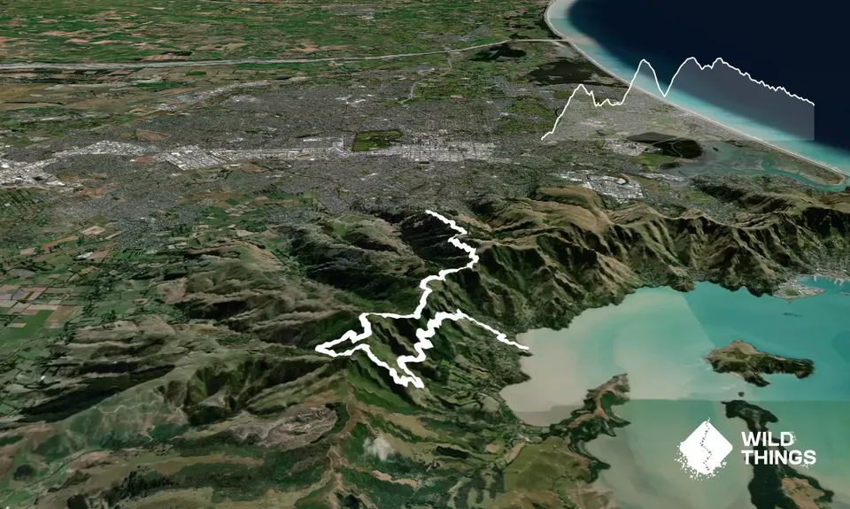
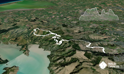
This one is for those like their runs a bit less travelled and a bit more technical. Note the vertical - most of the 1000m plus is in the first 8 km or so, you have been warned!

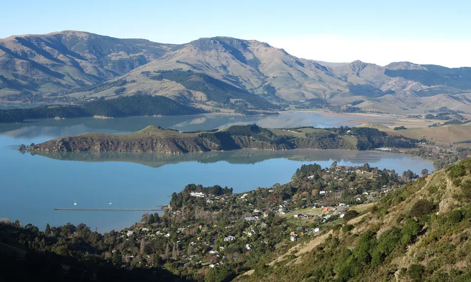
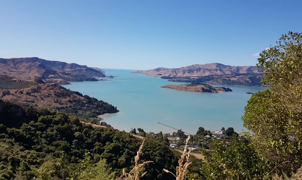
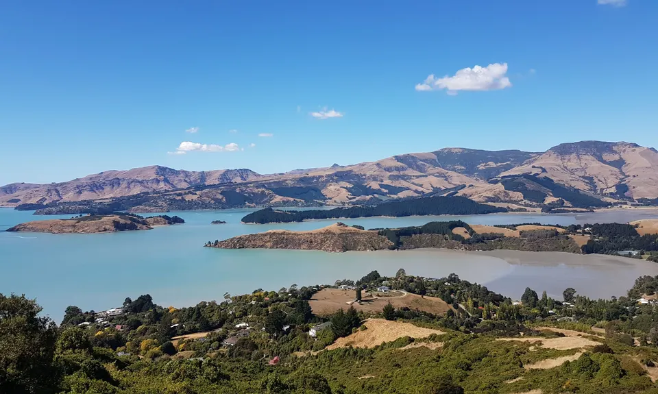
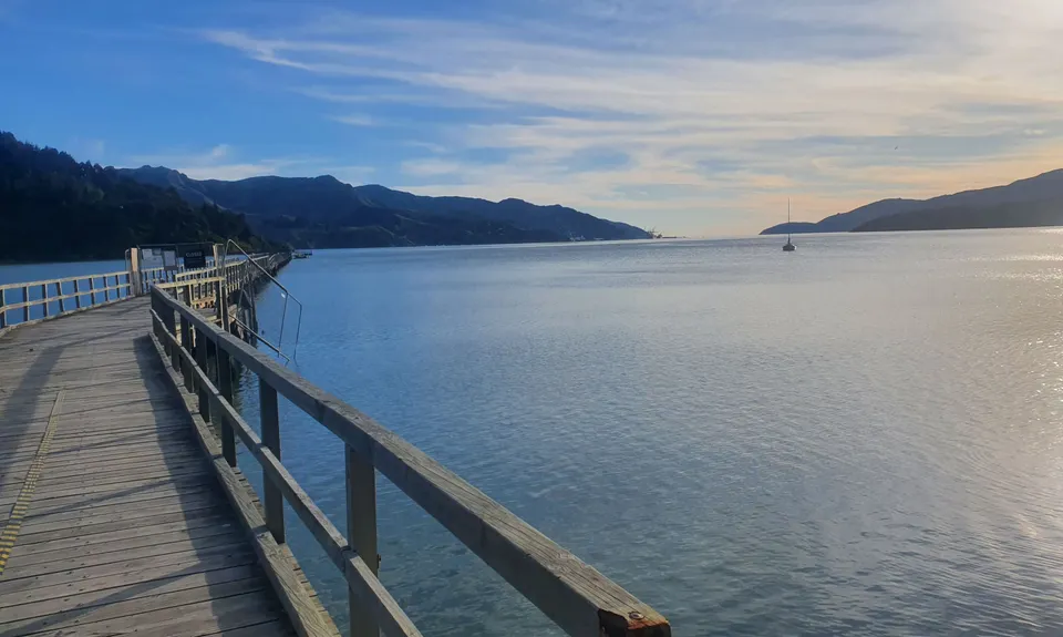
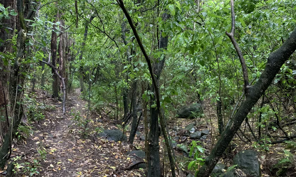
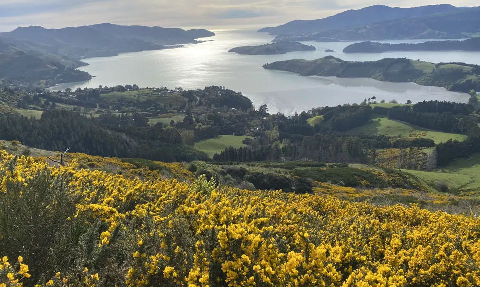
Starting at the Governors Bay wharf make your way up Jetty Road. Ignore the pull of the pub and She Chocolate and head left to pick up the signposted Faulkners Track up to Lighthouse Lane, and then head on uphill alongside houses. Soon you will have gained over 200m of vert and be above the township and on to the trails proper. After a while pick up the South Boundary track as it begins climbing and sidling the hill flanks. Impressive views as you nip in and out of bush and start to get the essence of the trails, which can become very muddy and slippery when wet.

Keep going along the South Boundary Track until you eventually reach the Bush Road Track - follow these nice technical trails along down to pick up the junction with O'Farrell's Track. O'Farrell's is a nice broad level sort of affair for a couple of km's as you emerge into areas devastated by the 2017 Port Hills Fire.

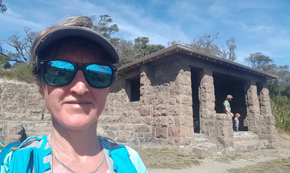
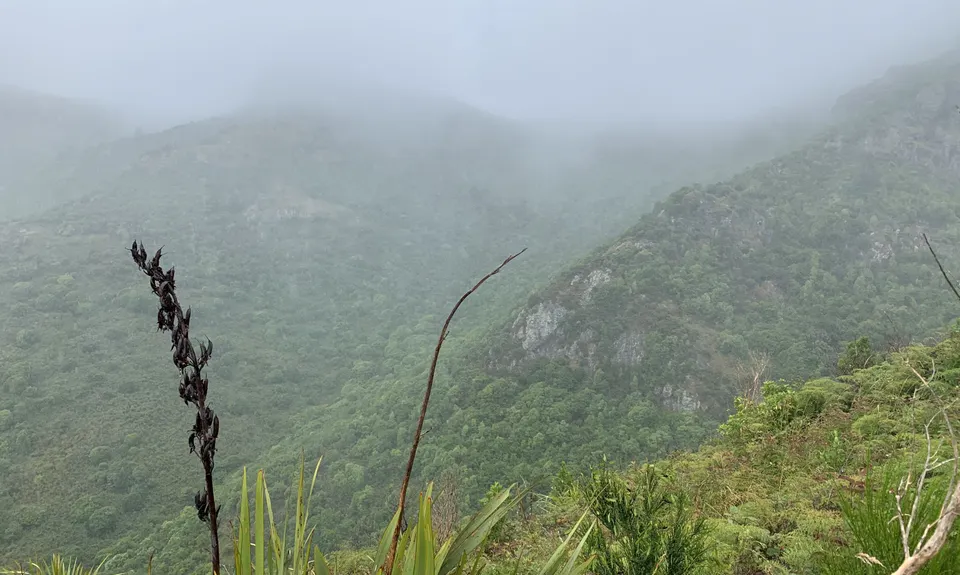
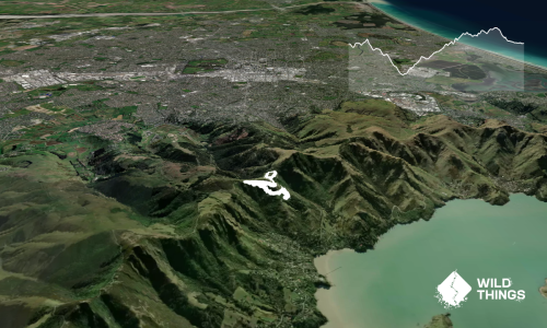
Next you are looking for the Cass Ridge Track, which is your self propelled 'escalator' up to the Summit Road - and it doesn't muck around in elevating you rapidly to the Sign of the Bellbird. Have a breather and loo stop if needed at the Sign of the Bellbird before heading down into the bush and around the wonderful circuit that is the Orongomai Trail. This is a 3km circuit through possibly the best kept secret in the whole Christchurch area - and miraculously it survived the 2017 fires. There are quite a few junctions through here, just keep following the Orongomai Track all the way down and then back up the other side of its pleasant minor waterways. Prolific birdlife here and a real taste of what used to be - and another 250m of down and then back up vert for your tally.

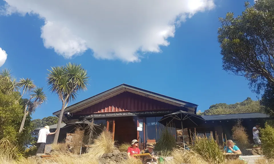
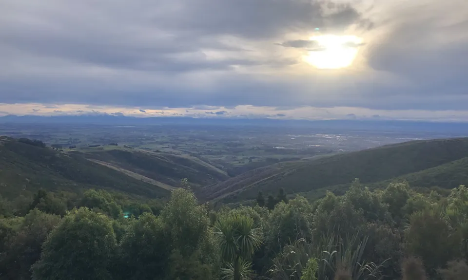
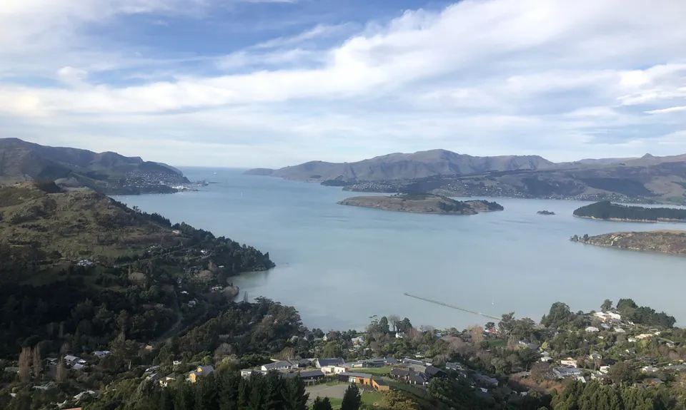
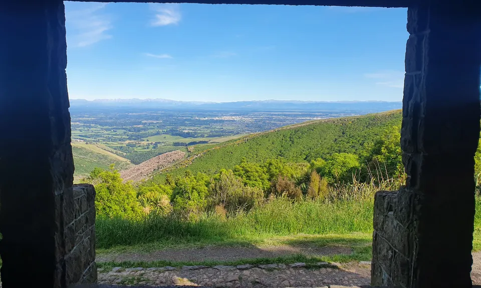
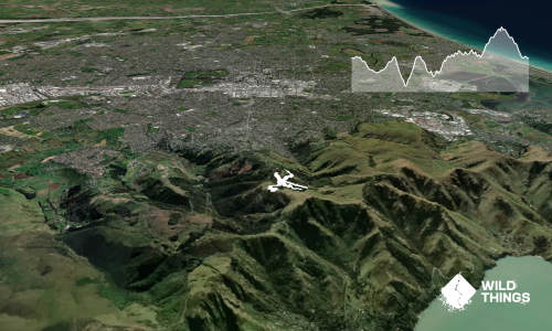
Once back up to the Summit Road then hop across to the Crater Rim and enjoy the tremendous ridgeline views for 3-4km along to the Sign of the Kiwi - water and loo available here, and a store for other refreshments if needed. The last stretch is a cruisy glide down the Harry Ell track to the Sign of the Takahe, so named after the vision and dreams of the network of buildings and tracks you have just explored for 16kms.

Traverse the Port Hills and enjoy probably the most single trail in native bush that can be found in the Christchurch area. More than you would expect, and despite the 2017 fires which thankfully spared some (but not all) of the native Port hills gems. Along the way you'll link a network of trails with the visionary work of Harry Ell and his various Signs Of buildings- the Bellbird, Kiwi and Takahe, each reminders of a visionary man's work in establishing and preserving the Port Hills as a recreational centrepoint for Christchurch.

Unless you are planning to run back over you probably want to get dropped off or have a car shuffle. Buses to travel to Governor's Bay but not so frequently.

14 km

27 minutes

Unknown

No

Hard.

Due to the number of track junctions taking a map and the guide will be really useful. Theres a number of great maps on the Christchurch City Council website too

Generally good.

Lightweight fleece top, Short-sleeved thermal top, Seam-sealed waterproof jacket, Windproof jacket, Gloves, Beanie/thermal headwear, Whistle, First aid kit, Extra food for emergencies, Cellphone, Map.

Bring you own- you can fill up 10km in at the Sign of the Kiwi

Can get cold and windy at any time of year, very occasionally snow in winter. Muddy after rain. take the right soles with you!

She Cafe or Governors Bay Hotel
Governors Bay
Food, beer and chocolate indulgence. MMMM. AFTER your run though!

Cup cafe and Emporers New Clothes Cafe
Dyers Pass Road a block down from the Takahe
Coffee, nibbles and ales

Trail Legend

Tony Sharpe

Tony Sharpe

has completed The Guv'nor & His Birds once in the last year.

Learn about Trail Legends.

You and The Guv'nor & His Birds

As a VIP member you can record private notes for this trail, see all of your times and more.

Register Now

Already have an account? Login now

Trail Reviews

Awesome tracks and linking it with Missing link track what a cool loop, thanks to Tony & Corey for creating these and Sam Mowat for inspiring me to run these two routes today. Yay

Sia Svendsen

June 27, 2021

Stunning run encompassing significant amounts of native bush. A great way to experience some of the best the Port Hills has to offer, especially to those (myself included) stuck in a rut of running the front hills closest to Chch.

Simon Dunlop

January 8, 2021

This is a challenging (as advertised) but inspired route. I had never been on any of the Ohinetahi tracks on the Governors Bay side of things, not had I been on the Orongomai Track. I found myself saying God, I love the Port Hills. What a treat to see so many new tracks in a day (including a bonus ascent/descent of Summit Rd - the Ohinetahi track junctions are a bit confusing so we accidentally found ourselves at Summit Rd and decided to drop back down for more punishment. For logistics, we had a friend drop us off in Governors Bay and then ran home.

Matt Halverson

July 5, 2020

Ok I cheated slightly and made this a loop by coming down the trail at the back of Coronation hill after pit stopping at sign of the kiwi. Ends up slightly longer (17.40km) but at least it gets you back to where you started with only a wee bit of road at the bottom.

Rebecca Sunderland

March 22, 2020

Login to submit a review

Trail Running Community

Find people who are interested in or have completed this trail run.

You must register or login to view this feature.

Register Now

Overlapping Trails

These overlap with this trail to some degree. You may wish to combine them but please note that to qualify for FKTs on these runs you should record a separate activity for each.

The Crater Rim

The Crater Rim

Length: 27.9km

Level: Intermediate

Takahe Half

Takahe Half

Length: 21.1km

Level: Beginner - Intermediate

Bird to Bird

Bird to Bird

Length: 9.8km

Level: Beginner - Intermediate

O'Farrells For Shore

O'Farrells For Shore

Length: 11.5km

Level: Intermediate

The Governator

The Governator

Length: 9.9km

Level: Intermediate - Experienced

Governator 2 - Judgement Day

Governator 2 - Judgement Day

Length: 7.7km

Level: Intermediate

Other trails nearby
Banks Peninsula Ultra Beer Run

Banks Peninsula Ultra Beer Run

Length: 50.0km

Level: Experienced

Christchurch 360 Trail - Sugarloaf Hills Section

Christchurch 360 Trail - Sugarloaf Hills Section

Length: 18.2km

Level: Intermediate

The North Faces

The North Faces

Length: 24.8km

Level: Beginner - Intermediate

Holliss Stairway to Heaven

Holliss Stairway to Heaven

Length: 8.7km

Level: Beginner - Intermediate

Find more trails and peaks nearby