Last Updated: 6th Apr 2025
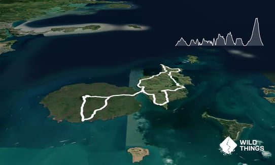
Rangitoto - Motutapu Double
Last Updated: 6th Apr 2025
Grunt Factor: 43 ?
Gnarl Factor: 34 ?
36.6km
900m
900m
262m
Last Updated: 6th Apr 2025
Last Updated: 6th Apr 2025
Grunt Factor: 43 ?
Gnarl Factor: 34 ?
36.6km
900m
900m
262m
Front country - easily accessible
Loop
Undulating, some big hills
Beach
Coastal
Open farmlands
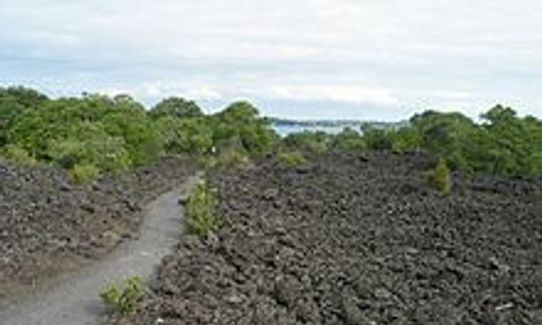
Volcanic
Gravel Road
Easy Single Track
Moderate Single Track
Technical Single Track
Average Uphill Gradient: +5.9%
Average Downhill Gradient: -5.6%
VIP Feature: Send this route to your Garmin account so you can follow the course on your Garmin device.
Login as a VIP to see the trailhead information.
Not suitable
Slow
4:45
Moderate
3:30
Fast
This run is a gem!
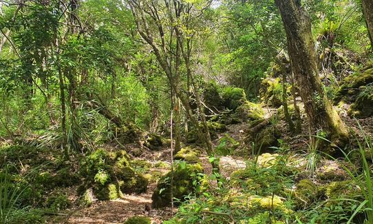
Off the ferry and straight into it! As a warm up, take the first right (do not go up the Summit Track) and head on Islington Bay Road towards Motutapu Island. 6ks on a relatively flat, gravel road will see you reach Motutapu. If you enjoy more technical terrain (rock hopping), instead of Islington Road, you can follow the coastal track to Motutapu - this will make the run a couple of k's longer.
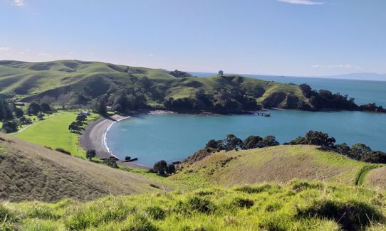
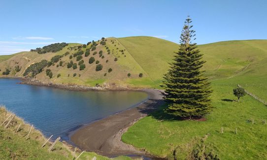
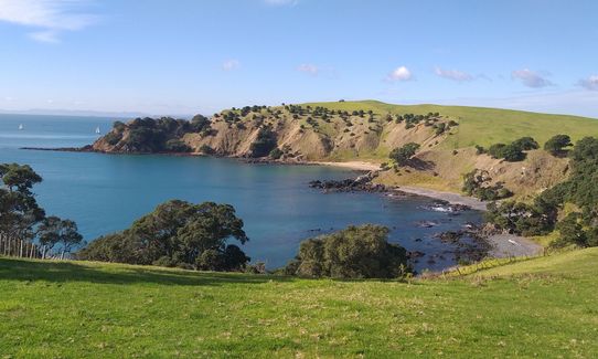
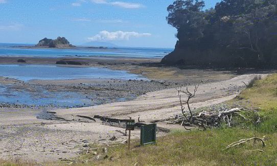
Once on Motutapu Island, follow the road up to the left for approx 700 metres, then turn off onto trail on the left. You will follow this trail past the Motutapu Outdoor Education Camp. Stick to the coastal road and follow the Pohutukawa Trail, which continues on to Billy Goat Track as far as Billy Goat Point - Pause - Enjoy the view and take a selfie! This is approx 13ks in. Backtrack on yourself, and take a left on to Wetland Track. Maybe stop at some of the beautiful bays on the way.
At Waikarapupu Bay, take the trail closest to the coast (I don't know if it has a name?) instead of Wetland. You will end up on Station Bay Access Track. Continue on to Motutapu Island Road, following the signs for Home Bay. This is the 21k mark. There are toilets here. See a big, single track hill ahead of you to the left of the toilets?? Yup, you're going that way! That's Motutapu Walk Way. Take a detour down to the left on Emu Point Walkway - you will be rewarded with more delightful views! Up and out of the bay, a left turn on to Motutapu Walk Way, and soon you're back on Rangitoto! 28ks in....
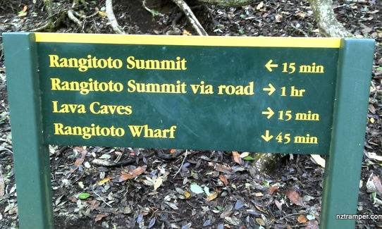
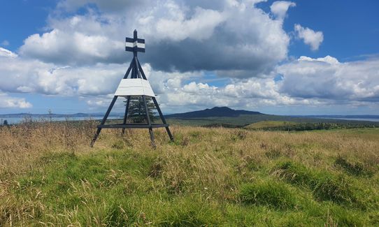
Head back on Islington Bay Road towards the ferry terminal, and after 3ks, turn right on to Summit Track. A bit of a climb and you're at the top of a volcano! Enjoy the Crater Rim Track and the gorgeous views up the very tippy top. Follow the single summit track the whole way back down to the ferry, and there you have it! A great day out on two islands! On the way down you can take a very short detour to the Lava Caves - bring your head torch to make the most out of it!
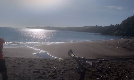
Don't forget to trig-bag on the way!! A nice refreshing swim at the end is MAGIC!
I have been known to stash a chilly bin of goodies near the ferry terminal - towel, togs, extra water, food..... Works a treat!
Emerging from the sea just 600 years ago, pest-free Rangitoto Island is the youngest volcano in New Zealand.
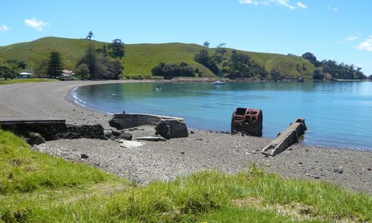
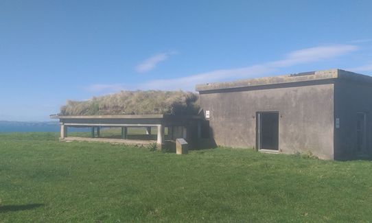
At 178 million years old pest-free Motutapu is one of the oldest land masses in the Hauraki Gulf. The island has lived an exciting life - it was intensively settled by Maori, it hosted massive Victorian picnic parties, and was a base during WWll. You will see many bunkers on the way around!
The islands are connected by a small bridge.
If you know of any public toilets near the trail start or on the route, please login and then let us know so we can update this section.
Can only be reached by boat. Check out fullers.co.nz for timetable. Tickets are $33 return, and on Saturdays and Sundays they have return tickets on the 7.30am sailing for $20. You can also get on/off in Devonport.
0 km
0 minutes
Unknown
No
Moderate.
Perfect throughout.
Windproof jacket, Whistle, First aid kit, Extra food for emergencies, Cellphone, Map
No water really available on the islands. You will need to carry quite a bit. Motutapu in particularly is very exposed and can get exceptionally hot. Best to stash a chilly bin of goodies near the wharf! There is a tap available beside the toilets in Home Bay but best not to rely on it though as I would imagine it dries up during summer.
Sometimes the ferries don't run in very bad weather. Motutapu is very exposed and has a lot of damage done to it after the cyclones earlier in 2017
Fastest Known Times (FKTs)
You and Rangitoto - Motutapu Double
As a VIP member you can record private notes for this trail, see all of your times and more.
Already have an account? Login now
Some commentary on the state of Motutapu after a visit this morning, as it has evolved over recent years.
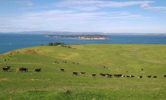
A few years ago, the island had been farmed for many years and docile dairy cattle kept the grass down. You might have to navigate some cow pats, and occaisionally around a herd of cattle, but it was all straight forward.
Then in recent years the livestock were all removed. Some of the secondary tracks around the island ended up knee high with grass and weren't easy to follow.
On this visit, a lot of that secondary track had been mown. Some of the main tracks had a bit of grass growth but nothing too long, and often just clover.
Livestock has returned to the island, although on this visit it was in much smaller numbers with a couple of herds across the trail at different points. Unfortunately they are now much larger beef cattle, and as I encountered cows with their calves had to proceed cautiously, waiting for them to clear the way.
Unfortunately there's a bad combination of the presence of a farming operation, without the full farm activity. There were many farm gates to open and close, as well as stiles and pedestrian gates. A lot of these are in decay, a couple of stiles were starting to get overgrown. Some of the signage has deteriorated also, it does not appear that DoC are focused on the trail maintenance.
I was pleased though to see that there's some new native plantings on one section, and I spotted 3 takahe at Home Bay and another 3 at the OECD.
December 21
ST
A great day out. Fortunately, we did it with some overcast and light drizzle. DO NOT underestimate Motatapu. Since the cattle have moved off the island, all grass is very long and thick. So the trails are sometimes hard to find and often un-runable. Rangitoto, by comparison, was a breeze!
September 7, 2020
There is a lot to like on this run - being so close to the city but then having quite an expansive area to run in... Only drawback for me is that it is bloody hot on Rangitoto and Motatapu! Best to go in winter rather than the middle of summer like me.
January 6, 2020
Fantastic run, great views, beautiful beaches, hun emplacements, cows, cow poo (and lots of it). A lot of the run is paddocks, not formed trails and well trodden by cow hoofs so slow going in places. Definitely a good weather run as a lot of it is on exposed hills and windy
July 6, 2019
These overlap with this trail to some degree. You may wish to combine them but please note that to qualify for FKTs on these runs you should record a separate activity for each.
Send to your phone
Scan the below QR code to open this trail on your phone.

Tip: position the QR code in your phone camera screen.


