Last Updated: 26th May 2025
Bus Station to Beer Spot
Last Updated: 26th May 2025
Open
Grunt Factor: 34 ?
Gnarl Factor: 18 ?
32.4km
970m
985m
107m

Last Updated: 26th May 2025
Last Updated: 26th May 2025
Open
Grunt Factor: 34 ?
Gnarl Factor: 18 ?
32.4km
970m
985m
107m
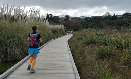
Urban
Point to Point (one way)
Undulating, small hills only
Dog Friendly
Native bush
Plantation/exotic forest
Coastal
Other
Sealed Road
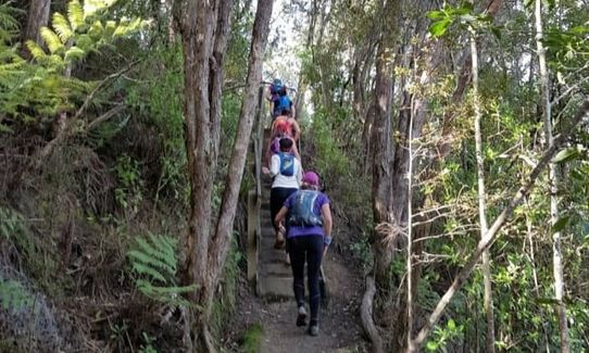
Easy Single Track
Moderate Single Track
Average Uphill Gradient: +5.9%
Average Downhill Gradient: -6.0%
VIP Feature: Send this route to your Garmin account so you can follow the course on your Garmin device.
Login as a VIP to see the trailhead information.
5:00
Slow
4:00
Moderate
3:00
Fast
This is a similar run for much of the route as Station to Station, which was created a few years ago. However this is longer and has more trail and less road over the last few kms. And it finishes at a fine craft beer venue! This trail can be varied to take in additional trails around Northcote/Birkenhead, and for a super-sized version you can head to the east coast beaches and run north back to start point (North Shore Ultra is under design!). Note that tracks are closed from time to time for upgrade etc so be prepared to divert if needed.
This version takes you from Albany bus station to the Beer Spot in Northcote, which is a short distance to Smales Farm bus station, thus allowing you to catch a Northern Express bus back to Albany (probably 10 minutes ride).
Note: The trail from Manuka Reserve to Kapatiki Rd has been closed for a while and has fallen into disrepair, so this guide and the gpx have been amended.
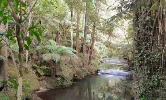
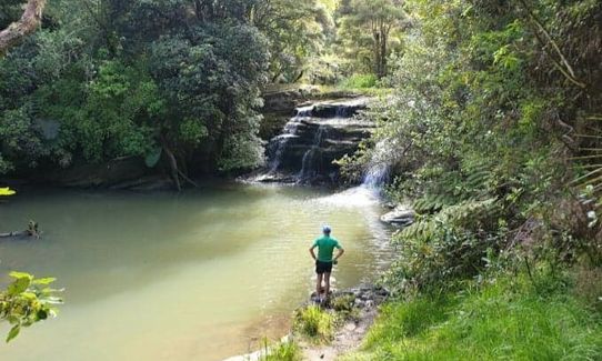
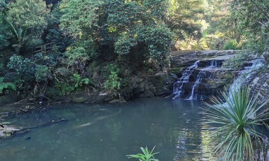
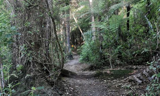
Cross Oteha Valley Rd and go left down to Hooton Park and to Mills Lane. At Mills Lane go right for a few metres only (entrance to former Kurai Purapura Retreat/Centrepoint (back in the day!)). Cross bridge and immediately turn left onto trail. Follow this trail all the way to Gills Rd. Cross Gills Rd. Take the path to the right of the one lane bridge – it looks like a driveway and you do pass a couple of houses. To the right there is a track up to the Gills Trig which is a loop up and down stairs – you can add this in as you enter and exit at the same spot, and it is a lovely section of bush (the gpx to this guide includes this.) When you exit the trig track go right, (if you choose not to do trig loop continue on path keeping river on left.) You will get to a good waterfall, with an initial view from above and then a viewpoint around the corner. Pause to take a photo!!
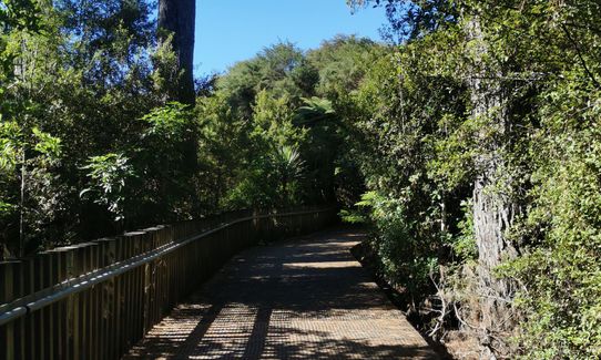
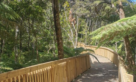
Follow the trail around, over a wooden bridge (can be slippery) and up behind some apartment buildings and the Albany pub. Take path up to carpark by the pub. Carefully cross Dairy Flat Highway, go over bridge. There is a wide grass trail here heading around into Kell Park around the back of some shops and a gallery. Cross what looks like an old orchard onto the path in Kell Park, down a boardwalk and around over the bridge crossing Lucas Creek. You then follow a path across a reserve all the way to Albany Highway.
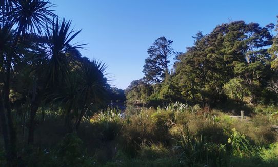
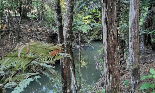
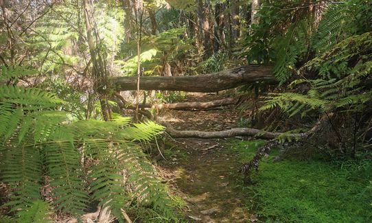
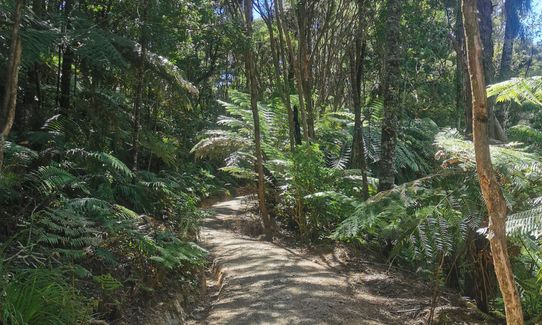
Across the highway (there is pedestrian access under the road bridge at this point) is the entrance to Fernhill Escarpment, a beautiful bush section with many totara trees This is a long section of trail running alongside a creek all the way to Bush Rd. The best way to navigate through is to keep the creek on your right to start with – there is trail, boardwalk, stairs, and eventually a bridge over the river, with trails on other side taking you to Bush Road. There is also a track to the right of the river, less boardwalk than the other side. The left hand track has been upgraded recently and is sometimes closed for work but as at May 2025 it looks like this is nearly complete.
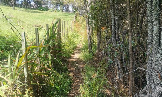
When you reach Bush Rd, cross the road, turn left, and just across the bridge on your right is the entrance to Burnside Escarpment - this is a great trail, more rugged than Fernhill, and with various side tracks that can be explored and some quirky signage and also tornado debris from a few years ago, If you stick to the lower trails (see gpx), you eventually come out on Tawa Drive near the Greville Rd motorway intersection. Turn right and run along Tawa Drive to Rosedale Rd. Turn right and run along the road a few hundred metres – you want to cross the road and take the driveway into the Rosedale Park Sportsground. There are toilets and a water tap here. Skirt around the fields and onto the path leading out to Paul Matthews Rd.
Immediately across the road is a bike/walking path leading down to a tunnel which passes under the Upper Harbour Highway (SH18). Follow the track to Unsworth Heights, crossing Barbados Drive. Go left and then head up Mallard Place. About halfway up these is a path next to a driveway, turn right onto that and follow the Unsworth bush trails through to Unsworth Reserve and then to Goldfinch Rise. Head right up the hills to intersection with Unsworth Drive, go left onto Glenfield Rd, and up to traffic lights (intersection with Sunset Rd) Cross here onto Glendhu Rd and you have a long downhill road section (1.7km) with a footbridge at the bottom to the western end of Glendhu Rd. A few metres up the road veer right and down the bottom of the street is the entrance to the Glenfield Coastal Walkway.
Run the Glenfield estuary trail as far as Lynn Reserve, cross road and go up thru Leigh Scenic Reserve, up to Bryers place, then right onto Leigh Tce, right onto Manuka Rd, left down Witheford Drive, left onto Valecrest Pl, then take the path and stairs at end into Witheford Reserve, connecting with trail further along Kaipatiki Rd before heading into Eskdale Reserve. To get to the Eskdale cross Kaipatiki Rd and head right a bit further to the bridge. Do not cross bridge: the entrance to Eskdale bush is on your left, head onto this trail. There are a few side trails on this track, you need to follow the signs to the cemetery, near the top of the reserve and the corner of Glenfield and Eskdale Roads.
Run down Eskdale Rd, or on the parallel path through the cemetery, cross over Eskdale and continue a short way down hill to Inglis Street. Turn left down here,and quickly left onto Ridgewood Crescent - and within a few metres you will find a track (on your right) into Ridgewood Reserve. Take this trail through some mature bush, when you reach a T junction at the end turn left onto track that leads to Roseberry Ave. Run a short way along Roseberry Ave to the junction with Berne Place - veer left up Berne Place, and then left again into Park Hill Road. Go up Park Hill (which is steepish) for around 150 metres and there is a walkway on your right. Take this and head down into Birkenhead War Memorial Park.
This trail leads down to some newish boardwalk and bridges and trail. When you reach concrete pathway at end go left and head up to roadway past the sports clubs onto Glenfield Rd. Cross Glenfield Road and turn left. A short way along there is a walkway on your right leading to City View Terrace. Head along City View Terrace to the end and then turn right into Tui Glen Rad. Follow the road down to the end: this is the entrance to the lovely Kauri Glen Reserve (entrance with a footwash station - this reserve lives up to its name and is full of kauri). There is a very popular high swingbridge in here. Can be busy at weekends!
Follow the trails in Kauri Glen mostly downhill - following the signs for Woodside Ave. At Woodside Ave cross the road and go straight into the trail opposite, this runs alongside Onepoto Stream to Lake Road. Cross Lake Rd, go right for a few metres and then into Rotary Grove - down the path/road that also leads to the tennis club. The track continues past the tennis club and playground through some bush to Tarahanga Street. Cross the street and run down the path to Onepoto Domain.
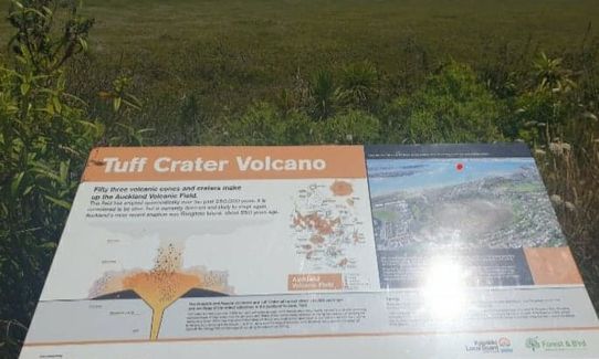
Run alongside the ponds and across the Domain. Toilets and a tap located here. Then follow boardwalk to path junction and veer right and follow track around and then up some stairs and a steep path between houses to Sylvan Ave. Cross Sylvan Ave and head down Heath Street, At the end between some houses there is a grass access way down to Heath Reserve (this is a bit hard to spot). Run across Heath Reserve to the start of the Tuff Crater trail. Run around in a clockwise direction until you reach a track heading up the hill on your left. This will bring you out onto the end of Akoranga Drive near some big commercial buildings (including the Warehouse head office).
From there you want to head left along Akoranga Drive for about 1km. On your right there is an entrance to Smiths Bush - there is a short gravel access way leading to a grassy area, and a rough track leading into the bush on your left. Smiths Bush is the native bush reserve right next to the motorway, rugby fields and netball courts. It has some huge puriri trees and other native trees, and some easy boardwalked trails. When you emerge from this trail, cross the carpark by the fields and head left down the main road to the Beerspot at 54 Northcote Rd (or turn right and head over the motorway if you want to avoid the beer (why would you?)) If you are super-thirsty at this stage you can skip Smiths Bush, run to the end of Akoranga Drive, turn right and head down to the Beer Spot. Smales Farm bus station is a short walk back over the motorway and to your left.
Several waterfalls, notably in Gills Reserve near beginning. Lucas Creek was an early settlement and there is info about that on the trail, as well as info about early settlement in Albany and Glenfield. Plenty of mature bush (including kauri in some parts), creeks, estuary. Tuff Crater near the end of the run is a volcanic crater that last erupted about 200,000 years ago.
If you know of any public toilets near the trail start or on the route, please login and then let us know so we can update this section.
Thousands of carparks (unless you are there on a work day morning when the park and ride is full). And as it is a bus station, plenty of transport options (Northern Express buses run from the city very regularly)
19 km
25 minutes
Yes
No
Moderate.
Route does cross a number of roads, it is useful to have map/phone to get your bearings. in recent years tracks have been closed from time to time in Eskdale and Kauri Glen, and new trails opened , so the exact route may need to vary.
Perfect throughout.
Windproof jacket, Cellphone, Map
Plenty of shops on route, and drinking taps in parks
none
road crossings!
Beer Spot
54 Northcote Rd
https://thebeerspot.co.nz/
Cos running should be rewarded with a decent beer - and Beer Spot has about 40 on tap!
Trail Legend
Login as a VIP to become a Trail Legend. Learn about Trail Legends.
Fastest Known Times (FKTs)
You and Bus Station to Beer Spot
As a VIP member you can record private notes for this trail, see all of your times and more.
Already have an account? Login now
These overlap with this trail to some degree. You may wish to combine them but please note that to qualify for FKTs on these runs you should record a separate activity for each.
Send to your phone
Scan the below QR code to open this trail on your phone.

Tip: position the QR code in your phone camera screen.


