Last Updated: 6th Jan 2026
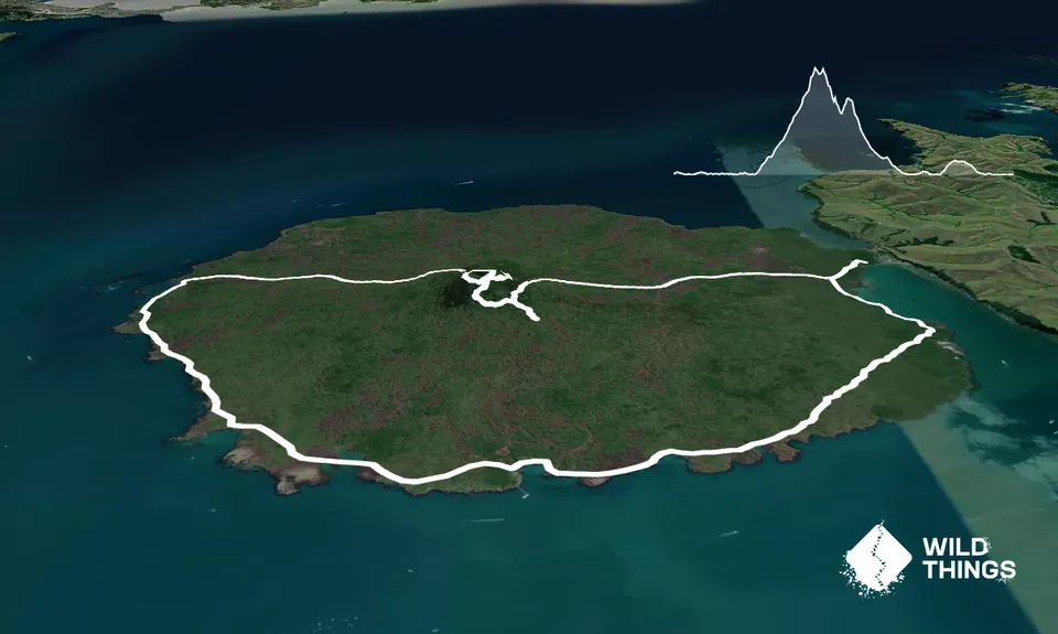
Rangitoto Circumnavigation
Last Updated: 6th Jan 2026
Open
Grunt Factor: 21 ?
Gnarl Factor: 30 ?
20.0km
430m
430m
249m
Trail Map
This Topo layer only covers NSW/ACT.
Switch to another map layer when viewing outside this area.
Switch to another map layer when viewing outside this area.


