Last Updated: 21st Oct 2024
Rangitoto Romp
Last Updated: 21st Oct 2024
Open
Grunt Factor: 18 ?
Gnarl Factor: 18 ?
14.2km
450m
450m
260m


Last Updated: 21st Oct 2024
Last Updated: 21st Oct 2024
Open
Grunt Factor: 18 ?
Gnarl Factor: 18 ?
14.2km
450m
450m
260m
Front country - easily accessible
Combo
Very hilly
Native bush
Volcanic
Gravel Road
Easy Single Track
Moderate Single Track
Technical Single Track
Average Uphill Gradient: +7.2%
Average Downhill Gradient: -6.3%
VIP Feature: Send this route to your Garmin account so you can follow the course on your Garmin device.
Login as a VIP to see the trailhead information.
3:00
Slow
2:15
Moderate
1:30
Fast
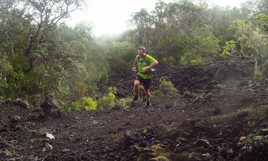
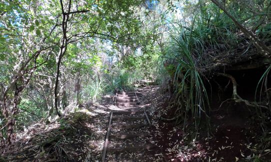
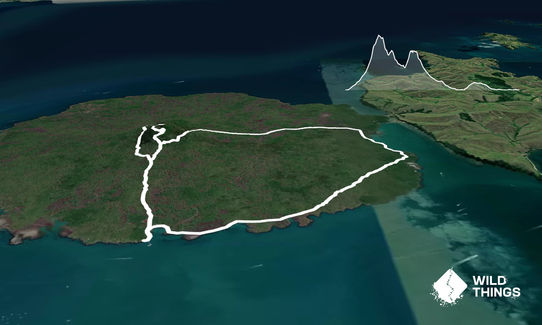
Just a hundred metres from the wharf you will pick up the Summit Track (signposted sensibly enough to 'Rangitoto Summit'). Follow this up the gradually steepening side of the volcano, ignoring the left turns to Kidney Fern Glen and Wilson's Park Track.
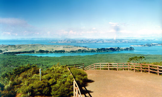
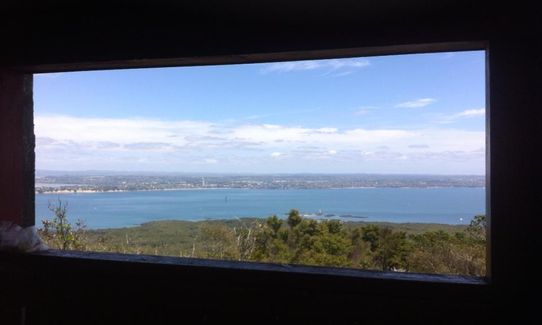
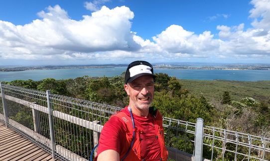
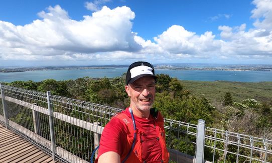
After about 2 kms you'll reach a bit of a clearing. Carry straight on following the steps on the Rangitoto Summit track. Another 300m of lovely bush running brings you to the Crater Rim Track. Turn sharp left up the boardwalk to the summit trig and stupendous 360° views across the harbour and the Hauraki Gulf.
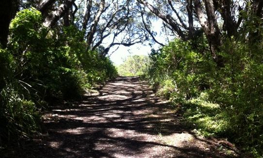
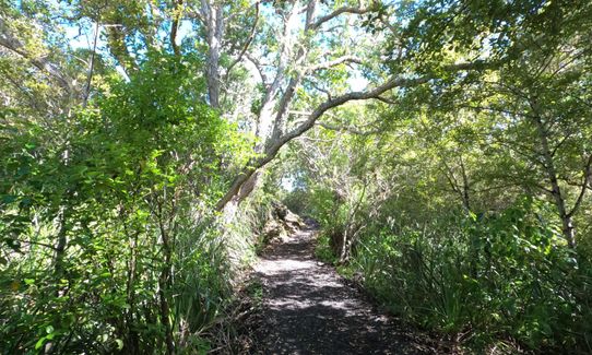
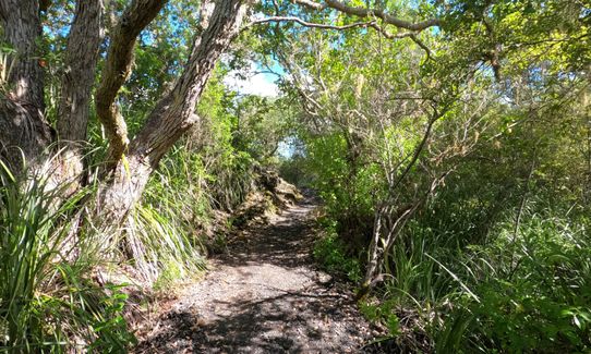
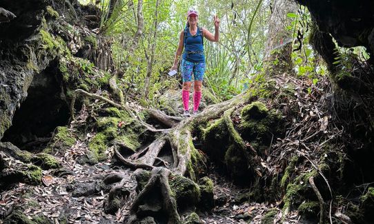
Exit the summit area on the far side via the Crater Rim Track and follow a short distance until a wide track heads off downhill to your left. Follow this and very soon turn left on to Summit Road. Follow this downhill for about 200m before turning left on to Wilson's Park Track. This is a beautiful stretch of single track that sidles around the side of the hill before rejoining the Summit Track in about 1.3 kms. If you're in luck you may see saddlebacks in the trees along here.
Turn left on the Summit Track and re-trace your earlier steps up the hill to the clearing. This time leave the clearing to the right following the sign to 'Rangitoto Summit via Road' and 'Lava Caves'. Keep a careful eye out for a junction after a couple of hundred metres. Here you turn left (NOT straight on towards Lava Caves) and follow it a wee way until you reach Summit Road.
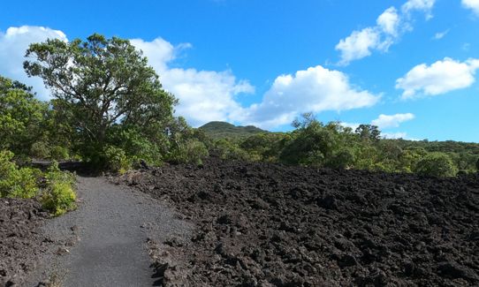
On hitting Summit Road turn right and follow this rocky road down the hill for almost 3 kms. En route you need to bear left at a junction following the sign to Islington Bay Wharf.
When almost back at sea level turn right at a sign to Yankee Wharf, from where you will pick up the rugged and rocky Coastal Track that carries you the remaining 5 kms back to the wharf and hopefully a waiting ferry.
This trail includes the peak Rangitoto.
You are going to the top of a volcano that erupted from the sea only about 600 years ago - it is a special and unique place.
If you know of any public toilets near the trail start or on the route, please login and then let us know so we can update this section.
Fullers ferries leave from the Ferry Building in downtown Auckland
0 km
0 minutes
Unknown
No
Easy.
The route is well signposted, just keep a sharp eye for the described turns.
Generally good.
Short-sleeved thermal top, Seam-sealed waterproof jacket, Beanie/thermal headwear, Whistle, First aid kit, Extra food for emergencies, Survival bag, Cellphone, Map
None. Take your own and plenty of it if it's a summer run.
The heat that bounces back of the volcanic rock of the island can be cruel in summer. Be prepared - leave well hydrated and take plenty of fluids with you.
Harsh, volcanic scoria is the base of the trails - take tough shoes and DON'T fall on this stuff - it hurts! It can be very hot in summer so carry plenty of fluid.
Trail Legend
Login as a VIP to become a Trail Legend. Learn about Trail Legends.
Fastest Known Times (FKTs)
You and Rangitoto Romp
As a VIP member you can record private notes for this trail, see all of your times and more.
Already have an account? Login now
I don’t know if I can claim this for the Challenge as ended up 1km less. Essentially did it in reverse taking the coastal track first, mostly nice training for technical agility of the feet over the Lava rocks but a formed track so you can’t get lost and some beautiful wee forested areas to run through. Came across families of Saddlebacks. Take care easy to trip in this part as I did, ended up with a few crazers!! Less crowds on the way up which was nice....and yes stunning views from the top. Nice easy romp bacon down to the wharf.
March 15, 2021
KR
I had trouble "running" the coastal portion- I would call it a slow jaunt as very rocky and hard to get good footing but still really lovely. The advantage of turning and doing the coastal portion first is there was no one on this trail adn by the time we got to the summit we were the only ones there :) I still love the waitaks the best but this is a good alternative. I added on a jaunt over to motutapu island for the extra kilometers and even better isolation from people :)
March 19, 2018
Nice ferry trip each way with a cold beer option for the return leg. A good mix of running surfaces with some gnarly sections. Great views from the top that make for a compulsory pause, as Andre has mentioned worth taking in some of Motutapu as well which can be done as part of the Dual event.
April 20, 2017
These overlap with this trail to some degree. You may wish to combine them but please note that to qualify for FKTs on these runs you should record a separate activity for each.
Send to your phone
Scan the below QR code to open this trail on your phone.

Tip: position the QR code in your phone camera screen.


