Last Updated: 17th Feb 2026
The Rangicircum
Last Updated: 17th Feb 2026
Open
Grunt Factor: 22 ?
Gnarl Factor: 64 ?
19.5km
50m
50m
10m
Last Updated: 17th Feb 2026
Last Updated: 17th Feb 2026
Open
Grunt Factor: 22 ?
Gnarl Factor: 64 ?
19.5km
50m
50m
10m
Front country - easily accessible
Loop
Totally/mostly flat
Native bush
Beach
Coastal
Volcanic
Gravel Road
Technical Single Track
Untracked / Route only
Average Uphill Gradient: +1.00%
Average Downhill Gradient: -1.00%
VIP Feature: Send this route to your Garmin account so you can follow the course on your Garmin device.
Become a VIP Member to see the trailhead information.
Not suitable
Slow
5:15
Moderate
4:00
Fast
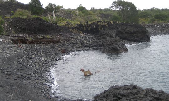
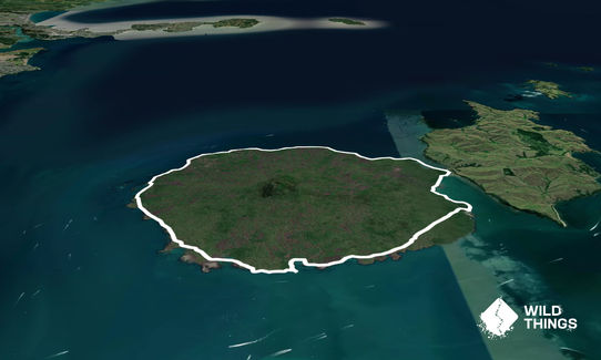
Straight off the first ferry of the day turn right and then right again onto the single track path about 400m in. Here you traverse lava flows and then head into the bush for a while until emerging at Islington Bay. Follow the coast to the Motutapu bridge, then if you've timed it right head across the low tide sand to the start of the untracked section. Here scramble over, around and through the wild lava formations, past Wreck Bay and follow around until finally you will see Takapuna, and eventually the lighthouse near MacKenzie Bay.
Then its the easiest section on gravel roads back to the wharf, which is good because you may be rushing for that last 4pm ferry. Between the first and last ferry you have 6hrs which should be enough time, but keeps the pressure on a bit to make it fruity!
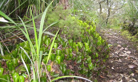
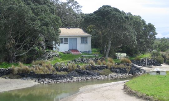
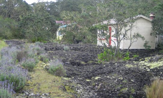
Awesome volcanic rock landscape, wild lava formations on the northern un-tracked section. Worlds largest Puhutakawa forest, native birds including Saddlebacks. Historic Baches from the 1930's of which about 28 remain
If you know of any public toilets near the trail start or on the route, please login and then let us know so we can update this section.
Park in the downtown multi car park or take public transport and grab the Fullers ferry, generally from Pier 4
0 km
0 minutes
Unknown
No
Hard.
Stick to the coastline for the untracked sections. Occasionally the top edge of the lava provides the best travel, it is best to avoid bush bashing where the vegetation gets dense and overhangs - then you can drop down to the rocky beaches when necessary. Make sure low tide is your friend (timed for around the middle of your expedition)
Generally good.
Lightweight fleece top, Windproof jacket, Gloves, Personal Locator Beacon (PLB), Whistle, First aid kit, Extra food for emergencies, Cellphone, Map
None, must carry with you
Can be done all year round. May be too hot in summer on the lava.
Lava is extremely sharp - take gloves and do not fall! Timing the tides is important to ease passage and avoid a wave wash
Do you have a suggestion on where to go afterwards for the best coffee / cake / breakfast / brunch / beer?
Fastest Known Times (FKTs)
You and The Rangicircum
As a VIP member you can record private notes for this trail, see all of your times and more.
Already have an account? Login now
These overlap with this trail to some degree. You may wish to combine them but please note that to qualify for FKTs on these runs you should record a separate activity for each.
Send to your phone
Scan the below QR code to open this trail on your phone.

Tip: position the QR code in your phone camera screen.
Plan smarter, stay motivated, track your progress, and unlock the full Wild Things experience — while saving along the way.


