Last Updated: 21st Sep 2023
Goldies Goodness
Last Updated: 21st Sep 2023
Closed More info
Grunt Factor: 14 ?
Gnarl Factor: 58 ?
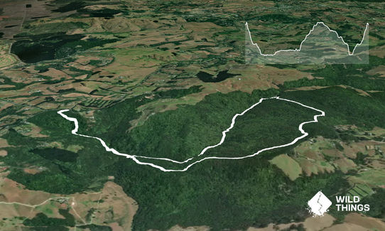
8.0km
325m
325m
200m
Last Updated: 21st Sep 2023
Last Updated: 21st Sep 2023
Closed More info
Grunt Factor: 14 ?
Gnarl Factor: 58 ?
8.0km
325m
325m
200m
Front country - easily accessible
Combo
Undulating, small hills only
Native bush
Riverside
Easy Single Track
Moderate Single Track
Untracked / Route only
Average Uphill Gradient: +7.5%
Average Downhill Gradient: -7.8%
VIP Feature: Send this route to your Garmin account so you can follow the course on your Garmin device.
Login as a VIP to see the trailhead information.
2:00
Slow
1:30
Moderate
1:00
Fast
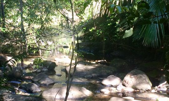
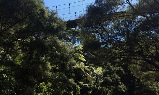
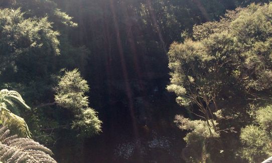
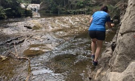
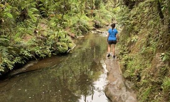
Spray your shoes and head downhill for just over a km to the Mokoroa Stream (turn right just before the swingbridge to get to the stream bed). From here you get a short loop but be warned the creek bed section of this loop is very technical, so expect this to be one of the longest 2-3km time wise in your life. It's basically a sort of track, sort of route up the Mokoroa Stream and a great route it is.
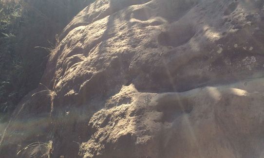
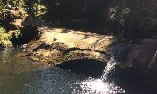
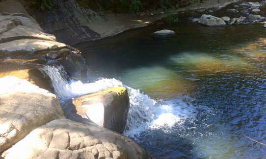
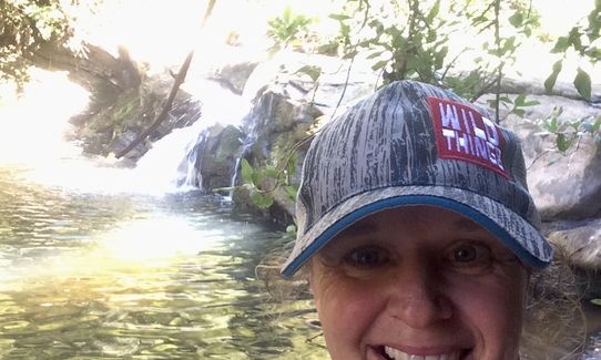
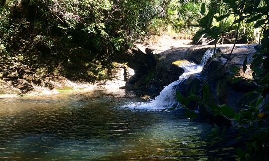
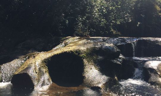
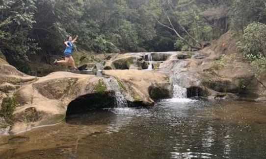
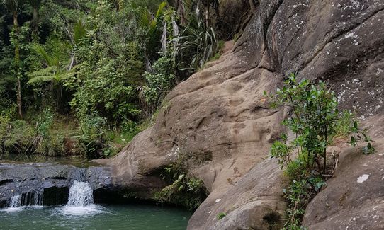
Admire many small cascades, a fantastic swimming hole and an all round gorgeous spot. Be warned - after or during heavy rain this creek can rise rapidly and whilst it has been done DOC don't recommend being here in these conditions (think water down the neck of your jacket type events happening - from personal dumb experience).
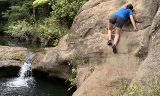
You'll meander your way in and out of the stream and the small pieces of technical track to eventually get to the Mokoroa Falls. A spot where you can't go any further (take another pic or two) and spin back round and head downstream 200-300m keeping your eyes peeled for a track and set of stairs on your left (looking downstream). Take these up to the top and a short track left 100m or so takes you to the lookout over the falls. Again picture time.
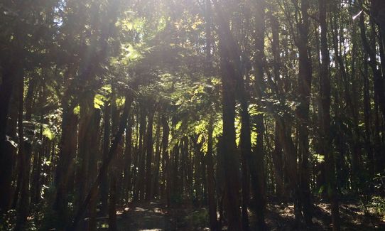
Turn around and head up this track avoiding any small inviting looking little detours left and right - head up the main track climbing to the signposted intersection where you take a right turn. This well groomed gravel track heads back down to the swingbridge you almost crossed earlier. Cross this and enjoy the 1.2km climb back to Constable Rd.
This adventure run has it all, well formed single track, beautiful bush and a route that follows in and out of the stream bed.
Can be added to the Te Henga Trail for distance and more hills.
If you know of any public toilets near the trail start or on the route, please login and then let us know so we can update this section.
Parking at small car park, safe, no public transport to trail head.
43 km
40 minutes
Unknown
No
Moderate.
Once in the stream bed section if you lose the track of feel you're off course you can always head back into the stream bed and follow the direction of the stream. There's so many crossings you'll end up finding the track again
Very patchy.
Thermal leggings, Long-sleeved thermal top, Seam-sealed waterproof jacket, Beanie/thermal headwear, Personal Locator Beacon (PLB), Whistle, First aid kit, Cellphone
You're in a stream for half the run so there's plenty around if you get desperate.
The DOC sign says don't head in here after or during heavy rain. Ignore this at your peril - the stream gets very full.
Slippery rocks in the stream bed.
There's not a lot round - take your own cold beer
Fastest Known Times (FKTs)
You and Goldies Goodness
As a VIP member you can record private notes for this trail, see all of your times and more.
Already have an account? Login now
RC
Fun awesome loop, great to do in summer when its hot as there are plenty of river crossings in the first half to cool down in. The trail along/across/beside the river can be quite gnarly, but is awesome for those that remember fondly when all the Waitakere trails used to be like that, but don't expect the river section to be very quick, its more about fun then speed. Note that when starting from the Constable road end the first 1.2km are a lot of stairs down, which you need to come back up later!!
November 2, 2020
NN
Less running and more scrambling than anticipated. It's really pretty but the river part is muddy and slippery in parts. Theres also a small rock climbing section around the swimming hole. ?
September 26, 2020
Send to your phone
Scan the below QR code to open this trail on your phone.

Tip: position the QR code in your phone camera screen.


