Last Updated: 15th Jul 2024
Western Rangitoto
Last Updated: 15th Jul 2024
Open
Grunt Factor: 16 ?
Gnarl Factor: 9 ?
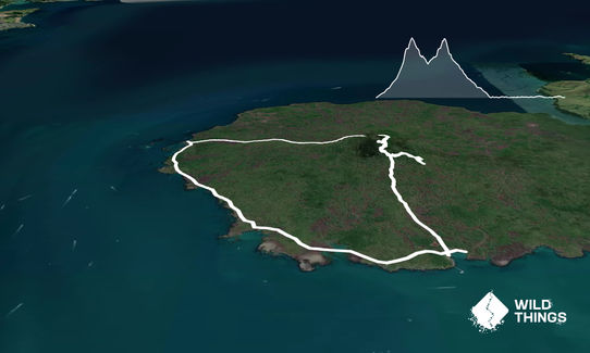
13.5km
430m
430m
262m
Last Updated: 15th Jul 2024
Last Updated: 15th Jul 2024
Open
Grunt Factor: 16 ?
Gnarl Factor: 9 ?
13.5km
430m
430m
262m
Front country - easily accessible
Loop
Undulating, some big hills
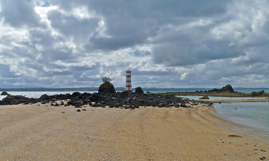
Beach
Coastal
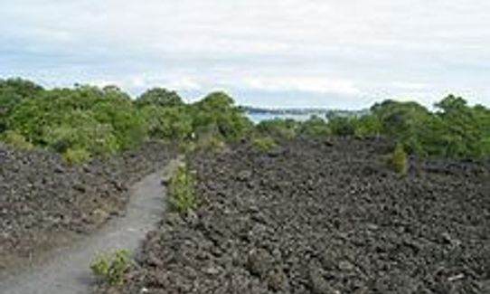
Volcanic
Farm Road / 4WD Track
Easy Single Track
Average Uphill Gradient: +6.5%
Average Downhill Gradient: -6.1%
VIP Feature: Send this route to your Garmin account so you can follow the course on your Garmin device.
Login as a VIP to see the trailhead information.
2:15
Slow
1:45
Moderate
1:15
Fast
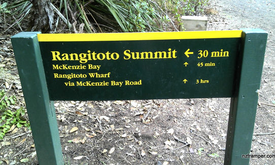
Off the ferry, head straight up the Summit Track. Take a detour through the lava caves. Don't forget your headtorch so you can make the most of it!
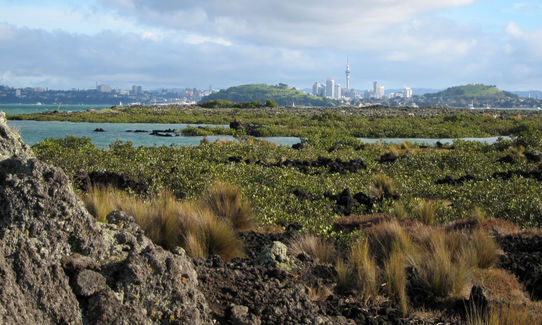
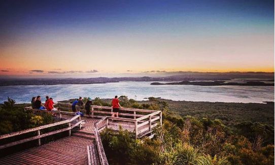
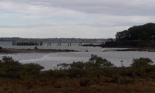
At the top, enjoy the incredible views, and run around the Crater Rim Track. After you've had your fill at the top, follow the McKenzie Bay Road west (looking towards Auckland.) At the bottom of McKenzie Bay Road, make sure you take in McKenzie Bay Beach and the Lighthouse - wow! Follow McKenzie Bay Road the whole way back to the ferry terminal! Bingo!
Don't forget to stash a chilly bin near the ferry terminal with swimming togs, towel, water, food.......
This trail includes the peak Rangitoto.
Emerging from the sea just 600 years ago, pest-free Rangitoto Island is the youngest volcano in New Zealand
If you know of any public toilets near the trail start or on the route, please login and then let us know so we can update this section.
Only accessible by boat. fullers.co.nz. Return ferry is $33. 7.30am ferry on Saturdays and Sundays for $20 return.
0 km
0 minutes
Unknown
No
Easy.
Generally good.
Whistle, First aid kit, Extra food for emergencies, Cellphone, Map
No water available on the island. BYO!
It gets very dry over in Rangi, best to take extra water and leave it near the ferry terminal
Trail Legend
Login as a VIP to become a Trail Legend. Learn about Trail Legends.
Fastest Known Times (FKTs)
You and Western Rangitoto
As a VIP member you can record private notes for this trail, see all of your times and more.
Already have an account? Login now
Tough run with heat, soft sand on the road and lava rocks to navigate. Great training for other off road events that we have planned in 2022. The views amazing and a lovely swim whilst waiting for the ferry. 1hr 45 mins with the odd walk.
January 3, 2022
These overlap with this trail to some degree. You may wish to combine them but please note that to qualify for FKTs on these runs you should record a separate activity for each.
Send to your phone
Scan the below QR code to open this trail on your phone.

Tip: position the QR code in your phone camera screen.


