Last Updated: 1st Mar 2024
Te Ara ki Uta ki Tai
Last Updated: 1st Mar 2024
Open
Grunt Factor: 20 ?
Gnarl Factor: 16 ?
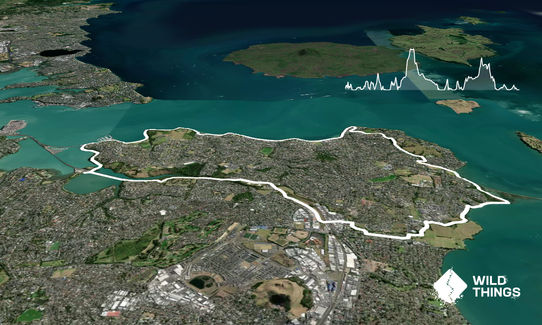
22.5km
310m
310m
67m
Last Updated: 1st Mar 2024
Last Updated: 1st Mar 2024
Open
Grunt Factor: 20 ?
Gnarl Factor: 16 ?
22.5km
310m
310m
67m
Urban
Loop
Undulating, small hills only
Coastal
Other
Easy Single Track
Moderate Single Track
Untracked / Route only
Average Uphill Gradient: +2.7%
Average Downhill Gradient: -2.7%
VIP Feature: Send this route to your Garmin account so you can follow the course on your Garmin device.
Login as a VIP to see the trailhead information.
3:00
Slow
2:30
Moderate
2:00
Fast
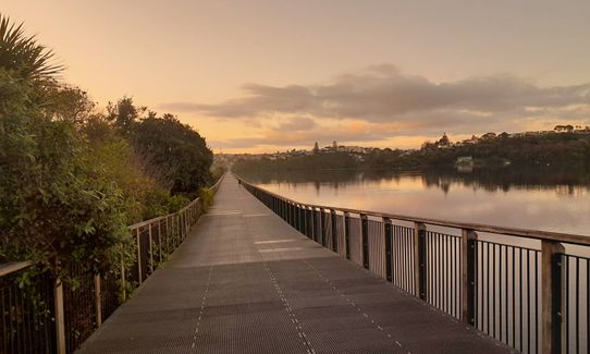
From Mission Bay, head east towards the city along Tamaki Drive. On reaching Hobson Bay, follow Ngapipi Road on your left over the hill and down to Orakei Basin, turning right onto the bridge. Then cross Orakei road, heading down the hill to the cycleway across Orakei basin.
Follow the cycleway across the basin then up the hill, veer left onto the cycleway alongside the Meadowbank train station. Continue the length of the cycleway to come out onto the Kohimarama / St Heliers / St Johns roads intersection. There is one fork along the cycleway, keep right at this point. Proceed along St Johns Rd and cross it to proceed along the cycleway down the hill in the direction of Glen innes. On coming to a junction, take the right to go through the tunnel under the railway and into Glen Innes township.
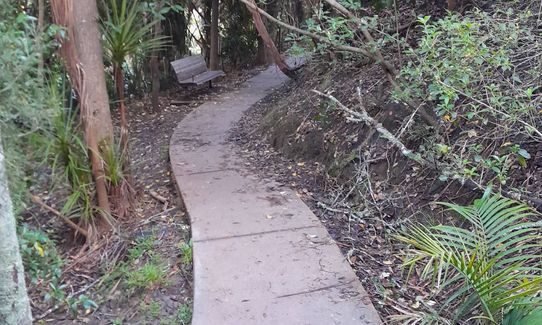
Proceed directly ahead until reaching Maybury Reserve on the right, and enter it. Run through the reserve to exit at Maybury Street. Continue in the same general direction along Maybury to Elstree, turning left then crossing the road. Another trail will shortly come up on your right, next to a creek. Follow this trail for a bit. It does pop out to roadside footpath, but follow the path to your right then you almost immediately turn right again onto more trail. Follow this along - you eventually come to a wide concrete shared path, which you cross over to continue on more basic trail. This does peter out into grass but continue along here, up the hillock and over the tree roots.
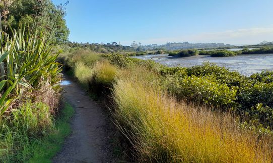
This is the trickiest navigation point of the route with the grassed area opening up around you surrounded by shrubby bush. Dip down the hill to your right to follow more trail. This will bring you to a short coastal road section before then reaching the entrance to Tahuna Torea Nature Reserve, follow the Lagoon Track path to the right then follow the trail around the point - at any forks, take the ones that do not say either "spit" or "carpark" and you should make it through the reserve successfully.
You will eventually come to a short concrete hill section that drops down to Roberta Reserve, follow the path along the beach then angle left to enter Glendowie Park. Head through the park to Whitehaven Road, turn right up the hill then on to Forfar Road on your left and to the entrance to Churchill Park. Drop down the trail to your left and then proceed through Churchill on the path alongside the creek.
Cross the road when you come to it, running under the scout hall in front of you, and along the grass track ahead. Where this runs out, you drop onto a trail to your left and follow it, keeping left at forks then up the steps to exit Churchill Park. Turn right along Riddell Road then left alongside Glover Park and continuing along Glover Road.
Turn right on Springcombe and follow the road around to Achilles Point, then proceed along Cliff Road. This will take you to St Heliers, where you will then follow Tamaki Drive back to the start.
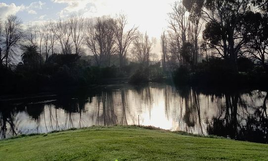
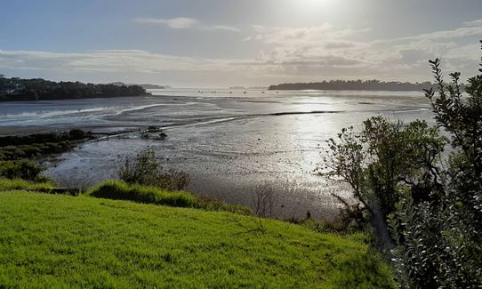
This route takes in the Auckland eastern beaches along Tamaki Drive, Hobson Bay, Pourewa creek valley and the Tahuna Torea wetlands.
Te Ara ki Uta ki Tai is the name of the cycleway which you will follow, this then links up with the Glen Innes trails.
If you know of any public toilets near the trail start or on the route, please login and then let us know so we can update this section.
Mission Bay is on bus routes and there is ample beachside or street parking near by.
8 km
15 minutes
Unknown
No
Moderate.
Navigation is generally straight forward although a GPX trace will certainly help through the more uncertain twists and turns around Glen Innes and Point England.
Perfect throughout.
Cellphone, Map
There are water fountains available on Tamaki Drive at Okahu Bay, St Heliers, and Kohimarama. Otherwise water is not readily available.
None.
This route crosses Tamaki Drive, Orakei Road, and St Johns Road and caution should be taken in these places.
Mission Bay Cafe
85 Tamaki Drive, Mission Bay
https://missionbay.cafe/
Bodrum Kitchen Mission Bay
81 Tamaki Drive, Mission Bay
https://bodrum.co.nz/
Tana Mera Espresso
12B Patteson Avenue, Mission Bay
https://bodrum.co.nz/
Fastest Known Times (FKTs)
You and Te Ara ki Uta ki Tai
As a VIP member you can record private notes for this trail, see all of your times and more.
Already have an account? Login now
These overlap with this trail to some degree. You may wish to combine them but please note that to qualify for FKTs on these runs you should record a separate activity for each.
Send to your phone
Scan the below QR code to open this trail on your phone.

Tip: position the QR code in your phone camera screen.


