Last Updated: 4th Feb 2024
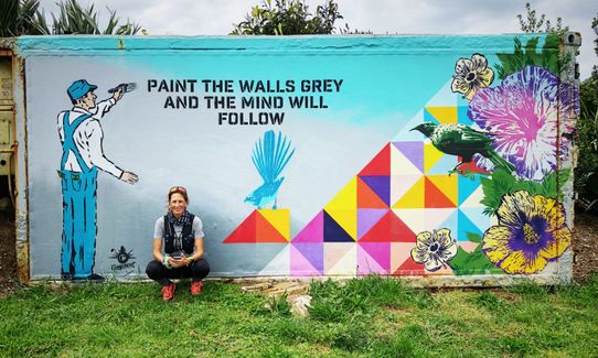
Te Ara Hura West
Last Updated: 4th Feb 2024
Grunt Factor: 19 ?
Gnarl Factor: 25 ?
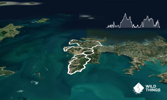
17.0km
470m
470m
70m
Last Updated: 4th Feb 2024
Last Updated: 4th Feb 2024
Grunt Factor: 19 ?
Gnarl Factor: 25 ?
17.0km
470m
470m
70m
Urban fringe
Loop
Undulating, small hills only
Dog Friendly
Native bush
Beach
Coastal
Sealed Road
Easy Single Track
Moderate Single Track
Average Uphill Gradient: +7.3%
Average Downhill Gradient: -7.2%
Login as a VIP to see the trailhead information.
3:30
Slow
2:45
Moderate
2:00
Fast
IMPORTANT: see notes below re detours currently in place*
Described in clockwise direction as this gets the 3km of road section under your belt as a warm up. Like most NZ trail this is best enjoyed in winter after lots of rain.
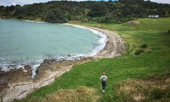
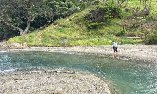
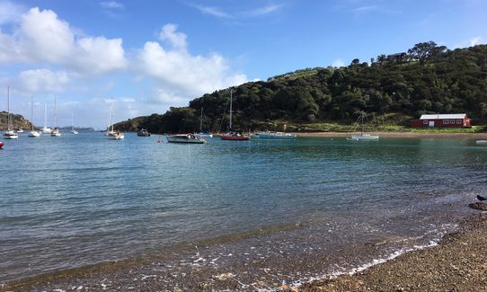
Follow the signs from Oneroa to the Mudbrick vineyard on Church Bay Road. Carry on past the Mudbrick for about 1km looking out for a trail head on your left, there is a toilet here so hard to miss. Enter the single track which will head downhill to a beach where you turn right and follow the track with the sea on your left. This is marked by DOC yellow/green posts. This will keep you in view of the sea or not far from it for another 3km.
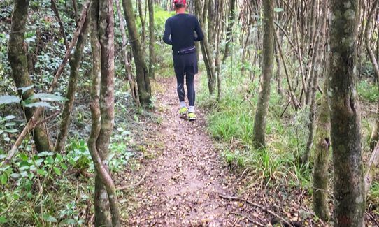
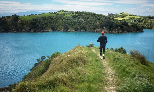
The track then heads inland across a gravel road through a bush section, once again very well marked with posts. This brings you out to the water’s edge again and continues all the way to Matiatia Wharf which is about the 10km mark and a perfect aid station for caffeine, food and a water bottle top up. From the Wharf head along the waters edge again towards the red barn where you will pick up the track again as you hug the coastline, just follow the markers you can’t go wrong.
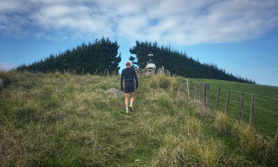
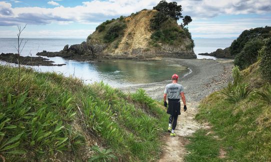
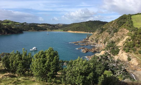
At about 14km you will come to Owhanake Beach, following the track and marker posts. This will pop you out at Island Bay, then up the hill from where the track turns inland via Fossil Bay vineyard. Follow the road down the hill once again marked with posts to the road and the turn left along the road for a short way until you get to an entrance to Oneroa Beach. Keep an eye out for the toilet block and this is your marker to head up the hill and finish where you started.
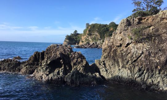
* There are three track closures on this trail due to erosion causing unstable cliffs. The track closure signs and barriers (at Church Bay and Island Bay) are now very prominent. The diversions around these are below. Note: this will add 3.5km to the trail if you opt for the option to take in the one-way route to Island Bay. After the track heads inland you will come across the track closed sign at Church Bay. Take the marked track to the right (signposted to Oneroa) and continue along here, across the private farm access road, and into the bush and down to the road (Church Bay Road). Turn left and run back up the road past Mudbrick on your right and continue up to Nick Johnstone Dr. Note: Be very aware of traffic on this section as there is limited verge available.Turn left down Nick Johnstone Dr and follow this right to the end, taking the left fork which takes you back onto the track. Continue to Matiatia Wharf. (Note: best to time your arrival at the wharf for either 2.5 hours before or 1.5 hours after high tide to avoid wet feet for the section to red barn). Continue as per route description, but just before Owhanake Beach is a short well-marked diversion around a slip. When you get to the beach you have a choice as there is a major track closure ahead.Either take the track to the right and join Korora Rd and continue on to Oneroa Beach or opt for a look at Island Bay Beach. For Island Bay, continue along the trail, crossing a gravel road, to the trail closed sign then retrace your steps back to the gravel road and turn left - this is in fact a private road but we had no problems running along it and then going through the small gate at the end onto Korora Road. Continue along this road to Oneroa Beach.
* The gpx file for this guide is now corrected to reflect these detours. If you become aware of any track re-openings or further changes to the route please email us
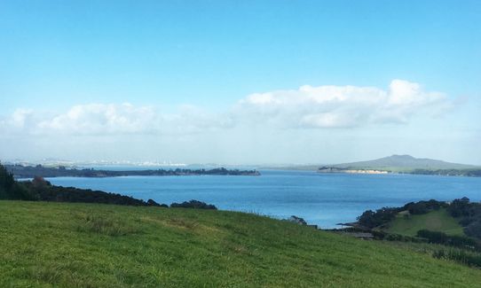
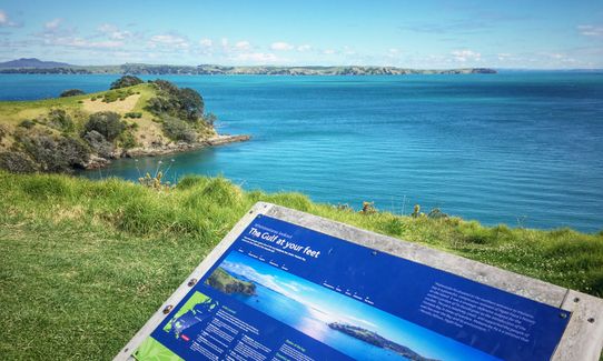
Coastal cliffs and Real Estate envy.
If you know of any public toilets near the trail start or on the route, please login and then let us know so we can update this section.
Any bus from the Ferry terminal.
44 km
60 minutes
Yes
No
Easy.
This track is very well marked with DOC yellow/green posts and the track is well defined and used.
Generally good.
Windproof jacket, Whistle, First aid kit, Extra food for emergencies, Cellphone, Map
Matiatia Wharf has water fill station and cafe.
Muddy when wet
Some closures due to bad weather occasionally but alternative routes around these should be available.
Fastest Known Times (FKTs)
You and Te Ara Hura West
As a VIP member you can record private notes for this trail, see all of your times and more.
Already have an account? Login now
lovely circuit - no problem at all with going through the 'track closed' sections (including Island Bay).
February 27, 2020
Beautiful coastal run with great views of Auckland, Waiheke, and how the 1% holiday! Trail erosion detour still in place at Church Bay, but the alternative has a nice bush section and takes you back past Mudbrick and Cable Bay allowing for a "Waiheke resupply". Trail is still closed at Island Bay due to erosion. Was going to chance it, but was advised not to by some locals at the beach. Took the walking track from Owhanake Bay up to Delamore Dr as an alternative.
July 14, 2019
GK
This run was brilliant as part of a day trip to Waiheke. We hopped on the ferry, ran, swam then went for a lovely lunch. The ferry and trail run allowed dogs so I brought my border collie and she loved sprinting around in the bush. The only downside is near church bay the track has been damaged in a storm and says closed. Some locals told us most people just ignore the signs and go through. We found this segment pretty tough because its totally overgrown with grass and very hard to follow. The rest of the trail is well maintained.
April 28, 2019
CF
A great way to spend a morning followed by a swim then lunch in Oneroa. A lovely runnable trail showing off the beauty and views of Waiheke.
January 6, 2019
Send to your phone
Scan the below QR code to open this trail on your phone.

Tip: position the QR code in your phone camera screen.


