Last Updated: 19th Nov 2024
Watercare Coastal Walkway
Last Updated: 19th Nov 2024
Open
Grunt Factor: 12 ?
Gnarl Factor: 4 ?
16.0km
10m
10m
10m
Last Updated: 19th Nov 2024
Last Updated: 19th Nov 2024
Open
Grunt Factor: 12 ?
Gnarl Factor: 4 ?
16.0km
10m
10m
10m
Urban fringe
Out and Back
Totally/mostly flat
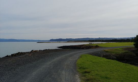
Coastal
Open farmlands
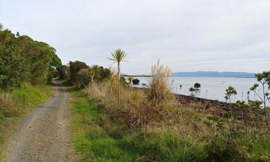
Farm Road / 4WD Track
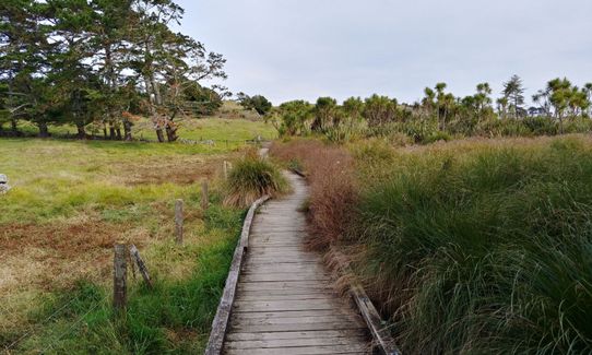
Easy Single Track
Average Uphill Gradient: +1.2%
Average Downhill Gradient: -1.2%
VIP Feature: Send this route to your Garmin account so you can follow the course on your Garmin device.
Login as a VIP to see the trailhead information.
2:30
Slow
2:00
Moderate
1:30
Fast
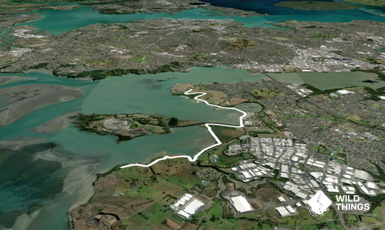
Start at the Ambury Regional Park car park. Head south through a couple of farm gates and turn left for the start of the Walkway, skirting the farm paddocks. After about 1km you have two options. Either turn right down to the waterfront and then turn left when you hit the water or carry on straight and follow the farm road round, either way you will end up in the same place.
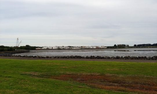
Carry on east along the water until you cross the in/outlet of Mangere Lagoon. Veer right along the water towards the Watercare facility (or veer left and do a loop of the lagoon, adding a couple of kms). Run past the industrialness of the Mangere Wastewater Treatment Plant, keeping your eyes turned to the sea. Skip across the Puketutu Island Road and turn right on the on the far side of the water.
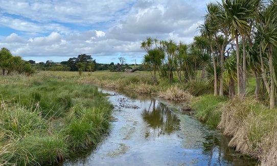
About 750m along turn left (or continue straight onto Puketutu Island for a detour.) Continue along the foreshore, veering right until you run through Oruarangi Rd car park (alternative starting point if you wish). Go across the little bridge and onto the Otuataua Stonefields path. When you see the signs for the lookout turn left to follow the gravel path or carry on past the lookout along the beach if you want to get off the path. Either way you will end up at a dead end around 8km into the run.
Turn around and head back the way you came. About 100m from the end there is a side path that takes you onto the stonefields proper if you want to have a look around before retracing your steps.
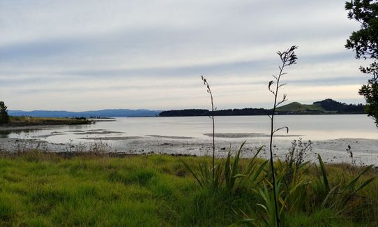
Route starts at Ambury Regional Park, a working farm, and the halfway point is at Otuataua Stonefields, a historic reserve. There are bird roosts and a variety of bird life along the way as the route skirts around Manukau Harbour.
Ambury Park beside function centre and Oruarangi Road carpark and towards the Stonefields end at the Oruarangi boat ramp (https://maps.app.goo.gl/gVEkx3k1YV3RUDDq5)
Car Parking available. You can get to Mangere Bridge within 1 km of the start by bus.
22 km
23 minutes
No
No
Easy.
See the detailed description.
Generally good.
Windproof jacket, Whistle, First aid kit, Extra food for emergencies, Cellphone, Map
Plenty of water along the route, but not for drinking!
All season track.
Trail Legend
Login as a VIP to become a Trail Legend. Learn about Trail Legends.
Fastest Known Times (FKTs)
You and Watercare Coastal Walkway
As a VIP member you can record private notes for this trail, see all of your times and more.
Already have an account? Login now
This track is closed by the watercare plant just by the lagoon. Its closed till October 2023. You can still make it a decent 10km trail run or a walk.
Scenic view and surrounded by a mix of birds and animals.
Nice flat trail and easy to run.
June 13, 2023
Just did it today and yes the track is fully open. Mostly flat gravel so good for getting a bit of mileage with a bit of nice single trail towards the Otuataua stonefields end. However that end is also very flooded at the moment - hard to distinguish the track from the creek! But hey - you can just run through it:)
September 11, 2022
This track is now fully open although a section past the construction is narrower at present. Easy, flat, majority gravel track.
April 11, 2022
Send to your phone
Scan the below QR code to open this trail on your phone.

Tip: position the QR code in your phone camera screen.


