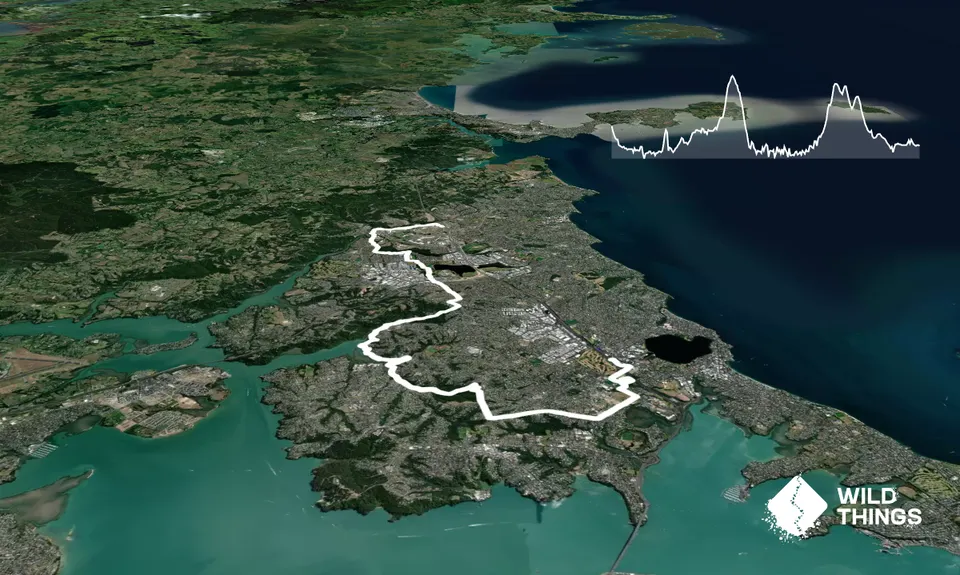
This trail can be varied to take in additional trails around Northcote/Birkenhead, and for a super-sized version you can head to the east coast beaches and run north back to start point (North Shore Ultra is under design!). This version takes you from Albany bus station to Smales Farm bus station, thus allowing you to catch a Northern Express bus back to Albany (probably 10 minutes ride).
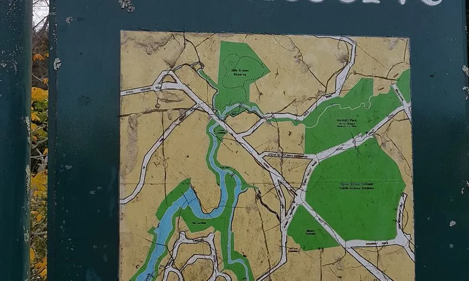
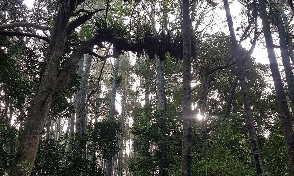
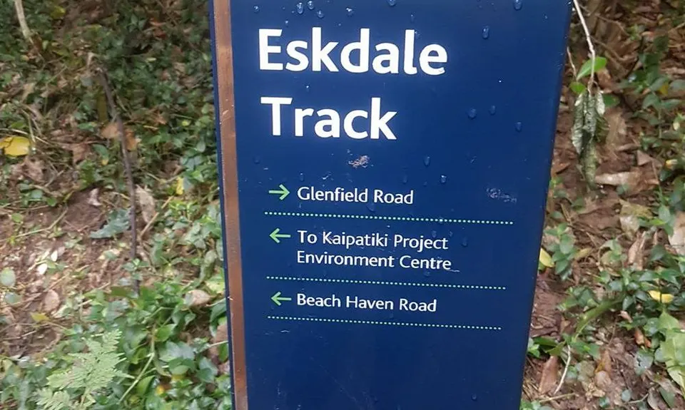
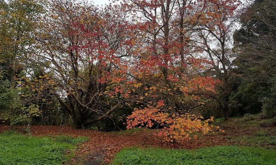
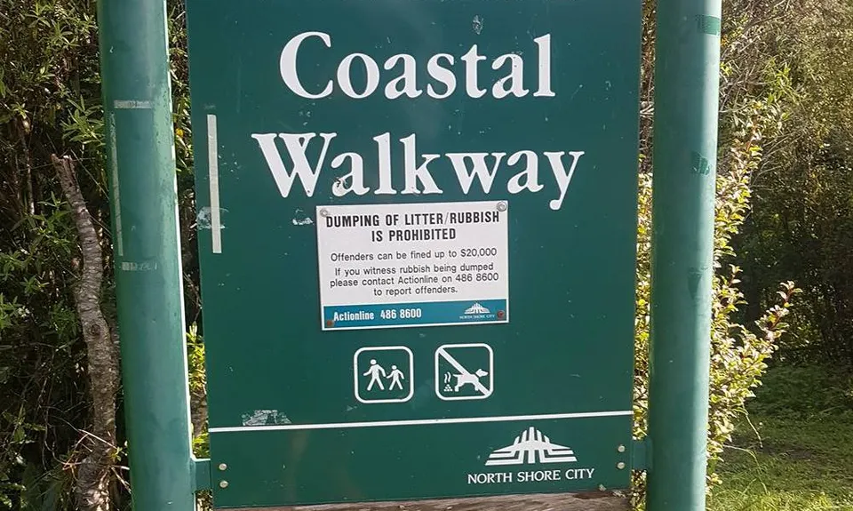
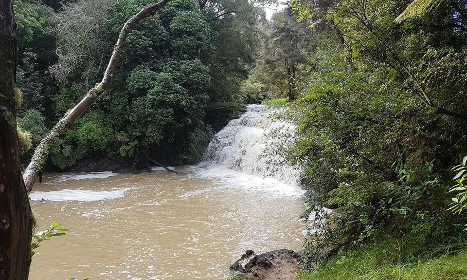
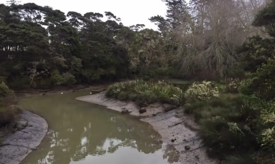
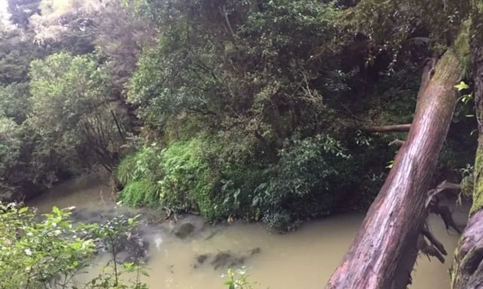
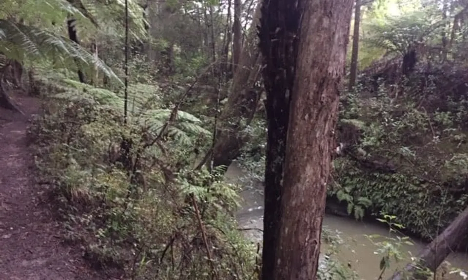
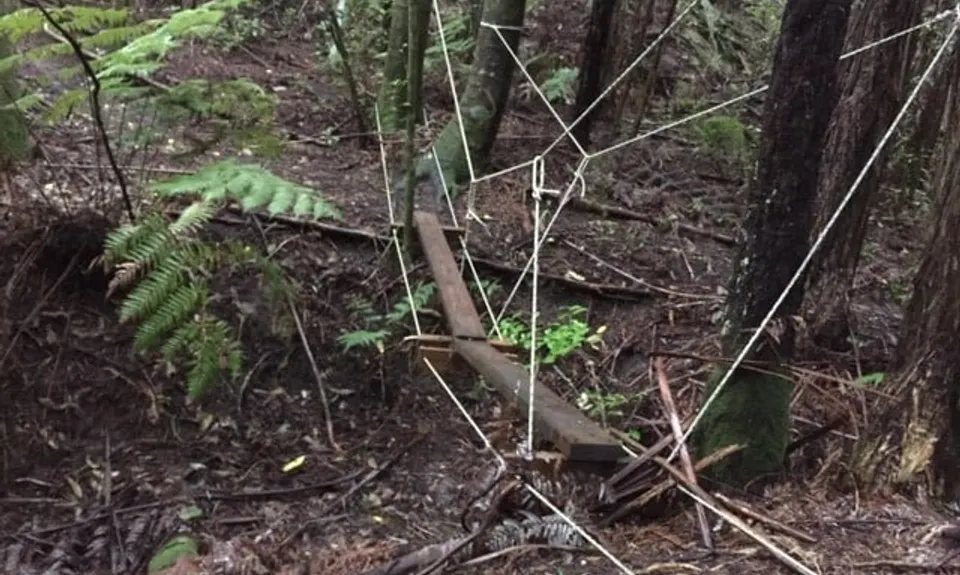
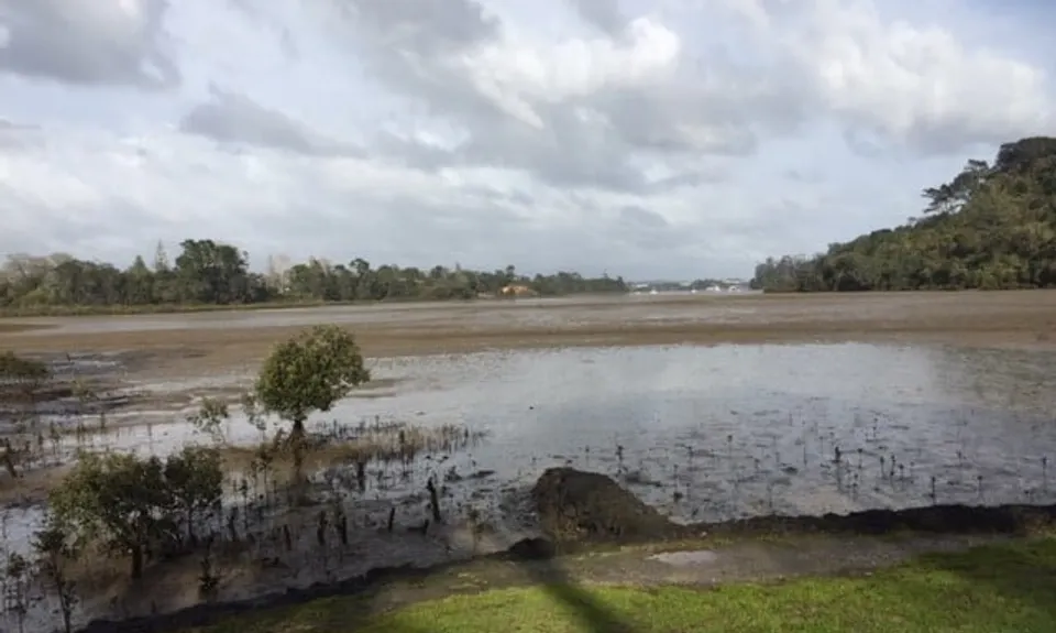
Cross Oteha Valley Rd and go left down to Hooton Park and to Mills Lane. At Mills Lane go right for a few metres only (entrance to Kurai Purapura Retreat). Cross bridge and immediately turn left onto trail. Follow this trail all the way to Gills Rd. Cross Gills Rd and the one way bridge. There is an option to head up the hill to the trig however on this route take the flat trail to the left "Gills Reserve Heritage trail". Follow a concrete path alongside Lucas Creek - after a couple of hundred of metres you reach a good waterfall. Soon after that you come to Dairy Flat Highway. Cross the busy road carefully opposite the Toyota dealership. There is a wide grass trail here heading around to the left into Kell Park around the back of some shops and a gallery. Cross what looks like an old orchard onto the path in Kell Park, down a boardwalk and around over the bridge crossing Lucas Creek. You then follow a path across a reserve all the way to Albany Highway. Across the highway (there is pedestrian access under the road bridge at this point) is the entrance to Fernhill Escarpment, a beautiful bush section with many totara trees. (The "closed" sign relates to bikes, not foot traffic) This is a long section of trail running alongside a creek all the way to Bush Rd. The best way to navigate through is to keep the creek on your right most of the way and stay on the trails nearest the creek - there are some upper trails as well that can be explored. When you reach Bush Rd, cross the road, turn right, run to intersection with Rosedale Rd, cross, turn left and head down Rosedale Rd maybe 200m. There is a wide grass trail on your right, take this and you will end up on Emerald Way (houses), on your right there is a path and bridge leading to Stonedge Lane, go right and you will see an accessway through to Rosedale Park Sportsground. Skirt around the fields and onto the path leading out to Paul Matthews Rd. Immediately across the road is a track leading down to a tunnel which passes under the Upper Harbour Highway (SH18). Follow the track to Unsworth Heights, crossing Barbados Drive. Take the long boardwalk into Unsworth Reserve, through Unsworth Reserve to Goldfinch Rise. Head right up the hills to intersection with Unsworth Drive, go left onto Glenfield Rd, and left on Glenfield Rd and up to traffic lights (intersection with Sunset Rd) Cross here onto Glendhu Rd and you have a long downhill road section (1.7km) with a footbridge at the bottom to the western end of Glendhu Rd. A few metres up the road veer right and down the bottom of the street is the entrance to the Glenfield Coastal Walkway. There a two sections - the first section (approx. 2km) goes to Manuka Reserve so keep following the signs to Manuka Rd. You go through a dog walking park as you approach Manuka Reserve. There is a good lookout over the estuary here and a boat ramp, toilets etc. The next section (also about 2km) is to Kaipatiki Rd. At the Rd go right and there is a trail for a few hundred metres alongside the road. Cross Kaipatiki Rd and head right a bit further to the bridge. Do not cross bridge: the entrance to Eskdale bush is on your left, head onto this trail. There are a few side trails on this track, you need to follow the signs to Glenfield Rd (the main track). Towards the end of the trail there are a number of options, however if you keep heading more or less uphill you will end up on Glenfield Rd. Cross Glenfield Rd and go right to intersection with Pupuke Rd. Run down Pupuke Rd to intersection with Raleigh Rd (and note at this point you are missing the very fine trails near of Kauri Glen Park very nearby!) down Raleigh Rd to roundabout, cross over Lake Rd to Exmouth Rd, take first left (College Rd) and then follow College Rd to Akoranga Drive. Go left onto Akoranga Drive and at some point cross the road and run most of the way to the Onewa Domain. Just before the domain go right down a gravel path/road, cross a grass area and on your left is the entrance to Smiths Bush. Wind your way through Smiths Bush (very mature trees, puriris and kauri, right next to the motorway), coming out next to the sportfields. Cross carpark to Northcote Rd, turn right, cross motorway, cross road and take pathway through to Smales Farm bus station.