Last Updated: 4th Jan 2025
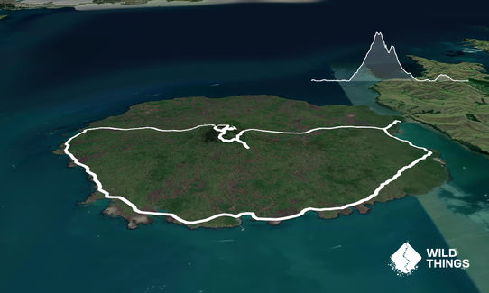
Rangitoto Circumnavigation
Last Updated: 4th Jan 2025
Open
Grunt Factor: 21 ?
Gnarl Factor: 30 ?
20.0km
430m
430m
249m
Last Updated: 4th Jan 2025
Last Updated: 4th Jan 2025
Open
Grunt Factor: 21 ?
Gnarl Factor: 30 ?
20.0km
430m
430m
249m
Front country - easily accessible
Combo
Very hilly
Coastal
Volcanic
Gravel Road
Easy Single Track
Technical Single Track
Average Uphill Gradient: +4.2%
Average Downhill Gradient: -4.1%
VIP Feature: Send this route to your Garmin account so you can follow the course on your Garmin device.
Login as a VIP to see the trailhead information.
3:00
Slow
2:30
Moderate
2:00
Fast
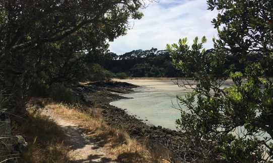
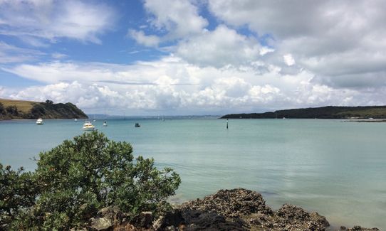
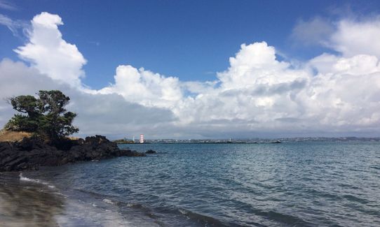
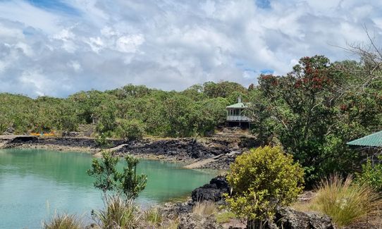
This route circumnavigates the island to avoid the big crowds that are often going up the summit track. Go left once past the toilets after you get off the ferry and follow the gravel road (Mckenzie Bay road) around the bottom of the island. About 5km into the run you will see the road go left or right (towards the summit). If you go left you will head down to Mckenzie Bay beach to give you views of the north shore and the lighthouse. Returning to the road, head towards the summit.
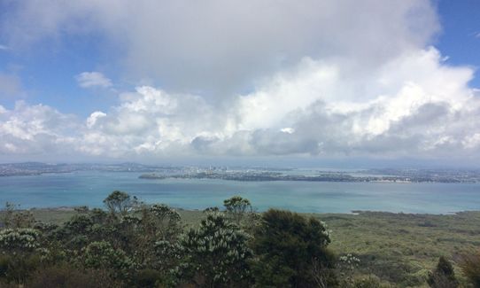
Once near the top you will head up the boardwalk (stairs) to reach the crater rim and get the views. Once you have had enough of the views (or the crowds at the top), take the track that goes down past an old gun house and follow this around the crater rim until you get back to the boardwalk, but instead of going back down the stairs, take the summit track downwards.
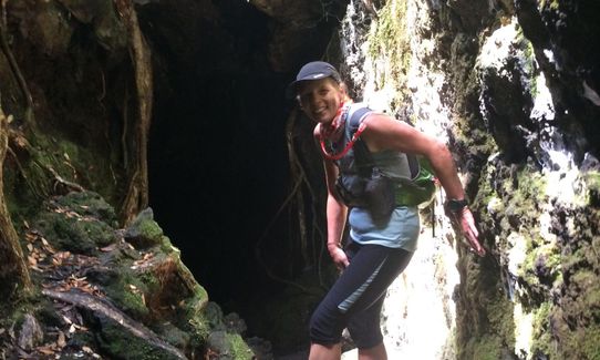
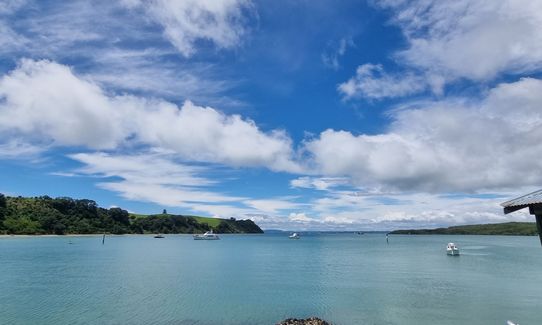
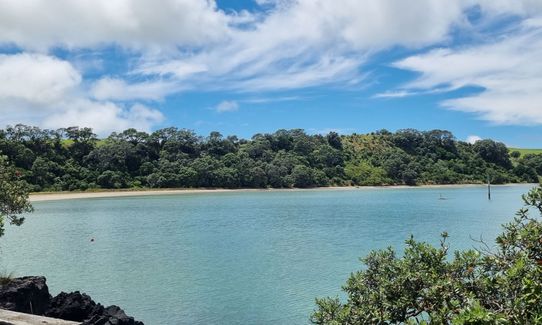
After running down the summit track for about 300m you will see a track going to the left. Go left and follow this to the lava caves. Explore the lava caves. Once returning from the lava caves, instead of taking the route all the back to the summit track, you will see a track going to your right about 100m from the lava caves. Go right here and this will take you back to the Mckenzie Bay road. Once there you will go right and this will become the summit road. Follow the summit road to Islington Bay road (go left) and continue on Islington Bay road until you get to Islington Bay (this is the alternative docking for the ferry in bad weather).
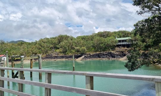
You could also head over to Motatapu Island for further adventures if you wish. From here, head back along Islington Bay road and then turn left on Yankee Wharf road. Follow this road to a wharf and continue past it until you see the coastal track sign and follow this track back to the ferry (there is one point near the start of the coastal track that the track continues straight ahead and but the coastal track goes right here. Go right otherwise you will end in a dead end).
This trail includes the peak Rangitoto.
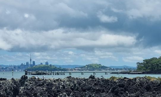
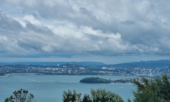
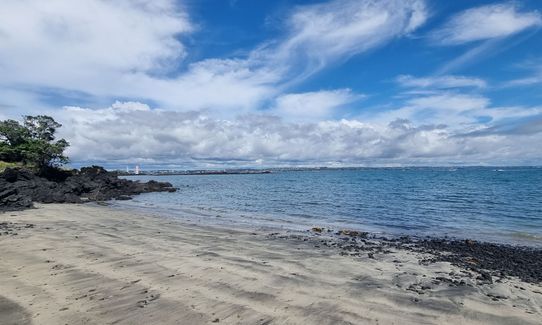
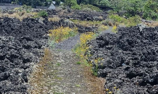
Amazing views of Auckland and coastal areas. Lots of volcanic rocks and some lava caves to explore.
If you know of any public toilets near the trail start or on the route, please login and then let us know so we can update this section.
If going from downtown Auckland, park in the Downtown carpark and its an easy walk across the road to the Ferry terminals.
0 km
0 minutes
Unknown
No
Moderate.
The gravel roads are easy to navigate, but the tracks are a little more tricky as the volcanic rock sometimes doesn't make the "track" obvious where is it.
Generally good.
Long-sleeved thermal top, Seam-sealed waterproof jacket, Gloves, Beanie/thermal headwear, Whistle, First aid kit, Extra food for emergencies, Survival blanket, Cellphone, Map
No fresh water anywhere!
Very very hot in summer. The black volcanic rock heats up and this heats you up. Very exposed at times. Windy and cold at the summit in winter.
Volcanic rock hurts ALOT if you fall over. Watch your foot placing!
Trail Legend
Login as a VIP to become a Trail Legend. Learn about Trail Legends.
Fastest Known Times (FKTs)
You and Rangitoto Circumnavigation
As a VIP member you can record private notes for this trail, see all of your times and more.
Already have an account? Login now
Did this in July 2021. A rahui iwas n place on Motutapu, but Rangitoto is currently open. A really enjoyable run with some amazing views. The rocky part of the coastal track had me down to a very slow walk at times, and I was very pleased to have some chunky trail shoes on!!
I did spend a bit of time at the summit and at the lava caves - it might blow out your time, but well worth it.
(If going for an FKT maybe do the run without stopping then hike back up to the summit on the main track for some exploring - plenty of time to do this for catching the ferry back to the CBD.
The instructions in the description above are top-notch btw!
July 8, 2021
VA
I completed this trail twice on consecutive days on October 10th and October 11th 2018. Both days the weather was cloudy/fine. I took the 9:15 ferry from Auckland which let me start my runs around 9:50. The first part to the West of the island (McKenzie Bay) is a mostly flat easy vehicle track for about 5k. At McKenzie Bay I turned East which steadily turns into an easy climb until you reach the boardwalk/stairs after about 8k in total. I took the boardwalk up and down (instead of the official description of this trail) which is about 1.5km return. Then it is a fast little run over 3km down to Islington Bay. Another small deviation of the official description is that you can get on the Coastal Ttrack at the water edge in Islington Bay, wich is what I did both day. The remaining about 5.5k of the Coastal Track are partly nice and partly very technical, which slowed me down to a crawl (5-6 kph at some stage) . The final 1-2k the path shapes up and allows a nice endsprint.My Garmin indicated just over 19k for the full loop. The first day I went too easy at 2hr34m not sure what I would find, but the next day I pushed a bit harder for a 2hr17 run (I am about a 4-hour marathoner). As long as you do it within 3 hours, you can catch the 12:45 ferry back that gets you to Auckland by 1:15pm. All in all the best run I have found for anyone staying in Auckland CBD. The boat ride back and forth ($36) is a nice bonus.
October 30, 2018
These overlap with this trail to some degree. You may wish to combine them but please note that to qualify for FKTs on these runs you should record a separate activity for each.
Send to your phone
Scan the below QR code to open this trail on your phone.

Tip: position the QR code in your phone camera screen.


