Last Updated: 20th May 2024
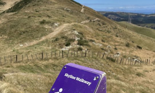
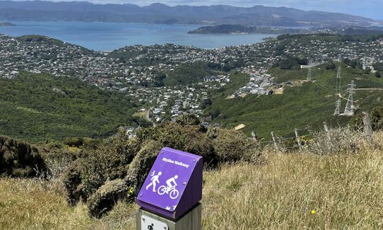
Skyline - Mt Kaukau
Last Updated: 20th May 2024
Open
Grunt Factor: 24 ?
Gnarl Factor: 12 ?
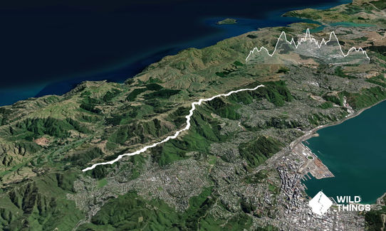
20.0km
880m
880m
430m


Last Updated: 20th May 2024
Last Updated: 20th May 2024
Open
Grunt Factor: 24 ?
Gnarl Factor: 12 ?
20.0km
880m
880m
430m
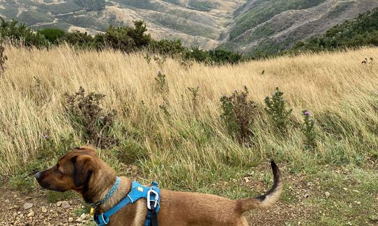
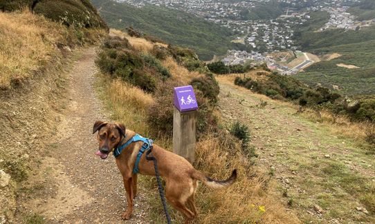
Urban fringe
Out and Back
Undulating, small hills only
Dog Friendly
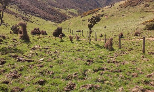
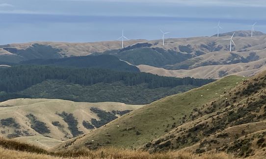
Open farmlands
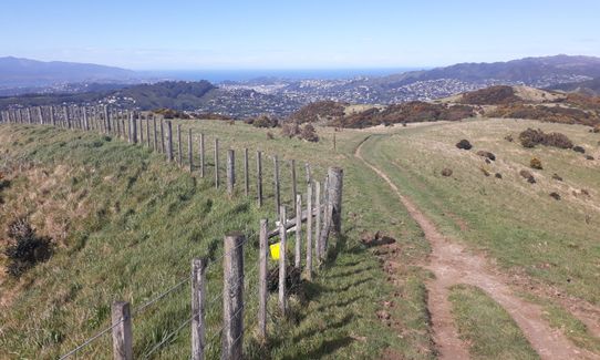
Open ridges/tops
Farm Road / 4WD Track
Easy Single Track
Moderate Single Track
Average Uphill Gradient: +8.4%
Average Downhill Gradient: -8.6%
VIP Feature: Send this route to your Garmin account so you can follow the course on your Garmin device.
Login as a VIP to see the trailhead information.
3:30
Slow
2:30
Moderate
1:35
Fast
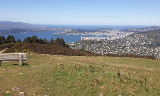
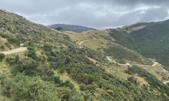
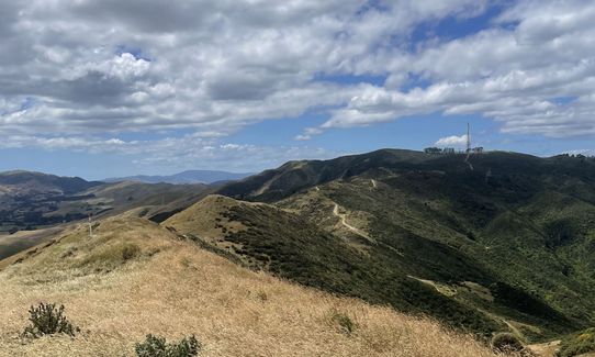
Starting at Makara Saddle follow the signs for Skyline and/or Mt Kaukau. Along the open tops there are a mixture of signs, poles, warratahs, and orange disks to keep you on route. You'll spot Mt Kaukau with its transmission tower in the distance... keep aiming for that. Mt Kaukau has a lookout deck and is the turn around point.
A popular run/walk/ride that will provide amazing views on clear sunny days, or will make you feel like you're in a tornado on a bad day. When there's no wind and the sun is shining there is no better place to run in Wellington making it possibly a 5 star run, but that combination can be a rarity and on a bad day you may rate it as a 1 star.
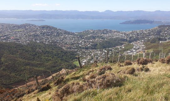
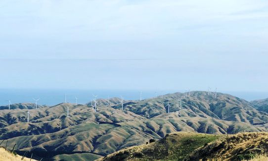
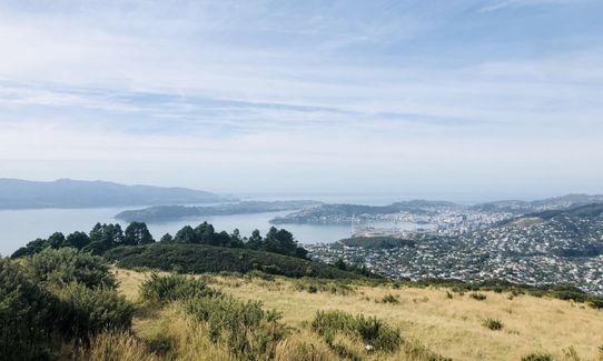
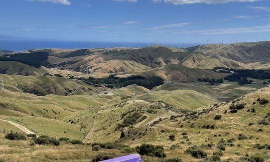
The track traverses Wellingtons predominant western skyline ridge offering views over Wellington harbour, city and western suburbs to the east, or over the Makara/Ohariu Valley farmland and Cook Straight to the west. The ridgeline is mostly open grassy farmland with pockets of regenerating native bush below.
This run can be done either as a one way or return starting in Johnsonville, Khandallah, or Karori with many alternative entry and exit points depending on what you feel up to. This description is for the return from Makara Saddle which is popular due to parking availability and the return from Mt Kaukau being easier.
Public toilets are available at Karori Park.
There is parking available at the saddle of Makara Rd for a few cars, or 10m further on at the Makara Rd entrance to Makara Peak Mountain Bike Park. This is a reasonably busy road so cars are generally safe, but don't leave valuables in plain sight.
You can catch the Karori Park #3 bus to the end of the line dropping you near the bottom of Makara Rd. Either head up Makara Rd for 1km to the start of the track or take the Wahine trail at the back of Karori Park (also at the end of the bus route) up to the start of the Skyline Trail.
8 km
18 minutes
Yes
No
Easy.
On the way back towards Makara Saddle there is one point where you need to keep an eye out, or else you'll be heading south along a parallel ridgeline taking you to British Peak along private farmland instead of Makara Saddle.
At about the 13.5km mark into the run after you climb up away from the power pylons you cross under that drop down into Crofton Downs, there is a farm track that heads right and looks like the main route... don't be fooled by this, stick left and follow the orange disks on the fenceline until you rejoin the well trodden path.
Perfect throughout.
Long-sleeved thermal top, Windproof jacket, Beanie/thermal headwear, Whistle, First aid kit, Extra food for emergencies, Survival blanket, Cellphone, Map
There is no water on route. Either fill up from home or at Karori Park.
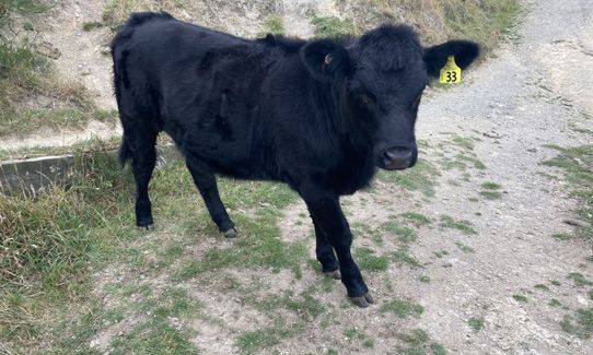
The track is exposed to strong winds all year around so don't head up there in a gale warning unless you need your head cleared. Wellington is known as the windy city and Mt Kaukau is often recording Wellington's strongest gusts of wind. After a lot of rain especially in winter parts of the trail can be churned up by cows.
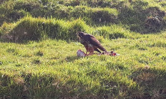
If you are taking a dog with you, a lot of the trail is through working farms. There are cows that have been known to stomp on dogs, especially when calving. Dogs are supposed to be leashed at all times, but if they're not, make sure they are around the farm animals.
One Fat Bird
162 Karori Rd, Karori
http://onefatbird.co.nz/
Great selection of post run beers.
Penny's
282 Karori Rd, Karori
http://pennysfreshfood.co.nz/
The best coffee in Karori plus Penny and her team make amazing takeaway food.
Trail Legend
Login as a VIP to become a Trail Legend. Learn about Trail Legends.
Fastest Known Times (FKTs)
You and Skyline - Mt Kaukau
As a VIP member you can record private notes for this trail, see all of your times and more.
Already have an account? Login now
BD
Took the bus to Broadmeadows, ran first up Mt. Kaukau, then along the track back home in Karori, a total of 15km. Beautiful track, with the best views of the city. Very windy though, almost got blown off track a few times.
November 12, 2023
Very runnable track that gives amazing views of Wellington. Even on a still day very windy. Running from the saddle to trig definitely the most fun way with a easier homeward run. A great way to see the city.
January 7, 2022
Great views across the city and over to the Makara coastline. Very exposed though, especially near the Kaukau end. If you start at the Khandallah Pool and add on the climb to Mt Kaukau it's 23km and about 1300m elevation gain. The advantage of starting there is the carpark, public toilets and cafe for refuelling.
June 6, 2021
Always a great run, even when youre scrambling up banks to avoid unfriendly cows. I love this one no matter what the weather is doing - you can get some brilliant views, thick mist or be blown off the track!
February 20, 2020
These overlap with this trail to some degree. You may wish to combine them but please note that to qualify for FKTs on these runs you should record a separate activity for each.
Send to your phone
Scan the below QR code to open this trail on your phone.

Tip: position the QR code in your phone camera screen.


