Last Updated: 2nd Sep 2024
Extended Skyline
Last Updated: 2nd Sep 2024
Open
Grunt Factor: 31 ?
Gnarl Factor: 13 ?
29.0km
1100m
1025m
445m
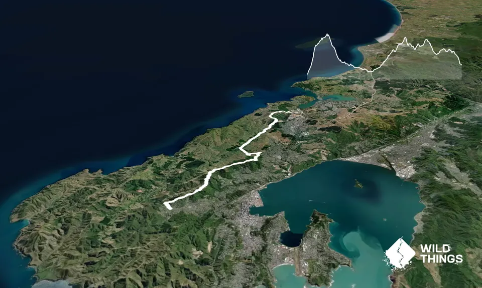
Trail Map
This Topo layer only covers NSW/ACT.
Switch to another map layer when viewing outside this area.
Switch to another map layer when viewing outside this area.


