Last Updated: 20th May 2024
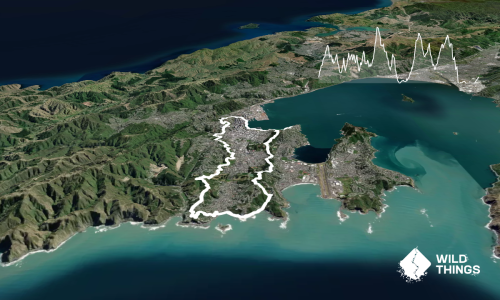
Otari-Wilton's Bush Loop
Last Updated: 20th May 2024
Grunt Factor: 9 ?
Gnarl Factor: 59 ?
5.1km
210m
210m
175m


Last Updated: 20th May 2024
Last Updated: 20th May 2024
Grunt Factor: 9 ?
Gnarl Factor: 59 ?
5.1km
210m
210m
175m
Urban fringe
Loop
Very hilly
Dog Friendly
Native bush
Easy Single Track
Moderate Single Track
Technical Single Track
Average Uphill Gradient: +15.70%
Average Downhill Gradient: -18.20%
VIP Feature: Send this route to your Garmin account so you can follow the course on your Garmin device.
Become a VIP Member to see the trailhead information.
0:55
Slow
0:45
Moderate
0:35
Fast
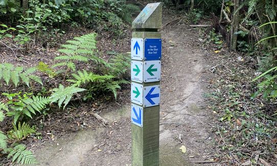
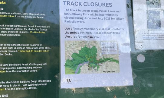
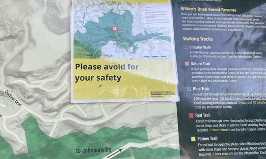
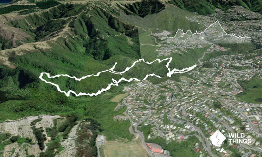
This route is named for the Red Yellow and Blue routes shown on the official map here.
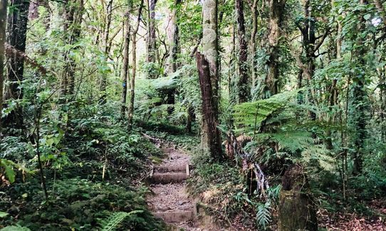
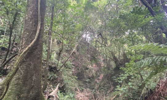
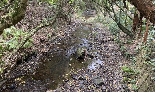
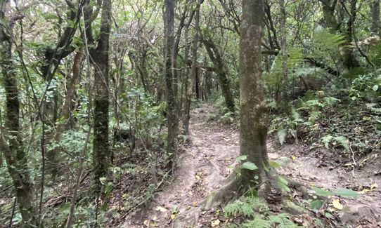
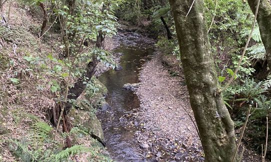
Start from the car park, take the gravelled track following signs to the Troup Picnic Lawn for 300-400m until the hairpin right turn up the Red Track. The next 3km or so are a roller-coaster of steep ascent and descent (lots of steps!), rocky and hidden roots, narrow, and muddy and slippery after rain, with a couple of stream crossings without bridges. There are also low-hanging creepers across the track, just at neck height, so keep your eyes open. Add risk of hearing loss from deafening tui and other birdlife.
Take the Red Track and follow signs to the "Flax Clearing" (note turn off to Chartwell Drive for an alternative start and finish point). Turn right into the clearing but then keep to the left hand edge and exit from the clearing via the Yellow Track. Follow the Yellow Track then turn right onto the Blue Track, and follow signs to the "800 Year Old Rimu". From the rimu continue on the Blue Track eventually looping back to the "Troup Picnic Lawn". There are a couple of exits off the Blue Track up to the Skyline and also into Karori Cemetery from here - take the left hand path each time to stay in the reserve. The back part of this track continues to be steep, muddy, narrow, rocky, and slippery - take care! Then it's down the final flight of steps to the bridge over the stream and eel ponds to the picnic lawn, and from here it becomes a lot easier so speed up for the final sprint back to the car park.
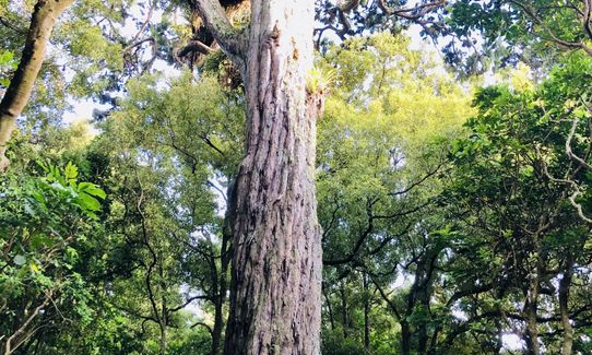
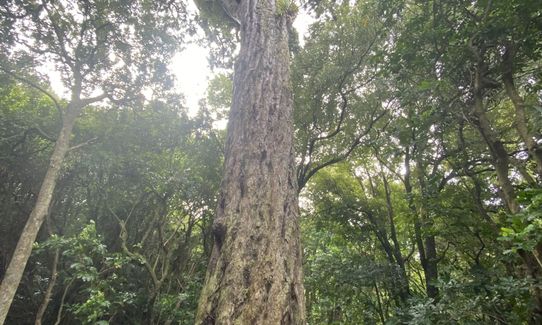
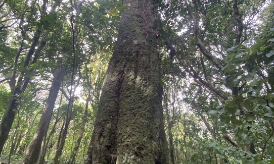
This run is wholly within Otari-Wilton's Bush, so pretty much entirely through native bush. There's an 800-year-old Rimu to see, native birds (tui, kaka, pewakawaka, etc.) everywhere, eels (!), ...
Toilets are available at the information centre (main carpark) and the Troup Picnic Lawn.
Parking for 15 or so cars and plenty of railings to lock a bike to. There is also an occasional bus along Churchhill Drive.
5 km
13 minutes
Yes
No
Moderate.
The first time you do this loop you might take a wrong turn but it's all in the Otari-Wilton's Bush reserve so you won't get too lost.
Generally good.
Short-sleeved thermal top, Beanie/thermal headwear, Whistle, Survival blanket, Cellphone, Map
None
I haven't run this in summer - it might be less slippery with fewer fallen leaves and less mud on the track but beware after rain at any time of year. Also it is almost entirely under cover of fairly dense bush and on an east-facing slope, so it gets dark earlier than you might expect - take a torch if running late in the day.
Can be very slippery, and some hidden rocks and roots to trip over. The comment about low-hanging creepers is serious - there are a several U-shaped loops of thick creeper at neck height over the track so keep your eyes open.
Automat
7 Burma Road, Khandallah
http://www.automat.co.nz/
It's not that close but they do great chai lattes!
Do you have another suggestion on where to go afterwards for the best coffee / cake / breakfast / brunch / beer?
Trail Legend
Login as a VIP to become a Trail Legend. Learn about Trail Legends.
Fastest Known Times (FKTs)
You and Otari-Wilton's Bush Loop
As a VIP member you can record private notes for this trail, see all of your times and more.
Already have an account? Login now
Great trail. Did on a rainy day but actually not too slippery. Very popular and well trodden so does get muddy but not overgrown at all. A couple of tiny streams to cross. Heaps of steps and lots of reasonably technical rooty stuff. Today upper yellow loop closed due to a slip, but easy to get back on track. Also, the footbridge at the beginning is closed temporarily but you can get around on the road easily.
January 27, 2024
This is a lovely route through native bush, yet extremely accessible. Its pretty technical in places and was very muddy and slippy today, but well worth it!
June 28, 2020
You'd never know you're only minutes from the city,this place is other-worldly. Beautiful bush and a few streams to run alongside.
May 26, 2020
Once again this wonderful country amazes me... in the heart of our capital city a few kms from the centre of Government... here is this slice of wilderness nestled in a valley, quiet and stunning... you can escape and in minutes it feels like you are way out in the Bush. Just magic.
March 17, 2020
These overlap with this trail to some degree. You may wish to combine them but please note that to qualify for FKTs on these runs you should record a separate activity for each.
Send to your phone
Scan the below QR code to open this trail on your phone.

Tip: position the QR code in your phone camera screen.