Last Updated: 19th Feb 2025
Tawatawa Trails
Submitted by Cate Shave
Last Updated: 19th Feb 2025
Open
Grunt Factor: 12 ?
Gnarl Factor: 21 ?
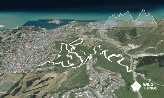
8.8km
430m
430m
174m


Last Updated: 19th Feb 2025
Submitted by Cate Shave
Last Updated: 19th Feb 2025
Open
Grunt Factor: 12 ?
Gnarl Factor: 21 ?
8.8km
430m
430m
174m
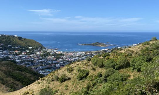
Urban fringe
Loop
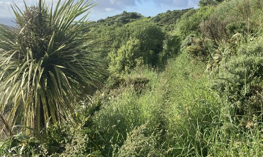
Undulating, some big hills
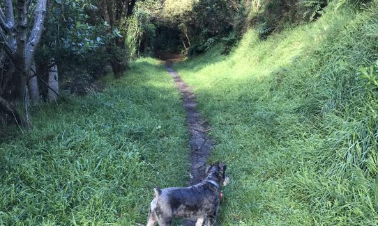
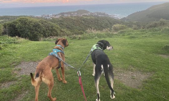
Dog Friendly
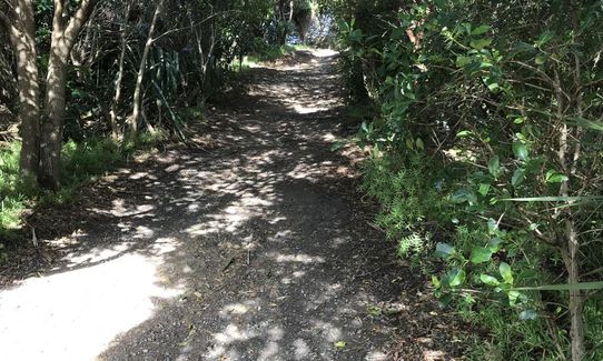
Native bush
Open farmlands
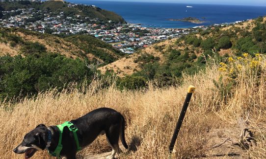
Open ridges/tops
Gravel Road
Farm Road / 4WD Track
Easy Single Track
Average Uphill Gradient: +13.1%
Average Downhill Gradient: -13.1%
VIP Feature: Send this route to your Garmin account so you can follow the course on your Garmin device.
Login as a VIP to see the trailhead information.
1:45
Slow
1:20
Moderate
0:50
Fast
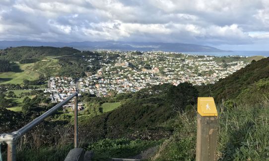
Starting at the entrance to the driveway of Tapu Te Ranga Marae, you head up the driveway and take the track to the right of the Manawa Karioi Ecological Restoration Project's display board. Follow the 4-wheel drive track up past the top horse paddock (so keep dogs on a lead until well past this point). Follow the trail curving around the west edge of the horse paddock, and take the trail to your right where it forks at the corner of the paddock.
Carry on up the track until you come to a gate/stile - this marks the start of the Tawatawa Reserve. Go through the gate, and take the trail to your left marked City to Sea Walkway. Follow this up over the hill, and just before it hits Frobisher Street take a sharp right back into the Reserve along the 4 wheel drive track. This will take you past the point where you entered the Reserve, and on to where the reservoir is. Take the stairs to the right of the reservoir, and then the trail that heads into bush to the left of the next set of big stairs - this is the Tawatawa Bush Track (but there's no sign).
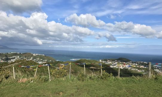
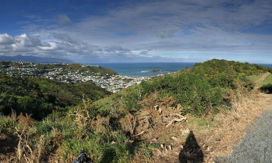
Follow this trail through bush around the valley, until it forks - take the right fork (the Akiraho Track) which will switchback all the way up to the ridgeline. When you hit the ridgeline you'll go through a small gate, follow the trail round to your right and through another gate about 20m on. Then follow the trail to the left when it forks again which takes you around the hill above Owhiro Valley. On your left will be the Whārangi Track down to Happy Valley Road - you can follow this down and back up to add 2.5km and some hill practice (this is also part of the WUU2K course).
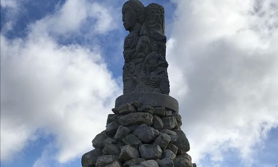
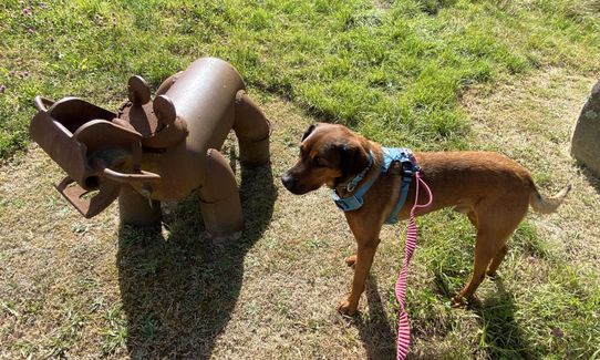
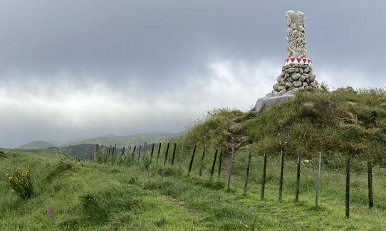
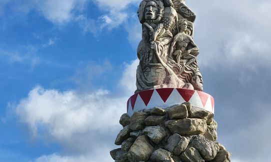
Once you come back up the Whārangi Track turn left and follow the ridgline past the powhenua sculpture (on your left) and through another small gate. Cross the grassy paddock (look out to Cook Strait to your right) and take the gravel track to your hard left and down about 30m until you hit the end of Quebec Street. Go through the gate, and then immediately a hard right and down some stairs, which takes you back onto a trail that heads on through more bush. When the track splits (you'll see the golf course down to your left, and the marae to your right) take the hard right track which carries you on around the hillside.
You'll rejoin the Tawatawa bush track just at the base of the big stairs you passed earlier - 140 steps, great for stair repeats! Instead of taking the small stairs to your left that you came over earlier, follow the trail that takes you around the right of that small hill and back to the reservoir. Pass back to the gate where you entered the Reserve, but this time take the track down to your right. Partway down the hill the track splits and you want to take the hard left track, which will take you back down to where you began at the marae (after crossing a small stream).
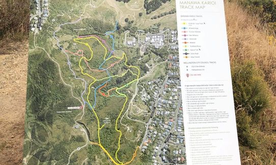
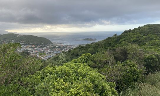
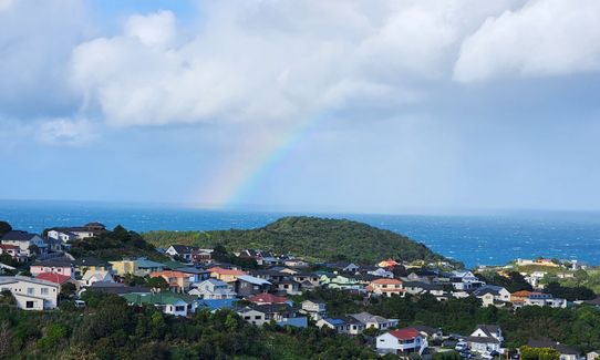
The trail begins in the grounds of Tapu Te Ranga Marae, winds up through native bush cared for by the Manawa Karioi Ecological Restoration Project, heads into and around Tawatawa Reserve, and passes the distinctive powhenua sculpture of Maori Chiefs by Bruce Stewart up on Tawatawa Ridge. It also traces a small part of the WUU2K course.
Official trailhead: Wakefield Park. If you start on Happy Valley Rd: 44 Jefferson Street, Brooklyn.
There is normally plenty of parking in the street, or the surrounding streets. Best not to leave valuables in sight in your car (as with anywhere really, just be sensible). Easy bus access from town - catch the number 1 or 4 out to Island Bay and just after you go down the hill into Island Bay (with the skate park/mountain bike track/golf course to your left and the Wakefield soccer pitch to your right), push the bell to get off. The bus will stop just past the roundabout - cross over the road and head up Dee street, at the end of that short street take a left onto Eden and then an immediate right onto Danube. The trail starts at the end of this short cul de sac
6 km
15 minutes
Yes
No
Moderate.
Some tracks are named and marked, others aren't. Because the South Coast is often in sight, that's a good orientation clue. The tricky bits to watch for are where the track splits just at the corner of the horse paddock above the marae (you want to take the right track that follows around the edge of the horse paddock), and getting on to the start of the Tawatawa Bush Track because it's not marked (you will have just come over a short run of stairs, and see a much longer run of stairs in front of you - the track you want is not the hard left at the bottom of the short run of stairs (cause that will just take you back to the reservoir - you'll follow that one when you come back later to this same point - but the next one to your left which will take you around the edge of the hill the bigger run of stairs comes down.)
Perfect throughout.
Thermal leggings, Long-sleeved thermal top, Seam-sealed waterproof jacket, Gloves, Beanie/thermal headwear, Whistle, First aid kit, Extra food for emergencies, Cellphone, Map
None - you must carry your own. There is a concrete water trough up by the powhenua sculpture that dogs can drink out of (make sure you use the one marked for dogs, not the baths which are the horse troughs)
Pretty muddy in places after rain, as much of the track is dirt.
There are horses in the area - especially at the top of the Akiraho Track and the powhenua sculpture. There are also ducks, chickens and horses around the marae, so make sure you keep dogs on a lead through all those areas.
Blue Belle Cafe
142 The Parade, Island Bay
https://www.facebook.com/TheBlueBelleCafe/
Great coffee and pies!!
Floyd's Cafe
130 the Parade, Island Bay
https://www.facebook.com/FloydsCafeIslandBay/
Great coffee and breakfasts
Empire Cinema
214 The Parade
https://www.empirecinema.nz/
Fantastic gelato!!
Trail Legend
Login as a VIP to become a Trail Legend. Learn about Trail Legends.
Fastest Known Times (FKTs)
You and Tawatawa Trails
As a VIP member you can record private notes for this trail, see all of your times and more.
Already have an account? Login now
Loved the ~8 km of rolling, undulating singletrack. Didn’t love the stairs that were slippery in places. Unfortunately it was very slow going in places with deep muddy patches and overgrown (thigh high grass). Very pretty through tree tunnels and a view spots where you got a spectacular view of Island Bay and the Cook Straight. The switch backs up from Happy Valley road is part of the WUU2K route for those that want to train on it….!
November 30, 2022
Great one for dogs as they can be off lead for much of the trail, apart from where the horse grazing is. Much easier to find your way around now they've added the track markers too! We started and finished at the Happy Valley Road, like Richele suggested which made it more accessible for us.
July 1, 2020
My local, so I have to rate it at 4 stars - I love the opportunity to run with my dog off lead, and the many different trails in the area allow you to piece together a nice run no mater how much or little time you have.
July 31, 2019
Send to your phone
Scan the below QR code to open this trail on your phone.

Tip: position the QR code in your phone camera screen.


