Last Updated: 20th May 2024
Rangitatau Plane Spotting
Submitted by Richele McKenzie
Last Updated: 20th May 2024
Open
Grunt Factor: 7 ?
Gnarl Factor: 18 ?
5.3km
250m
250m


Last Updated: 20th May 2024
Submitted by Richele McKenzie
Last Updated: 20th May 2024
Open
Grunt Factor: 7 ?
Gnarl Factor: 18 ?
5.3km
250m
250m
Urban fringe
Loop
Undulating, small hills only
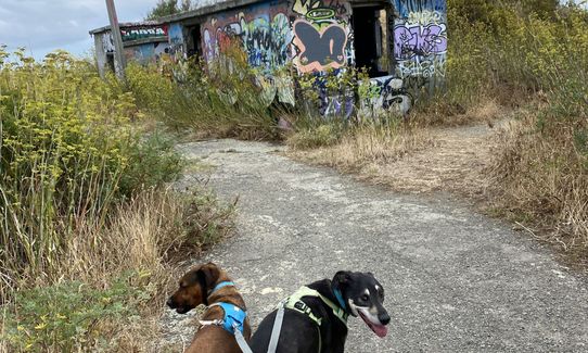
Dog Friendly
Native bush
Beach
Open ridges/tops
Sealed Road
Farm Road / 4WD Track
Easy Single Track
Technical Single Track
Average Uphill Gradient: +9.2%
Average Downhill Gradient: -9.2%
VIP Feature: Send this route to your Garmin account so you can follow the course on your Garmin device.
Login as a VIP to see the trailhead information.
45:00
Slow
35:00
Moderate
25
Fast
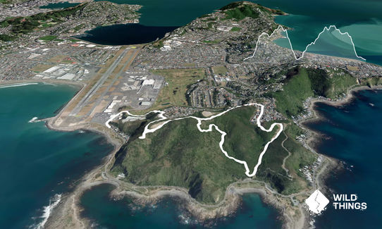
Starting on Moa Point Road, head right down Stewart Duff Drive to the sign saying "Kekerenga Street Reserve".
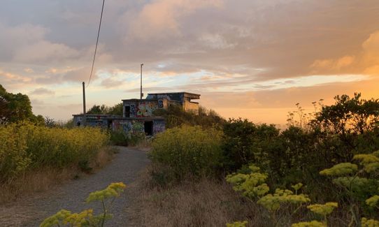
Head up the driveway and soon you will see the track starting on the left. Follow this to the first intersection, where you turn right and pop out at the Kekerenga St playground. Head right again and continue to another sign saying "Palmer Head Navigational Aid Site". This takes you to the bunkers.
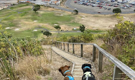
After a quick look around the bunkers continue along the old paved path until you see another track on the right (approx 1.5km from the start of your run). This takes you down to Tarakena Bay. Then head up hill towards the dog exercise area (not towards the Ataturk memorial), swing left near the top and you come out at Bowes Crescent.
After a short dash up Bowes, turn left onto Birkhall and look for the track with a small sign "to Ahuriri Street". This takes you along more old overgrown paved path (almost as good as trail!) until you pass the trail you had taken to Tarakena Bay. This time head back towards the bunkers, then back down the start at Moa Point.
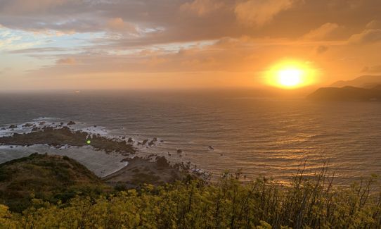
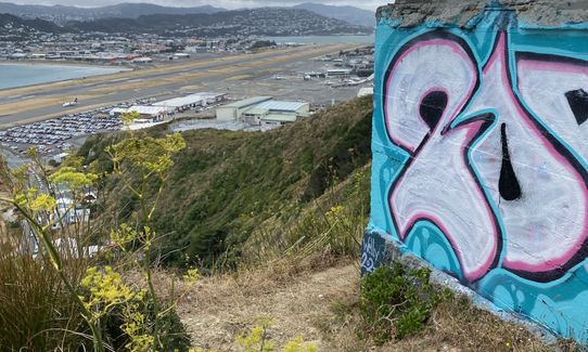
Make sure you take time to check out the views and watch the planes landing. The views make up for the amount of tarmac on this trail.
History: Rangitatau Reserve takes its name from a Ngāi Tara pā which was situated on the headland on the western side of Tarakena Bay. Poito Pā was located below it on a low spur in the valley. The two pā were built to protect the sea approach to a third pā site in Worser Bay, but both were destroyed by raiders in 1819 -1820. The Poito track from the Tarakena Bay car park winds up to the left towards the pā sites, then joins the sealed road near the airport navigation beacon. World War II fortifications are at the end of this headland. (www.wellington.govt.nz).
Lyall Bay Surfclub, 100-64 Lyall Parade.
There is usually plenty of street parking along Moa Point Road. Wellington Airport is very close - a good opportunity for a leg stretch if you're waiting to pick someone up.
8 km
12 minutes
Yes
No
Easy.
Perfect throughout.
Whistle, First aid kit, Extra food for emergencies, Cellphone, Map
None.
As per most Wellington trails, the tops may be challenging when windy.
Take care not to get too close to the edge while checking out the ruins.
Spruce Goose
30 Cochrane Street, Rongotai
sprucegoose.net.nz
Coffee and plane spotting
Parrotdog Brewery
60/66 Kingsford Smith St, Lyall Bay
parrotdog.co.nz
Beer and burgers. And your dog can come too!
Trail Legend
Login as a VIP to become a Trail Legend. Learn about Trail Legends.
Fastest Known Times (FKTs)
You and Rangitatau Plane Spotting
As a VIP member you can record private notes for this trail, see all of your times and more.
Already have an account? Login now
Perfect while waiting for a flight. Great chance to observe my grandfathers fishing grounds
February 7
Great little trail with some spectacular views. Avoid in a Wellington southerly!
July 17, 2024
Fantastic little loop if you have some time to kill at the airport, thanks for sharing
January 29, 2024
Send to your phone
Scan the below QR code to open this trail on your phone.

Tip: position the QR code in your phone camera screen.


