Last Updated: 1st Nov 2024
Biblical
Last Updated: 1st Nov 2024
Open
Grunt Factor: 10 ?
Gnarl Factor: 29 ?
7.0km
260m
260m
350m
.jpg?tr=w-542,h-325)
.jpg?tr=w-542,h-325)
.jpg?tr=w-542,h-325)
.jpg?tr=w-542,h-325)
.jpg?tr=w-542,h-325)
.jpg?tr=w-542,h-325)

Last Updated: 1st Nov 2024
Last Updated: 1st Nov 2024
Open
Grunt Factor: 10 ?
Gnarl Factor: 29 ?
7.0km
260m
260m
350m
Urban fringe
Combo
Undulating, small hills only
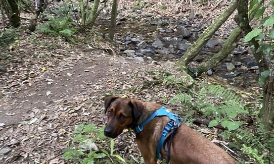
Dog Friendly
Native bush
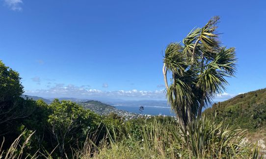
Open tussock/grasslands
Farm Road / 4WD Track
Easy Single Track
Moderate Single Track
Technical Single Track
Average Uphill Gradient: +11.50%
Average Downhill Gradient: -11.40%
VIP Feature: Send this route to your Garmin account so you can follow the course on your Garmin device.
Become a VIP Member to see the trailhead information.
1:20
Slow
1:00
Moderate
0:40
Fast
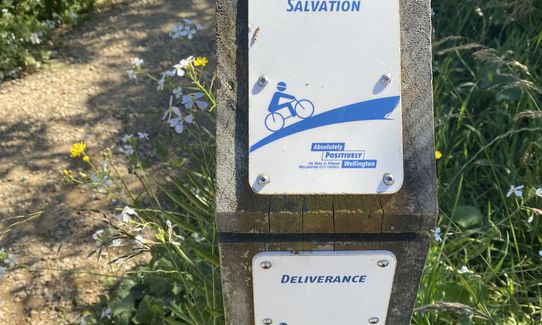
From the car park, take the left hand track and take the left turn to Deliverance a short way in. The first half of this track is steep, rooty and rocky and can be wet even after dry weather. One for those who enjoy a bit of technical! It then flattens out to several small stream crossings (which you can usually cross without getting wet feet).
When the track finishes at Fitzgerald Place, turn right and head up Salvation. This has recently been graded and despite being all uphill, is very smooth and runnable. You’ll come to a turnoff to Woodhouse Ave on the left. Ignore this and turn right, following the sign to Wrights Hill Lookout. As the hill flattens out you’ll pass another turnoff to the left to Lansdowne Track which you can ignore. A bit more climb then you’ll come out back at the car park where you started.
By now you’ll be nicely warmed up, so resist the temptation to end there and cross the road, picking up John’s track (signposted Wright’s Hill Lookout). At the next intersection, don’t turn right (Wrights Hill lookout), but carry on straight (towards lower car park and Karori sanctuary), then repeat at the next intersection. You’ll shortly come to the Lookout Walkway.
Turn right here following sign to Karori Sanctuary, left at the next (Karori Sanctuary), then straight on at the unmarked post when you should see the Sanctuary fenceline. Turn right and follow the track keeping the fence to your left until you get to the road on the right heading to “The parade ground / Wrights Hill”.
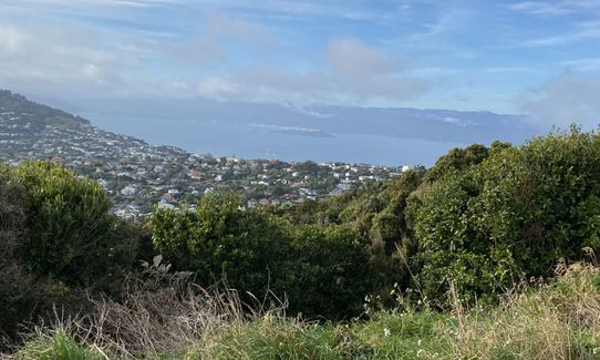
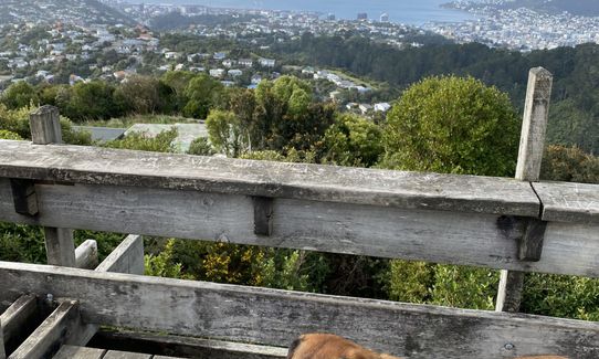
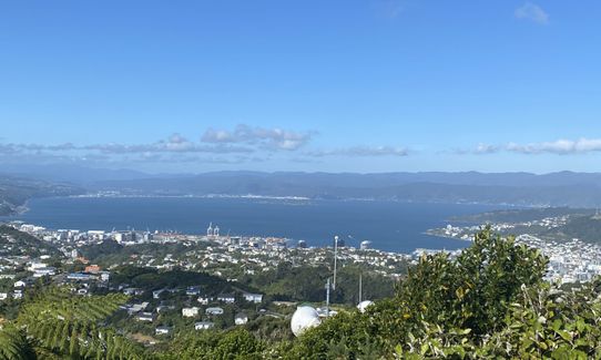
A short way up this road, turn off to the track on the right – Gun Emplacement 3 Track, and follow this up until it opens up on the sealed road which takes you on the right to the Wrights Hill Lookout. Stop here and soak up the spectacular views across Wellington and check out the WWII gun emplacements. Head to the far side of the fortress (underground bunker) to the sealed path and follow its winding path down (or take the shortcut stairs) to rejoin John’s track.
Turn left at the first intersection then it’s just a leisurely return back down John’s track to the finish.
Keep an eyes out and ears open out for mountain bikes - on Salvation in particular!
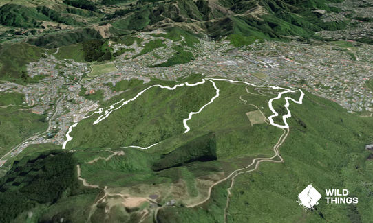
This trail includes the peak Wrights Hill.
Wrights Hill Reserve borders Zealandia, so you are likely to see and hear plenty of native birds e.g. tui, kaka, kereru and piwakawaka. At the top of Wrights Hill you can also explore the WWII fortress and gun emplacements.
There is a toilet at the main carpark for the Mountain Bike Park and at Ben Burn Park, on Campbell Street.
Large car park with plenty of parking available and signage of the reserve. If catching a bus, take the 21 Karori (Wrights Hill) bus to the top of Campbell St, then walk 10 minutes (steeply) up Wrights Hill Road to the car park.
7 km
14 minutes
Yes
No
Easy.
There are large reserve maps at the start and at the bottom of Deliverance (Fitzgerald Place). There are lots of track intersections along the route but they are all well marked.
Generally good.
Windproof jacket, Whistle, First aid kit, Extra food for emergencies, Cellphone, Map
There are no safe drinking water sources anywhere on this route so make sure you carry enough with you
The Deliverance track is steep, rocky and slippery in places so wear grippy shoes and proceed with caution
Keep an eyes out and ears open out for mountain bikes - on Salvation in particular!
Although it is recommended for bikes to go up Salvation and down Deliverance, people generally treat Salvation as two-way so you are likely to encounter walkers coming the other way.
At the very end of the run, take care exiting John's track and crossing the road as it's on a blind corner.
One Fat Bird
162 Karori Road
http://onefatbird.co.nz/
Good selection of local and international craft beers and decent food
The Pickle Jar
5 Parkvale Road, Karori
https://www.thepicklejar.co.nz/
Great burgers and pizza
Gipps St Deli
4 Gipps St, Karori
https://gippsstdeli.squarespace.com/
Great coffee
Do you have another suggestion on where to go afterwards for the best coffee / cake / breakfast / brunch / beer?
Trail Legend
Login as a VIP to become a Trail Legend. Learn about Trail Legends.
Fastest Known Times (FKTs)
You and Biblical
As a VIP member you can record private notes for this trail, see all of your times and more.
Already have an account? Login now
Good tour de Wrights Hill! Deliverance is quite a challenge - particularly after rain!
November 5, 2024
great fun. starts super technical and quite slippery on the stones, even when dry, but quickly becomes very runable. fun loop.
January 31, 2024
Wonderful run! Don't do Delicerance in the dark with a freshly rolled ankle tho... thanks Joe sweet trails! I got 320 vert
July 21, 2023
Loved Johns Track and Salvation but Deliverance was a challenge - slipped over a few times! Took the dog but kept him on a short lead and listened out for bikes. Great views!
May 28, 2020
These overlap with this trail to some degree. You may wish to combine them but please note that to qualify for FKTs on these runs you should record a separate activity for each.
Send to your phone
Scan the below QR code to open this trail on your phone.

Tip: position the QR code in your phone camera screen.
Plan smarter, stay motivated, track your progress, and unlock the full Wild Things experience — while saving along the way.


