Last Updated: 27th May 2024
Graveyard Shift
Last Updated: 27th May 2024
Open
Grunt Factor: 9 ?
Gnarl Factor: 15 ?
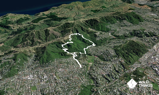
7.5km
300m
300m
260m
.jpg?tr=w-542,h-325)
.jpg?tr=w-542,h-325)
.jpg?tr=w-542,h-325)
.jpg?tr=w-542,h-325)
.jpg?tr=w-542,h-325)
.jpg?tr=w-542,h-325)


Last Updated: 27th May 2024
Last Updated: 27th May 2024
Open
Grunt Factor: 9 ?
Gnarl Factor: 15 ?
7.5km
300m
300m
260m
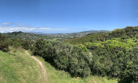
Urban fringe
Loop
Undulating, small hills only
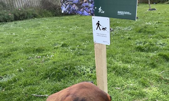
Dog Friendly
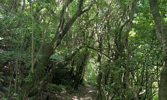
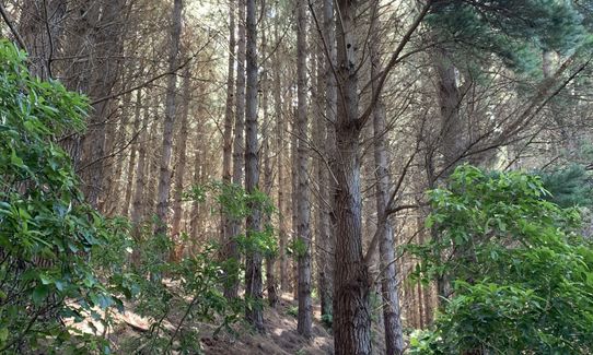
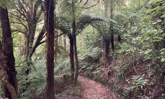
Native bush
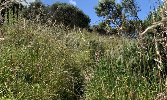
Open tussock/grasslands
Sealed Road
Farm Road / 4WD Track
Easy Single Track
Average Uphill Gradient: +9.90%
Average Downhill Gradient: -10.10%
VIP Feature: Send this route to your Garmin account so you can follow the course on your Garmin device.
Become a VIP Member to see the trailhead information.
1:20
Slow
1:00
Moderate
0:40
Fast
This is an easy and enjoyable route, taking in the historic cemetery, some sweet single-track running on a couple of tracks that are well-kept secrets (or they were until now), and options to extend on to several other tracks in the area.
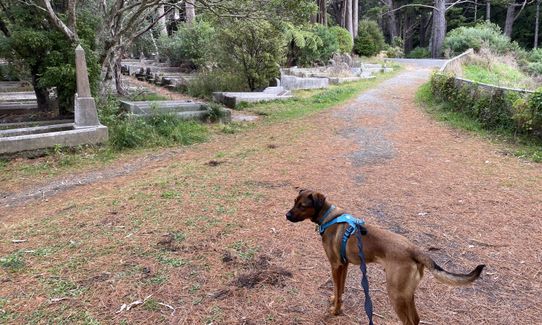
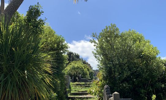
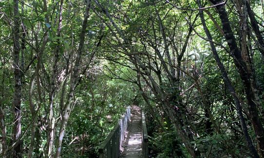
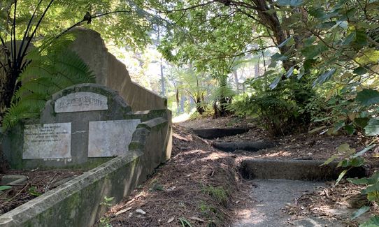
From the main cemetery entrance, follow the sealed road straight and down, past literally thousands of dearly departed, until you reach a bend with a 20 speed limit sign with a track off to the left. Take this track and head up the steps when it opens out. At the top of the steps, turn left, then right at the next T-junction, then left at the next T-junction.
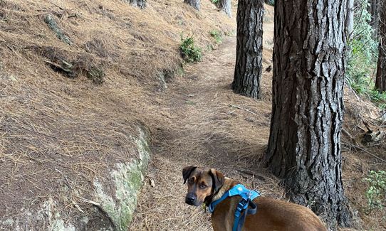
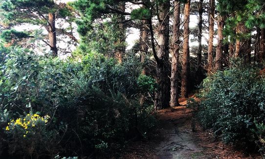
A short way up the road you’ll see a wooden sign on the right to Johnston Hill/Skyline Walkway. Take this track and a short way in, turn right at the intersection, heading to Ōtari-Wilton’s Bush & Skyline Walkway. Enjoy a gradual descent to the next wooden sign, where you carry on straight, marked to Skyline Walkway. You’re now on the Cemetery Skyline Link track, which is a lovely ascent up a tranquil single track. You’ll pass a couple more intersections – just keep following the signs to Skyline Walkway.
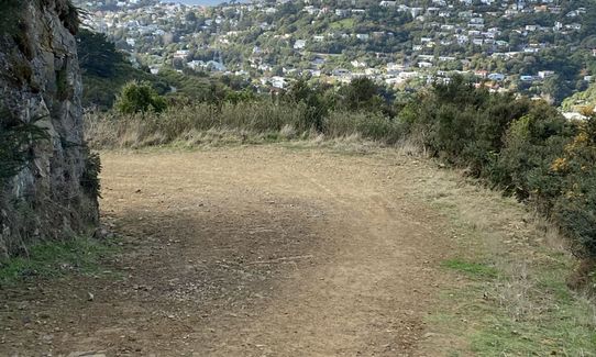
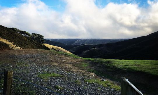
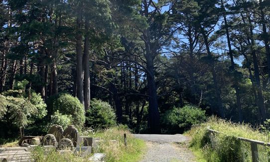
Eventually you’ll come to a cross-roads, where Skyline is marked to the left. Don’t turn left here, but instead head straight, signposted Grant’s Track. This is another really enjoyable track that rises through the bush to emerge on a ridge overlooking the western suburbs. Cross a couple of stiles, and at the second one (highest point in the run), turn sharp right and run down the 4WD track signed towards Ōtari-Wiltons Bush and Chartwell. You’ll cross a cattle grid, and descend for 500m before rising again.
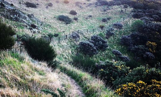
When you come to a left hand bend with the 4WD track splitting in two, look for a small track leading off to the right, pointing to Ōtari-Wilton’s Bush. Take this track and follow it down, crossing another stile along the way, then continuing down to eventually open out onto a grassy area (flax clearing). Head towards the left corner and take the path heading straight (not the left one). You’ve now joined the red loop track.
Turn right at the T-junction at the bottom and follow the flat trail which takes you over a footbridge and out into the troup picnic area. Toilets and water here if you need. At the far side of the picnic area past the toilets, take the path on the right signed to Karori Cemetery and follow this for 750m until you reach a track heading off to the right over a bridge towards the cemetery. Take this, head up the steps at the top, then follow the road round to the right. One more climb up this road then you’ll see a green Exit sign pointing left. Turn left here and follow the road back down and through the cemetery to the finish.
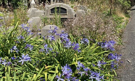
Karori Cemetery is New Zealand's second largest burial ground, covering nearly 40 hectares. It was the final resting place of about 83,000 people. Today, it is a wealth of Wellington history and a peaceful place to visit.
There is toilet within the cemetery, near main entrance. Two further toilets are located with Ōtari
Parking is available round the corner on Rosehaugh Avenue. If taking the bus, take the #2 Karori and get off at the first stop on Karori Road (just past the traffic lights as you turn left at the top of Chaytor St)
5 km
10 minutes
Yes
No
Easy.
There are lots of track intersections on this route but all are well marked, and there are maps at both Karori Cemetery and Otari-Wilton's Bush
Generally good.
Windproof jacket, Whistle, First aid kit, Cellphone, Map
Water and toilets are located just inside the entrance at the start/finish, and also at the Troup Picnic Area at Otari-Wilton's Bush
The tracks are generally well-draining and you'll be sheltered for most of the time, so this is a good one for when the weather is keeping you off the hilltops
Marsden Village Cafe
153 Karori Road
Good brunch options
Sweet Bakery & Cakery
149 Karori Road
http://www.sweetbakery.co.nz/
Whittakers hot chocolate, coffee and a selection of sweat treats
One Fat Bird
162 Karori Road
https://onefatbird.co.nz/
Great revolving selection of local and international craft beers
Do you have another suggestion on where to go afterwards for the best coffee / cake / breakfast / brunch / beer?
Trail Legend
Login as a VIP to become a Trail Legend. Learn about Trail Legends.
Fastest Known Times (FKTs)
You and Graveyard Shift
As a VIP member you can record private notes for this trail, see all of your times and more.
Already have an account? Login now
Very enjoyable run - great direction instrucutions -got a little lost in the cemetary on the way back but it is easy enough to find the entrance/exit!
Good variety of terrain and great views in places.
December 2, 2024
BD
Loved this trail. Part of it was closed due to treefall, but a quick look at the map showed me a detour, which worked out perfectly. I got to the top at golden hour, which gave beautiful views over the bay.
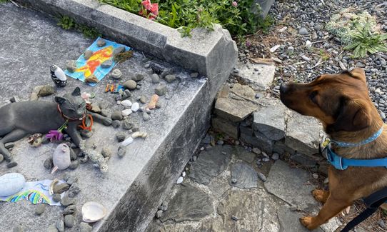
Only minor thing is the graveyard part, not sure how respectful it is towards the mourning and the deceased.
September 29, 2023
Great trails - lots of single track through native bush with a stretch of farm 4WD track thrown in. Lots of ups and downs. Only rated this down because of the road at the start and end. Very interesting weaving through the different grave sites but not as pleasant as trail.
April 12, 2023
These overlap with this trail to some degree. You may wish to combine them but please note that to qualify for FKTs on these runs you should record a separate activity for each.
Send to your phone
Scan the below QR code to open this trail on your phone.

Tip: position the QR code in your phone camera screen.
Plan smarter, stay motivated, track your progress, and unlock the full Wild Things experience — while saving along the way.


