Last Updated: 20th May 2024

Beginner - Intermediate

Save Trail Save

I've done it Done

Makara Peak Grand Loop

Last Updated: 20th May 2024

Beginner - Intermediate

Save Trail Save

I've done it Done

Notice More info

Grunt Factor: 18 ?

Gnarl Factor: 24 ?

11.7km

700m

700m

400m


Login as a VIP to see driving directions, distance and time.

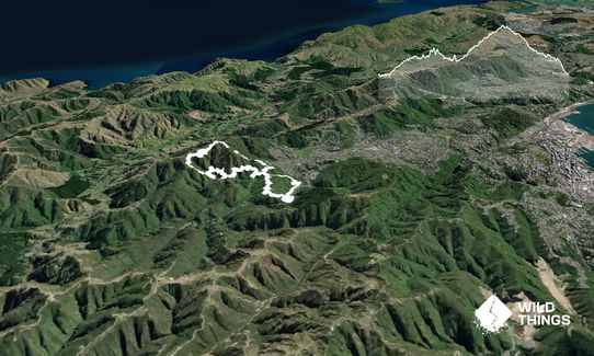
Trail Map

Type of Run

Urban fringe

Loop

Undulating, some big hills

Native bush

Open tussock/grasslands

Run Makeup

5%
85%
10%

Farm Road / 4WD Track

Easy Single Track

Moderate Single Track

Average Uphill Gradient: +12.8%

Average Downhill Gradient: -13%

Trailhead

Login as a VIP to see the trailhead information.

Estimated Times to Run

2:10

Slow

1:30

Moderate

1:05

Fast

Starting in the main car park follow all trails in their intended direction to avoid being run over by mountain bikes. Also make sure to pull aside and let bikes pass if you hear any coming up behind.

Take the following tracks in order: Koru - Sally Alley - Missing Link - Aratihi - 4WD to Summit - North Face - Smokin' - Big Tom's Wheelie - SWIGG.

This trail includes the peak Makara Hill.

Makara Peak Mountain Bike Park is a shared use recreation reserve where walkers and runners are welcome but need to give way to mountain bikers. The park is 250 hectares with over 40km of single track, mostly all hand built by volunteers.

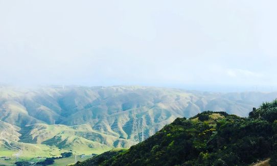
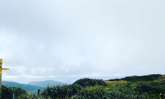
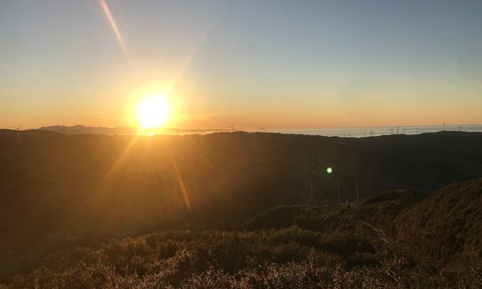
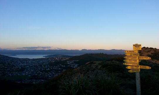
Makara Peak is part of the Outer Green Belt and established as a mountain bike park in 1998, prior to that it was a run down farm. Today the park is in various stages of native bush regeneration with an active volunteer pest control group and tree planting group. The upper sections of the park have low vegetation or are still in grass, offering fantastic views over Cook Strait, the South Island, and over Wellington Harbour.

See www.makarapeak.org for more info and a printable map of the whole park.

Toilets are available in the main carpark.

There is a signed car park with toilets, information board and water about 1km down South Karori Rd. Overflow car parking is available 50m further south.

If catching a bus take the Karori Park #3 to the end of the line then follow South Karori Rd as above.

8 km

19 minutes

Unknown

No

Easy.

The whole route has large signage and map boards along the route.

Patchy.

Windproof jacket, Whistle, First aid kit, Extra food for emergencies, Survival blanket, Cellphone, Map

There is drinking water in the main car park only.

These tracks are well gravelled and graded for all year use by mountain bikers, therefore apart from the odd puddle after rain there are no issues.

Make sure to give way to mountain bikers (who are all friendly and probably willing to chat).

One Fat Bird
162 Karori Rd, Karori
http://onefatbird.co.nz/
A good selection of beer for post (or pre) run recovery.

Lucky Bakery
100 Karori Rd, Karori
Good old traditional kiwi bakery (best pies in Wellington? - just don't expect gourmet).

Penny's
282 Karori Rd, Karori
http://pennysfreshfood.co.nz/
Tasty takeaway food with the best coffee in Karori.

Trail Legend

Richele McKenzie

Richele McKenzie

has completed Makara Peak Grand Loop once in the last year.

Learn about Trail Legends.

You and Makara Peak Grand Loop

As a VIP member you can record private notes for this trail, see all of your times and more.

Register Now

Already have an account? Login now

Trail Reviews

Fabulous loop and yes, what Joe said about the trail changes! I did this in conjunction with a run down and back up Salvation which you can reach near the bike park car park - a new track called Biblical has recently been added so you could combine the two. Very runnable tracks - but best not to have earbuds in so you can hear any bikes coming behind you:)

Karen Spencer

May 30, 2020

There have been quite a few trail changes over the last few years and this could do with an edit:- North Face Link is now just North Face- JFK and Ridgeline Extension are no more, you now just follow Smokin' after North Face until it joins Big Toms Wheelie. - And then you take SWIGG the rest of the way. Starfish follows a different route down now.Finally, the last third of Sally Alley is currently closed due to a slip so you need to follow diversion round the 4WD track to get to Missing Link.

Joe Benbow

May 23, 2020

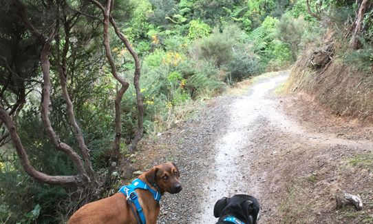
Had a fun morning running this very friendly trail with the dogs. Its a good one to do on a rainy day as youre mostly sheltered (apart from the Peak). Dogs are welcome but MUST be on leads. Im also very careful to listen out for mountain bikes and pull the dogs off the track when needed (plus I avoid weekends). Drinking fountain available in carpark.

Richele McKenzie

May 28, 2019

Absolute cracker of a loop. You can now avoid almost all of the 4wd track by taking the tracks that lead over the swing bridge pretty much up to the summit.

Helen Carrington

January 22, 2018

Login to submit a review

Trail Running Community

Find people who are interested in or have completed this trail run.

You must register or login to view this feature.

Register Now

Overlapping Trails

These overlap with this trail to some degree. You may wish to combine them but please note that to qualify for FKTs on these runs you should record a separate activity for each.

Park 2 Peak 2 Park

Park 2 Peak 2 Park

Length: 10.7km

Level: Beginner - Intermediate

Swing Into Action

Swing Into Action

Length: 13.0km

Level: Beginner - Intermediate

The Benbow Round

The Benbow Round

Length: 22.5km

Level: Beginner - Intermediate

Mini Makara Mission

Mini Makara Mission

Length: 6.0km

Level: Beginner - Intermediate

Mid Makara Magic

Mid Makara Magic

Length: 5.7km

Level: Beginner

Other trails nearby
Graveyard Shift

Graveyard Shift

Length: 7.5km

Level: Beginner

Tawatawa Trails

Tawatawa Trails

Length: 8.8km

Level: Beginner

Skyline - Mt Kaukau

Skyline - Mt Kaukau

Length: 20.0km

Level: Beginner - Intermediate

Red-Rocks, Hawkins Hill, Tip-Track Loop

Red-Rocks, Hawkins Hill, Tip-Track Loop

Length: 16.0km

Level: Beginner - Intermediate

Find more trails and peaks nearby