Last Updated: 20th May 2024
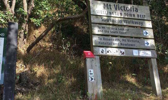
Southern Walkway
Submitted by Sarah Fisher
Last Updated: 20th May 2024
Open
Grunt Factor: 12 ?
Gnarl Factor: 18 ?
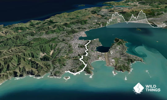
10.3km
415m
400m
185m


Last Updated: 20th May 2024
Submitted by Sarah Fisher
Last Updated: 20th May 2024
Open
Grunt Factor: 12 ?
Gnarl Factor: 18 ?
10.3km
415m
400m
185m
Urban
Point to Point (one way)
Undulating, small hills only
Dog Friendly
Native bush
Plantation/exotic forest
Coastal
Sealed Road
Easy Single Track
Average Uphill Gradient: +9.7%
Average Downhill Gradient: -8.3%
VIP Feature: Send this route to your Garmin account so you can follow the course on your Garmin device.
Login as a VIP to see the trailhead information.
1:50
Slow
1:25
Moderate
0:55
Fast
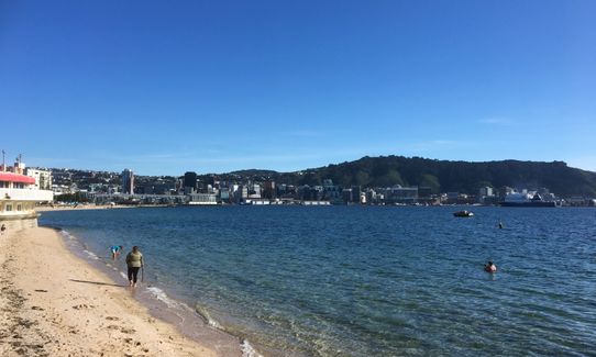
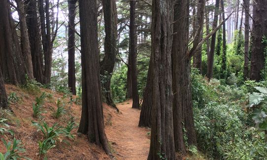
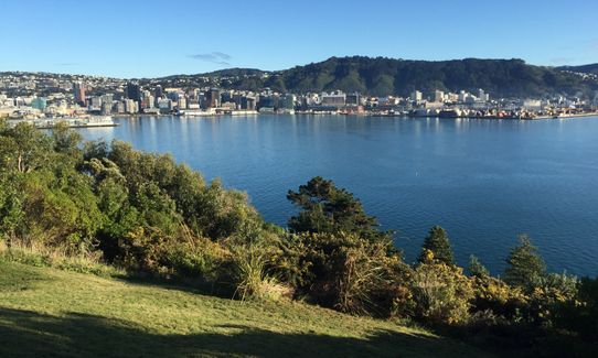
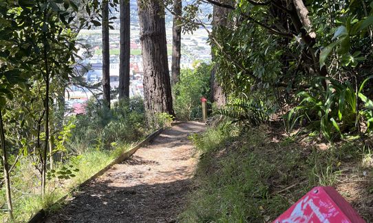
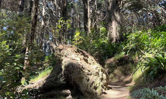
The Southern Walkway is a 10km trail along the Town Belt between Oriental Bay and Island Bay. It is a good beginner trail as it is very closed to public transport and in cellphone reception the entire trail. While there are a few steep climbs, they are not particularly difficult or long. The trail is well marked by pink bollards labelled with the Southern Walkway along the entire walkway.
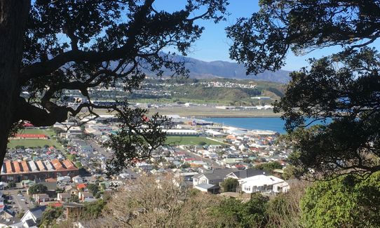
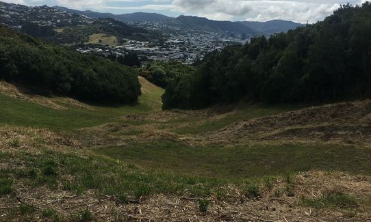
From Oriental Parade, you head up towards Mt Victoria on the trails then hit Alexandra Road. The trail then wanders down through pine trees to Mt Alfred and down towards the bottom of Alexandra Road and Constable Street. You will need to cross Constable Street which can be quite a busy road. The trail then continues above Kilbirnie to Melrose.
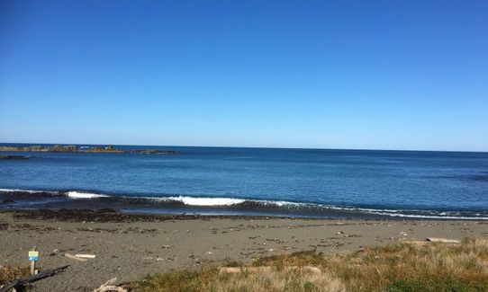
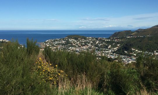
From the reservoir at the top of the access pathway, follow the Southern Walkway arrows, which takes you under the pines to Truby King Park bringing you out onto Manchester Street and then to Sutherland Crescent. Walk down the driveway and cross Manchester Street, go 40m uphill then take Sutherland Crescent to Melrose Park. From Melrose Park climb to the ridgeline and follow South to Mt Albert before it descends to Sinclair Park. From here it is a nice descent down to Houghton Bay and then following the road along to Island Bay to the finish of the trail at Shorland Park.
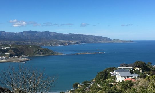
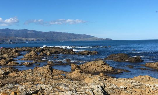
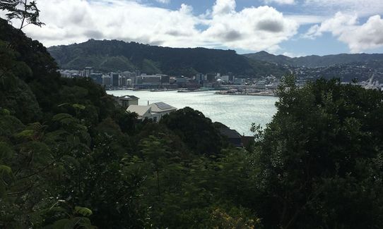
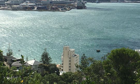
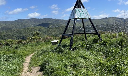
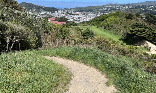
Once you hit Alexandra Road just under Mt Victoria a short diversion back to the left along Alexandra Road leads you up to the Mt Victoria Summit which has amazing views of Wellington city, the harbour and across to Petone. The Bronze Cannon and Byrd Memorial are also point located here. The Walkways passes through Truby King Gardens and past Truby King House. These gardens are really beautiful when in season with blossoms. The extra climb up to the trig on Mt Albert is definitely worth the effort for the views it gives out to the Cook Strait & Tapu te Ranga Island, "Isle of Hallowed Ways” which is near the shore of Island Bay and the finish of the Walkway
210/216 Oriental Parade at the north end and Shorland Park at the south end, as well as one near the corner of Alexandra and Lookout Roads on Mt Vic.
There is plenty of on street parking at either end where it would be safe to park a car. There is a good public transport system from the Southern end at Island Bay. You could park your car at the Northern end then catch the Island Bay bus back into town then walk or catch another bus back around to your car on Oriental Parade.
3 km
12 minutes
Yes
No
Easy.
Ensure you are always following pink bollards as there are purple bollards through Mt Victoria that lead up to the Summit.
The trail continues on the other side of Constable Street so you need to cross this road and then follow the pink bollards up the hill onto Paeroa Street then onto Coromandel Street.
Perfect throughout.
Long-sleeved thermal top, Seam-sealed waterproof jacket, Gloves, Beanie/thermal headwear, Whistle, First aid kit, Extra food for emergencies, Survival bag, Cellphone, Map
There may be a water tap at Melrose Park and Shorland Park.
Wellington can be cold and windy at any time of year but Mt Albert and the road section around the Coast to Island Bay are particularly exposed. The rest of the trail is mostly under trees but the trails can be muddy after heavy rain.
Trail Legend
Login as a VIP to become a Trail Legend. Learn about Trail Legends.
Fastest Known Times (FKTs)
You and Southern Walkway
As a VIP member you can record private notes for this trail, see all of your times and more.
Already have an account? Login now
Great traverse of the hills between the airport and the city. Fantastic Harbour, city and south coast views. I walked this with my wife and we really enjoyed it - will be back to have a run next time. Only downside is some steep road and footpath bits - would prefer more trail but the views make up for it. Given Wellington's winds, pick the direction that suits the wind otherwise it could be quite unpleasant.
October 20, 2023
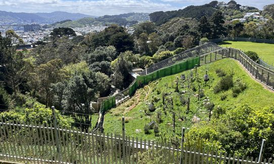
I'm lucky to live close to this one, so have been fortunate to enjoy it many times, in all seasons and weathers. I love the zig zags across the ridgelines, giving you views across the city each side. And not many trails will take you past a zoo! Then there's the joy of blasting up those last few stairs to the top of Mt Vic, and grinning maniacally at all the tourists standing there taking selfies ;-)
July 31, 2019
Send to your phone
Scan the below QR code to open this trail on your phone.

Tip: position the QR code in your phone camera screen.


