Last Updated: 16th Oct 2024
Park 2 Peak 2 Park
Submitted by Joe Benbow
Last Updated: 16th Oct 2024
Open
Grunt Factor: 12 ?
Gnarl Factor: 24 ?
10.7km
310m
320m
400m
.jpg?tr=w-542,h-325)
.jpg?tr=w-542,h-325)
.jpg?tr=w-542,h-325)
.jpg?tr=w-542,h-325)


Last Updated: 16th Oct 2024
Submitted by Joe Benbow
Last Updated: 16th Oct 2024
Open
Grunt Factor: 12 ?
Gnarl Factor: 24 ?
10.7km
310m
320m
400m
Urban fringe
Loop
Undulating, small hills only
Dog Friendly
Native bush
Open tussock/grasslands
Open ridges/tops
Sealed Road
Easy Single Track
Moderate Single Track
Average Uphill Gradient: +5.7%
Average Downhill Gradient: -5.9%
VIP Feature: Send this route to your Garmin account so you can follow the course on your Garmin device.
Login as a VIP to see the trailhead information.
1:40
Slow
1:20
Moderate
0:50
Fast
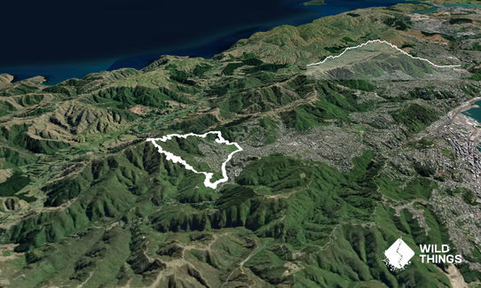
Similar to the Makara Peak Grand Loop, but on some different tracks, including some superbly runnable downhills. And it starts and finishes at the cafe!
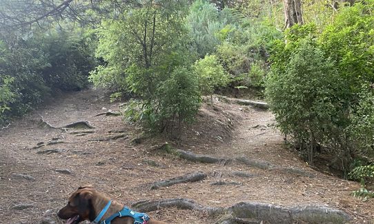
From the corner of Karori Park by the car park and cafe, run along the circular path anti-clockwise until you come to the smaller car park at the north-east corner. Cross the car park and head left up the track leading gently uphill. Follow this up and across two other cross-tracks until you see the Wahine track starting at a footbridge. Start going up this track, then after about 50m, bear left onto K2. (This 0.5k loop is optional as it brings you out just a little further up Wahine – look out for the fairy houses on the way)
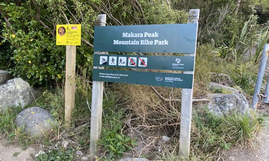
Continue up Wahine for about another 0.5k until it joins the Skyline track at the back of the woods. Take a left and follow Skyline until it comes out at Makara Road saddle. Be careful crossing the road here as the corners are tight and cars can be going quite fast. At the far side of the road you should see the entrance to the MTB park. Go through the metal bike stile on the left and follow the T4 trail up a couple of switchbacks to the water tank.
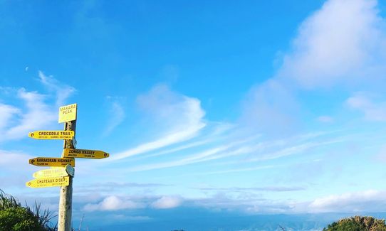
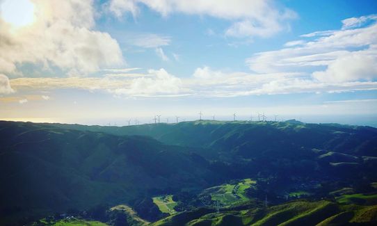
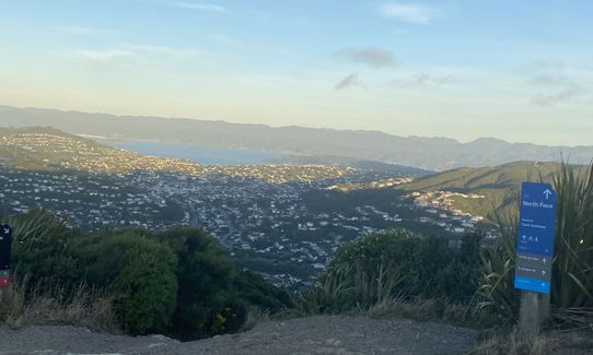
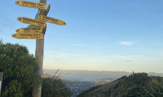
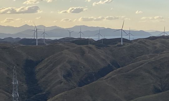
At the back of the water tank, continue up T4 until you reach a crossroads, then go straight over on to the continuation of the T4 track. Follow this up to the 4WD track which it merges onto after a left uphill turn. Turn right onto the continuation of T4 and keep heading up as the track eventually joins Aratihi before popping you out at the summit. Once you get there, take a moment to refuel and soak in the stunning panoramic views across Wellington and the South Island.
Now for the fun bit... head down the track marked Peak Flow, which is 1.8k of insanely good fun with its rolls and berms. When it opens at the bottom to the 4WD track, cross straight over and bear right onto Starfish. This one's a bit more technical but still very runnable. When this finishes at the 4WD, take the track opposite called Big Tom's Wheelie. This is quite a short one. When it finishes, don't take the track marked SWIGG, but instead the one just behind it called Lazy Fern. This is another 1.8k long, really easy, enjoyable track to run downhill through the bush, finishing at the MTB car park.
If you're desperate, there are loos here, otherwise turn left on the main road and follow this back up to Karori Road and the park where you started.
You'll be going on the following tracks in order: K2 - Wahine - Skyline - T4 – Aratihi - Peak Flow - Starfish - Big Tom's Wheelie - Lazy Fern
This trail includes the peak Makara Hill.
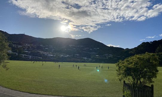
Karori Park and the main entrance to the mountain bike park.
There is plenty of parking at Karori Park or on Karori Road if the park is busy with weekend sports. If catching a bus, take the #2 from Wellington and get off at the park or the next stop (which is the end of the line)
7 km
11 minutes
Yes
No
Moderate.
The tracks are all well-marked and there are boards at several places with maps of the entire park. I've indicated in the main description where there are forks to take, but as long as you know the names of the tracks you're looking for, you can't get too lost as you will always end up back at the bottom of the hill in Karori.
Generally good.
Long-sleeved thermal top, Windproof jacket, Whistle, First aid kit, Extra food for emergencies, Survival bag, Cellphone, Map, Headtorch and spare batteries
There are water fountains by the cafe at the start/finish only
The peak is very exposed so can be cold and windy, even if it's fine at the bottom. The tracks are generally firm but some are rocky and can be slippy after a lot of rain and there can be a few puddles in places.
Recommended to run this in the anti-clockwise direction as per the map as you'll generally be going up uphill tracks and downhill tracks. The exceptions are Wahine, Varleys and parts of Zacs track and North Face Extension which are two-way, so you may encounter bikes. The whole park is shared between walkers, runners and bikes though, so smile and give way and you'll be sweet.
Take care crossing Makara Road as there are a couple of blind corners and cars can go quite fast.
Karori Park Cafe
Karori Park
https://www.facebook.com/karoriparkcafe/
Easily positioned for fuelling up before the run, or for a post-race coffee and slice. Good value meals/brunches too
Pickle Jar
5 Parkvale Road, Karori
https://www.thepicklejar.co.nz/
A great option for something a little stronger. Excellent pizzas and burgers. Their Thursday evening burger specials have become a regular post-run event for the WoRM crew....
One Fat Bird
162 Karori Road
https://onefatbird.co.nz/
Great revolving selection of local and international craft beers, and a full restaurant-quality menu
Trail Legend
Login as a VIP to become a Trail Legend. Learn about Trail Legends.
Fastest Known Times (FKTs)
You and Park 2 Peak 2 Park
As a VIP member you can record private notes for this trail, see all of your times and more.
Already have an account? Login now
great stuff. able to run majority of way to makara summit. lovely single track, soft on the karori side and lower makara, a bit rockier on the initial descent. final road section short but worth it to make the loop.
a couple of navigation updates: the route up is now signed t4 all the way (t4 = trail to the top). on the way down, starfish now seems to be signed as Ridgeline Extension, connecting peak flow above to big tom's wheelie below.
January 29, 2024
I really enjoyed ths one - the run up to Makara is nice and runnable and not too steep. Going back down from the peak via Peak Flow, it looks like some of the signage may have changed - just keep heading down, take the right hand fork when you cross over the first four-wheel drive track and continue till you see the sign for Starfish. This seems to take you directly to the MTB car park.
October 24, 2023
BD
The gentle slopes of the mtb tracks make for a really dashing training! The trail itself is not the prettiest, but the view up top is amazing.
October 3, 2023
These overlap with this trail to some degree. You may wish to combine them but please note that to qualify for FKTs on these runs you should record a separate activity for each.
Send to your phone
Scan the below QR code to open this trail on your phone.

Tip: position the QR code in your phone camera screen.


