Last Updated: 5th Feb 2025
The Benbow Round
Joe's Loop
Submitted by Richele McKenzie
Last Updated: 5th Feb 2025
Open
Grunt Factor: 28 ?
Gnarl Factor: 17 ?
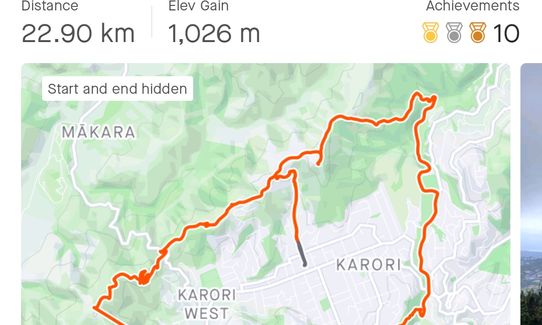
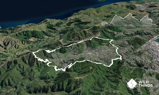
22.5km
915m
925m

Last Updated: 5th Feb 2025
Submitted by Richele McKenzie
Last Updated: 5th Feb 2025
Open
Grunt Factor: 28 ?
Gnarl Factor: 17 ?
22.5km
915m
925m
Urban fringe
Loop
Undulating, small hills only
Dog Friendly
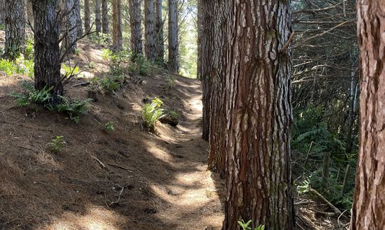
Native bush
Plantation/exotic forest
Open farmlands
Open ridges/tops
Sealed Road
Farm Road / 4WD Track
Easy Single Track
Moderate Single Track
Average Uphill Gradient: +8.0%
Average Downhill Gradient: -8.1%
VIP Feature: Send this route to your Garmin account so you can follow the course on your Garmin device.
Login as a VIP to see the trailhead information.
4:00
Slow
3:00
Moderate
2:30
Fast
The Benbow Round celebrates our good friend Joe who was a prolific submitter of quality Wild Things trails and an all-round great guy.
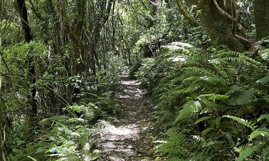
Starting on Waiapu Road, near Zealandia, the first section is road, connecting the north and south sides of the trail. Head down Waiapu, across Appleton Park, down Curtis Street and across Ian Galloway Park to the Ōtari track that is located near the clubrooms. Follow this through the bush, past the public toilet and picnic area, then just over the little bridge there is a sign on the left. Follow the arrow "Easy Route to Moko".
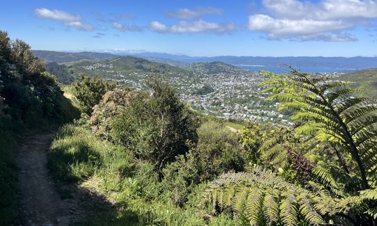
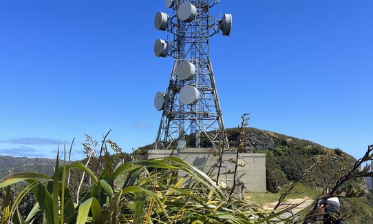
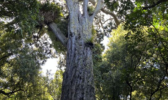
After pausing to appreciate Moko, the 800-year-old Rimu, continue up to Blue Trail until you get to a sign pointing to Skyline Walkway, head straight up a short set of stairs, through some tail pines, across Grant's Track, to a more open trail, follow the signs to Johnston's Hill. Stop to admire the view then head back down the small section of track you just came up, heading left at the stile and connect to Skyline Walkway.
Follow Skyline all the way to Mākara Road. Carefully cross the road and head up T4 mountain bike track then connect to Snake Charmer via a short section of Zac’s Track. Snake Charmer will take you to Mākara Peak.
Now for some fabulous downhill! The route to the mtb carpark is Peak Flow – Three Brothers – Smokin – Big Tom’s Wheelie – SWIGG. Turn left out of the carpark, cross South Karori Road and head up a walkway pointing towards Hazelwood Ave, where you cross over and head down Fitzgerald Ave to the start of Salvation track. Salvation comes out at the Wrights Hill Middle carpark. Cross over and head up John’s Track, following the signs to Wrights Hill fortress. From the top of Wright’s Hill head down to the Scout Den (signs for Karori Sanctuary/Campbell St).
The final section of trail follows the Zealandia Fenceline, and heads down through Birdwood Reserve, finishing back on Waiapu Road.
This trail includes the peaks Makara Hill, Johnston Hill and Wrights Hill.
Ōtari-Wilton's Bush contains native plants from all over New Zealand. Moko is Wellington’s oldest and tallest tree.
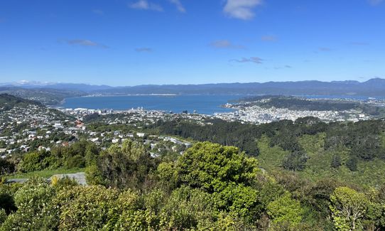
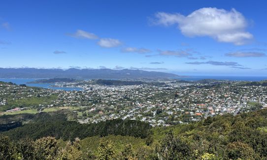
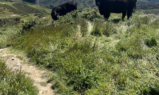
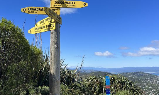
Views from the summit of Johnston's Hill include Wellington Harbour, the Hawkins Hill ridgeline, the Mākara hills and the South Island. Capital Kiwi Project have recently released Kiwi into the hills around Mākara and if you're running at night you might be lucky enough to spot one of these awesome birds along Skyline, or in the mountain bike park.
Wrights Hill Fortress, built during World War Two, consists of an underground network of tunnels, operation rooms and three gun emplacements. If you have time check out Zealandia Te Māra a Tāne, the world’s first fully-fenced urban ecosanctuary.
Toilets are available in the Mtb carpark, Karori Park, Ōtari and the main entrance to the cemetery.
The number 2 (Karori) bus stops just down Chaytor Street, at Appleton Park. Parking is available along the road, or at Appleton Park.
4 km
9 minutes
Yes
No
Moderate.
Navigation through Ōtari can sometimes be a bit tricky, so keep an eye on signage.
Perfect throughout.
Windproof jacket, Whistle, First aid kit, Extra food for emergencies, Cellphone, Map
Water and toilet available in Ōtari, at the Zealandia Visitor Centre and Mākara Peak Mountain Bike Park main carpark. There is also a water fountain at the beginning of Salvation track.
Tracks through Ōtari and Wright's Hill Reserve can get very muddy and slippery after rain. Mākara Peak may be exposed to cold winds during winter.
Cross roads carefully, particularly at Mākara Saddle. Watch out for mountain bikers in the park. If you're running with a dog please keep it on lead at all times as there are Kiwi and many other precious native birds out and about.
The Pickle Jar
5 Parkvale Road, Karori
thepicklejar.co.nz
Have a beer (and maybe a burger!) for Joe. The pub is also frequented by Wellington Running Meetup (WoRM) on Thursday nights.
Trail Legend
Login as a VIP to become a Trail Legend. Learn about Trail Legends.
Fastest Known Times (FKTs)
You and The Benbow Round
As a VIP member you can record private notes for this trail, see all of your times and more.
Already have an account? Login now
An amazing suburban loop. Remarkably shaded apart from the really open skyline section, so enjoyable even when hot out. It seems everyone has their variations. For me that includes down 4WD and green trail Lazy Fern on makara peak, avoiding the fast bikes.
February 26, 2024
Great mix of trails and terrain and a genuine 20km + loop around the Wellington hills, incoporating the iconic Skyline trail, Makara Peak, Johnston Hill and Wrights Hill. I always get nervous on MTB trails - particularly going downhill so my only two criticisms are too much time on MTB trails off Makara Peak down into Karori before the climn to Wrights Hill and too much time at the start on pavement. All said and done, a good solid hit out!
November 28, 2023
These overlap with this trail to some degree. You may wish to combine them but please note that to qualify for FKTs on these runs you should record a separate activity for each.
Send to your phone
Scan the below QR code to open this trail on your phone.

Tip: position the QR code in your phone camera screen.


