Last Updated: 23rd Jan 2024

Intermediate - Experienced

Save Trail Save

I've done it Done

Arthur's Point to Sunshine Bay

Moonlight track, Ben Lomond, Ben Lomond Ridgeline

Queenstown, Otago

Submitted by David Haunschmidt

Last Updated: 23rd Jan 2024

Intermediate - Experienced

Save Trail Save

I've done it Done

Open

Grunt Factor: 40 ?

Gnarl Factor: 49 ?

18.3km

1575m

1640m


Login as a VIP to see driving directions, distance and time.

Trail Map

Type of Run

Front country - easily accessible

Point to Point (one way)

Mountainous

Native bush

Open tussock/grasslands

Open ridges/tops

Run Makeup

50%
25%
25%

Easy Single Track

Moderate Single Track

Technical Single Track

Average Uphill Gradient: +16.9%

Average Downhill Gradient: -17.5%

Trailhead

Login as a VIP to see the trailhead information.

Estimated Times to Run

Not suitable

Slow

3:5

Moderate

2:15

Fast

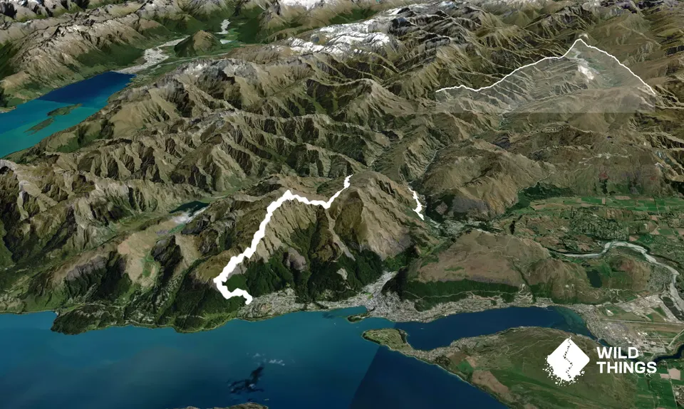
Great point to point run, or you can do it as an out-and-back.

Start from the Moonlight track trailhead at Arthur's Point (easy to find on google maps - above McChesney Rd). Follow the signs for the moonlight track and Ben Lomond Saddle.

Approx. 5km in there is an obvious sign pointing up towards Ben Lomond Saddle. Follow the orange markers up to the Saddle. There are a couple of stiles to cross as you are ascending.

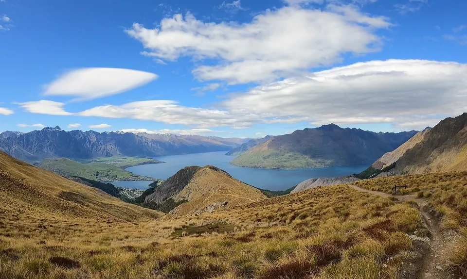
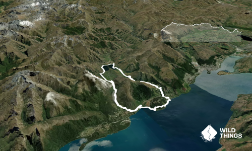
Once at the Saddle, you can see Ben Lomond in front of you. Take the Trail to the right and ascend Ben Lomond. You can summit Ben Lomond and get some spectacular views. A few 100 metres from the summit there is a less obvious trail taking you down the ridgeline track descent to Sunshine Bay. This follows the ridgeline all the way to the bushline. Relatively easy to follow, but no DOC markers. Technical and steep in places.

Once at the bushline, there is a more obvious trail to the left taking you down through some mountainbike tracks to the Sunshine bay trailhead. Crosses private land. Managed by Ben Lomond Station. From April to November, be prepared for snow and ice on the summits.

Take all your own water/nutrition. You can do in either direction, or as an out and back. You could also turn this into a loop by running back to Arthur's point through Queenstown and up Gorge Road.

This trail includes the peak Ben Lomond .

Awesome views. All really enjoyable single track. Varied.

Free parking available at both sides.

6 km

12 minutes

No

No

Moderate.

The Ridgeline track follows the obvious ridgeline down to Sunshine Bay. It is marked on GPS maps. It does not have poles or DOC markers. It is steep and technical in places.

Generally good.

Long-sleeved thermal top, Seam-sealed waterproof jacket, Beanie/thermal headwear, Personal Locator Beacon (PLB), Whistle, First aid kit, Extra food for emergencies, Survival blanket, Cellphone, Map, Crampons / microspikes (for winter conditions)

Take your own for the entire trip.

Avoid the ridgeline and Ben Lomond Summit in very windy, wet or snowy/icy conditions.

Some technical pieces of trail.

Trail Legend

David Haunschmidt

David Haunschmidt

has completed Arthur's Point to Sunshine Bay once in the last year.

Learn about Trail Legends.

You and Arthur's Point to Sunshine Bay

As a VIP member you can record private notes for this trail, see all of your times and more.

Register Now

Already have an account? Login now

Trail Reviews

Be the first to submit a review for Arthur's Point to Sunshine Bay!

Login to submit a review

Trail Running Community

Find people who are interested in or have completed this trail run.

You must register or login to view this feature.

Register Now

Overlapping Trails

These overlap with this trail to some degree. You may wish to combine them but please note that to qualify for FKTs on these runs you should record a separate activity for each.

Moonlighting to Sefferstown

Moonlighting to Sefferstown

Length: 11.5km

Level: Beginner

Moonlighting around Bowen Peak

Moonlighting around Bowen Peak

Length: 24.0km

Level: Beginner - Intermediate

Moonlighting to Sefferstown

Moonlighting to Sefferstown

Length: 11.5km

Level: Beginner

Moonlighting around Bowen Peak

Moonlighting around Bowen Peak

Length: 24.0km

Level: Beginner - Intermediate

Moonlighting to Sefferstown

Moonlighting to Sefferstown

Length: 11.5km

Level: Beginner

Moonlighting around Bowen Peak

Moonlighting around Bowen Peak

Length: 24.0km

Level: Beginner - Intermediate

Moonlighting to Sefferstown

Moonlighting to Sefferstown

Length: 11.5km

Level: Beginner

Moonlighting around Bowen Peak

Moonlighting around Bowen Peak

Length: 24.0km

Level: Beginner - Intermediate

Other trails nearby
One Mile - Gondola Scenic Route

One Mile - Gondola Scenic Route

Length: 9.3km

Level: Beginner - Intermediate

Loopin' Moke Lake

Loopin' Moke Lake

Length: 6.1km

Level: Beginner

The Felic Relic

The Felic Relic

Length: 28.0km

Level: Beginner

The Harcombe Round

The Harcombe Round

Length: 161.1km

Level: Experienced

Find more trails and peaks nearby