Last Updated: 21st Sep 2023

Beginner - Intermediate

Save Trail Save

I've done it Done

Fernhill Loop

Queenstown, Otago

Submitted by James Harcombe

Last Updated: 21st Sep 2023

Beginner - Intermediate

Save Trail Save

I've done it Done

Open

Grunt Factor: 19 ?

Gnarl Factor: 57 ?

8.1km

640m

640m

920m


Login as a VIP to see driving directions, distance and time.

Trail Map

Type of Run

Front country - easily accessible

Loop

Very hilly

Dog Friendly

Native bush

Plantation/exotic forest

Open tussock/grasslands

Run Makeup

30%
40%
30%

Easy Single Track

Moderate Single Track

Technical Single Track

Average Uphill Gradient: +18.3%

Average Downhill Gradient: -17.7%

Trailhead

Login as a VIP to see the trailhead information.

Estimated Times to Run

1:30

Slow

1:10

Moderate

0:55

Fast

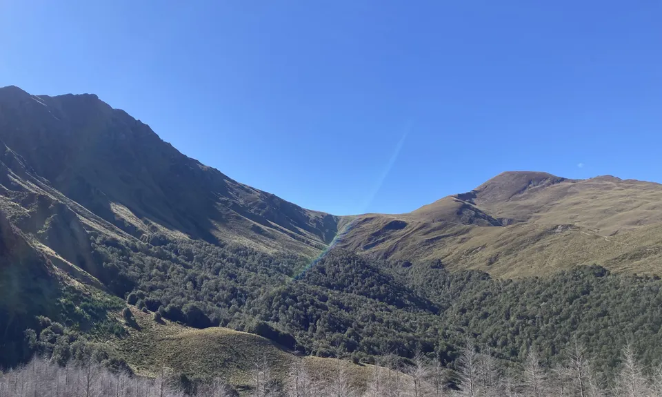
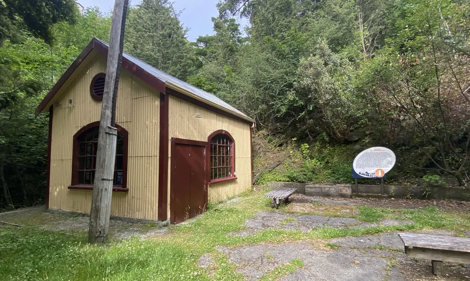
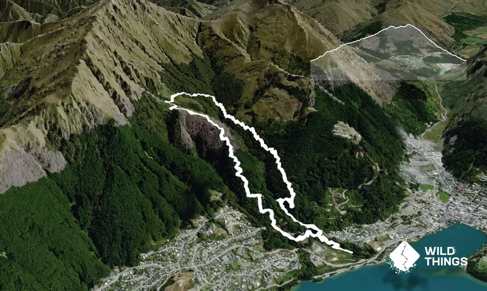
Head up the gravel track from the car park, until you reach the old power station. Turn right at this point and follow the obvious walking track. Cross the MTB track and continue on until you reach a wide footpath (about 5 mins walk). At this point turn left, then almost immediately right. From this point, the track is marked with orange arrows. After the first set of steep steps, the track traverses for a while before splitting in two next to an old tree stump. At this point, you will need to turn right uphill. Do not go downhill, as the track is difficult to pick up again from this left turn. Continue up through native beech, following the old pipeline and the orange markers.
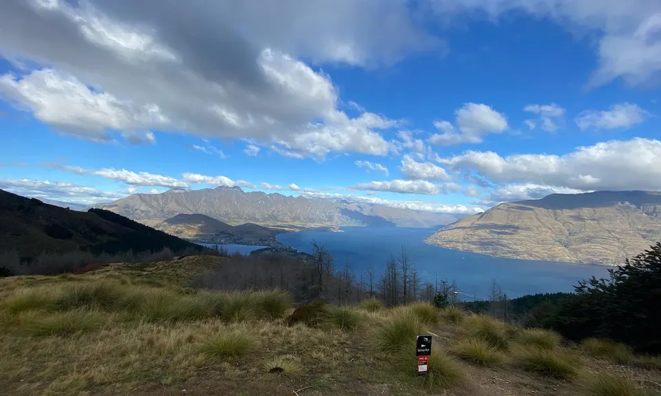
At the dam you will need to follow the track to the right and continue on to a large clearance, that is usually occupied by downhill bikers nursing their wounds! You will need to join the obvious 4WD track for about 10m's, keeping a lookout for the track heading off to the left. It has track markers, and is parallel to the MTB track coming in from the left. Once you're on this track, navigation is pretty straightforward and obvious!
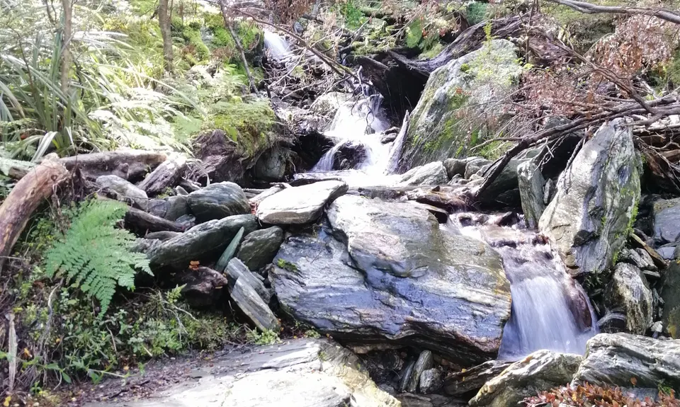
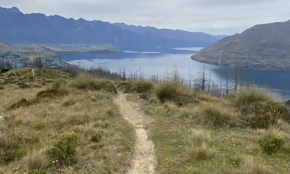
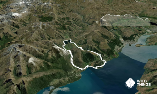
There is a river crossing that's normally quite easy, though could be dangerous in real wet conditions. The descent through the pine forest towards Fernhill, follows red tagged warratahs. Do keep your eye on these, as there are several MTB tracks that go off in a more obvious direct descent.
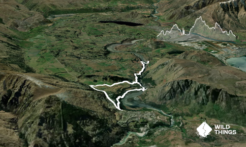
When you reach the bike park, you will need to turn right, then left, and descend through the middle of the bike park to join the wide footpath the other side. Turn left and head down. This then connects with the first junction you encountered on the way up.

The track starts at the site of Queenstown's original power generator. There is an information board detailing this historic site (worth a read!). The track also follows the original pipeline, and passes the dam that supplied the water. At the first major clearance, it's not uncommon to spot Kea....

There is plenty of parking at the end of the aforementioned gravel road. Fernhill Roundabout is a short jog (5mins) from the centre of town.

2 km

5 minutes

Yes

No

Moderate.

Please refer to route description.

Generally good.

Long-sleeved thermal top, Seam-sealed waterproof jacket, Gloves, Beanie/thermal headwear, Whistle, First aid kit, Extra food for emergencies, Cellphone, Map, Crampons / microspikes (for winter conditions).

There is a tap at the Midway Clearance (where the mountain bikers converge!). The tap is however disconnected during the Winter months. There are two creek crossings along the way.

Snow is often encountered on the exposed upper sections. As the track isn't very high, the snow tends to thaw and re-freeze, making for some pretty slippery conditions. The upper section tends to be muddy after rain.

As mentioned, the One Mile Creek crossing could be hazardous after very heavy rain. Watch out for the tree roots on the upper section.

Smiths Brewery
Shotover Street
http://www.smithscraftbeer.co.nz
Best selection of craft beer in town, and awesome fries!

Trail Legend

Brad Geen

Brad Geen

has completed Fernhill Loop 4 times in the last year.

Learn about Trail Legends.

You and Fernhill Loop

As a VIP member you can record private notes for this trail, see all of your times and more.

Register Now

Already have an account? Login now

Trail Reviews

Attempted to do this today, found my way up the first bit but took a wrong turn at some point (I think in the MTB park clearing) and ended up on the Ben Lomond track, got almost to the summit in the snow then took a MTB track across to where I thought I needed to be, ended up doing 14Km but had a great time blatting down the Grade 5 MTB track in the snow :)

Jo Burton

August 10, 2021

Great local trail in the heart of Queenstown. A bit grunty on the uphill but you will be rewarded with some of the best views of the surrounding area. Be mindful that MTB riders will be crossing in some sections and be sure to pay respect to the Kelly "McGazza" McGarry epitaph as you run by.

Chris Seymour

April 13, 2021

A grunty little climb to an awesome clearing. Late June there was a little snow on the upper open sections (and/or a little mud). Saw a few wild goats. Consider taking spikes for your shoes if in midwinter or the snow level is quite low.Beware the indicated times. I ran about 1hr 28min, and I am not a novice runner. Mind you, I found it be difficult to navigate for the first 1-2 km (and coming home), even with the trail instructions, as there are many criss-crossing MTB tracks. The orange markers and triangles are easy to follow, but only once clearly on the single track (a bit sparse before then, when you actually need them!) I managed to find my way clockwise by mistake. Next time I would consider following the GPX file for the first few kms up and straight back down, just as an orientation before heading off...Note that the Runhunters app version starts and ends at Thompson Street rather than One Mile... Worth considering also.

Bryan Stout

June 28, 2020

Hiked it today with my wife . Even with the trail notes we got thrown off by the first turn off to the Ben Lomond/Fernhill loop. Ended up doing the loop clockwise and still had an amazing time. Beautiful views and stunning trails.

Rees Skiff

March 23, 2020

Login to submit a review

Trail Running Community

Find people who are interested in or have completed this trail run.

You must register or login to view this feature.

Register Now

Overlapping Trails

These overlap with this trail to some degree. You may wish to combine them but please note that to qualify for FKTs on these runs you should record a separate activity for each.

Ben Lomond from One Mile

Ben Lomond from One Mile

Length: 14.0km

Level: Beginner - Intermediate

One Mile - Gondola Scenic Route

One Mile - Gondola Scenic Route

Length: 9.3km

Level: Beginner - Intermediate

Ben Lomond via Tiki Trail

Ben Lomond via Tiki Trail

Length: 16.0km

Level: Intermediate

Other trails nearby
Jacks Point to Queenstown Trail

Jacks Point to Queenstown Trail

Length: 25.0km

Level: Beginner - Intermediate

Loopin' Moke Lake

Loopin' Moke Lake

Length: 6.1km

Level: Beginner

Arawata Track

Arawata Track

Length: 3.0km

Level: Beginner

Lake Johnston Ferry Hill Loop

Lake Johnston Ferry Hill Loop

Length: 15.1km

Level: Beginner - Intermediate

Find more trails and peaks nearby