WARNING: this is a serious undertaking that should only be attempted by experienced mountain runners with good navigational and route-finding skills. If you want to include Single Cone then you also need to be an experienced climber! If you feel you need a detailed description of the route then you should NOT be attempting it. With this is mind the route description, map & gpx file are indicative only.
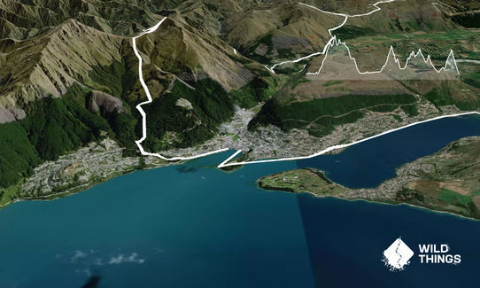
An instant classic. From the mind of James Harcombe comes a long aesthetic linkage of the Wakatipu basin's high peaks, starting and finishing at the Memorial Arch in Queenstown (at the end of Church St).
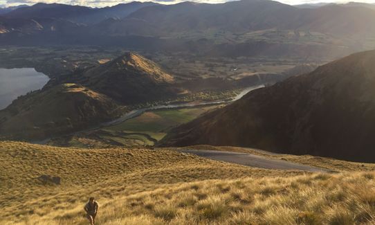
For a long easy warm up follow the dual purpose track around the Gardens and on to the Frankton Track. Continue as far as the road bridge over the lake outlet, cross on the old bridge (now repurposed for walkers and cyclists) then follow the main road as far as The Remarkables Ski Field access road. Follow the mountain bike trail (careful for high speed downhillers - use the road if you aren't there early early morning). Follow the road until you peel off and head up the tussock to the main ridge. Follow the ridge to Shadow Basin.
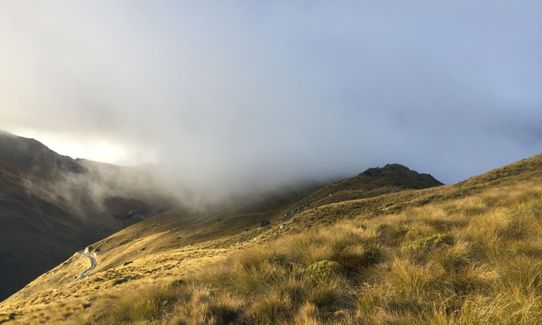
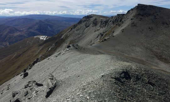
Take a quick peak over the lookout to the lake. Down through the ski-field to pick up the Lake Alta track. IF YOU ARE CAPABLE head up to Single Cone. This involves high consequence scrambling (hands and feet, full 4 points of contact, 100-1500m fall potential!) This really is only an option if you are capable, have some climbing experience, and most importantly, if the weather and, or, conditions allow. Definitely not an option if you don't have alpine experience.
If Single Cone isn't your thing, cool. In any case, next, head off towards the east, to the top of the Sugar Bowl chairlift. From the top of the chairlift, head to the high point to the East. From here you'll descend slightly and, heading East, you'll join a ridge towards Ben Cruachan. The northern aspect of the ridge is the easiest route to follow, though those who've not had enough scrambling on Single Cone can stick to the ridge itself!
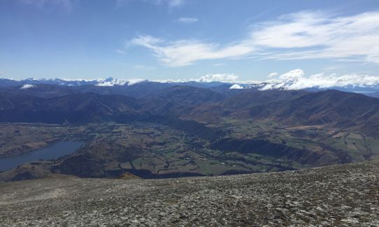
From Ben Cruachan, follow the old farm road towards Mt.Salmond. After the peak, follow the DOC sign right down towards the Glenroy Water Race Trail. DO NOT follow the obvious farm track straight ahead, as this is private land, and part of the Glenroy Hunting Lodge (you have been warned!).
Follow the Glen Roy Water Race trail to Coal Pit Saddle and down to Gibbston. After the Gibbston Tavern, join the Queenstown Trail network on the other side of the road, and follow the signs to Arrowtown. After a pint at the Fork And Tap, head back downstream on the Centennial Walkway, cross the first bridge and head up Tobin's Track. When you meet the road at the top, turn right, follow the gravel road for a short distance, then turn left at the sign for Bracken Saddle/Miner's Trail. You'll reach a sign for Crown Peak just past a stone ruin. Here you'll need to do an out and back to the top of Crown Peak.
Once back at the sign, continue straight ahead for a few hundred metres then turn right, following the sign to Arrowtown via the saddle. On descending from the saddle, you'll reach another junction, turn right, and this will lead you down to the Macetown Road. At the road, turn right and continue to the far end of Hayes Creek Trail (a left turn through a closed gate, some k's after the iron bridge over the Arrow River). Go up the trail to the flat plateau, and pick up the trail to Big Hill
After Big Hill, continue down to Big Hill Saddle, then head towards Brow Peak, then on to Coronet Peak. This is a poled route, but sometimes not easy to follow (particularly as you'll now probably be in the middle of the night!). Find your way to the top of Coronet Peak, and back down again to the base building.
It's now time to hit the road, down to the Skippers Road, turn right and head up Mt Dewar. After backtracking from the summit of Mt Dewar, it's down the road to Arthurs Point. You are actually only 6km from Queenstown now, but... as you head down Gorge Road, you're turning up McChesney Road to the Moonlight Track. Ahh, the Moonlight Track, it's a blessing. After about 5km of Moonlighting turn left for Ben Lomond Saddle. So close to finishing. Just a little untracked climb to the top of Bowens Peak. Back down to the saddle and the long descent down to town.
Now, if you want to get your 161.1km (100miles) you may need to get inventive. A little side trip through Fernhill Loop, or even just a deviation across to Wynyard Bike Park... see the GPX. If you cross the bike tracks, be mindful of bikes (some of these areas they have right of way). You may not be thinking straight, it might be good to have a pal to help you out here. Ahhhhh, along the waterfront into town, soak up the glory of Queenstown Bay. There may be tourists wondering why you look so dishevelled, why you look so broken from just running through town. If you let slip to some locals that you're out there, you may find you have a cheer squad at the finish. Don't forget to touch the Memorial Arch, time starts and finishes there! Well done, you've got the Harcombe Round in the bag!