Last Updated: 10th Nov 2024
Moonlighting to Sefferstown
Submitted by James Harcombe
Last Updated: 10th Nov 2024
Open
Grunt Factor: 24 ?
Gnarl Factor: 56 ?
11.5km
790m
790m
705m
Last Updated: 10th Nov 2024
Submitted by James Harcombe
Last Updated: 10th Nov 2024
Open
Grunt Factor: 24 ?
Gnarl Factor: 56 ?
11.5km
790m
790m
705m
Front country - easily accessible
Out and Back
Undulating, some big hills
Open farmlands
Open tussock/grasslands
Farm Road / 4WD Track
Moderate Single Track
Technical Single Track
Average Uphill Gradient: +15.7%
Average Downhill Gradient: -16.2%
VIP Feature: Send this route to your Garmin account so you can follow the course on your Garmin device.
Login as a VIP to see the trailhead information.
2:00
Slow
1:30
Moderate
1:00
Fast
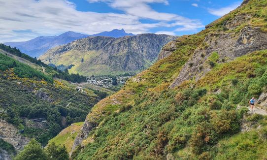
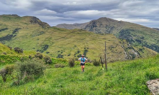
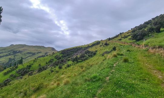
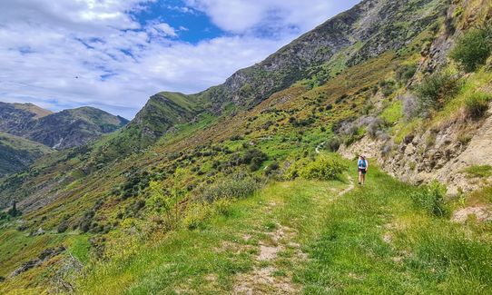
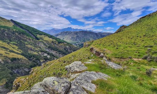
From the car park, continue a short distance along the road, and take the track marked to the left. From here it's an obvious track that climbs and sidles along the Shotover Gorge. You will reach a high point where there is a track to the left. At this point, head straight on and down hill, following the stone cairns. The track descends a technical section, then continues to undulate, eventually joining an overgrown 4WD track. This track climbs for a short distance, then descends to join another, more major 4WD track (at about 4.5km's from the start). At the junction, turn left (up the hill). Near the top of the hill, there is a sign for Queenstown via the Ben Lomond Saddle. Take this turn, pass through the gate, and continue on for a further 200m's. There is a hill on the right, when you can see the other side of it, look for a waratah that marks the descent to Sefferstown. There is often flagging tape on the waratah, as you are now on the course for the Shotover Moonlight Mountain Marathon. Follow the markers down the hill, then take the right turn towards the huts (marked by a lone standard in the field). Once down by the huts, turn left to the junction with the main 4WD track, then right down the hill. After a short distance, there is another junction (signposted Arthurs Point), at which point you need to turn right again, up the hill. This leads you back up to the junction of the path to Ben Lomond Saddle. From this point, retrace your steps to Arthurs Point.
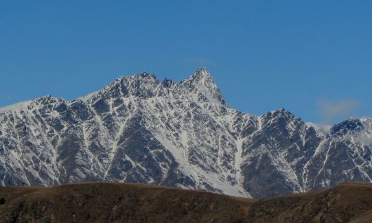
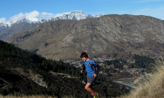
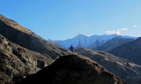
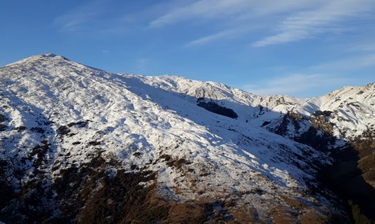
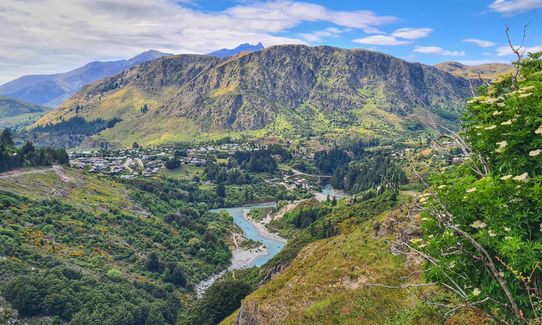
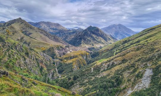
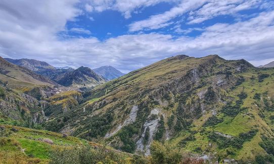
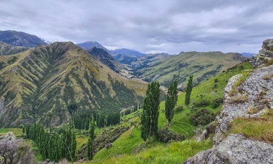
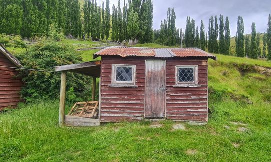
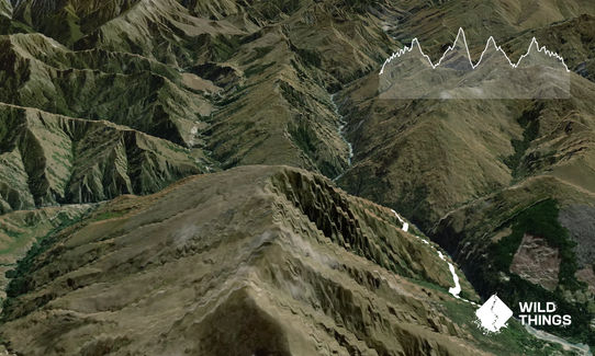
The track climbs high above the Shotover Gorge, giving great views of the river, eventually arriving at the historic settlement of Sefferstown (Private).
If you know of any public toilets near the trail start or on the route, please login and then let us know so we can update this section.
The car park given in the start point directions is small, but safe. There is a bus service from Queenstown that stops at the bottom of McChesney Road. It's also possible to run along the Wetlands Track from Queenstown, which joins the bike track beside the main road. This would add another 6km's from the town centre, each way, onto the run.
5 km
9 minutes
No
No
Moderate.
There are a few points where it's possible to go off on sheep tracks, and loose the main track. Take care on all the single track to keep following the markers and/or cairns.
Patchy.
Thermal leggings, Lightweight fleece top, Short-sleeved thermal top, Long-sleeved thermal top, Seam-sealed waterproof jacket, Gloves, Beanie/thermal headwear, Whistle, First aid kit, Extra food for emergencies, Survival bag, Cellphone, Map, Crampons / microspikes (for winter conditions)
There are a couple of small creeks along the track, though I wouldn't trust them unless you were really desperate! This track is on Ben Lomond Station, and stock is often encountered.
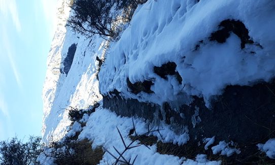
The track can be very icy with packed snow and blue ice in the winter. During the Spring, it can also be muddy and slippery as the thaw takes hold - there are several steep drop offs and slips, so care needs to be taken.
There are a couple of slips that have left only a very narrow portion of track. If you suffer from vertigo, this may not be the track for you!
Bespoke Kitchen
9 Isle St., Queenstown
http://www.bespokekitchen.co.nz
Great coffee and cake!
Smiths Craft Brewery
Shotover Street
http://www.smithscraftbeer.co.nz
Best selection of craft beer in town.
Atlas Beer Cafe
Steamer Wharf
http://www.atlasbeercafe.com
Good selection of beer. Awesome steak, and a great location overlooking the lake.
Trail Legend
Login as a VIP to become a Trail Legend. Learn about Trail Legends.
Fastest Known Times (FKTs)
You and Moonlighting to Sefferstown
As a VIP member you can record private notes for this trail, see all of your times and more.
Already have an account? Login now
Fabulous run with amazing views. Had difficulty finding the descent down to Sefferstown as path across field is not at all visible. Ended up going up too far. Came back down and then did the wee loop in reverse - easier route finding but climbing the hill probably harder than the 4wd track! Maybe also need to point out that whilst there is some 'overgrown' 4wd track, it is not easy underfoot. Might not be suitable for absolute beginners. I loved it though!
December 15, 2022
Great way to take in an out and back portion of the Moonlight Track to gain some great views of the surrounding peaks. Easy car park option at the Arthurs Point trail head side.
October 28, 2021
These overlap with this trail to some degree. You may wish to combine them but please note that to qualify for FKTs on these runs you should record a separate activity for each.
Send to your phone
Scan the below QR code to open this trail on your phone.

Tip: position the QR code in your phone camera screen.


