Last Updated: 24th Mar 2024

Beginner - Intermediate

Save Trail Save

I've done it Done

Kelly Tops

Arthurs Pass, West Coast

Submitted by Katie Smith

Last Updated: 24th Mar 2024

Beginner - Intermediate

Save Trail Save

I've done it Done

Open

Grunt Factor: 36 ?

Gnarl Factor: 83 ?

12.7km

1225m

1225m

1425m


Login as a VIP to see driving directions, distance and time.

Trail Map

Type of Run

Front country - easily accessible

Combo

Very hilly

Native bush

Open tussock/grasslands

Open ridges/tops

Run Makeup

30%
60%
10%

Moderate Single Track

Technical Single Track

Untracked / Route only

Average Uphill Gradient: +21.2%

Average Downhill Gradient: -19.2%

Trailhead

Login as a VIP to see the trailhead information.

Estimated Times to Run

3:30

Slow

2:45

Moderate

2:00

Fast

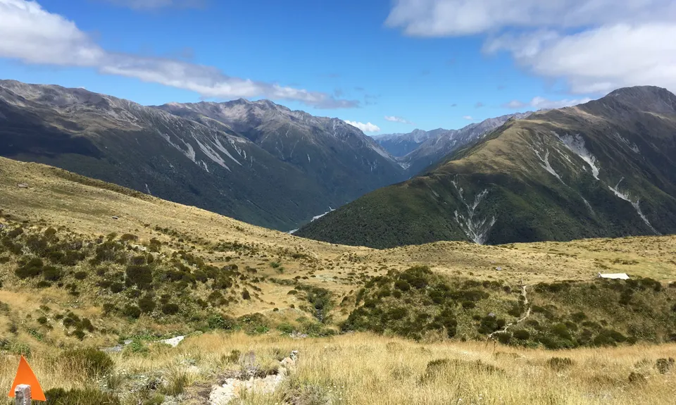
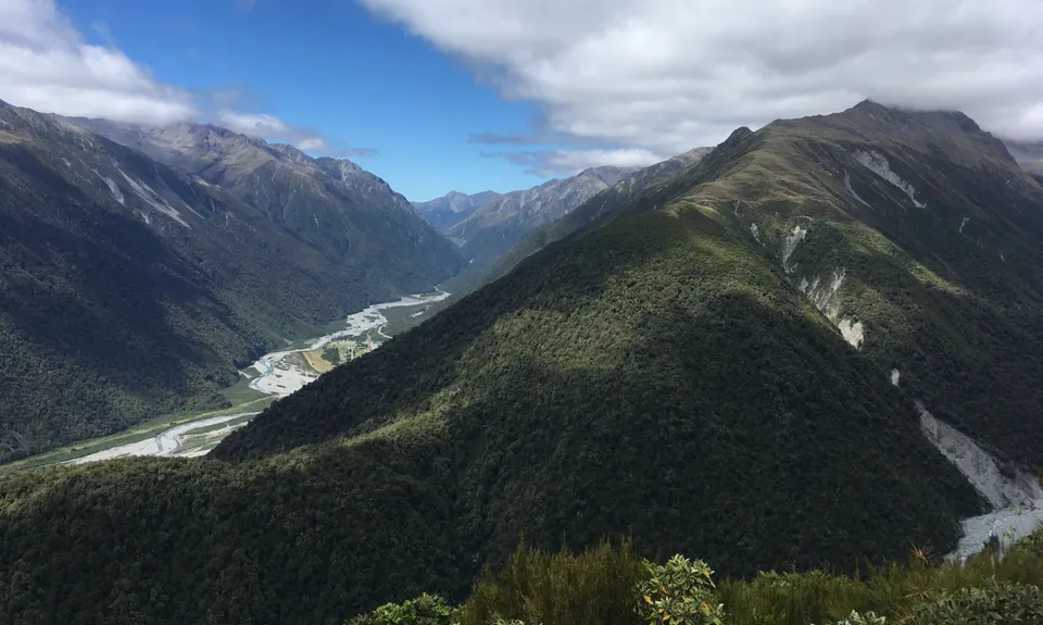
This is an out-and-back run with a small loop around the tops to take in the best views. Start from the carpark following signs to Carroll Hut (not up Hunts Creek). You hop across a side creek flowing into the Kelly River early on, then follow its spur up, up and up. The climb is fairly constant, steepening in the middle before some slight respite as you break out of the bush and sidle around above the head of a creek. Have a look at the waterfall here.

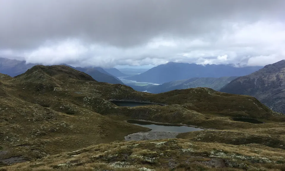
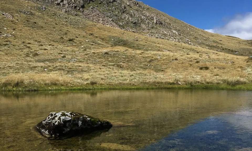
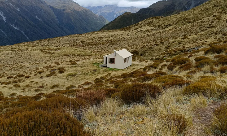
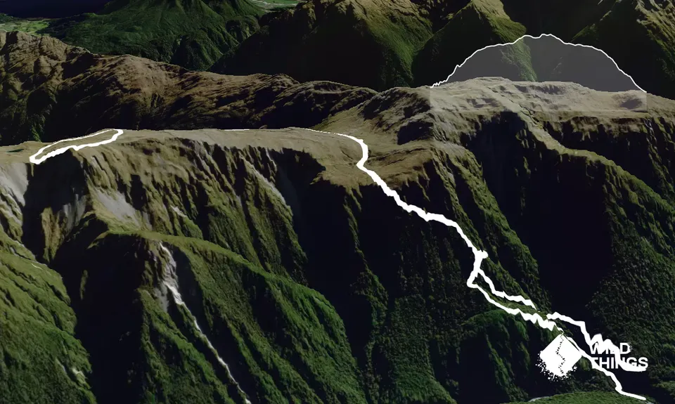
The track then pops up into tussock shortly before you reach Carroll Hut. From here the track becomes a poled route climbing up between tarns. Kelly Hill with its radio tower is visible on the right. The track heads left instead onto the main Kelly Range. Above the hut the gradient is much more runnable. Eventually you crest the top just below point 1385 and can see two tarns (the third and fourth are initially hidden). The poled route continues on the right, but instead cut down the bench between the two large tarns. Go around the one on the left, aiming for the ridge edge which looks down into Kelleys Creek. You can see Carroll Hut from here. Climb back along this edge aiming again for point 1385, then when you see the poled route you came up head back down to join it. From here follow the track back the way you came.

Stunning views, keas, flowering alpine plants, great rata in the right season

Plenty of parking - don't leave valuables in the car though.

17 km

18 minutes

Unknown

No

Moderate.

If not confident with the untracked loop portion described, stay on the track for an out-and-back

Patchy.

Long-sleeved thermal top, Seam-sealed waterproof jacket, Beanie/thermal headwear, Whistle, First aid kit, Extra food for emergencies, Cellphone, Map.

Water available from several creeks and tarns, and from Carroll Hut

Very exposed on the tops, can be cold even in summer. Expect snow through the winter.

Trail Legend

Kane Aitken

Kane Aitken

has completed Kelly Tops once in the last year.

Learn about Trail Legends.

You and Kelly Tops

As a VIP member you can record private notes for this trail, see all of your times and more.

Register Now

Already have an account? Login now

Trail Reviews

Great track. Nice tarns to camp too. Added Kelly hill too for some stunning views of Mt Alexander. .

Sia Svendsen

May 22, 2021

True very on the way up that's for sure!

Tony Sharpe

May 11, 2019

Login to submit a review

Trail Running Community

Find people who are interested in or have completed this trail run.

You must register or login to view this feature.

Register Now

Other trails nearby
Arthur's Pass Taster

Arthur's Pass Taster

Length: 9.6km

Level: Beginner

Poulter River Ranger

Poulter River Ranger

Length: 53.0km

Level: Intermediate - Experienced

Waimak Col (Otira to Klondyke)

Waimak Col (Otira to Klondyke)

Length: 32.0km

Level: Very Experienced

Avalanche Peak - Crow River

Avalanche Peak - Crow River

Length: 20.0km

Level: Intermediate - Experienced

Find more trails and peaks nearby