Andrews-Poulter CircuitIntermediate
Submitted by Katie Smith
Back country - remote
Loop
Very hilly
Native bushRiversideOpen tussock/grasslands
Intermediate
9:00 (Slow)
6:30 (Moderate)
5:00 (Fast)
-8.7%
+8.7%
Fastest Known Times (FKTs)
Please set your gender to see your position on the FKT leaderboards.
The more , the harder the FKT will be to beat. Learn about Fastest Known Times.
Description
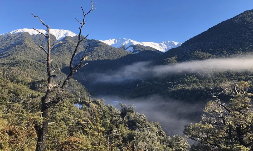
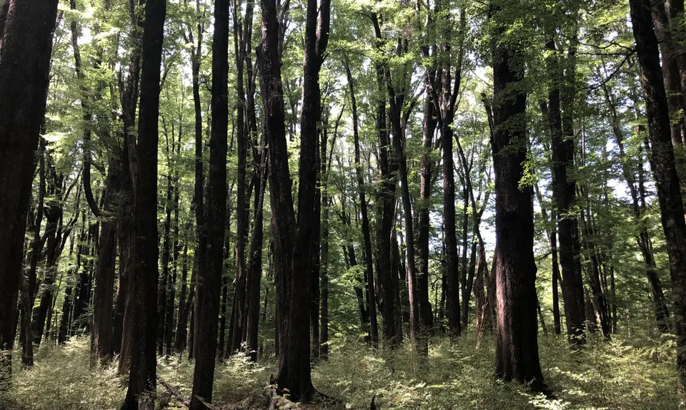
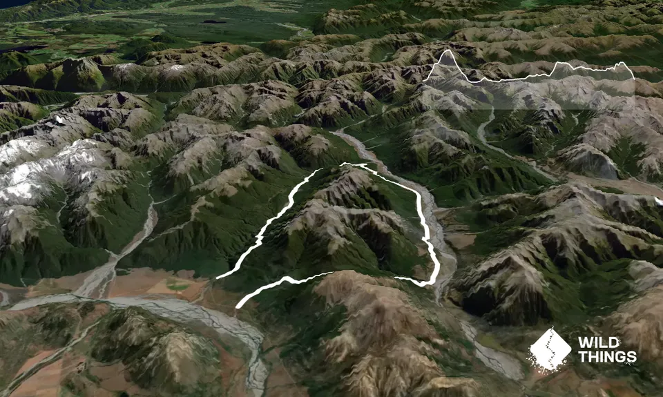
This can be run in either direction - the way that is described means you get to the major climb of Binser Saddle first, rather than at the end of the run. From the Binser Saddle sign follow the 4wd track for a short distance before another sign on the right shows where the track enters the beech forest. From here the track climbs steadily and at times quite steeply for a sustained 600m to the saddle, where you will come across an open tussocky flat surrounded by beech forest. From here there is a lovely flowing descent through beech right down into the Poulter Valley.
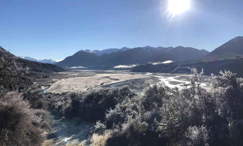
You will come out through some scrub and down a steep eroded slope before turning left onto the obvious 4wd track on the valley flats. This winds along through matagouri scrub with patches of beech for around 10km, and is easy pleasant running with a gentle gradient. About halfway along you reach the edge of Mt White Station and cross a stile - from here the 4wd track narrows to a quad bike track, and becomes grassier. Continue heading up the valley.
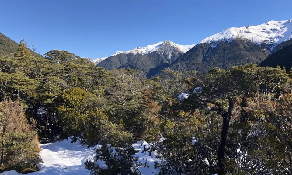
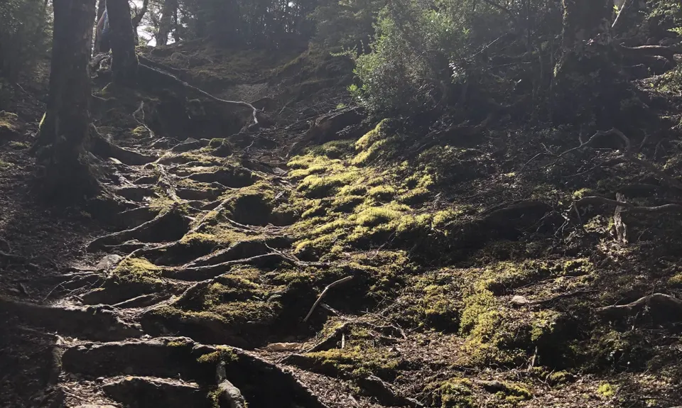
After the track starts into the beech again you will come across a fork in the track, with a sign to Casey Hut. Both the tramping and MTB tracks now point in the same direction along the same track showing 15 mins tramp to the hut. Follow the markers down to the flats and along to the new hut built June 2020. Continue along the flats to the site of the old hut. You may be able to see the charred outline of where it burnt down fairly recently. From the old hut site, follow the sign leading off to the left to Andrews Valley and Shelter. Soon the track starts to climb quite steeply through the trees, before sidling around for 2-3km
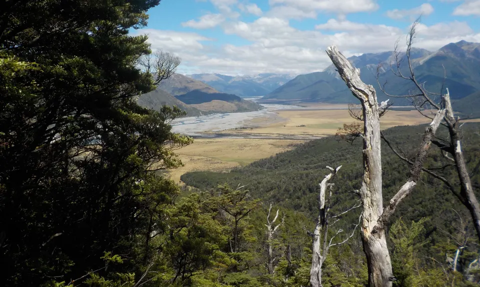
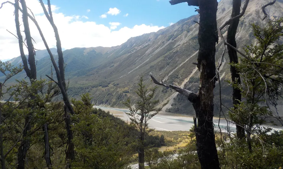
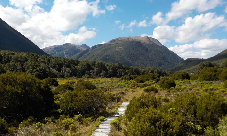
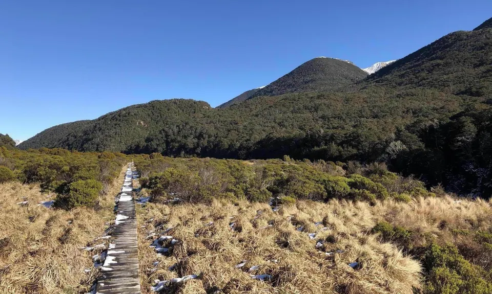
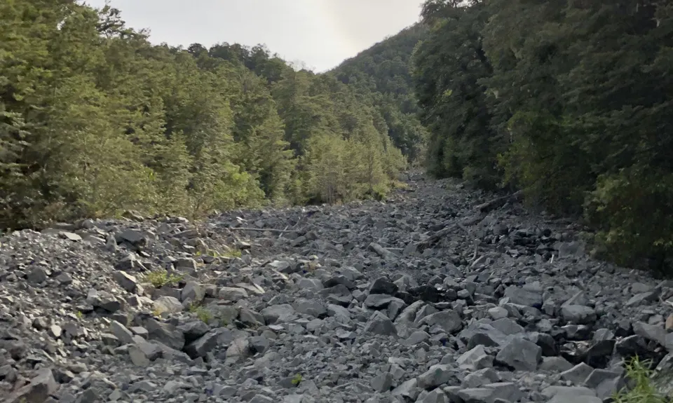
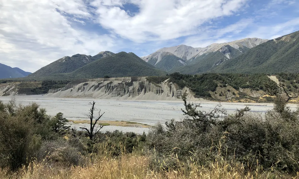
At around the 23km mark you come out into river flats, where the running is a mix of grass and some river bed running. You climb very gently to Casey Saddle, then enter another open flat (Hallelujah Flat), with a further mix of grassy single track, river shingle and a short distance of boardwalk. The views from here are stunning.
You re-enter the bush feeling like the end must be near, but there is a further 6km or so of up-and-down through the beech trees, before a steady descent to Andrews Stream and the shelter. The loop can be completed by adding 2km of gravel road between Andrews Shelter and the Binser Saddle car park, or else leave a car at Andrews Shelter on the way in.
Trail Community
Features of interest
This run provides a great mix of hills, technical rooty beech forest track, and easy river flat running. Stunning mountain surroundings.
Make Up of Run
Technical Single Track: 40%
Moderate Single Track: 30%
Farm Road / 4WD Track: 30%
Route Data
Reviews:
Overlapping Runs
The following trails overlap with this run to some degree. You may wish to combine them but please note that to qualify for FKTs on these runs you should record a separate Strava activity for each

Poulter River Ranger
Length: 53.00km
Photos:
Your Trail Wishlist
All the runs that are on your To Do list (no limit).
Add to wishlist view wishlistWild Explorers
I did it!-
Access
Turn off SH73 to Mt White Station. Head down over the bridge over the Waimakariri then turn right, following the road onwards past the turn-off to the Hawdon Valley, and past Andrews Shelter (where you will finish). Just after a small ford there is a DoC sign for Binser Saddle on the left - park here on the grassy flat.
No public transport, plenty of parking
25 km
24 minutes
No
No
-
Staying Safe
Easy.
All forks are well signposted and the track is marked throughout - through the Hallelujah Flat and Casey Saddle just keep your eyes peeled for poles, as sometimes the route crosses the stream.
Non-existent.
Long-sleeved thermal top, Seam-sealed waterproof jacket, Gloves, Beanie/thermal headwear, Personal Locator Beacon (PLB), Whistle, First aid kit, Extra food for emergencies, Survival bag, Cellphone, Map, Headtorch and spare batteries.
Plenty of drinkable water from streams and rivers along the way.
The flats through the Andrew Valley can get swampy after sustained rain, and can hold snow over winter. There are several side creeks to cross in the Poulter Valley that would be harder after lots of rain. It also gets very hot in summer, so keep drinking!
-
Post run indulgence
Bealey Hotel
Bealey
thebealeyhotel.co.nz
Great burgers, friendly staff, nice atmosphere -
Sponsor this trail
See other runs nearby:
Bealey - Avalanche Traverse
Goat Pass
Rome Ridge/Rough Creek Alpine Circuit
Cass-Lagoon Trail
Woolshed Whopper
Avalanche Peak - Crow River
Hawdon-Edwards Classic
Polar Discovery
The Taipo
Waimak Col (Otira to Klondyke)
The Bloody Limit
Oates for Breakfast
Avalanche Peak
Bealey Blaster
Encompassing Arthur's Pass
Barker's for Brunch
KKK (Klondyke - Kelly - Klondyke)
Otira Temple
Kelly Tops
Poulter River Ranger
Dash, Bash, Splash and Dash Harman Pass
Arthur's Pass Taster