Last Updated: 21st Sep 2023

Beginner

Save Trail Save

I've done it Done

Arthur's Pass Taster

Arthurs Pass, Canterbury

Submitted by Katie Smith & Kirstine Collins

Last Updated: 21st Sep 2023

Beginner

Save Trail Save

I've done it Done

Open

Grunt Factor: 15 ?

Gnarl Factor: 30 ?

9.6km

410m

410m

980m


Login as a VIP to see driving directions, distance and time.

Trail Map

Type of Run

Front country - easily accessible

Out and Back

Undulating, small hills only

Native bush

Riverside

Open tussock/grasslands

Run Makeup

70%
20%
10%

Easy Single Track

Moderate Single Track

Technical Single Track

Average Uphill Gradient: +9.4%

Average Downhill Gradient: -9.0%

Trailhead

Login as a VIP to see the trailhead information.

Estimated Times to Run

1:30

Slow

1:10

Moderate

0:50

Fast

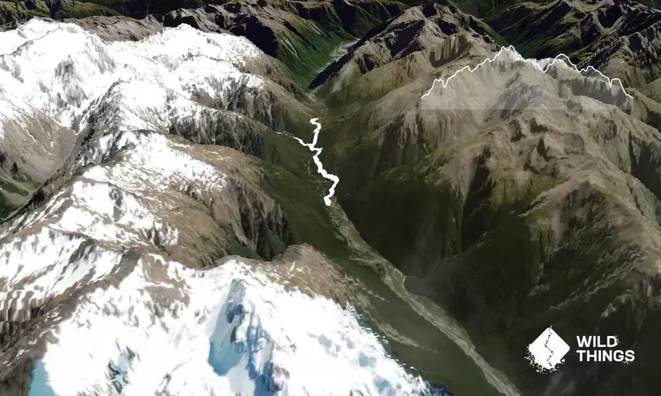
This is an out-and-back track from Arthur's Pass village to the Otira Valley on mostly very well formed track. It can be used as an access way to many of the tracks to the tops too, and can be extended by heading up the Otira Valley at the end. The short side trips to Bealey Chasm and the Devil's Punchbowl are worth it too (though not included here).

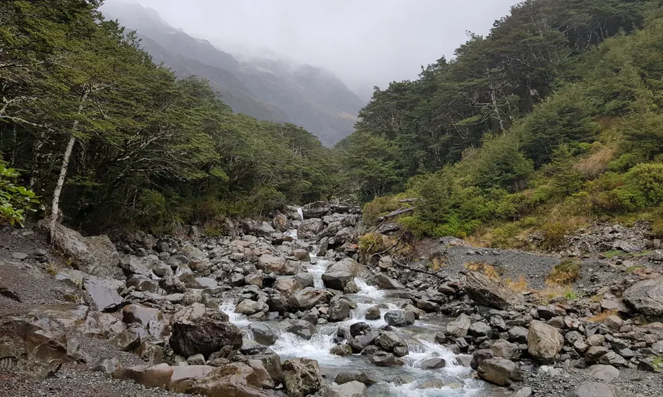
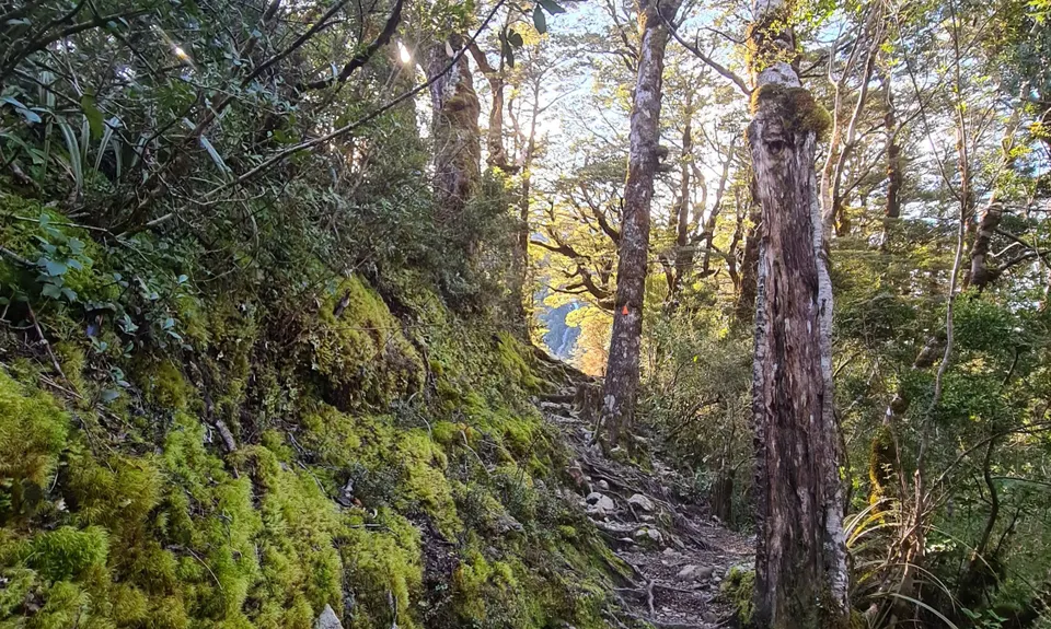
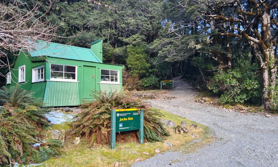
The track starts at the Devil's Punchbowl car park. Cross the footbridge over the Bealey River then bear left - the track is sign-posted as the Arthur's Pass Walkway. The first few kms undulate through beech forest, with a steep drop then climb out of a side creek via loads of stairs. There are several view points giving great views up and down the valley. You then descend to the historic Jack's Hut, and cross the main road here.

The track continues on the other side, and shortly you will reach the turn-off to Bealey Chasm. Continue past the turnoff remaining on the main track. You will visit this on the way back. 

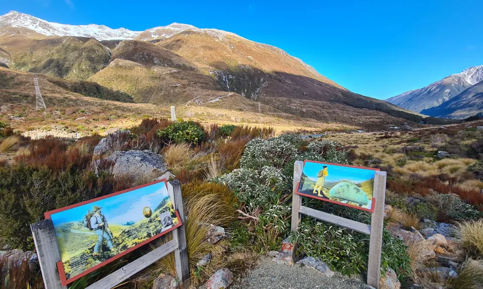
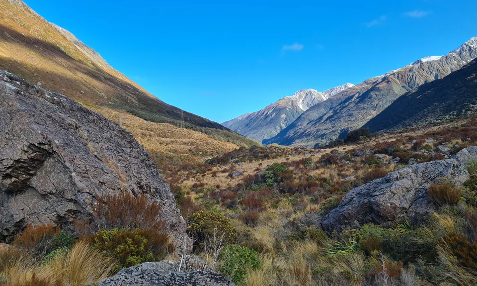
The track then climbs gradually through the bush and then breaks into open tussock/scrub. Shortly after you cross a bridge and continue climbing up to a lookout with signs about the history and geology of the area. This is the turnaround point.

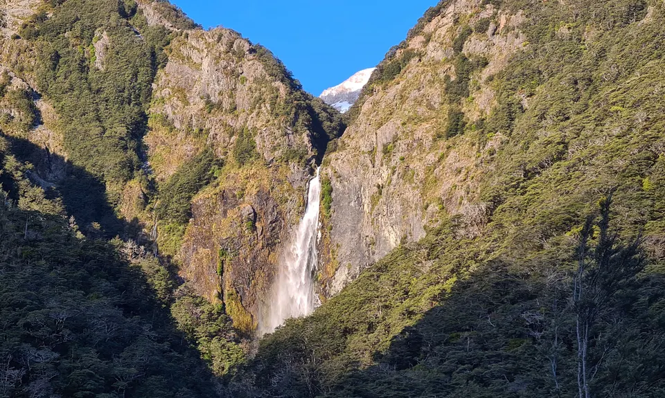
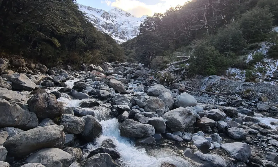
Head back the way you came until reaching the turnoff to Bealey Chasm. Turn right down this track. You will drop down to a bridge over the river. Stop and take in the chasm before tackling a short steep rocky climb. It is only a hundred meters and then the trail alternates between boardwalk and dirt as it continues climbing at a gentle gradient. When you reach the river take in the view up the valley. 

 Head back the way you came and grab a coffee and date scone in Arthur's Pass!

Take a side trip to the Devil's Punchbowl falls, and check out the Dobson Memorial.

Lots of parking

1 km

1 minutes

Unknown

No

Easy.

Patchy.

Long-sleeved thermal top, Windproof jacket, Beanie/thermal headwear, Whistle, First aid kit, Extra food for emergencies, Cellphone, Map

Loads of creeks to drink from along the way

Snow in winter can make the open bits of the track slow going, but in general it's still runnable and easy to follow. The Lake Misery section gets wet/boggy after heavy rain. The open bits are exposed to weather all year round.

Trail Legend

Christian Couper

Christian Couper

has completed Arthur's Pass Taster once in the last year.

Learn about Trail Legends.

You and Arthur's Pass Taster

As a VIP member you can record private notes for this trail, see all of your times and more.

Register Now

Already have an account? Login now

Trail Reviews

Epic little run I went down to the memorial but the track to lake misery was still closed, then had fun running up Bealey track as far as I could, some gorgeous views but back at carpark not quite 9.60km on my phone, so not sure if my trip counts. But lots beautiful scenery !!!

Lynette ELFICK

September 6, 2022

Fantastic run. Well maintained gravel path through bush and some open areas with great views. A few stairs for the steeper bits bit gradients are runnable.
The only reason it is not 5 stars is because part of the track is closed. The track from the summit to Lake Misery is closed. I di the side trail to upper Bealey river to make up the missing distance.

Kirstine Collins

April 25, 2021

Login to submit a review

Trail Running Community

Find people who are interested in or have completed this trail run.

You must register or login to view this feature.

Register Now

Overlapping Trails

These overlap with this trail to some degree. You may wish to combine them but please note that to qualify for FKTs on these runs you should record a separate activity for each.

The Bloody Limit

The Bloody Limit

Length: 11.5km

Level: Very Experienced

Other trails nearby
Polar Discovery

Polar Discovery

Length: 25.0km

Level: Experienced

Hawdon-Edwards Classic

Hawdon-Edwards Classic

Length: 30.0km

Level: Intermediate - Experienced

Avalanche Peak - Crow River

Avalanche Peak - Crow River

Length: 20.0km

Level: Intermediate - Experienced

Andrews-Poulter Circuit

Andrews-Poulter Circuit

Length: 36.0km

Level: Intermediate

Find more trails and peaks nearby