Last Updated: 21st Sep 2023

Beginner

Save Trail Save

I've done it Done

Otira Temple

Arthurs Pass, Canterbury

Submitted by Katie Smith

Last Updated: 21st Sep 2023

Beginner

Save Trail Save

I've done it Done

Closed More info

Misery Trail is closed permanently now, meaning you'd need to use the road to link the Otira Valley & Temple Basin tracks

Please notify us if this has changed.

Grunt Factor: 34 ?

Gnarl Factor: 59 ?

16.1km

1120m

1120m

1360m


Login as a VIP to see driving directions, distance and time.

Trail Map

Type of Run

Front country - easily accessible

Out and Back

Very hilly

Riverside

Open tussock/grasslands

Run Makeup

10%
20%
20%
50%

Farm Road / 4WD Track

Easy Single Track

Moderate Single Track

Technical Single Track

Average Uphill Gradient: +14.2%

Average Downhill Gradient: -14.4%

Trailhead

Login as a VIP to see the trailhead information.

Estimated Times to Run

4:00

Slow

2:30

Moderate

2:00

Fast

This run links some of the track options right off SH73 - do all or any part of it instead of driving by!

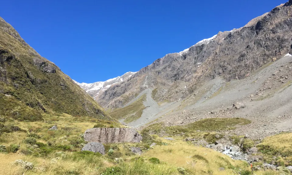
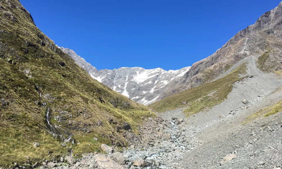
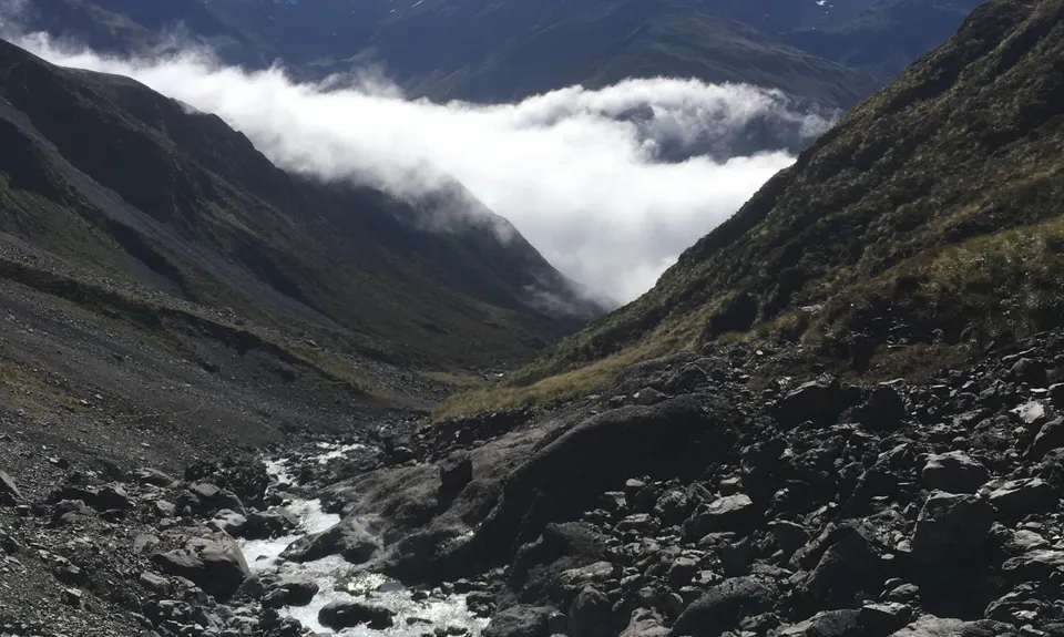
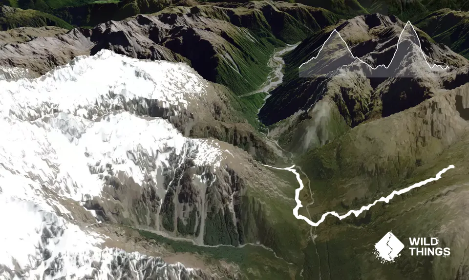
Park at the Otira Valley car park. Start off up the valley track, ignoring the turn-off to Lake Misery. The track climbs gradually up the true right of the Otira River, with great views right from the start. After about 2km cross the bridge over the river and continue up the valley, now on the true left. The track is still intermittently marked with cairns, but in places needs a bit of attention to stay on. The further up you get, the better the views of Mt Rolleston ahead, and back to Mt Phipps across the valley.

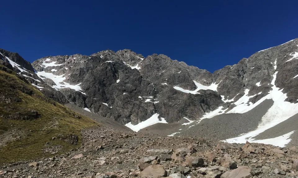
After about another 1.5km you reach the end of the runnable track - you can climb as far as you like before turning around to head back the same way. On the return, take the turn-off to Lake Misery. This track will link you to the Temple Basin track after about 1.5km. It is a mix of boardwalk and single track, with nice variety. A short climb gives great views along the valley before descending towards the road. Ignore the right hand track to Jack's Hut and Arthur's Pass and cross the road to an obvious footbridge. After going across this turn left up the Temple Basin track. This is initially a loose rocky 4WD track, but gets better as you climb up, and becomes narrower. Follow your nose up to the ski field buildings, and turn around to enjoy the view back across the valley. The route description stops here, but you can again head further up if you like. Head back down the same way, crossing back past Lake Misery and back to your car.

Small car park, generally safe

5 km

5 minutes

Unknown

No

Easy.

In poor visibility the track up Otira Valley might be harder to follow

Patchy.

Long-sleeved thermal top, Seam-sealed waterproof jacket, Gloves, Beanie/thermal headwear, Whistle, First aid kit, Extra food for emergencies, Cellphone, Map.

Drink from the Otira on the way up and back, then fill bottles at the footbridge before starting up Temple Basin - no water here until the top.

Snow in winter, and the Otira Valley track crosses avalanche paths so be careful. The weather changes quickly and can be very cold even in summer.

You and Otira Temple

As a VIP member you can record private notes for this trail, see all of your times and more.

Register Now

Already have an account? Login now

Trail Reviews

A rough and rugged adventure! Its very close to a red track in my opinion. Worth noting misery lake trail is marked closed now, I enquired at the visitors center and basically its being retired But if youre careful its still useable. Use caution on boardwalks.

Sam McEwan

June 28, 2020

Awesome combo. We did this will finding and placing some geocaches, for those in the know. Look out for the ThreeSharpe and the Temple of Doom cache up the Temple basin side and some DOC placed ones in the Otira head. Fun times

Tony Sharpe

December 24, 2018

Login to submit a review

Trail Running Community

Find people who are interested in or have completed this trail run.

You must register or login to view this feature.

Register Now

Other trails nearby
Encompassing Arthur's Pass

Encompassing Arthur's Pass

Length: 60.0km

Level: Very Experienced

Poulter River Ranger

Poulter River Ranger

Length: 53.0km

Level: Intermediate - Experienced

The Taipo

The Taipo

Length: 17.5km

Level: Beginner

Bealey - Avalanche Traverse

Bealey - Avalanche Traverse

Length: 13.1km

Level: Experienced

Find more trails and peaks nearby