Last Updated: 20th Jul 2025
Woolshed Whopper
Last Updated: 20th Jul 2025
Open
Grunt Factor: 36 ?
Gnarl Factor: 94 ?
8.9km
925m
925m
1429m

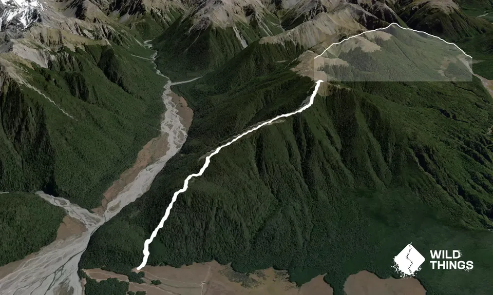
Trail Map
This Topo layer only covers NSW/ACT.
Switch to another map layer when viewing outside this area.
Switch to another map layer when viewing outside this area.


