Last Updated: 30th Nov 2023

Intermediate - Experienced

Save Trail Save

I've done it Done

Barker's for Brunch

Arthurs Pass, Canterbury

Submitted by Mike Steel

Last Updated: 30th Nov 2023

Intermediate - Experienced

Save Trail Save

I've done it Done

Open

Grunt Factor: 66 ?

Gnarl Factor: 59 ?

38.0km

1170m

1170m

1560m


Login as a VIP to see driving directions, distance and time.

Trail Map

Type of Run

Back country - remote

Out and Back

Undulating, some big hills

Native bush

Riverside

Open ridges/tops

Run Makeup

30%
20%
20%
30%

Easy Single Track

Moderate Single Track

Technical Single Track

Untracked / Route only

Average Uphill Gradient: +7.7%

Average Downhill Gradient: -7.7%

Trailhead

Login as a VIP to see the trailhead information.

Estimated Times to Run

Not suitable

Slow

5:30

Moderate

4:00

Fast

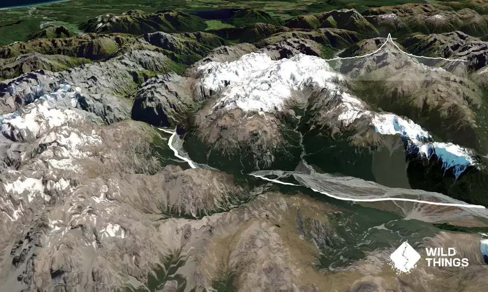
A summer-autumn in/out run to a spectacular high hut, when the rivers are low. Leave early so you have plenty of time to enjoy brunch and take in the expansive views at and around the hut. From the car head off up the Waimak river- crossing it towards Turkey Flat and on to the Anti-Crow hut. The marked track continues upriver and leads to Carrington hut (all very runnable).

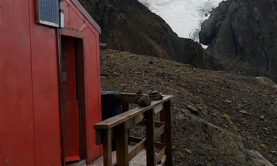
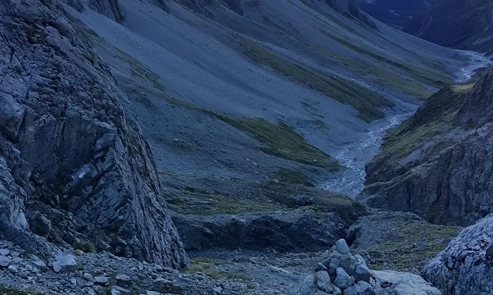
From Carrington hut continue up the White River and as the valley sweeps round to the south-west cross onto the other side (not on the cableway). From here the going is slower, and routefinding is less clear, but you are simply heading up-valley. After crossing the gushing stream off the Cahill Glacier you need to negotiate a steep ravine (look for cairns). Once across this head steeply up the side of rocky knoll (the hut is on the top of this - head up with the knoll on your right) and cut back to the hut. The hut has an awesome location and views, by a tarn with big mountains around, and expansive views. Excellent place to spend some time and explore. Return the same way - going back is much easier.

mountains, glaciers, tarns, rivers, and the highest hut in Arthur's Pass NP

Plenty of parking - reasonably secure, however turn your side mirrors in (to avoid keas removing your side mirrors - happened to us once).

9 km

9 minutes

Unknown

No

Moderate.

take a topomap and read the links below

Non-existent.

Long-sleeved thermal top, Seam-sealed waterproof jacket, Beanie/thermal headwear, Personal Locator Beacon (PLB), Whistle, First aid kit, Extra food for emergencies, Survival blanket, Cellphone, Map, Headtorch and spare batteries.

plenty of water at huts and in the streams

In winter/spring the route from Carrington to Barker Hut is often deep snow (with Avalanche risk) so not feasible for a run. The rivers also need to be low to negotiate them safely. Definitely a run that is best from mid-summer to early autumn, in settled weather, and not after heavy rain.

Bealey Pub
Bealey
https://www.thebealey.co.nz/
Moas and beer

Sheffield pie shop
Sheffield
best pies between Christchurch and Arthurs Pass

You and Barker's for Brunch

As a VIP member you can record private notes for this trail, see all of your times and more.

Register Now

Already have an account? Login now

Trail Reviews

Ran from o malleys track by the bridge as rivers were high, we measured it as 50km return. Was 0.7m when we ran for reference and was achievable. Amazing run, barker hut is the most magical spot for a hut I’ve seen. Easy jog to carrington, carrington - barker technical boulder hopping and a steep scramble to finish. Highly reccomend

Ryan Hart

November 8, 2022

Barker Hut is in a stunning location, but I think even Killian Jornet would struggle to do this in 4hrs return!!

6-8hrs return is more realistic. There are lots of big rocks and no track up the White River. Carrington to Barker will take you just as long as Klondyke to Barker. I measured the distance as 42km return.

Daniel Parkinson

July 13, 2021

Barker Hut is just the most magical place to hang out. Did this a few years back now but must return soon. Thanks Mike

Tony Sharpe

October 24, 2018

Login to submit a review

Trail Running Community

Find people who are interested in or have completed this trail run.

You must register or login to view this feature.

Register Now

Overlapping Trails

These overlap with this trail to some degree. You may wish to combine them but please note that to qualify for FKTs on these runs you should record a separate activity for each.

Waimak Col (Otira to Klondyke)

Waimak Col (Otira to Klondyke)

Length: 32.0km

Level: Very Experienced

Other trails nearby
Avalanche Peak

Avalanche Peak

Length: 8.7km

Level: Intermediate

Kelly Tops

Kelly Tops

Length: 12.7km

Level: Beginner - Intermediate

Encompassing Arthur's Pass

Encompassing Arthur's Pass

Length: 60.0km

Level: Very Experienced

Oates for Breakfast

Oates for Breakfast

Length: 29.0km

Level: Intermediate - Experienced

Find more trails and peaks nearby