Last Updated: 25th Jan 2024
Andrews-Poulter Circuit
Submitted by Katie Smith
Last Updated: 25th Jan 2024
Open
Grunt Factor: 65 ?
Gnarl Factor: 48 ?
36.0km
1600m
1600m
1067m
Last Updated: 25th Jan 2024
Submitted by Katie Smith
Last Updated: 25th Jan 2024
Open
Grunt Factor: 65 ?
Gnarl Factor: 48 ?
36.0km
1600m
1600m
1067m
Back country - remote
Loop
Very hilly
Native bush
Riverside
Open tussock/grasslands
Farm Road / 4WD Track
Moderate Single Track
Technical Single Track
Average Uphill Gradient: +8.7%
Average Downhill Gradient: -8.7%
Login as a VIP to see the trailhead information.
9:00
Slow
6:30
Moderate
5:00
Fast
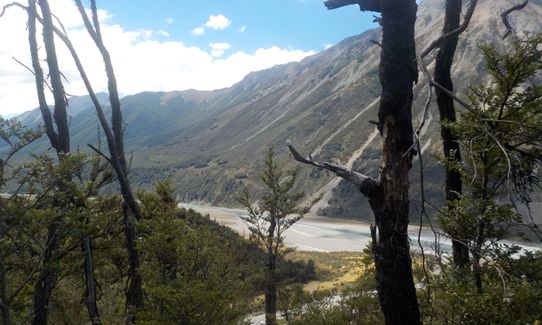
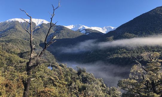
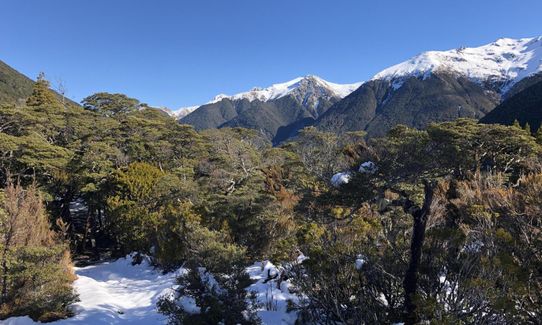
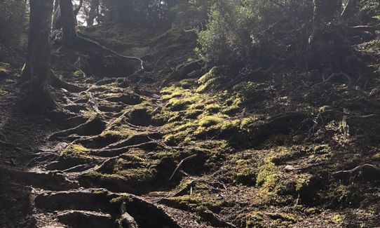
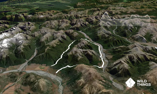
This can be run in either direction - the way that is described means you get to the major climb of Binser Saddle first, rather than at the end of the run. From the Binser Saddle sign follow the 4wd track for a short distance before another sign on the right shows where the track enters the beech forest. From here the track climbs steadily and at times quite steeply for a sustained 600m to the saddle, where you will come across an open tussocky flat surrounded by beech forest. From here there is a lovely flowing descent through beech right down into the Poulter Valley.
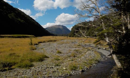
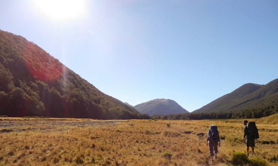
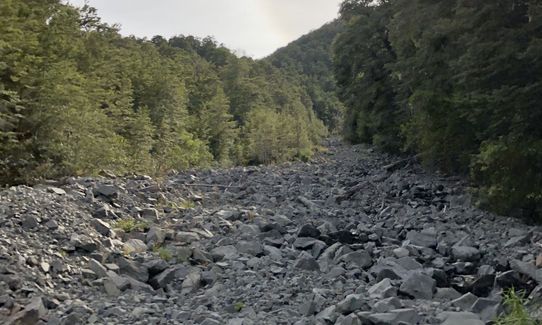
You will come out through some scrub and down a steep eroded slope before turning left onto the obvious 4wd track on the valley flats. This winds along through matagouri scrub with patches of beech for around 10km, and is easy pleasant running with a gentle gradient. About halfway along you reach the edge of Mt White Station and cross a stile - from here the 4wd track narrows to a quad bike track, and becomes grassier. Continue heading up the valley.
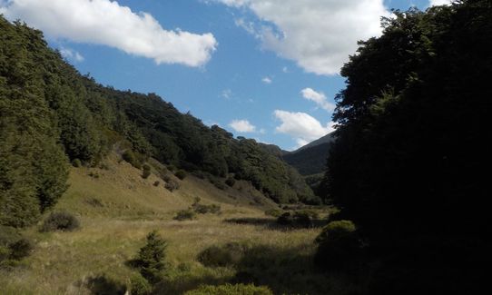
After the track starts into the beech again you will come across a fork in the track, with a sign to Casey Hut. Both the tramping and MTB tracks now point in the same direction along the same track showing 15 mins tramp to the hut. Follow the markers down to the flats and along to the new hut built June 2020. Continue along the flats to the site of the old hut. You may be able to see the charred outline of where it burnt down fairly recently. From the old hut site, follow the sign leading off to the left to Andrews Valley and Shelter. Soon the track starts to climb quite steeply through the trees, before sidling around for 2-3km
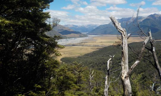
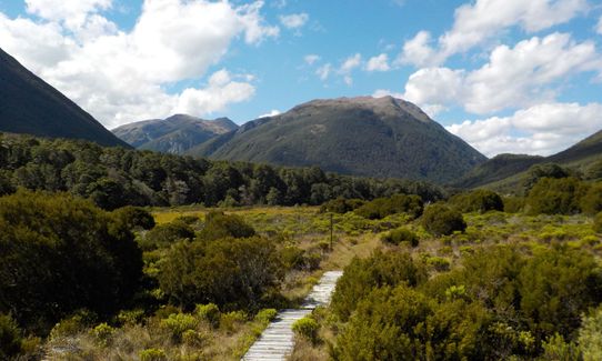
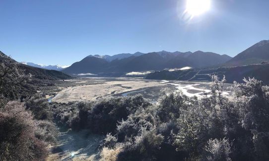
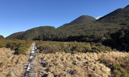
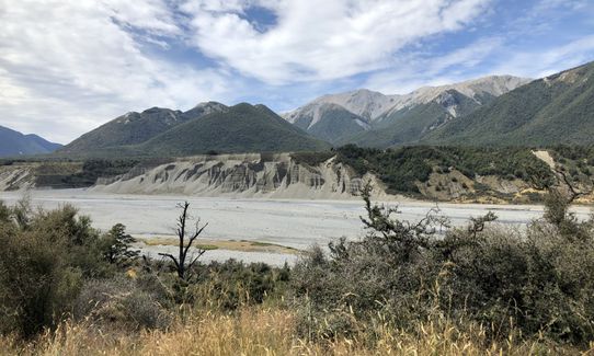
At around the 23km mark you come out into river flats, where the running is a mix of grass and some river bed running. You climb very gently to Casey Saddle, then enter another open flat (Hallelujah Flat), with a further mix of grassy single track, river shingle and a short distance of boardwalk. The views from here are stunning.
You re-enter the bush feeling like the end must be near, but there is a further 6km or so of up-and-down through the beech trees, before a steady descent to Andrews Stream and the shelter. The loop can be completed by adding 2km of gravel road between Andrews Shelter and the Binser Saddle car park, or else leave a car at Andrews Shelter on the way in.
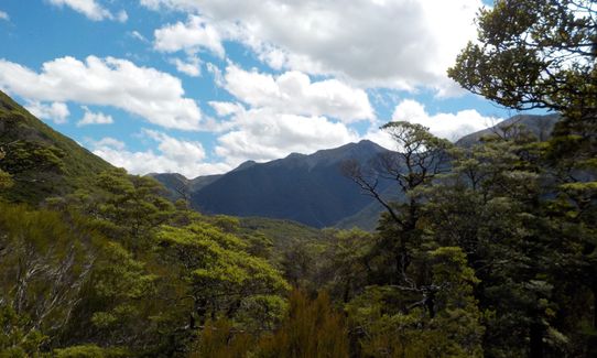
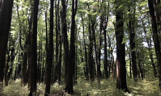
This run provides a great mix of hills, technical rooty beech forest track, and easy river flat running. Stunning mountain surroundings.
No public transport, plenty of parking
25 km
24 minutes
Unknown
No
Easy.
All forks are well signposted and the track is marked throughout - through the Hallelujah Flat and Casey Saddle just keep your eyes peeled for poles, as sometimes the route crosses the stream.
Non-existent.
Long-sleeved thermal top, Seam-sealed waterproof jacket, Gloves, Beanie/thermal headwear, Personal Locator Beacon (PLB), Whistle, First aid kit, Extra food for emergencies, Survival bag, Cellphone, Map, Headtorch and spare batteries
Plenty of drinkable water from streams and rivers along the way.
The flats through the Andrew Valley can get swampy after sustained rain, and can hold snow over winter. There are several side creeks to cross in the Poulter Valley that would be harder after lots of rain. It also gets very hot in summer, so keep drinking!
Bealey Hotel
Bealey
thebealeyhotel.co.nz
Great burgers, friendly staff, nice atmosphere
Trail Legend
Fastest Known Times (FKTs)
You and Andrews-Poulter Circuit
As a VIP member you can record private notes for this trail, see all of your times and more.
Already have an account? Login now
Such a fun route. We ran the extra 3km from andrews shelter to the start which was a good 20min warmup. Super glad we did it CCW to get the climb of the binser saddle done first and that we didnt have to go down it as there are some steep rocky dry sections in places where confidence is essential. Some windfall still present on the poulter side of the saddle which added some extra time. DOC has changed the signs on the lead up to Casey hut to where you turn right and run down to casey hut instead of left and taking the shortcut over to where the old hut was (not sure if they want people to go through the track section thats part of the existing map). Great swimhole at the end which was well worth the dip. Would love to still do this again but CW to see what it would be like to do the gentle downhill down the Poulter.
December 18
A fantastic trail running loop. I’d recommend going over Casey saddle first, this way you’ll have a gentle downhill down the Poulter river. It was great to finish with the descent from Binser saddle which was very runnable and almost all downhill from the saddle!
November 13, 2022
Nice terrain and track surface. Great valley section in the Poulter and good running tracks in the bush sections, although there was a wee washout (July 2021) coming from Binser Saddle into the Poulter. Well marked bush tracks and easy navigation in the Poulter.
The passes are not too high (and in bush) and this route could be done in less than perfect conditions, if one needs to hit a
April 30, 2022
A second running of this route anti clockwise this time was a nice change. It's a favourite for all the variety of flora, lots of water even in full summer, and often the weather is ok in this area when further west is too wet.
Be wary of wasp season from Jan through to May. They're not my friends and limit how many trees you can grab to pull up hill of slow down!
January 22, 2022
These overlap with this trail to some degree. You may wish to combine them but please note that to qualify for FKTs on these runs you should record a separate activity for each.
The Wild Things Trail Directory is proudly supported by 
Send to your phone
Scan the below QR code to open this trail on your phone.

Tip: position the QR code in your phone camera screen.


