Last Updated: 21st Sep 2023

Experienced

Save Trail Save

I've done it Done

Matukituki Cascade Saddle Dart Epic

Wanaka, Otago

Submitted by Sofia Peters

Last Updated: 21st Sep 2023

Experienced

Save Trail Save

I've done it Done

Open

Grunt Factor: 113 ?

Gnarl Factor: 46 ?

61.0km

3395m

3370m


Login as a VIP to see driving directions, distance and time.

Trail Map

Type of Run

Back country - remote

Point to Point (one way)

Mountainous

Native bush

Open tussock/grasslands

Open ridges/tops

Run Makeup

16%
36%
16%
16%
16%

Farm Road / 4WD Track

Easy Single Track

Moderate Single Track

Technical Single Track

Untracked / Route only

Average Uphill Gradient: +11.0%

Average Downhill Gradient: -10.9%

Trailhead

Login as a VIP to see the trailhead information.

Estimated Times to Run

Not suitable

Slow

14:00

Moderate

11:00

Fast

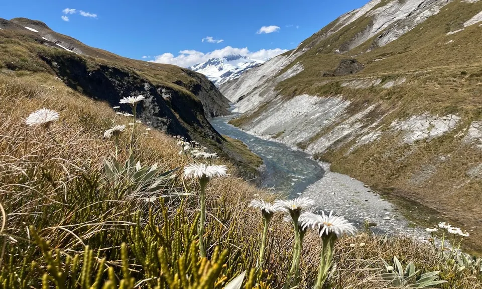
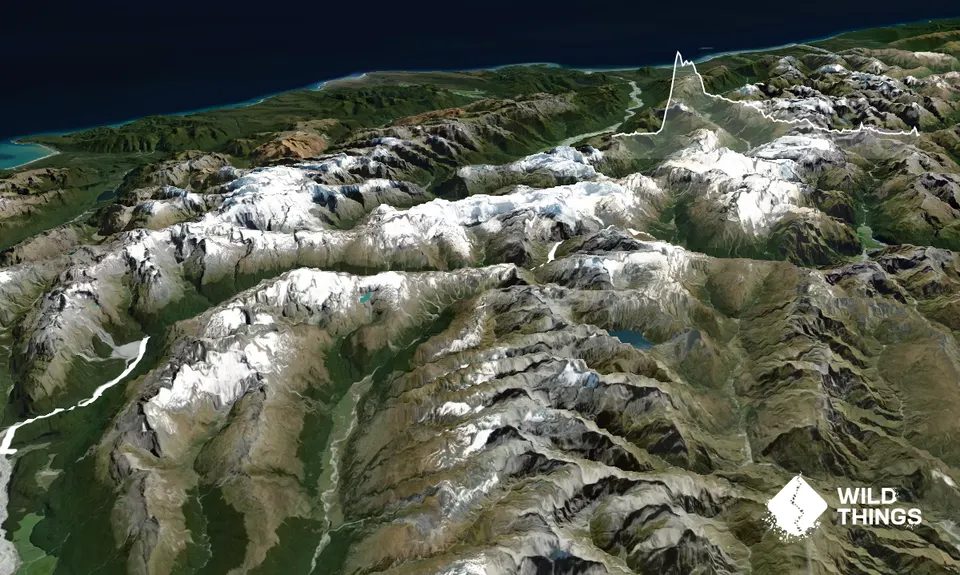
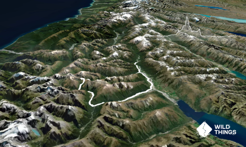
Starting from Raspberry Flat Carpark, find the DOC signs for the trailhead to Aspiring Hut. Enjoy some nice easy valley running for approximately 10km into Aspiring Hut to get the blood flowing.

At Aspiring Hut, locate the trailhead for the Cascade Saddle Track in the beech trees behind the hut. The track is signposted from Aspiring Hut and climbs steadily up through mixed beech forest.

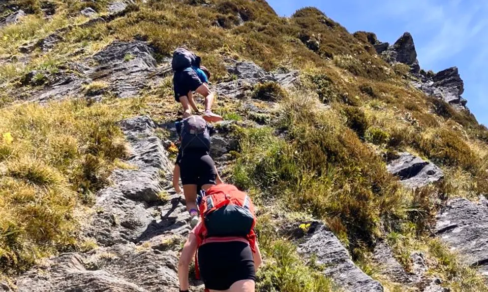
Above the bushline, the track becomes a route and is marked with orange poles. It follows a steep snow grass and tussock ridge with some rocky outcrops and ledges to negotiate.

From the bushline, the route is narrow, steep, and very exposed - you will need your hands to climb. The route reaches the pylon at the top of the ridge (1835 m) via a steep and narrow gully that holds snow for much of the year.

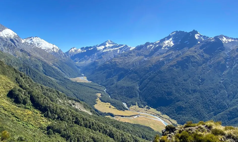
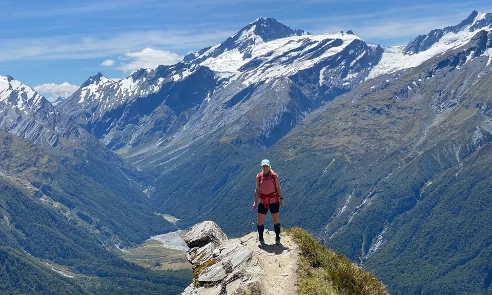
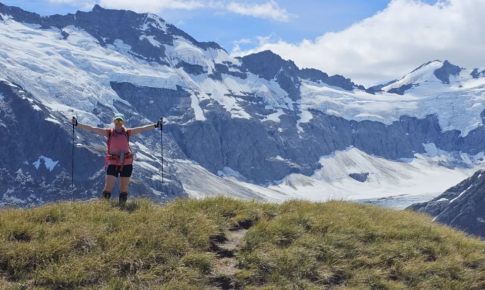
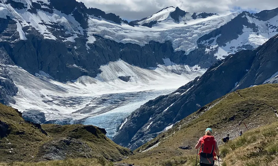
After the pylon follow the poles down to Cascade Creek, and cross it to the easy slopes and flats leading to Cascade Saddle (1524 m). The route to the Dart valley veers off to the left, just before you reach Cascade Saddle. Follow the orange poles along the ridge, then the rock cairns down the steep and unstable slopes down to the valley floor and lateral moraines of the Dart Glacier.

The traverse from the ridge to the valley floor is above 1500 metres and very exposed to the weather.

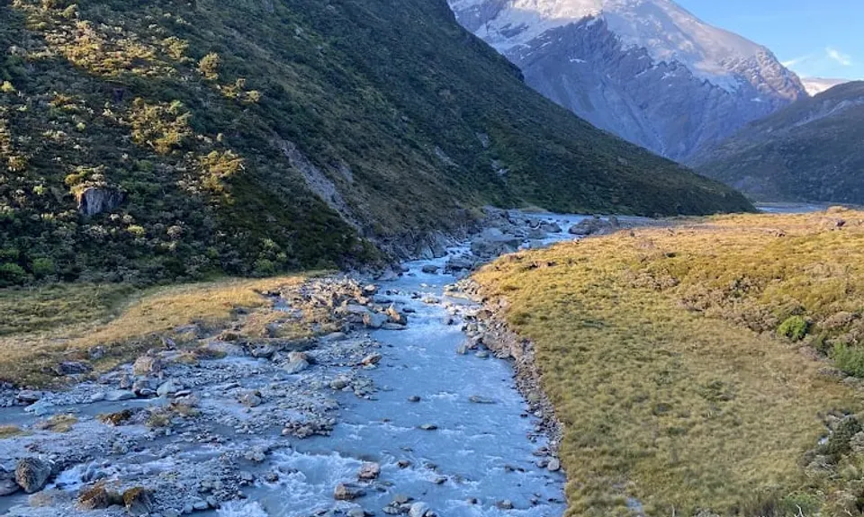
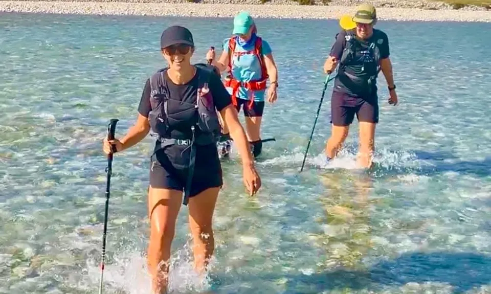
Stay on the true left bank of the Dart River/Te Awa Whakatipu – the left side looking down river. You will need to ford several side streams. The water level rises quickly with either rain or afternoon snow melt, take care in particular with streams further down the valley, close to Dart Hut.

Slightly upstream from the confluence of the Dart and Snowy Creek, a bridge over the creek leads to Dart Hut.

From Dart Hut, follow the track down Dart Valley through beech forest and across some exposed grassy flats to Daleys Flat Hut. From here, it's a cruisy undulating 16km home through more beautiful beech forest to the end of the trail at the carpark at Chinamans Bluff.

Stunning panoramic views of Mt Aspiring, Mt Barff, and other surrounding peaks on the climb up and over Cascade Saddle. Views of Dart Glacier and the Dart River down Dart Valley.

There is plenty of parking available at Raspberry Flat Carpark, which is about a 1.5 hour drive from Wanaka. This is a popular spot for trampers, day hikers, and mountaineers accessing Rob Roy Glacier, French Ridge and Liverpool Huts, and Mt Aspiring and the surrounding peaks; as such, the carpark can be pretty full so best to arrive early. Overnight parking is allowed and seems relatively safe. Flush toilets are also available at the carpark.

8 km

9 minutes

Unknown

No

Hard.

From Dart Hut, make sure you take the track that continues down the Dart River towards Daleys Flat Hut. DO NOT TAKE THE TRACK UP TO REES SADDLE.
Orange markers and poles are consistent throughout the Cascade Saddle route, look for them.

Non-existent.

Waterproof leggings, Thermal leggings, Lightweight fleece top, Long-sleeved thermal top, Seam-sealed waterproof jacket, Gloves, Beanie/thermal headwear, Personal Locator Beacon (PLB), Whistle, First aid kit, Extra food for emergencies, Survival bag, Cellphone, Compass, Map, Headtorch and spare batteries, Crampons / microspikes (for winter conditions)

Plenty of water is available at huts and stream crossings. Take a decent-sized bladder and fill up at each hut (Aspiring, Dart, and Daleys Flat).

Cascade Saddle Route is extremely hazardous in wet conditions and can be very slippery. It can also hold snow for much of the year, even during summer months; educate yourself on the current conditions, be prepared to assess the risks for yourself, bring the appropriate equipment, and be prepared to turn around if conditions aren't favourable. The saddle is also exposed to high winds and cold temperatures throughout the year.
Stream crossings along the route can also present hazards during or after periods of heavy rain or snowmelt.


From DOC: "If snow is present [on the Cascade Saddle route], do not proceed without an ice axe and crampons and the skills to use them - slipping can mean falling several hundred metres off the cliffs."

You and Matukituki Cascade Saddle Dart Epic

As a VIP member you can record private notes for this trail, see all of your times and more.

Register Now

Already have an account? Login now

Trail Reviews

Be the first to submit a review for Matukituki Cascade Saddle Dart Epic!

Login to submit a review

Trail Running Community

Find people who are interested in or have completed this trail run.

You must register or login to view this feature.

Register Now

Overlapping Trails

These overlap with this trail to some degree. You may wish to combine them but please note that to qualify for FKTs on these runs you should record a separate activity for each.

Rees - Cascade

Rees - Cascade

Length: 55.0km

Level: Experienced

Rees Dart Reverse Run

Rees Dart Reverse Run

Length: 63.0km

Level: Intermediate - Experienced

Other trails nearby
Lindis Peak Track

Lindis Peak Track

Length: 11.4km

Level: Beginner - Intermediate

Boundary Creek Track

Boundary Creek Track

Length: 14.2km

Level: Beginner - Intermediate

Cardrona to Meg Hut

Cardrona to Meg Hut

Length: 18.5km

Level: Beginner - Intermediate

Little Criffel from the Larches

Little Criffel from the Larches

Length: 19.0km

Level: Beginner - Intermediate

Find more trails and peaks nearby