Last Updated: 6th Mar 2025
Isthmus Peak
Last Updated: 6th Mar 2025
Grunt Factor: 29 ?
Gnarl Factor: 26 ?
16.6km
1250m
1250m
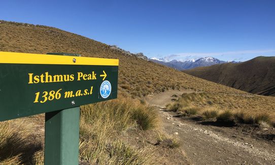
1386m

Last Updated: 6th Mar 2025
Last Updated: 6th Mar 2025
Grunt Factor: 29 ?
Gnarl Factor: 26 ?
16.6km
1250m
1250m
1386m
Front country - easily accessible
Out and Back
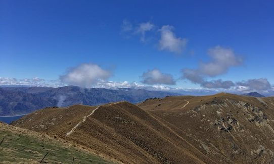
Mountainous
Native bush
Open farmlands
Open tussock/grasslands
Open ridges/tops
Farm Road / 4WD Track
Easy Single Track
Moderate Single Track
Technical Single Track
Average Uphill Gradient: +15.00%
Average Downhill Gradient: -15.00%
VIP Feature: Send this route to your Garmin account so you can follow the course on your Garmin device.
Become a VIP Member to see the trailhead information.
4:30
Slow
3:15
Moderate
2:00
Fast
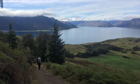
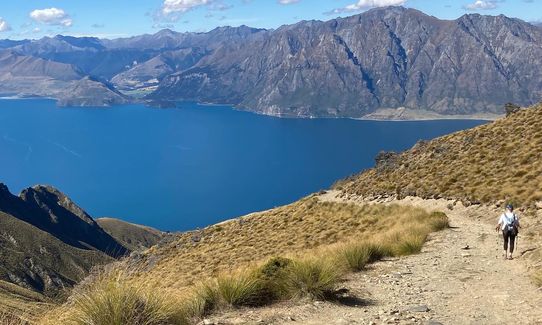
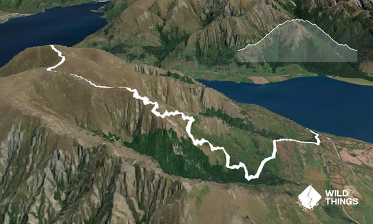
This is an easy-to-follow slog up and fun run down route.
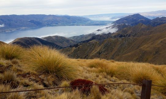
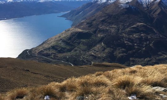
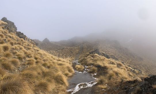
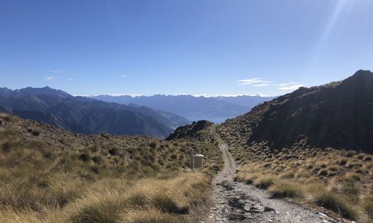
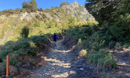
From the car park cross the road and follow the poles alongside the road for maybe 100m - these lead you to the start of the track proper which is poled all the way to the summit. En route, you'll skirt a nice remnant stand of native beech and traverse across open farmland before starting the steady, occasionally steep, zig-zag ascent on the farm track.
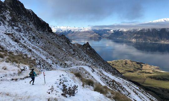
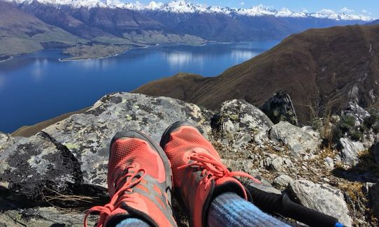
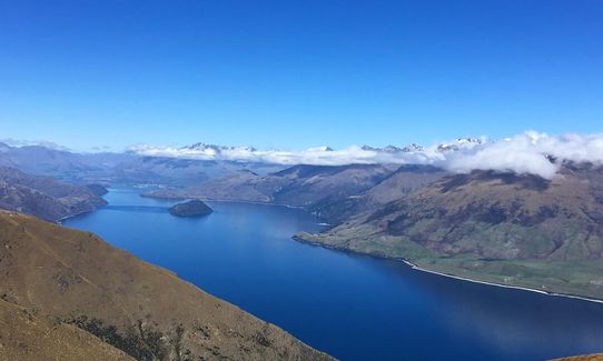
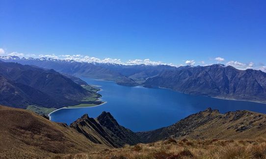
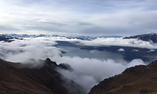
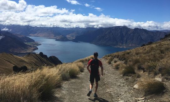
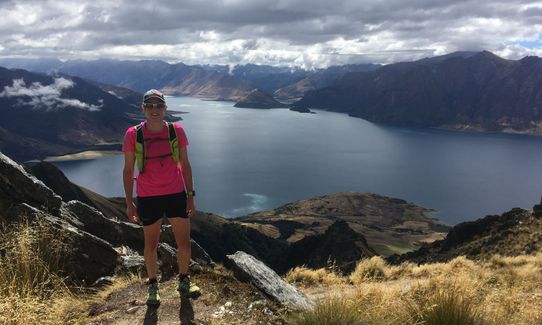
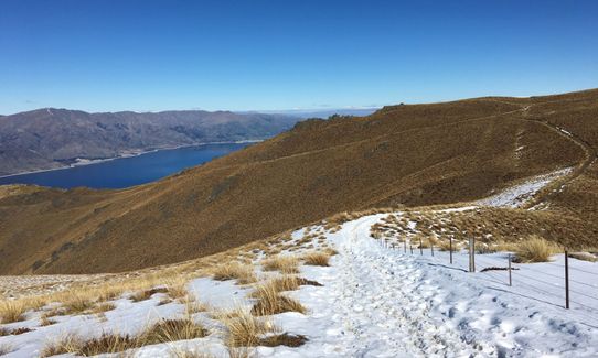
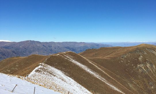
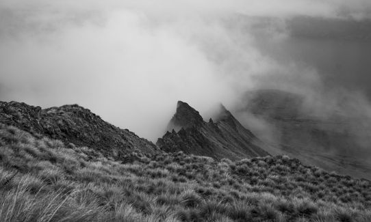
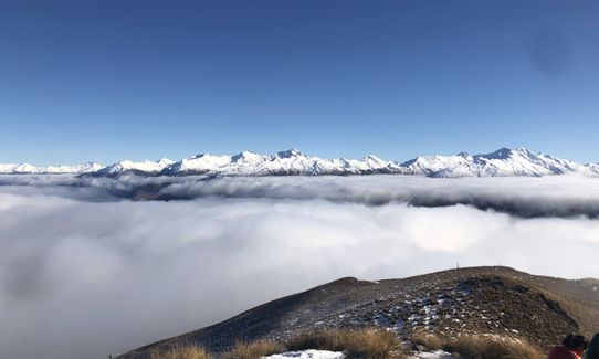
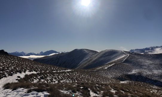
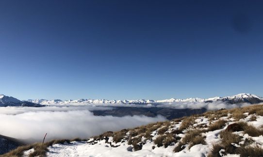
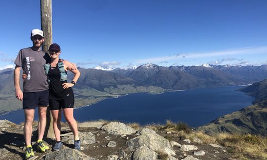
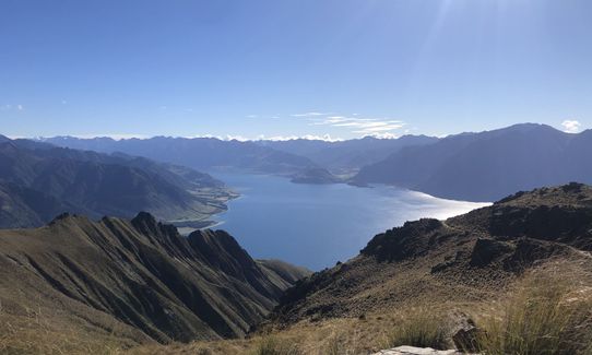
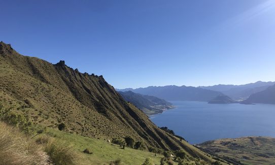
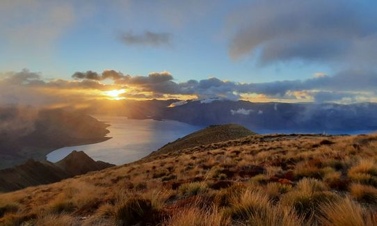
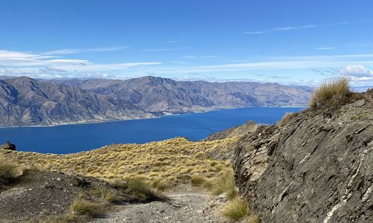
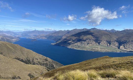
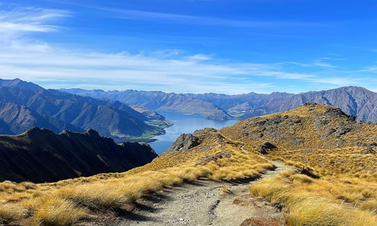
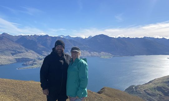
When you reach 1340m altitude you'll come to an obvious junction with Isthmus Peak signposted right. Follow this trail, now quite rough, as it undulates along the ridge to terminate at the summit of Isthmus Peak. Drink in the stunning views, snap a few shots (not forgetting to post them later on this trail guide!) and head back down the way you came. A great day out with the satisfaction of bagging a significant peak thrown in for good measure!
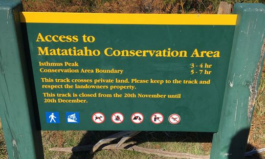
Please note: This track is on private property and is closed annually from 20 Nov to 20 Dec. Please adhere to the regulations when visiting: Stay on the marked track, do not interact with the livestock, no dogs/drones/poaching/camping/paragliding/fires/graffiti/weapons permitted, and no littering rubbish. Thank you.
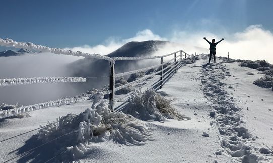
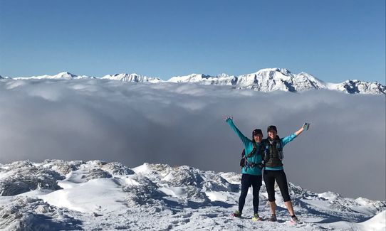
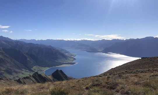
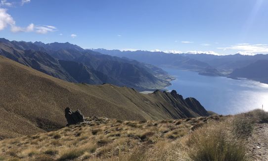
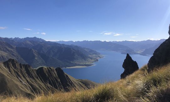
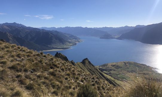
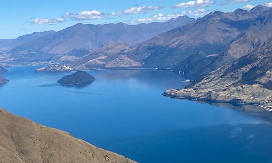
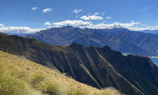
Stunning views all the way! They just get better as you get higher.
If you know of any public toilets near the trail start or on the route, please login and then let us know so we can update this section.
There is a small car park at the side of the road - room for only 6-8 vehicles and as this track is becoming more popular it'd pay to get there early during the busy summer season
33 km
28 minutes
No
No
Easy.
Just follow the poles and signposts - easy.
Generally good.
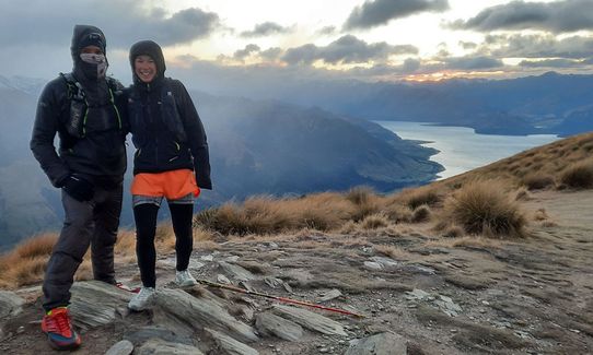
Thermal leggings, Lightweight fleece top, Long-sleeved thermal top, Seam-sealed waterproof jacket, Gloves, Beanie/thermal headwear, Whistle, First aid kit, Extra food for emergencies, Survival blanket, Cellphone, Map, Headtorch and spare batteries
There is NO water along the way - take your own and if planning a long day in summer make sure you have plenty of it.
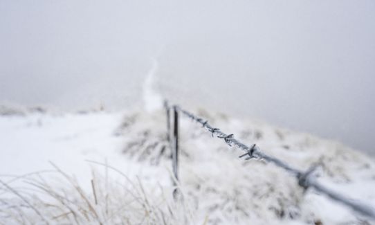
Typical Otago - can be very hot in summer, very cold any time of year. In winter expect ice and snow, take micro-spikes in case.
Nothing out of the ordinary
Do you have a suggestion on where to go afterwards for the best coffee / cake / breakfast / brunch / beer?
Trail Legend
Login as a VIP to become a Trail Legend. Learn about Trail Legends.
Fastest Known Times (FKTs)
You and Isthmus Peak
As a VIP member you can record private notes for this trail, see all of your times and more.
Already have an account? Login now
Great alternative track to Roy’s Peak.
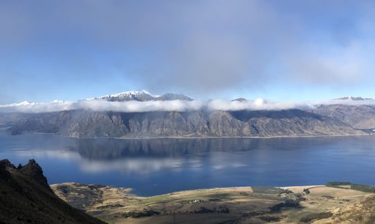
Similar track but in my opinion better views as have a 360° view of Lake Wanaka and Lake Hawea plus the southern alps.
April 21, 2023
Absolutely amazing. A proper slog up and quite the temperature change at the top but boy those views are epic. First time I have slogged over 1000m climb on a training run and didn’t even realise it. Defo bring extra layers and enough hydration ;)
April 8, 2022
These overlap with this trail to some degree. You may wish to combine them but please note that to qualify for FKTs on these runs you should record a separate activity for each.
Send to your phone
Scan the below QR code to open this trail on your phone.

Tip: position the QR code in your phone camera screen.
Plan smarter, stay motivated, track your progress, and unlock the full Wild Things experience — while saving along the way.