Last Updated: 21st Sep 2023

Very Experienced

Save Trail Save

I've done it Done

Run Rabbit Run

Wanaka, Otago

Submitted by Mike Steel

Last Updated: 21st Sep 2023

Very Experienced

Save Trail Save

I've done it Done

Open

Grunt Factor: 118 ?

Gnarl Factor: 76 ?

63.0km

2360m

2400m

1400m


Login as a VIP to see driving directions, distance and time.

Trail Map

Type of Run

Back country - remote

Point to Point (one way)

Mountainous

Native bush

Riverside

Open tussock/grasslands

Open ridges/tops

Run Makeup

30%
40%
30%

Moderate Single Track

Technical Single Track

Untracked / Route only

Average Uphill Gradient: +9.7%

Average Downhill Gradient: -8.8%

Trailhead

Login as a VIP to see the trailhead information.

Estimated Times to Run

Not suitable

Slow

15:00

Moderate

12:00

Fast

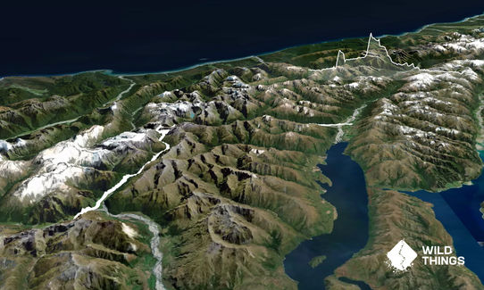
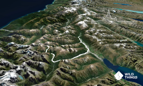
This classic and awesome 63km wilderness tramp through Aspiring Natiional Park can be done as a day run, but only under ideal summertime conditions, with low rivers, no low snow, fine settled weather and adequate care and preparation. Even then it's a big day out and a committing run. Start at first light, carry extra gear (including a torch and extra food) and read Moirs Guide.

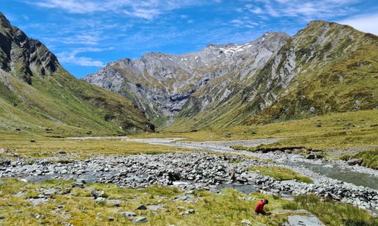
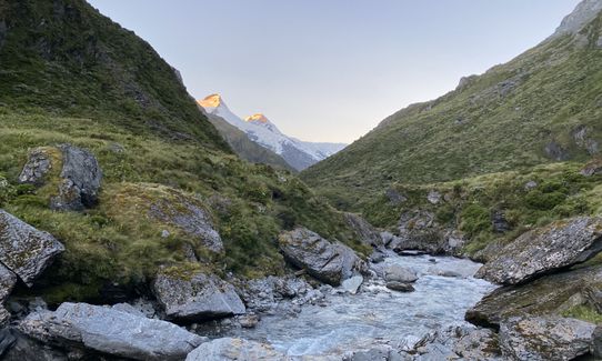
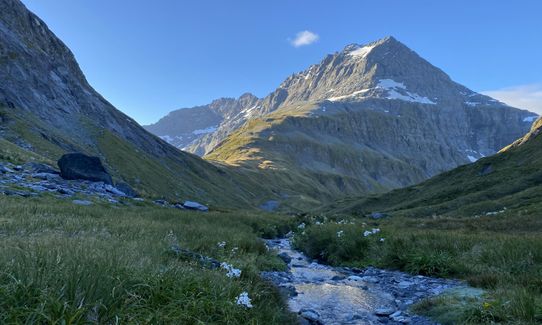
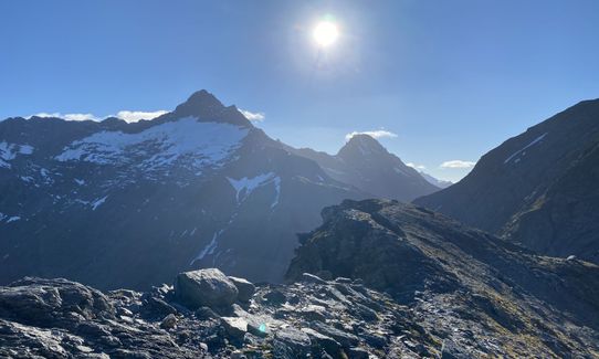
Cross the swingbridge across the West Matukituki and take the East Matukituki track and start the long but stunning run up the remote East Matukituiki valley (with occasional wire bridges across side-streams) to Junction Flat, up and over the high bypass of Bledisloe gorge to Ruth Flat (where you can marvel at the impressive East Face of Mt Fastness), and follow occasional poles/cairns up valley. Provided the weather is still fine carry on up the zig-zag route onto the steep and spectacular Rabbit Pass. This leads into delightful hanging valley which finishes abruptly as you approach the notorious 'Waterfall Face'. The descent of this steep, exposed face of grassy bluffs requires care (the first marker pole is up well out to the true left of the face), though it's going to be easier than if you had a tramping pack on (take extreme care if it's wet - if in doubt turn back).

Once down, at Waterfall Flat, a rough track leads through scrub above gorges before dropping down to Top Flats Hut. From here there is a long, cruisy run across open river flats and bush to Kerin Forks Hut. Some distance below the hut, find a suitable braided place to cross the Wilkin and run out the last dozen or so km mostly down the true left of the river and tracks to the Makarora, dinner and beer.

Next day it's a nice bike ride back (~110km) to the car beside the lakes, and via Wanaka. Just after Gledhu Bay, it's worth tossing the tent etc into scrub by the road for later pickup so you don't need to bike it the last 40km, much of which is gravel.

Impressive cirques and hanging glaciers, remote valleys, spectacular pass. Good running on the way out.

Space to park (note this is well before the big Raspberry Flat parking area).

46 km

56 minutes

Unknown

No

Extreme.

Take extreme care in the area near Rabbit Pass.

Non-existent.

Thermal leggings, Long-sleeved thermal top, Seam-sealed waterproof jacket, Gloves, Beanie/thermal headwear, Personal Locator Beacon (PLB), Whistle, First aid kit, Extra food for emergencies, Survival bag, Cellphone, Compass, Map, Headtorch and spare batteries

Plenty of water the whole way.

Only feasible as a run for a fairly short period (mid summer- early autumn), and then only in fine weather.

Note that there are no huts in the East Matukituki so you are on your own there. Take care on Rabbit Pass and descending the Waterfall face, and particular care crossing the Makarora River at the end since you're likely to be a bit tired (suss out where to cross it the day before, and carry head-torches in case you run out of daylight). Be prepared to turn back before Rabbit Pass/Waterfall face. And take a buddy to share the fun - it's probably not a good run to do by yourself!

You and Run Rabbit Run

As a VIP member you can record private notes for this trail, see all of your times and more.

Register Now

Already have an account? Login now

Trail Reviews

Ran the pass in 15 hours. Very few stops apart from photos and filling water bottles. Allow plenty of time as some parts are slow going...started Mavoura at 7am, was at top of waterfall face in 6hrs. From there another 9hrs, slow going through bush tracks to get to east matukituki...climbing over a couple.more valleys then anticipated. Poles are few and far between but important ones are there...up waterfall and down the shingly gut off rabbit pass. Beautiful across the pass. Take headtorchs just in case. 4 stars just cause the bush to get back to matukituki started to piss me off!

Julie Williamson

February 8, 2021

This is absolutely epic!
The start and finish of the route are good pole-hunting routes through either bush at Mt Aspiring, or grass fields at Makarora.
The middle middle is like another planet. You move through huge ranges of eco diversity along the way, and the basin was just magic - will go back and camp there for sure!
The pass itself can be very sketchy, so take Mike's description pretty seriously, it's claimed a few lives (mainly on the Makarora side) of the actual saddle as people ascent/descend above the basin.

Worked out to be 70 on both our watches on the day, so if that's too much in one hit, a two-day fast pack would be just as good at one of the huts along the way.

Ben Wallbank

January 17, 2021

Login to submit a review

Trail Running Community

Find people who are interested in or have completed this trail run.

You must register or login to view this feature.

Register Now

Overlapping Trails

These overlap with this trail to some degree. You may wish to combine them but please note that to qualify for FKTs on these runs you should record a separate activity for each.

Rock of Ages

Rock of Ages

Length: 31.0km

Level: Intermediate

Other trails nearby
Minaret Burn Track (short)

Minaret Burn Track (short)

Length: 19.8km

Level: Beginner

Motatapu Track - Full Monty

Motatapu Track - Full Monty

Length: 50.0km

Level: Intermediate - Experienced

Jack Hall's Saddle

Jack Hall's Saddle

Length: 22.0km

Level: Intermediate

Little Criffle A to B

Little Criffle A to B

Length: 18.0km

Level: Beginner - Intermediate

Find more trails and peaks nearby